| Home | City Bus | Maps | Villages | Cities | Rail | Tourist Places | School | College | Pin Codes | Corona Cases Count |
| Distance Calculator Bus Services IFSC Codes Trace Mobile Number Weather Search Place Trace IP Available Cash ATM/Banks Locate Polling Booth Report an Error contact People |
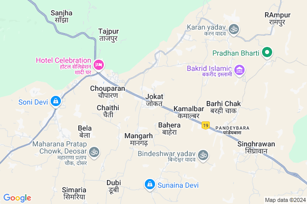
Jokat
Jokat Map
EDIT Map
Add Your House
 ..
..
Current Corona Virus Infected Patients Count in Hazaribagh District
| City Name | District Name | Total Covid cases |
|---|---|---|
| Hazaribagh District | Hazaribagh | 3 |
Locality Name :
Jokat
( जोकट )
Block Name : Chouparan
District : Hazaribagh
State : Jharkhand
Language : Hindi and Santali
Current Time 08:13 AM
Date: Saturday , Apr 26,2025 (IST)
Time zone: IST (UTC+5:30)
Elevation / Altitude: 386 meters. Above Seal level
Telephone Code / Std Code: 06547
Assembly constituency : Barhi assembly constituency
Assembly MLA : Umashankar Akela
Lok Sabha constituency : Hazaribagh parliamentary constituency
Parliament MP : JAYANT SINHA
Serpanch Name :
Pin Code : 825406
Post Office Name : Chouparan
Main Village Name : Jokat
Rivers Near Jokat
Barakar River
Brakar river
Barakar River
Brakar river
About Jokat
Correct below Info and add more info about JokatJokat is a small Village/hamlet in Chouparan Block in Hazaribagh District of Jharkhand State, India. It comes under Jokat Panchayath. It is located 50 KM towards North from District head quarters Hazaribagh. 0 KM from Chauparan. 133 KM from State capital Ranchi
Jokat Pin code is 825406 and postal head office is Chouparan .
Chaithi ( 3 KM ) , Chauparan ( 4 KM ) , Bela ( 5 KM ) , Tajpur ( 6 KM ) , Pandeybara ( 6 KM ) are the nearby Villages to Jokat. Jokat is surrounded by Itkhori Block towards west , Chandwara Block towards East , Barhi Block towards East , Padma Block towards South .
Jhumri Tilaiya , Hazaribag , Chatra , Bodh Gaya are the near by Cities to Jokat.
This Place is in the border of the Hazaribagh District and Gaya District. Gaya District Barachatti is west towards this place . Also it is in the Border of other district Koderma . It is near to the Bihar State Border.
Jokat 2011 Census Details
Jokat Local Language is Hindi. Jokat Village Total population is 1362 and number of houses are 248. Female Population is 47.5%. Village literacy rate is 55.4% and the Female Literacy rate is 22.2%.
Population
| Census Parameter | Census Data |
| Total Population | 1362 |
| Total No of Houses | 248 |
| Female Population % | 47.5 % ( 647) |
| Total Literacy rate % | 55.4 % ( 754) |
| Female Literacy rate | 22.2 % ( 302) |
| Scheduled Tribes Population % | 0.1 % ( 2) |
| Scheduled Caste Population % | 19.0 % ( 259) |
| Working Population % | 33.2 % |
| Child(0 -6) Population by 2011 | 251 |
| Girl Child(0 -6) Population % by 2011 | 47.8 % ( 120) |
Jokat Census More Deatils.
Politics in Jokat
Bharatiya Janata Party , BJP , INC are the major political parties in this area.Polling Stations /Booths near Jokat
1)Besik School Brindawan East Part2)P.s. Madhgopali
3)P.s. Mahudi (e. Part)
4)P.s.amjhar
5)P.s. Malikana
HOW TO REACH Jokat
By Rail
There is no railway station near to Jokat in less than 10 km.Colleges near Jokat
Bharat International Collage Bic
Address : Chouparan Hazaribag Jharkhrand
Schools near Jokat
Utkarmit High School Daihar
Address : Mid in Daihar Village
Ansian Public School
Address : At+post-Rampur,P.S.-Chauparan ,Dist-hazaribag
Daffodils Public School
Address : Kendua More, Chouparan
R.m.v.basariya
Address : Basariya
Govt Health Centers near Jokat
1) CHC CHAUPARAN , Community Health Center Chaoparan , Chouparan , Chatra More2) HSC Thuthi , Sub Center Thuthi , Thuthi , Near AWC
3) HSC BHUSHANDIH , Sub Center Bhushandi , Bhushandi , Near Middle School
Sub Villages in Jokat
Hospitals in Jokat,Chouparan
Loknayak Jaiprakash (LNJP) Eye Hospital
Bahera village Nav Bharat Jagriti Kendra (NBJK; Chouparan; Jharkhand 825406; India
1.9 KM distance Detail
Dhanvantri Aayurveda Aaushdhalaya
Chaithi More; Chouparan; Jharkhand 825406; India
3.2 KM distance Detail
more ..
Petrol Bunks in Jokat,Chouparan
HP PETROL PUMP - BHADRAKALI FUELS
Joket; ON NH-2 Chouparan; Jharkhand 835406; India
0.2 KM distance Detail
DEO PETROLEUM
PANDEYBERA(NH2);DIST HAZAR; HAZARIBAGH; Jharkhand 825406; India
7.0 KM distance Detail
more ..
Electronic Shops in Jokat,Chouparan
GALAXCY SPEEDO TRACK & MOBILE SHOP
Chaithi More; Chouparan; Jharkhand 825406; India
2.6 KM distance Detail
Police Stations near Jokat,Chouparan
Chouparan Police Station
NH2; Chaithi More; Chouparan; Jharkhand 825406; India
2.9 KM distance Detail
Governement Offices near Jokat,Chouparan
About Jokat &
History
How to reach Jokat
Tourist Places Near By Jokat
Schools in Jokat
Colleges in Jokat
Temperature & weather of Jokat
places in Jokat
Jokat photos
More Information
How to reach Jokat
Tourist Places Near By Jokat
Schools in Jokat
Colleges in Jokat
Temperature & weather of Jokat
places in Jokat
Jokat photos
More Information
Village Talk
Post News or Events about this Village
Near Cities
Jhumri Tilaiya 27 KM near
Hazaribag 49 KM near
Chatra 51 KM near
Bodh Gaya 52 KM near
Jhumri Tilaiya 27 KM near
Hazaribag 49 KM near
Chatra 51 KM near
Bodh Gaya 52 KM near
Near By Taluks
Chouparan 0 KM near
Itkhori 12 KM near
Chandwara 22 KM near
Barhi 23 KM near
Chouparan 0 KM near
Itkhori 12 KM near
Chandwara 22 KM near
Barhi 23 KM near
Near By Air Ports
Gaya Airport 60 KM near
Ranchi Airport 131 KM near
Patna Airport 154 KM near
Varanasi Airport 306 KM near
Gaya Airport 60 KM near
Ranchi Airport 131 KM near
Patna Airport 154 KM near
Varanasi Airport 306 KM near
Near By Tourist Places
Koderma 27 KM near
Jhumri telaiya 28 KM near
Chatra 51 KM near
Bodh Gaya 53 KM near
Kakolat 69 KM near
Koderma 27 KM near
Jhumri telaiya 28 KM near
Chatra 51 KM near
Bodh Gaya 53 KM near
Kakolat 69 KM near
Near By Districts
Koderma 36 KM near
Hazaribagh 48 KM near
Chatra 51 KM near
Gaya 62 KM near
Koderma 36 KM near
Hazaribagh 48 KM near
Chatra 51 KM near
Gaya 62 KM near
Near By RailWay Station
Koderma Junction Rail Way Station 28 KM near
Paharpur Rail Way Station 33 KM near
Koderma Junction Rail Way Station 28 KM near
Paharpur Rail Way Station 33 KM near