| Home | City Bus | Maps | Villages | Cities | Rail | Tourist Places | School | College | Pin Codes | Corona Cases Count |
| Distance Calculator Bus Services IFSC Codes Trace Mobile Number Weather Search Place Trace IP Available Cash ATM/Banks Locate Polling Booth Report an Error contact People |
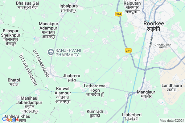
Jhabaredikhurd
Jhabaredikhurd Map
EDIT Map
Add Your House
 ..
..
Current Corona Virus Infected Patients Count in Haridwar District
| City Name | District Name | Total Covid cases |
|---|---|---|
| Haridwar District | Haridwar | 7 |
Locality Name :
Jhabaredikhurd
( झबरेड़ीखुर्द )
Block Name : Roorkee
District : Haridwar
State : Uttarakhand
Language : Hindi and Urdu
Current Time 12:26 PM
Date: Monday , Apr 28,2025 (IST)
Time zone: IST (UTC+5:30)
Elevation / Altitude: 267 meters. Above Seal level
Telephone Code / Std Code: 01334
Assembly constituency : Jhabrera assembly constituency
Assembly MLA : Virendra Kumar
Lok Sabha constituency : Hardwar parliamentary constituency
Parliament MP : Ramesh Pokhriyal 'Nishank'
Serpanch Name :
Pin Code : 247667
Post Office Name : Roorkee
Main Village Name : Jhabaredikhurd
Commodities Prices : Manglaur Market / Mandi
Jhabaredikhurd Live Weather
Temperature: 38.4 °C
clear sky
Humidity: 12%
Wind : 3.68 mt/sec towards S
StationName : "Manglaur"
observed on Now
Temperature: 38.4 °C
clear sky
Humidity: 12%
Wind : 3.68 mt/sec towards S
StationName : "Manglaur"
observed on Now
Jhabaredikhurd Weather Forecast for Next 5 days
29-04-2025
27.3°C to 40.6°C
clear sky, broken clouds
27.3°C to 40.6°C
clear sky, broken clouds
30-04-2025
26.4°C to 40.2°C
broken clouds, scattered clouds, few clouds, clear sky, overcast clouds
26.4°C to 40.2°C
broken clouds, scattered clouds, few clouds, clear sky, overcast clouds
01-05-2025
26.0°C to 40.6°C
overcast clouds, clear sky, broken clouds
26.0°C to 40.6°C
overcast clouds, clear sky, broken clouds
02-05-2025
24.3°C to 39.3°C
overcast clouds, broken clouds, light rain
24.3°C to 39.3°C
overcast clouds, broken clouds, light rain
03-05-2025
24.6°C to 37.2°C
overcast clouds, light rain
24.6°C to 37.2°C
overcast clouds, light rain
National Highways Reachable To Jhabaredikhurd
Nationa High Way :NH344
Nationa High Way :Old NH 58
Nationa High Way :NH344
Nationa High Way :Old NH 58
Rivers Near Jhabaredikhurd
Huim
Solani
Huim
Solani
About Jhabaredikhurd
Correct below Info and add more info about JhabaredikhurdJhabaredikhurd is a small Village/hamlet in Roorkee Block in Haridwar District of Uttarakhand State, India. It comes under Jhabaredikhurd Panchayath. It is located 41 KM towards west from District head quarters Haridwar. 10 KM from Roorkee. 68 KM from State capital Dehradun
Jhabaredikhurd Pin code is 247667 and postal head office is Roorkee .
Hathiya Thal ( 3 KM ) , Akbarpur Fazilpur ( 3 KM ) , Nagala/kubada ( 3 KM ) , Thithiki Qavadpur ( 4 KM ) , Delana ( 4 KM ) are the nearby Villages to Jhabaredikhurd. Jhabaredikhurd is surrounded by Roorkee Block towards East , Bhagwanpur Block towards North , Nagal Block towards west , Deoband Block towards South .
Manglaur , Roorkee , Purquazi , Saharanpur are the near by Cities to Jhabaredikhurd.
Jhabaredikhurd 2011 Census Details
Jhabaredikhurd Local Language is Hindi. Jhabaredikhurd Village Total population is 447 and number of houses are 75. Female Population is 43.8%. Village literacy rate is 58.8% and the Female Literacy rate is 21.7%.
Population
| Census Parameter | Census Data |
| Total Population | 447 |
| Total No of Houses | 75 |
| Female Population % | 43.8 % ( 196) |
| Total Literacy rate % | 58.8 % ( 263) |
| Female Literacy rate | 21.7 % ( 97) |
| Scheduled Tribes Population % | 0.0 % ( 0) |
| Scheduled Caste Population % | 62.6 % ( 280) |
| Working Population % | 36.5 % |
| Child(0 -6) Population by 2011 | 69 |
| Girl Child(0 -6) Population % by 2011 | 42.0 % ( 29) |
Jhabaredikhurd Census More Deatils.
Politics in Jhabaredikhurd
BJP , BSP , INC are the major political parties in this area.Polling Stations /Booths near Jhabaredikhurd
1)Rasulpur2)Roorkee Room No. 1
3)Roorkee Room No. 2
4)Safarpur Room No. 2
5)Najarapura
HOW TO REACH Jhabaredikhurd
By Rail
Iqbalpur Rail Way Station , Roorkee Rail Way Station are the very nearby railway stations to Jhabaredikhurd.Colleges near Jhabaredikhurd
Hariom Saraswati Degree Collage
Address :
Roorkee College Of Engineeing
Address : Canal Road Bajuheri
Schools near Jhabaredikhurd
Govt. Inter College Imlikhera
Address : imlikhera dharampur , roorkee , hardwar , Uttarakhand . PIN- 247667 , Post - Roorkee
Scholars Academy Kanhapur
Address : kanhapur(a.m.) , roorkee , hardwar , Uttarakhand . PIN- 247667 , Post - Roorkee
Skyward Public School
Address : balarpur mazra panyala cha. , roorkee , hardwar , Uttarakhand . PIN- 247667 , Post - Roorkee
City P.s. Public School
Address : ward 14 civil line south , roorkee , hardwar , Uttarakhand . PIN- 247667 , Post - Roorkee
Govt Health Centers near Jhabaredikhurd
1) Manakpur , Sub Centre Manakpur , Manakpur ,2) CHC Landora , Community Health Center Landora , ,
3) Khelpur , Sub Centre Khelpur , Khelpur ,
Sub Villages in Jhabaredikhurd
Hospitals in Jhabaredikhurd,Roorkee
MINHA NATUROPATHIC & YOGA CLINIC
Manglour - Jhabrera Rd; Jabarhera; Uttarakhand 247665; India
4.8 KM distance Detail
Dr.Deepak Verma Dental Clinic
Manglour - Jhabrera Rd; Lathardeva Hoon; Uttarakhand 247656; India
4.9 KM distance Detail
Tech Solutions
Iqbalpur Road in front of police station Jhabrera; Roorkee; Uttarakhand 247665; India
5.3 KM distance Detail
more ..
Petrol Bunks in Jhabaredikhurd,Roorkee
HP PETROL PUMP - HAMARA PUMP DHARAM S/S
Vill. Latherdeva Hoon Manglaur-jhabreda Road Roorkee; Dehradun; 247665; India
2.7 KM distance Detail
HP PETROL PUMP - ROYAL PETROLEUM
Jhabreda Iqbalpur Road Jhabreda Distt:; Dehradun; 247665; India
5.3 KM distance Detail
more ..
Schools in Jhabaredikhurd,Roorkee
New Era Public School
Latherdewa Sheikh Iqbalpur Road; Roorkee; Uttarakhand 247667; India
3.3 KM distance Detail
Electronic Shops in Jhabaredikhurd,Roorkee
Naresh Digital Photo Studio Manglour
Manglour; Jhabrera; Uttarakhand 247665; India
3.4 KM distance Detail
Local Parks in Jhabaredikhurd,Roorkee
Colonel Enclave Ph-II
Colonel Enclave Phase-II; Roorkee; Uttarakhand 247667; India
8.1 KM distance Detail
Police Stations near Jhabaredikhurd,Roorkee
Police Station
58 National Highway; Opp Hameed villa; Manglaur; Uttarakhand 247666; India
6.9 KM distance Detail
Mohammad pur Police Check Post;
Upper Ganga Canal Rd; Mohammed Pur; Roorkee; Uttarakhand 247667; India
7.0 KM distance Detail
About Jhabaredikhurd &
History
How to reach Jhabaredikhurd
Tourist Places Near By Jhabaredikhurd
Schools in Jhabaredikhurd
Colleges in Jhabaredikhurd
Temperature & weather of Jhabaredikhurd
places in Jhabaredikhurd
Jhabaredikhurd photos
More Information
How to reach Jhabaredikhurd
Tourist Places Near By Jhabaredikhurd
Schools in Jhabaredikhurd
Colleges in Jhabaredikhurd
Temperature & weather of Jhabaredikhurd
places in Jhabaredikhurd
Jhabaredikhurd photos
More Information
Village Talk
Post News or Events about this Village
Near Cities
Manglaur 5 KM near
Roorkee 8 KM near
Purquazi 16 KM near
Saharanpur 36 KM near
Manglaur 5 KM near
Roorkee 8 KM near
Purquazi 16 KM near
Saharanpur 36 KM near
Near By Taluks
Narsan 8 KM near
Roorkee 10 KM near
Bhagwanpur 16 KM near
Nagal 17 KM near
Narsan 8 KM near
Roorkee 10 KM near
Bhagwanpur 16 KM near
Nagal 17 KM near
Near By Air Ports
Muzaffarnagar Airport 50 KM near
Dehra Dun Airport 65 KM near
Chandigarh Airport 153 KM near
Indira Gandhi International Airport 175 KM near
Muzaffarnagar Airport 50 KM near
Dehra Dun Airport 65 KM near
Chandigarh Airport 153 KM near
Indira Gandhi International Airport 175 KM near
Near By Tourist Places
Roorkee 8 KM near
Haridwar 40 KM near
Rajaji National Park 41 KM near
Rishikesh 58 KM near
Dehradun 65 KM near
Roorkee 8 KM near
Haridwar 40 KM near
Rajaji National Park 41 KM near
Rishikesh 58 KM near
Dehradun 65 KM near
Near By Districts
Saharanpur 34 KM near
Haridwar 39 KM near
Muzaffarnagar 45 KM near
Bijnor 64 KM near
Saharanpur 34 KM near
Haridwar 39 KM near
Muzaffarnagar 45 KM near
Bijnor 64 KM near
Near By RailWay Station
Iqbalpur Rail Way Station 7.4 KM near
Roorkee Rail Way Station 7.5 KM near
Laksar Junction Rail Way Station 23 KM near
Iqbalpur Rail Way Station 7.4 KM near
Roorkee Rail Way Station 7.5 KM near
Laksar Junction Rail Way Station 23 KM near