| Home | City Bus | Maps | Villages | Cities | Rail | Tourist Places | School | College | Pin Codes | Corona Cases Count |
| Distance Calculator Bus Services IFSC Codes Trace Mobile Number Weather Search Place Trace IP Available Cash ATM/Banks Locate Polling Booth Report an Error contact People |
Thoi
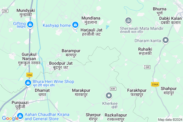
Thoi Map
EDIT Map
Add Your House
 ..
..
Current Corona Virus Infected Patients Count in Haridwar District
| City Name | District Name | Total Covid cases |
|---|---|---|
| Haridwar District | Haridwar | 7 |
Locality Name :
Thoi
( थोई )
Block Name : Narsan
District : Haridwar
State : Uttarakhand
Language : Hindi and Urdu
Current Time 05:33 PM
Date: Tuesday , Apr 29,2025 (IST)
Time zone: IST (UTC+5:30)
Elevation / Altitude: 261 meters. Above Seal level
Telephone Code / Std Code: 01334
Assembly constituency : Manglore assembly constituency
Assembly MLA : Kishore Upadhyay
Lok Sabha constituency : Hardwar parliamentary constituency
Parliament MP : Ajay Bhatt
Serpanch Name :
Pin Code : 247670
Post Office Name : Gurkul Narsan
Main Village Name : Thoi
Commodities Prices : Manglaur Market / Mandi
National Highways Reachable To Thoi
Nationa High Way :NH534
Nationa High Way :NH 334
Nationa High Way :NH534
Nationa High Way :NH 334
Rivers Near Thoi
Hindon River
Solani
Hindon River
Solani
About Thoi
Correct below Info and add more info about ThoiThoi is a small Village/hamlet in Narsan Block in Haridwar District of Uttarakhand State, India. It comes under Thoi Panchayath. It is located 41 KM towards South from District head quarters Haridwar. 10 KM from Narsan. 81 KM from State capital Dehradun
Thoi Pin code is 247670 and postal head office is Gurkul Narsan .
Barampur ( 3 KM ) , Boodpur Jat ( 4 KM ) , Nizampur ( 4 KM ) , Harchandpur ( 5 KM ) , Nagla China ( 5 KM ) are the nearby Villages to Thoi. Thoi is surrounded by Narsan Block towards North , Purkaji Block towards South , Laksar Block towards East , Roorkee Block towards North .
Purquazi , Manglaur , Roorkee , Muzaffarnagar are the near by Cities to Thoi.
This Place is in the border of the Haridwar District and Muzaffarnagar District. Muzaffarnagar District Purkaji is South towards this place . Also it is in the Border of other district Saharanpur . It is near to the Uttar Pradesh State Border.
Thoi 2011 Census Details
Thoi Local Language is Hindi. Thoi Village Total population is 529 and number of houses are 94. Female Population is 47.4%. Village literacy rate is 60.7% and the Female Literacy rate is 23.6%.
Population
| Census Parameter | Census Data |
| Total Population | 529 |
| Total No of Houses | 94 |
| Female Population % | 47.4 % ( 251) |
| Total Literacy rate % | 60.7 % ( 321) |
| Female Literacy rate | 23.6 % ( 125) |
| Scheduled Tribes Population % | 0.0 % ( 0) |
| Scheduled Caste Population % | 80.0 % ( 423) |
| Working Population % | 27.8 % |
| Child(0 -6) Population by 2011 | 75 |
| Girl Child(0 -6) Population % by 2011 | 41.3 % ( 31) |
Thoi Census More Deatils.
Politics in Thoi
INC , RJD , BSP , INC are the major political parties in this area.Polling Stations /Booths near Thoi
1)Bhagwanpur Chandanpur R.no. 2 West Part Bhavan2)Banheda Tanda
3)Manglaur R.no. 2
4)Manglore Miting Hal Naya Bhavan East Part
5)Manglore Miting Hal Naya Bhavan West Part
HOW TO REACH Thoi
By Rail
There is no railway station near to Thoi in less than 10 km.Colleges near Thoi
Vidya Vikasinee College
Address :
Mip School
Address :
Schools in Thoi
P.s. Thoi
Address : thoi , narsan , hardwar , Uttarakhand . PIN- 247670 , Post - Gurkul Narsan
Govt Health Centers near Thoi
1) CHC Landora , Community Health Center Landora , ,2) Manakpur , Sub Centre Manakpur , Manakpur ,
3) PHC Jawalapur , Jawalapur , Jawalapur ,
Sub Villages in Thoi
Hospitals in Thoi,Narsan
Smile Dental Clinic
Gurukul Narsan Road; Narsen Kalan; Uttarakhand 247670; India
7.9 KM distance Detail
more ..
Petrol Bunks in Thoi,Narsan
HP PETROL PUMP - SRI SAI FLG STN
HPC Dealers Village Khanpur; Dehradun; 247663; India
7.6 KM distance Detail
HP PETROL PUMP - INDIRA SERVICES
ON NH 58 Village Narsan; Dehradun; UL 243001; India
8.0 KM distance Detail
more ..
Colleges in Thoi,Narsan
Kastoorba Gandhi Balika Avasiya Madhyamic Vidhyalya
Harjolijatt; Uttarakhand 247670; India
3.5 KM distance Detail
Raja Mahendra Pratap Post Graduate College
National Highway 58; Gurukul Narsan; Uttarakhand 247670; India
8.0 KM distance Detail
RMPPV Inter College
National Highway 58; Gurukul Narsan; Uttarakhand 247670; India
8.1 KM distance Detail
more ..
Super Markets in Thoi,Narsan
Bright line Computers
Haji Hussain market 1; Khadar Chowk;; Purkaji; Uttar Pradesh 251327; India
10.2 KM distance Detail
Police Stations near Thoi,Narsan
Police Check Post; Gurukul Narsan
Delhi - Haridwar Rd; Gurukul Narsan; Uttarakhand 247670; India
7.9 KM distance Detail
Police Chowki; Ulehra Mod
Delhi - Haridwar Rd; Ulheda; Uttar Pradesh 247670; India
8.3 KM distance Detail
Governement Offices near Thoi,Narsan
Forest Office
Gurukul Narsen; Gurukul Narsan; Haridwar; NH-58; Delhi Haridwar Road; Roorkee; Roorkee; Uttarakhand 247667; India
8.1 KM distance Detail
state border checkpost
Delhi - Haridwar Rd; Jaitpur; Uttar Pradesh 247670; India
8.1 KM distance Detail
About Thoi &
History
How to reach Thoi
Tourist Places Near By Thoi
Schools in Thoi
Colleges in Thoi
Temperature & weather of Thoi
places in Thoi
Thoi photos
More Information
How to reach Thoi
Tourist Places Near By Thoi
Schools in Thoi
Colleges in Thoi
Temperature & weather of Thoi
places in Thoi
Thoi photos
More Information
Village Talk
Post News or Events about this Village
Near Cities
Purquazi 5 KM near
Manglaur 13 KM near
Roorkee 21 KM near
Muzaffarnagar 36 KM near
Purquazi 5 KM near
Manglaur 13 KM near
Roorkee 21 KM near
Muzaffarnagar 36 KM near
Near By Taluks
Khanpur 9 KM near
Narsan 10 KM near
Purkaji 11 KM near
Laksar 15 KM near
Khanpur 9 KM near
Narsan 10 KM near
Purkaji 11 KM near
Laksar 15 KM near
Near By Air Ports
Muzaffarnagar Airport 43 KM near
Dehra Dun Airport 77 KM near
Indira Gandhi International Airport 167 KM near
Chandigarh Airport 171 KM near
Muzaffarnagar Airport 43 KM near
Dehra Dun Airport 77 KM near
Indira Gandhi International Airport 167 KM near
Chandigarh Airport 171 KM near
Near By Tourist Places
Roorkee 21 KM near
Haridwar 40 KM near
Rajaji National Park 50 KM near
Rishikesh 61 KM near
Hastinapur 68 KM near
Roorkee 21 KM near
Haridwar 40 KM near
Rajaji National Park 50 KM near
Rishikesh 61 KM near
Hastinapur 68 KM near
Near By Districts
Muzaffarnagar 37 KM near
Haridwar 40 KM near
Bijnor 46 KM near
Saharanpur 52 KM near
Muzaffarnagar 37 KM near
Haridwar 40 KM near
Bijnor 46 KM near
Saharanpur 52 KM near
Near By RailWay Station
Laksar Junction Rail Way Station 12 KM near
Roorkee Rail Way Station 19 KM near
Laksar Junction Rail Way Station 12 KM near
Roorkee Rail Way Station 19 KM near