| Home | City Bus | Maps | Villages | Cities | Rail | Tourist Places | School | College | Pin Codes | Corona Cases Count |
| Distance Calculator Bus Services IFSC Codes Trace Mobile Number Weather Search Place Trace IP Available Cash ATM/Banks Locate Polling Booth Report an Error contact People |
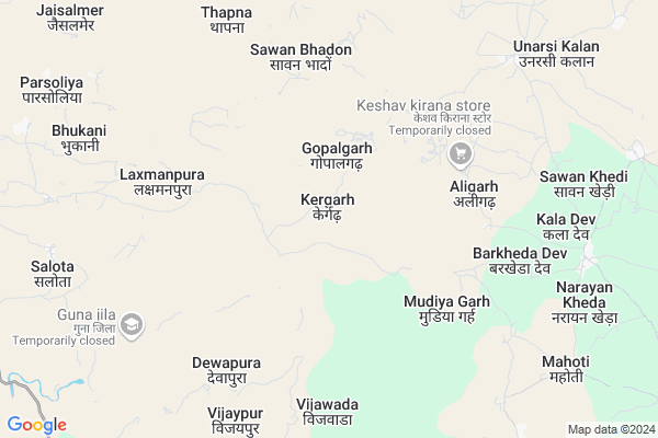
Kergarh
Kergarh Map
EDIT Map
Add Your House
 ..
..
Current Corona Virus Infected Patients Count in Guna District
| City Name | District Name | Total Covid cases |
|---|
Locality Name :
Kergarh
( केरगढ़ )
Tehsil Name : Raghogarh
District : Guna
State : Madhya Pradesh
Division : Gwalior
Language : Hindi
Current Time 08:23 PM
Date: Wednesday , Feb 05,2025 (IST)
Time zone: IST (UTC+5:30)
Elevation / Altitude: 421 meters. Above Seal level
Telephone Code / Std Code: 07544
Assembly constituency : Raghogarh assembly constituency
Assembly MLA : Jaivardhan Singh
Lok Sabha constituency : Rajgarh parliamentary constituency
Parliament MP : RODMAL NAGAR
Serpanch Name :
Pin Code : 473287
Post Office Name : Maksudangarh
Main Village Name : Kergarh
Commodities Prices : Aron Market / Mandi
Kergarh Live Weather
Temperature: 19.5 °C
clear sky
Humidity: 28%
Wind : 4.21 mt/sec towards NW
StationName : "Ä\u0080ron"
observed on 2 Hours Back
Temperature: 19.5 °C
clear sky
Humidity: 28%
Wind : 4.21 mt/sec towards NW
StationName : "Ä\u0080ron"
observed on 2 Hours Back
Kergarh Weather Forecast for Next 5 days
06-02-2025
13.7°C to 21.3°C
clear sky
13.7°C to 21.3°C
clear sky
07-02-2025
12.0°C to 25.1°C
clear sky
12.0°C to 25.1°C
clear sky
08-02-2025
12.3°C to 25.9°C
clear sky, scattered clouds, few clouds, broken clouds
12.3°C to 25.9°C
clear sky, scattered clouds, few clouds, broken clouds
09-02-2025
13.3°C to 27.6°C
scattered clouds, overcast clouds, broken clouds
13.3°C to 27.6°C
scattered clouds, overcast clouds, broken clouds
10-02-2025
16.2°C to 30.0°C
overcast clouds, broken clouds, scattered clouds, clear sky, few clouds
16.2°C to 30.0°C
overcast clouds, broken clouds, scattered clouds, clear sky, few clouds
National Highways Reachable To Kergarh
Nationa High Way :NH46
Nationa High Way :NH52
Nationa High Way :NH46
Nationa High Way :NH52
Rivers Near Kergarh
Parvan
Gaumukh Nadi
Parvan
Gaumukh Nadi
About Kergarh
Correct below Info and add more info about KergarhKergarh is a small Village/hamlet in Raghogarh Tehsil in Guna District of Madhya Pradesh State, India. It comes under Kergarh Panchayath. It belongs to Gwalior Division . It is located 49 KM towards South from District head quarters Guna. 16 KM from Raghogarh. 131 KM from State capital Bhopal
Kergarh Pin code is 473287 and postal head office is Maksudangarh .
Vijawada ( 7 KM ) , Vanjala ( 9 KM ) , Salota ( 10 KM ) , Mahu ( 10 KM ) , Parsoliya ( 11 KM ) are the nearby Villages to Kergarh. Kergarh is surrounded by Aron Tehsil towards East , Lateri Tehsil towards South , Chanchoda Tehsil towards west , Sironj Tehsil towards East .
Ashok Nagar , Raghogarh-Vijaypur , Guna , Sironj are the near by Cities to Kergarh.
Kergarh 2011 Census Details
Kergarh Local Language is Hindi. Kergarh Village Total population is 816 and number of houses are 191. Female Population is 48.9%. Village literacy rate is 32.4% and the Female Literacy rate is 12.7%.
Population
| Census Parameter | Census Data |
| Total Population | 816 |
| Total No of Houses | 191 |
| Female Population % | 48.9 % ( 399) |
| Total Literacy rate % | 32.4 % ( 264) |
| Female Literacy rate | 12.7 % ( 104) |
| Scheduled Tribes Population % | 73.4 % ( 599) |
| Scheduled Caste Population % | 0.0 % ( 0) |
| Working Population % | 47.9 % |
| Child(0 -6) Population by 2011 | 171 |
| Girl Child(0 -6) Population % by 2011 | 54.4 % ( 93) |
Kergarh Census More Deatils.
Politics in Kergarh
Bharatiya Janata Party , BJP , INC are the major political parties in this area.Polling Stations /Booths near Kergarh
1)Dehrikalan2)Imaliya
3)Duhavad
4)Lathya
5)Savatakhedi
HOW TO REACH Kergarh
By Rail
There is no railway station near to Kergarh in less than 10 km.Colleges near Kergarh
P.g. Collage
Address :
Cresent College Of Technology
Address : Opp. Bhopal Memorial Hospital , Karod, Bhopal
Government College, Guna, Madhya Pradesh
Address : Government College, Guna, Madhya Pradesh Chachoda
Sha-shib Aerospace Engineering
Address : Vivek Colony,opp. Guna Airport,
Govt. P. G. College
Address : Govt. P. G. Collegegunadistrict- Gunamadhya Prades
Schools in Kergarh
Uegs Kergarh
Address : kergarh , raghogarh , guna , Madhya Pradesh . PIN- 473287 , Post - Maksudangarh
Govt Health Centers near Kergarh
1) SHC Gader , 21 , Village , Aww ke pas2) SHC Barod , 45 , Village , Aww ke pas
3) SHC Unarshikalan , , vill Unarshikalan , SHC Unarshikalan
Sub Villages in Kergarh
Petrol Bunks in Kergarh,Raghogarh
HP PETROL PUMP - PRABHU KRIPA PETROL PUMP
Aaron; Madhya Pradesh 473101; India
21.7 KM distance Detail
more ..
About Kergarh &
History
How to reach Kergarh
Tourist Places Near By Kergarh
Schools in Kergarh
Colleges in Kergarh
Temperature & weather of Kergarh
places in Kergarh
Kergarh photos
More Information
How to reach Kergarh
Tourist Places Near By Kergarh
Schools in Kergarh
Colleges in Kergarh
Temperature & weather of Kergarh
places in Kergarh
Kergarh photos
More Information
Village Talk
Post News or Events about this Village
Near Cities
Ashok Nagar 18 KM near
Raghogarh-Vijaypur 25 KM near
Guna 48 KM near
Sironj 49 KM near
Ashok Nagar 18 KM near
Raghogarh-Vijaypur 25 KM near
Guna 48 KM near
Sironj 49 KM near
Near By Taluks
Raghogarh 16 KM near
Aron 21 KM near
Lateri 26 KM near
Chanchoda 31 KM near
Raghogarh 16 KM near
Aron 21 KM near
Lateri 26 KM near
Chanchoda 31 KM near
Near By Air Ports
Bhopal Airport 121 KM near
Indore Airport 254 KM near
Gwalior Airport 274 KM near
Khajuraho Airport 305 KM near
Bhopal Airport 121 KM near
Indore Airport 254 KM near
Gwalior Airport 274 KM near
Khajuraho Airport 305 KM near
Near By Tourist Places
Guna 47 KM near
Vidisha 109 KM near
Sanchi 109 KM near
Chanderi 111 KM near
Deogarh 112 KM near
Guna 47 KM near
Vidisha 109 KM near
Sanchi 109 KM near
Chanderi 111 KM near
Deogarh 112 KM near
Near By Districts
Guna 47 KM near
Ashoknagar 63 KM near
Rajgarh 71 KM near
Vidisha 109 KM near
Guna 47 KM near
Ashoknagar 63 KM near
Rajgarh 71 KM near
Vidisha 109 KM near
Near By RailWay Station
Chachaura Binaganj Rail Way Station 32 KM near
Ruthiyai Junction Rail Way Station 36 KM near
Chachaura Binaganj Rail Way Station 32 KM near
Ruthiyai Junction Rail Way Station 36 KM near