| Home | City Bus | Maps | Villages | Cities | Rail | Tourist Places | School | College | Pin Codes | Corona Cases Count |
| Distance Calculator Bus Services IFSC Codes Trace Mobile Number Weather Search Place Trace IP Available Cash ATM/Banks Locate Polling Booth Report an Error contact People |
Musreli
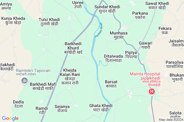
Musreli Map
EDIT Map
Add Your House
 ..
..
Current Corona Virus Infected Patients Count in Guna District
| City Name | District Name | Total Covid cases |
|---|
Locality Name :
Musreli
( मूसरेली )
Tehsil Name : Chanchoda
District : Guna
State : Madhya Pradesh
Division : Gwalior
Language : Hindi
Current Time 11:27 PM
Date: Thursday , Mar 13,2025 (IST)
Time zone: IST (UTC+5:30)
Elevation / Altitude: 435 meters. Above Seal level
Telephone Code / Std Code: 07546
Assembly constituency : Chachoura assembly constituency
Assembly MLA : Priyanka Penchi
Lok Sabha constituency : Rajgarh parliamentary constituency
Parliament MP : RODMAL NAGAR
Serpanch Name :
Pin Code : 473115
Post Office Name : Binaganj
Main Village Name : Musreli
Commodities Prices : Kumbhraj Market / Mandi
Musreli Live Weather
Temperature: 26.7 °C
clear sky
Humidity: 17%
Wind : 5.25 mt/sec towards W
StationName : "KumbhrÄ\u0081j"
observed on 12 Mins Back
Temperature: 26.7 °C
clear sky
Humidity: 17%
Wind : 5.25 mt/sec towards W
StationName : "KumbhrÄ\u0081j"
observed on 12 Mins Back
Musreli Weather Forecast for Next 5 days
14-03-2025
24.5°C to 26.7°C
clear sky
24.5°C to 26.7°C
clear sky
15-03-2025
23.4°C to 36.6°C
clear sky
23.4°C to 36.6°C
clear sky
16-03-2025
24.3°C to 36.6°C
clear sky, scattered clouds, few clouds, broken clouds
24.3°C to 36.6°C
clear sky, scattered clouds, few clouds, broken clouds
17-03-2025
24.7°C to 34.5°C
broken clouds, few clouds, scattered clouds, clear sky
24.7°C to 34.5°C
broken clouds, few clouds, scattered clouds, clear sky
18-03-2025
22.1°C to 34.3°C
few clouds, clear sky, scattered clouds, broken clouds
22.1°C to 34.3°C
few clouds, clear sky, scattered clouds, broken clouds
National Highways Reachable To Musreli
Nationa High Way :NH46
Nationa High Way :NH46;NH752B
Nationa High Way :NH46
Nationa High Way :NH46;NH752B
Rivers Near Musreli
Ajnal
Dedia Nala
Ajnal
Dedia Nala
About Musreli
Correct below Info and add more info about MusreliMusreli is a small Village/hamlet in Chanchoda Tehsil in Guna District of Madhya Pradesh State, India. It comes under Musreli Panchayath. It belongs to Gwalior Division . It is located 50 KM towards South from District head quarters Guna. 12 KM from Chanchoda. 140 KM from State capital Bhopal
Musreli Pin code is 473115 and postal head office is Binaganj .
Allikhedi ( 5 KM ) , Fajalpur ( 7 KM ) , Barkhedimafi ( 7 KM ) , Tulsikhedi ( 7 KM ) , Sundar Khedi ( 7 KM ) are the nearby Villages to Musreli. Musreli is surrounded by Chanchoda Tehsil towards west , Aron Tehsil towards East , Manoharthana Tehsil towards west , Lateri Tehsil towards East .
Raghogarh-Vijaypur , Ashok Nagar , Guna , Sironj are the near by Cities to Musreli.
Musreli 2011 Census Details
Musreli Local Language is Hindi. Musreli Village Total population is 402 and number of houses are 71. Female Population is 46.5%. Village literacy rate is 37.3% and the Female Literacy rate is 13.4%.
Population
| Census Parameter | Census Data |
| Total Population | 402 |
| Total No of Houses | 71 |
| Female Population % | 46.5 % ( 187) |
| Total Literacy rate % | 37.3 % ( 150) |
| Female Literacy rate | 13.4 % ( 54) |
| Scheduled Tribes Population % | 0.0 % ( 0) |
| Scheduled Caste Population % | 4.0 % ( 16) |
| Working Population % | 54.2 % |
| Child(0 -6) Population by 2011 | 87 |
| Girl Child(0 -6) Population % by 2011 | 40.2 % ( 35) |
Musreli Census More Deatils.
Politics in Musreli
Bharatiya Janata Party , BJP , INC are the major political parties in this area.Polling Stations /Booths near Musreli
1)Murela2)Bansakhedi
3)Khejadakala
4)Kanakhedi
5)Jamonyajagir
HOW TO REACH Musreli
By Rail
Kumbhraj Rail Way Station is the very nearby railway stations to Musreli.Colleges near Musreli
P.g. Collage
Address :
Cresent College Of Technology
Address : Opp. Bhopal Memorial Hospital , Karod, Bhopal
Government College, Guna, Madhya Pradesh
Address : Government College, Guna, Madhya Pradesh Chachoda
Sha-shib Aerospace Engineering
Address : Vivek Colony,opp. Guna Airport,
Govt. P. G. College
Address : Govt. P. G. Collegegunadistrict- Gunamadhya Prades
Schools in Musreli
Uegs Musreli
Address : musreli , chachoda , guna , Madhya Pradesh . PIN- 473115 , Post - Binaganj
Govt Health Centers near Musreli
1) SHC Rani Khejra , ranikhejda , ranikhejda , govt.school ke pass2) SHC Teligaon , SHC Teligaon , SHC Teligaon , Dehri Road Pass
3) SHC Barkhedi , SHC Barkhedi , SHC Barkhedi ,
Sub Villages in Musreli
Hospitals in Musreli,Chanchoda
Pari Medical; Tulsikhedi Road
Khatkiya; Kumbhraj; Madhya Pradesh 473222; India
11.4 KM distance Detail
more ..
Petrol Bunks in Musreli,Chanchoda
HP PETROL PUMP - SHRI RAM MEENA KUMBHRAJ
Hpcl Dealers Village Manpura Tehsil Kumbhraj; Bhopal; Madhya Pradesh 473222; India
9.9 KM distance Detail
more ..
Colleges in Musreli,Chanchoda
The Guidance Institute
House no. 13; Ward no. 4; Indra Colony; Kumbhraj; dist. Guna; M.P; Kumbhraj; Madhya Pradesh; India
11.3 KM distance Detail
Jaypee University Of Engineering And Technology
Agra Bombay Road; Raghogarh -Vijaypur; Madhya Pradesh 473226; India
18.5 KM distance Detail
more ..
Schools in Musreli,Chanchoda
Anand Sanskar Convent SchoolGawri
Jamner Rd; gaori; Janjali; Madhya Pradesh 473287; India
6.0 KM distance Detail
Gyandeep Public Convent School barsat Deepak Meena
Barsat; Madhya Pradesh 473287; India
6.6 KM distance Detail
Electronic Shops in Musreli,Chanchoda
satish dhakad csc and mp online
gram barsat tahsil raghogarh; raghogarh; Madhya Pradesh 473287; India
6.6 KM distance Detail
Super Markets in Musreli,Chanchoda
Devimahima mobile shop
Mumbai - Agra National Hwy; Binaganj; Madhya Pradesh 473115; India
17.4 KM distance Detail
Shivhare Kirana Store {Ashok Shivhare}
Binaganj; Madhya Pradesh 473115; India
17.5 KM distance Detail
Governement Offices near Musreli,Chanchoda
Public Works Department
Block Colony; Raghogarh; Madhya Pradesh 473226; India
21.3 KM distance Detail
The Vijaypur Public Carrier Union Office
Vijaipur; Madhya Pradesh 473112; India
22.9 KM distance Detail
About Musreli &
History
How to reach Musreli
Tourist Places Near By Musreli
Schools in Musreli
Colleges in Musreli
Temperature & weather of Musreli
places in Musreli
Musreli photos
More Information
How to reach Musreli
Tourist Places Near By Musreli
Schools in Musreli
Colleges in Musreli
Temperature & weather of Musreli
places in Musreli
Musreli photos
More Information
Village Talk
Post News or Events about this Village
Near Cities
Raghogarh-Vijaypur 20 KM near
Ashok Nagar 36 KM near
Guna 49 KM near
Sironj 70 KM near
Raghogarh-Vijaypur 20 KM near
Ashok Nagar 36 KM near
Guna 49 KM near
Sironj 70 KM near
Near By Taluks
Raghogarh 10 KM near
Chanchoda 12 KM near
Aron 38 KM near
Manoharthana 42 KM near
Raghogarh 10 KM near
Chanchoda 12 KM near
Aron 38 KM near
Manoharthana 42 KM near
Near By Air Ports
Bhopal Airport 129 KM near
Indore Airport 245 KM near
Gwalior Airport 278 KM near
Khajuraho Airport 324 KM near
Bhopal Airport 129 KM near
Indore Airport 245 KM near
Gwalior Airport 278 KM near
Khajuraho Airport 324 KM near
Near By Tourist Places
Guna 48 KM near
Sanchi 124 KM near
Vidisha 125 KM near
Chanderi 126 KM near
Deogarh 130 KM near
Guna 48 KM near
Sanchi 124 KM near
Vidisha 125 KM near
Chanderi 126 KM near
Deogarh 130 KM near
Near By Districts
Guna 48 KM near
Rajgarh 56 KM near
Ashoknagar 78 KM near
Jhalawar 114 KM near
Guna 48 KM near
Rajgarh 56 KM near
Ashoknagar 78 KM near
Jhalawar 114 KM near
Near By RailWay Station
Kumbhraj Rail Way Station 8.9 KM near
Chachaura Binaganj Rail Way Station 18 KM near
Ruthiyai Junction Rail Way Station 29 KM near
Kumbhraj Rail Way Station 8.9 KM near
Chachaura Binaganj Rail Way Station 18 KM near
Ruthiyai Junction Rail Way Station 29 KM near