| Home | City Bus | Maps | Villages | Cities | Rail | Tourist Places | School | College | Pin Codes | Corona Cases Count |
| Distance Calculator Bus Services IFSC Codes Trace Mobile Number Weather Search Place Trace IP Available Cash ATM/Banks Locate Polling Booth Report an Error contact People |
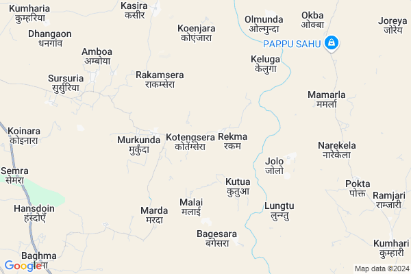
Kotengsera Map
EDIT Map
Add Your House
 ..
..
Current Corona Virus Infected Patients Count in Gumla District
| City Name | District Name | Total Covid cases |
|---|
Locality Name :
Kotengsera
( कोटिंग्सेरा )
Block Name : Gumla
District : Gumla
State : Jharkhand
Language : Nagpuri and Hindi, Oriya, Bihari, Kurukh.
Current Time 01:23 AM
Date: Friday , Mar 14,2025 (IST)
Time zone: IST (UTC+5:30)
Elevation / Altitude: 643 meters. Above Seal level
Telephone Code / Std Code: 06524
Assembly constituency : Bishunpur assembly constituency
Assembly MLA : CHAMRA LINDA
Lok Sabha constituency : Lohardaga parliamentary constituency
Parliament MP : SUDARSHAN BHAGAT
Serpanch Name :
Pin Code : 835229
Post Office Name : Basia
Main Village Name : Kotengsera
Commodities Prices : Lohardaga Market / Mandi
Kotengsera Live Weather
Temperature: 22.1 °C
clear sky
Humidity: 23%
Wind : 1.58 mt/sec towards NW
StationName : "GumlÄ\u0081"
observed on Now
Temperature: 22.1 °C
clear sky
Humidity: 23%
Wind : 1.58 mt/sec towards NW
StationName : "GumlÄ\u0081"
observed on Now
Kotengsera Weather Forecast for Next 5 days
14-03-2025
21.7°C to 21.7°C
clear sky
21.7°C to 21.7°C
clear sky
15-03-2025
20.5°C to 38.0°C
clear sky
20.5°C to 38.0°C
clear sky
16-03-2025
22.6°C to 38.9°C
clear sky, few clouds
22.6°C to 38.9°C
clear sky, few clouds
17-03-2025
23.7°C to 38.7°C
few clouds, clear sky, broken clouds, overcast clouds
23.7°C to 38.7°C
few clouds, clear sky, broken clouds, overcast clouds
18-03-2025
23.4°C to 36.8°C
scattered clouds, broken clouds, clear sky
23.4°C to 36.8°C
scattered clouds, broken clouds, clear sky
Rivers Near Kotengsera
Bassa
Lawa
Bassa
Lawa
About Kotengsera
Correct below Info and add more info about KotengseraKotengsera is a small Village/hamlet in Gumla Block in Gumla District of Jharkhand State, India. It comes under Kotengsera Panchayath. It is located 20 KM towards East from District head quarters Gumla. 22 KM from Gumla. 85 KM from State capital Ranchi
Kotengsera Pin code is 835229 and postal head office is Basia .
Amboa ( 7 KM ) , Kasira ( 7 KM ) , Olmunda ( 7 KM ) , Baghima ( 9 KM ) , Okba ( 9 KM ) are the nearby Villages to Kotengsera. Kotengsera is surrounded by Palkot Block towards South , Gumla Block towards west , Kamdara Block towards East , Bharno Block towards North .
Gumla , Simdega , Lohardaga , Jashpurnagar are the near by Cities to Kotengsera.
Kotengsera 2011 Census Details
Kotengsera Local Language is Nagpuri. Kotengsera Village Total population is 1164 and number of houses are 230. Female Population is 48.3%. Village literacy rate is 48.8% and the Female Literacy rate is 20.2%.
Population
| Census Parameter | Census Data |
| Total Population | 1164 |
| Total No of Houses | 230 |
| Female Population % | 48.3 % ( 562) |
| Total Literacy rate % | 48.8 % ( 568) |
| Female Literacy rate | 20.2 % ( 235) |
| Scheduled Tribes Population % | 85.1 % ( 990) |
| Scheduled Caste Population % | 0.3 % ( 3) |
| Working Population % | 57.9 % |
| Child(0 -6) Population by 2011 | 197 |
| Girl Child(0 -6) Population % by 2011 | 44.2 % ( 87) |
Kotengsera Census More Deatils.
Politics in Kotengsera
Bharatiya Janata Party , BJP , RAKAP , JMM , INC are the major political parties in this area.Polling Stations /Booths near Kotengsera
1)Primary School Kita2)Upgrade Middle School Phori Pasanga
3)Primary School Koynjara
4)Upgrade Middle School Kulabira
5)Upgrade Middle School Rekma
HOW TO REACH Kotengsera
By Rail
There is no railway station near to Kotengsera in less than 10 km.Colleges near Kotengsera
Baij Nath Jalan College
Address :
Tana Bhagat College
Address :
Albert Ekka Collage
Address :
Schools near Kotengsera
Don Bosco School, Gumla
Address : Don Bosco School
Gumla, Jharkhand 835207
Govt Health Centers near Kotengsera
1) HSC MURKUNDA , , MURKUNDA ,2) HSC KALIGA , , KALIGA ,
3) HSC BAGESERA , BAGESERA , ,
Sub Villages in Kotengsera
Petrol Bunks in Kotengsera,Gumla
HP PETROL PUMP - SAHU BROTHERS
HP Petrol Pump Dealer PO Gumla Jharkhand; Gumla; Jharkhand 835207; India
20.2 KM distance Detail
more ..
Super Markets in Kotengsera,Gumla
SHARDA AUTO AND TYARED
Tamar - Khunti - Kolebira Road; Konbir; Jharkhand 835211; India
20.5 KM distance Detail
Police Stations near Kotengsera,Gumla
Police Station
Tamar - Khunti - Kolebira Road; Basia; Jharkhand 835229; India
20.5 KM distance Detail
About Kotengsera &
History
How to reach Kotengsera
Tourist Places Near By Kotengsera
Schools in Kotengsera
Colleges in Kotengsera
Temperature & weather of Kotengsera
places in Kotengsera
Kotengsera photos
More Information
How to reach Kotengsera
Tourist Places Near By Kotengsera
Schools in Kotengsera
Colleges in Kotengsera
Temperature & weather of Kotengsera
places in Kotengsera
Kotengsera photos
More Information
Village Talk
Post News or Events about this Village
Near Cities
Gumla 20 KM near
Simdega 53 KM near
Lohardaga 55 KM near
Jashpurnagar 65 KM near
Gumla 20 KM near
Simdega 53 KM near
Lohardaga 55 KM near
Jashpurnagar 65 KM near
Near By Taluks
Basia 15 KM near
Palkot 19 KM near
Gumla 21 KM near
Kamdara 26 KM near
Basia 15 KM near
Palkot 19 KM near
Gumla 21 KM near
Kamdara 26 KM near
Near By Air Ports
Ranchi Airport 81 KM near
Gaya Airport 220 KM near
Patna Airport 327 KM near
Bhubaneswar Airport 364 KM near
Ranchi Airport 81 KM near
Gaya Airport 220 KM near
Patna Airport 327 KM near
Bhubaneswar Airport 364 KM near
Near By Tourist Places
Gumla 20 KM near
Chotanagpur 34 KM near
Simdega 52 KM near
Lohardaga 54 KM near
Jashpur 66 KM near
Gumla 20 KM near
Chotanagpur 34 KM near
Simdega 52 KM near
Lohardaga 54 KM near
Jashpur 66 KM near
Near By Districts
Gumla 20 KM near
Simdega 53 KM near
Lohardaga 55 KM near
Khunti 66 KM near
Gumla 20 KM near
Simdega 53 KM near
Lohardaga 55 KM near
Khunti 66 KM near
Near By RailWay Station
Hatia Rail Way Station 79 KM near
Ranchi Junction Rail Way Station 84 KM near
Hatia Rail Way Station 79 KM near
Ranchi Junction Rail Way Station 84 KM near