| Home | City Bus | Maps | Villages | Cities | Rail | Tourist Places | School | College | Pin Codes | Corona Cases Count |
| Distance Calculator Bus Services IFSC Codes Trace Mobile Number Weather Search Place Trace IP Available Cash ATM/Banks Locate Polling Booth Report an Error contact People |
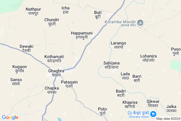
Khatanga Map
EDIT Map
Add Your House
 ..
..
Current Corona Virus Infected Patients Count in Gumla District
| City Name | District Name | Total Covid cases |
|---|
Locality Name :
Khatanga
( खटंगा )
Block Name : Ghaghra
District : Gumla
State : Jharkhand
Language : Nagpuri and Hindi, Oriya, Bihari, Kurukh.
Current Time 03:15 PM
Date: Tuesday , Apr 29,2025 (IST)
Time zone: IST (UTC+5:30)
Elevation / Altitude: 643 meters. Above Seal level
Telephone Code / Std Code: 06523
Assembly constituency : Bishunpur assembly constituency
Assembly MLA : CHAMRA LINDA
Lok Sabha constituency : Lohardaga parliamentary constituency
Parliament MP : SUDARSHAN BHAGAT
Serpanch Name :
Main Village Name : Khatanga
Commodities Prices : Lohardaga Market / Mandi
Khatanga Live Weather
Temperature: 29.5 °C
light rain
Humidity: 31%
Wind : 9.53 mt/sec towards SW
Rain : null
StationName : "LohÄ\u0081rdagÄ\u0081"
observed on Now
Temperature: 29.5 °C
light rain
Humidity: 31%
Wind : 9.53 mt/sec towards SW
Rain : null
StationName : "LohÄ\u0081rdagÄ\u0081"
observed on Now
Khatanga Weather Forecast for Next 5 days
30-04-2025
21.0°C to 24.4°C
light rain, overcast clouds, broken clouds
21.0°C to 24.4°C
light rain, overcast clouds, broken clouds
01-05-2025
20.4°C to 35.6°C
scattered clouds, clear sky, moderate rain, broken clouds, light rain
20.4°C to 35.6°C
scattered clouds, clear sky, moderate rain, broken clouds, light rain
02-05-2025
20.2°C to 34.5°C
clear sky, heavy intensity rain, moderate rain, overcast clouds, scattered clouds
20.2°C to 34.5°C
clear sky, heavy intensity rain, moderate rain, overcast clouds, scattered clouds
03-05-2025
20.3°C to 34.7°C
clear sky, few clouds, light rain, overcast clouds, scattered clouds
20.3°C to 34.7°C
clear sky, few clouds, light rain, overcast clouds, scattered clouds
04-05-2025
22.2°C to 35.2°C
scattered clouds, few clouds, clear sky, light rain, broken clouds
22.2°C to 35.2°C
scattered clouds, few clouds, clear sky, light rain, broken clouds
Rivers Near Khatanga
Bandi Koel Nadi
Sankh River :Sankh River
Bandi Koel Nadi
Sankh River :Sankh River
About Khatanga
Correct below Info and add more info about KhatangaKhatanga is a small Village/hamlet in Ghaghra Block in Gumla District of Jharkhand State, India. It comes under Khatanga Panchayath. It is located 31 KM towards North from District head quarters Gumla. 8 KM from Ghaghra. 86 KM from State capital Ranchi
Badri ( 6 KM ) , Devaki ( 6 KM ) , Chapka ( 6 KM ) , Kugaon ( 9 KM ) , Duko ( 12 KM ) are the nearby Villages to Khatanga. Khatanga is surrounded by Senha Block towards North , Sisai Block towards East , Gumla Block towards South , Lohardaga Block towards North .
Lohardaga , Gumla , Jashpurnagar , Churi are the near by Cities to Khatanga.
This Place is in the border of the Gumla District and Lohardaga District. Lohardaga District Senha is North towards this place .
Khatanga 2011 Census Details
Khatanga Local Language is Nagpuri. Khatanga Village Total population is 663 and number of houses are 118. Female Population is 50.5%. Village literacy rate is 32.4% and the Female Literacy rate is 12.8%.
Population
| Census Parameter | Census Data |
| Total Population | 663 |
| Total No of Houses | 118 |
| Female Population % | 50.5 % ( 335) |
| Total Literacy rate % | 32.4 % ( 215) |
| Female Literacy rate | 12.8 % ( 85) |
| Scheduled Tribes Population % | 93.2 % ( 618) |
| Scheduled Caste Population % | 0.0 % ( 0) |
| Working Population % | 46.9 % |
| Child(0 -6) Population by 2011 | 134 |
| Girl Child(0 -6) Population % by 2011 | 45.5 % ( 61) |
Khatanga Census More Deatils.
Politics in Khatanga
Bharatiya Janata Party , BJP , RAKAP , JMM , INC are the major political parties in this area.Polling Stations /Booths near Khatanga
1)Residential School Jehangutwa2)Sant Yud Middle School Nawdiha
3)Nav. Govt. Primary School Sehal
4)Govt. Middle School Banalat
5)Govt. Middle School Gamharia
HOW TO REACH Khatanga
By Rail
There is no railway station near to Khatanga in less than 10 km.Pincodes near Khatanga
835208 ( Ghaghra ) , 835302 ( Lohardaga ) , 835231 ( Bishunpur )Colleges near Khatanga
Tana Bhagat College
Address :
Schools near Khatanga
Sarswati Vidya Mandir
Address :
Rise And Glow Residential School
Address : Jawahar Navodaya Vidyalaya Masariya Road, Ghaghra. Gumla
Rise And Glow Residential School
Address : Jawahar Navodaya Vidyalaya Masariya Road, Ghaghra. Gumla
Govt Health Centers near Khatanga
1) HSC NAVDIHA , Navdiha , ,2) HSC GAMHARIA , Gamharia , ,
3) CHC GHAGHRA , , ,
Sub Villages in Khatanga
Petrol Bunks in Khatanga,Ghaghra
HP PETROL PUMP - MITRA SONS
HP Petrol Pump Ghaghra; Ghaghra Gumla Road Ghaghra; Ranchi; Jharkhand 835208; India
3.9 KM distance Detail
more ..
Colleges in Khatanga,Ghaghra
Mnoharlal Agarwal Saraswati Vidya Mandir; Lohardaga
Lohardaga; Jharkhand 835302; India
20.4 KM distance Detail
more ..
Electronic Shops in Khatanga,Ghaghra
पवन साहू स्टोर गम्हरिया
835208; Jharkhand State Highway 8; Gamhariya; Jharkhand 835324; India
3.4 KM distance Detail
Salman Heavy Vehicle Workshop
Bhusar - Ghaghara Rd; Ghaghra; Jharkhand 835208; India
3.5 KM distance Detail
Maa Durga Mobile & Electric
Bhusar - Ghaghara Rd; Ghaghra; Jharkhand 835208; India
4.9 KM distance Detail
Police Stations near Khatanga,Ghaghra
New Police Line ; Bakshidipa
New police line; Ekaguri; Jharkhand 835302; India
19.1 KM distance Detail
About Khatanga &
History
How to reach Khatanga
Tourist Places Near By Khatanga
Schools in Khatanga
Colleges in Khatanga
Temperature & weather of Khatanga
places in Khatanga
Khatanga photos
More Information
How to reach Khatanga
Tourist Places Near By Khatanga
Schools in Khatanga
Colleges in Khatanga
Temperature & weather of Khatanga
places in Khatanga
Khatanga photos
More Information
Village Talk
Post News or Events about this Village
Near Cities
Lohardaga 21 KM near
Gumla 29 KM near
Jashpurnagar 69 KM near
Churi 71 KM near
Lohardaga 21 KM near
Gumla 29 KM near
Jashpurnagar 69 KM near
Churi 71 KM near
Near By Taluks
Ghaghra 7 KM near
Senha 13 KM near
Sisai 18 KM near
Gumla 25 KM near
Ghaghra 7 KM near
Senha 13 KM near
Sisai 18 KM near
Gumla 25 KM near
Near By Air Ports
Ranchi Airport 83 KM near
Gaya Airport 187 KM near
Patna Airport 293 KM near
Varanasi Airport 334 KM near
Ranchi Airport 83 KM near
Gaya Airport 187 KM near
Patna Airport 293 KM near
Varanasi Airport 334 KM near
Near By Tourist Places
Lohardaga 21 KM near
Gumla 29 KM near
Netarhat 43 KM near
Latehar 58 KM near
Chotanagpur 58 KM near
Lohardaga 21 KM near
Gumla 29 KM near
Netarhat 43 KM near
Latehar 58 KM near
Chotanagpur 58 KM near
Near By Districts
Lohardaga 21 KM near
Gumla 29 KM near
Latehar 58 KM near
Jashpur 71 KM near
Lohardaga 21 KM near
Gumla 29 KM near
Latehar 58 KM near
Jashpur 71 KM near
Near By RailWay Station
Tori Junction Rail Way Station 52 KM near
Latehar Rail Way Station 57 KM near
Tori Junction Rail Way Station 52 KM near
Latehar Rail Way Station 57 KM near