| Home | City Bus | Maps | Villages | Cities | Rail | Tourist Places | School | College | Pin Codes | Corona Cases Count |
| Distance Calculator Bus Services IFSC Codes Trace Mobile Number Weather Search Place Trace IP Available Cash ATM/Banks Locate Polling Booth Report an Error contact People |
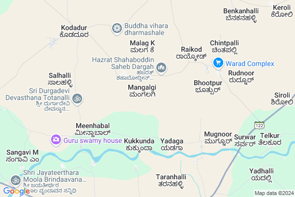
Mangalgi Map
EDIT Map
Add Your House
 ..
..
Current Corona Virus Infected Patients Count in Gulbarga District
| City Name | District Name | Total Covid cases |
|---|
Locality Name :
Mangalgi
( ಮಂಗಳ್ಗಿ )
Taluk Name : Chitapur
District : Gulbarga
State : Karnataka
Division : Gulbarga
Language : Kannada and Urdu
Current Time 11:10 AM
Date: Tuesday , Apr 29,2025 (IST)
Time zone: IST (UTC+5:30)
Elevation / Altitude: 427 meters. Above Seal level
Telephone Code / Std Code: 08474
Assembly constituency : Chincholi assembly constituency
Assembly MLA : Avinash Umesh Jadhav
Lok Sabha constituency : Bidar parliamentary constituency
Parliament MP : BHAGWANTH KHUBA
Serpanch Name :
Pin Code : 585312
Post Office Name : Kalgi
Main Village Name : Mangalgi
Commodities Prices : Sedam Market / Mandi
Edit below overview about Mangalgi
Edit below overview about Mangalgi
OverView of Mangalgi
Mangalgi is very beatiful village and in there mallikarjun temple it has 100 piller inside saround the temple made visual artis famous and Jain statue it was built in 9th century rulled by rastrakuta empire . Mangalgi has ancient history mallikarjun temple it becames Hindu temple . and muslim dharga famous festival in mangalgi grand celebration.In this village people living very happy compared to other village and so many people are good postion in the village here hard working people are so many here all are indipendent people we sawEdit below overview about Mangalgi
National Highways Reachable To Mangalgi
Nationa High Way :NH50
Nationa High Way :NH65
Nationa High Way :NH50
Nationa High Way :NH65
Rivers Near Mangalgi
Mullamari :ಮುಲ್ಲಾಮಾರಿ
Kagina :ಕಾಗಿನಾ
Mullamari :ಮುಲ್ಲಾಮಾರಿ
Kagina :ಕಾಗಿನಾ
About Mangalgi
Mangalgi is a small Village/hamlet in Chitapur Taluk in Gulbarga District of Karnataka State, India. It comes under Mangalgi Panchayath. It belongs to Gulbarga Division . It is located 52 KM towards East from District head quarters Gulbarga. 25 KM from Chitapur. 560 KM from State capital Bangalore
Mangalgi Pin code is 585312 and postal head office is Kalgi .
Neelhalli ( 10 KM ) , Telkur ( 11 KM ) , Halcher ( 12 KM ) , Sedam ( 12 KM ) , Rajapur ( 12 KM ) are the nearby Villages to Mangalgi. Mangalgi is surrounded by Sedam Taluk towards South , Basheerabad Taluk towards East , Chincholi Taluk towards North , Tandur Taluk towards East .
Sedam , Tandur , Wadi , Shahabad are the near by Cities to Mangalgi.
Mangalgi 2011 Census Details
Mangalgi Local Language is Kannada. Mangalgi Village Total population is 3424 and number of houses are 608. Female Population is 50.4%. Village literacy rate is 48.6% and the Female Literacy rate is 20.5%.
Population
| Census Parameter | Census Data |
| Total Population | 3424 |
| Total No of Houses | 608 |
| Female Population % | 50.4 % ( 1725) |
| Total Literacy rate % | 48.6 % ( 1663) |
| Female Literacy rate | 20.5 % ( 702) |
| Scheduled Tribes Population % | 0.1 % ( 3) |
| Scheduled Caste Population % | 14.8 % ( 506) |
| Working Population % | 47.1 % |
| Child(0 -6) Population by 2011 | 489 |
| Girl Child(0 -6) Population % by 2011 | 52.4 % ( 256) |
Mangalgi Census More Deatils.
Politics in Mangalgi
Bharatiya Janata Party , BJP , Indian National Congress (INC) , INC are the major political parties in this area.Polling Stations /Booths near Mangalgi
1)Govt Higher Primary School2)Govt. Higher Primary School(left Wing)
3)Shri Sharanabasaveshwara Vidya Mandir Building (left Wing)
4)Shri Sharana Basaveshwar Vidya Mandir Building (south Wing)
5)Govt Higher Primary School Building
HOW TO REACH Mangalgi
By Road
Chitapur is the Nearest Town to Mangalgi. Chitapur is 25 km from Mangalgi. Road connectivity is there from Chitapur to Mangalgi.By Rail
There is no railway station near to Mangalgi in less than 10 km. How ever there are railway Stations from Near By town Chitapur. are the railway Stations near to Chitapur. You can reach from Chitapur to Mangalgi by road after .Colleges near Mangalgi
Govt. Pu College Kalgi
Address :
Shri Revanasiddeshwara Shrimati Nagaratnamma Shivasharanappa Kamalapur First Grade College Kalgi.
Address :
Svv Education Society’s Smt. Mc Vasantha College Of Education
Address : Svv Education Society’s Smt. Mc Vasantha College O
Keerthi College Of Nursing
Address : Prashant Nagar B, Rajapur Road Gulbarga Karnataka
Deccan B.ed. College
Address : Malgatti Cross, Ring Road,gulbarga - 585 101
Schools near Mangalgi
Govt Rmsa Modal School Chittapur
Address : chittapur , chittapur , gulbarga , Karnataka . PIN- 585211 , Post - Chittapur
Jnv Korwar
Address : korwar , chittapur , gulbarga , Karnataka . PIN- 585211 , Post - Chittapur
Murarji Desai Res School Dandoti
Address : dandoti , chittapur , gulbarga , Karnataka . PIN- 585211 , Post - Chittapur
Murarji Desai Chittapur
Address : chittapur , chittapur , gulbarga , Karnataka . PIN- 585211 , Post - Chittapur
Govt Health Centers near Mangalgi
1) Sedam GGH , Sedam GGH , ,2) Sedam GGH , Sedam GGH , ,
3) Sedam GGH , Sedam GGH , ,
Sub Villages in Mangalgi
Petrol Bunks in Mangalgi,Chitapur
Hindustan Petroleum
Gulbarga; SH-10; Sedam Gulbarga Road; Seedam; Seedam; Karnataka 585222; India
12.0 KM distance Detail
more ..
Colleges in Mangalgi,Chitapur
Swami Vivekanand M S W College
Gulbarga; SH-10; Sedam Gulbarga Road; Seedam; Seedam; Karnataka 585222; India
10.8 KM distance Detail
Surabhi Arts and Commerce Degree College
Gulbarga; SH-10; Sedam Gulbarga Road; Seedam; Seedam; Karnataka 585222; India
10.8 KM distance Detail
more ..
Schools in Mangalgi,Chitapur
Govt Lower Primary School
Choti Girni Thanda Rd; Sedam; Karnataka 585222; India
10.6 KM distance Detail
Junior Government College
Basavanagar Rd; Basava Nagar; Sedam; Karnataka 585222; India
11.4 KM distance Detail
AL Ameen aied urdu higher primary school sedam
Sedam; Karnataka 585222; India
11.4 KM distance Detail
Electronic Shops in Mangalgi,Chitapur
Sony Computers & Studio
Near VC Railway Cross; Meda Complex Shah Hospital; Main Road; Sedam; Karnataka 585222; India
11.2 KM distance Detail
Super Markets in Mangalgi,Chitapur
Dhannama Devi Traders
Service Rd; MS Ramaiah North City; Bengaluru; Karnataka 560045; India
10.9 KM distance Detail
About Mangalgi &
History
How to reach Mangalgi
Tourist Places Near By Mangalgi
Schools in Mangalgi
Colleges in Mangalgi
Temperature & weather of Mangalgi
places in Mangalgi
Mangalgi photos
More Information
How to reach Mangalgi
Tourist Places Near By Mangalgi
Schools in Mangalgi
Colleges in Mangalgi
Temperature & weather of Mangalgi
places in Mangalgi
Mangalgi photos
More Information
Village Talk
Post News or Events about this Village
Near Cities
Sedam 11 KM near
Tandur 39 KM near
Wadi 40 KM near
Shahabad 40 KM near
Sedam 11 KM near
Tandur 39 KM near
Wadi 40 KM near
Shahabad 40 KM near
Near By Taluks
Sedam 24 KM near
Chitapur 24 KM near
Basheerabad 27 KM near
Chincholi 30 KM near
Sedam 24 KM near
Chitapur 24 KM near
Basheerabad 27 KM near
Chincholi 30 KM near
Near By Air Ports
Rajiv Gandhi International Airport 140 KM near
Sholapur Airport 163 KM near
Latur Airport 170 KM near
Nanded Airport 239 KM near
Rajiv Gandhi International Airport 140 KM near
Sholapur Airport 163 KM near
Latur Airport 170 KM near
Nanded Airport 239 KM near
Near By Tourist Places
Gulbarga 50 KM near
Bidar 87 KM near
Hyderabad 147 KM near
Medak 155 KM near
Mantralayam 165 KM near
Gulbarga 50 KM near
Bidar 87 KM near
Hyderabad 147 KM near
Medak 155 KM near
Mantralayam 165 KM near
Near By Districts
Gulbarga 50 KM near
Yadgir 63 KM near
Bidar 87 KM near
Rangareddi 101 KM near
Gulbarga 50 KM near
Yadgir 63 KM near
Bidar 87 KM near
Rangareddi 101 KM near
Near By RailWay Station
Sedam Rail Way Station 10 KM near
Malkhaid Road Rail Way Station 16 KM near
Sedam Rail Way Station 10 KM near
Malkhaid Road Rail Way Station 16 KM near