| Home | City Bus | Maps | Villages | Cities | Rail | Tourist Places | School | College | Pin Codes | Corona Cases Count |
| Distance Calculator Bus Services IFSC Codes Trace Mobile Number Weather Search Place Trace IP Available Cash ATM/Banks Locate Polling Booth Report an Error contact People |
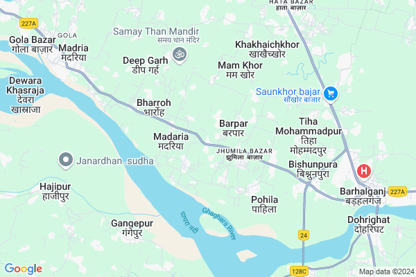
Dhanaw
Dhanaw Map
EDIT Map
Add Your House
 ..
..
Current Corona Virus Infected Patients Count in Gorakhpur District
| City Name | District Name | Total Covid cases |
|---|
Locality Name :
Dhanaw
( दानव )
Block Name : Gola
District : Gorakhpur
State : Uttar Pradesh
Division : Gorakhpur
Language : Hindi and Urdu, Bhojpuri
Current Time 03:20 PM
Date: Tuesday , Apr 29,2025 (IST)
Time zone: IST (UTC+5:30)
Elevation / Altitude: 71 meters. Above Seal level
Telephone Code / Std Code: 05525
Assembly constituency : Chillupar assembly constituency
Assembly MLA : Rajesh Tripathi
Lok Sabha constituency : Bansgaon parliamentary constituency
Parliament MP : Kamlesh Paswan
Serpanch Name :
Pin Code : 273402
Post Office Name : Barhalganj
Main Village Name : Dhanaw
Commodities Prices : Barhaj Market / Mandi
Dhanaw Live Weather
Temperature: 35.8 °C
scattered clouds
Humidity: 24%
Wind : 5.45 mt/sec towards E
StationName : "Gola BÄ\u0081zÄ\u0081r"
observed on 2 Hours Back
Temperature: 35.8 °C
scattered clouds
Humidity: 24%
Wind : 5.45 mt/sec towards E
StationName : "Gola BÄ\u0081zÄ\u0081r"
observed on 2 Hours Back
Dhanaw Weather Forecast for Next 5 days
30-04-2025
27.8°C to 36.5°C
overcast clouds, scattered clouds, clear sky
27.8°C to 36.5°C
overcast clouds, scattered clouds, clear sky
01-05-2025
26.8°C to 38.9°C
clear sky, scattered clouds, broken clouds
26.8°C to 38.9°C
clear sky, scattered clouds, broken clouds
02-05-2025
28.7°C to 37.9°C
few clouds, broken clouds, overcast clouds, clear sky
28.7°C to 37.9°C
few clouds, broken clouds, overcast clouds, clear sky
03-05-2025
26.7°C to 38.1°C
light rain, scattered clouds, clear sky
26.7°C to 38.1°C
light rain, scattered clouds, clear sky
04-05-2025
28.8°C to 40.2°C
clear sky, broken clouds, few clouds, overcast clouds
28.8°C to 40.2°C
clear sky, broken clouds, few clouds, overcast clouds
National Highways Reachable To Dhanaw
Nationa High Way :NH27
Nationa High Way :NH727A;NH727B
Nationa High Way :NH27
Nationa High Way :NH727A;NH727B
Rivers Near Dhanaw
Rapti River :Rapti River
Aami
Rapti River :Rapti River
Aami
About Dhanaw
Correct below Info and add more info about DhanawDhanaw is a small Village/hamlet in Gola Block in Gorakhpur District of Uttar Pradesh State, India. It comes under Dhanaw Panchayath. It belongs to Gorakhpur Division . It is located 59 KM towards South from District head quarters Gorakhpur. 9 KM from Gola. 296 KM from State capital Lucknow
Dhanaw Pin code is 273402 and postal head office is Barhalganj .
Parasia Mishr ( 1 KM ) , Barpar ( 1 KM ) , Madaria ( 1 KM ) , Nibi Dubey ( 1 KM ) , Chhitauna Bujurg ( 2 KM ) are the nearby Villages to Dhanaw. Dhanaw is surrounded by Barhalganj Block towards East , Gagaha Block towards North , Haraiya Block towards west , Badraon Block towards South .
Rudrapur , Azamgarh , Adari , Deoria are the near by Cities to Dhanaw.
This Place is in the border of the Gorakhpur District and Mau District. Mau District Dohri Ghat is East towards this place . Also it is in the Border of other district Azamgarh .
Dhanaw 2011 Census Details
Dhanaw Local Language is Hindi. Dhanaw Village Total population is 412 and number of houses are 62. Female Population is 45.6%. Village literacy rate is 74.8% and the Female Literacy rate is 30.6%.
Population
| Census Parameter | Census Data |
| Total Population | 412 |
| Total No of Houses | 62 |
| Female Population % | 45.6 % ( 188) |
| Total Literacy rate % | 74.8 % ( 308) |
| Female Literacy rate | 30.6 % ( 126) |
| Scheduled Tribes Population % | 0.0 % ( 0) |
| Scheduled Caste Population % | 26.0 % ( 107) |
| Working Population % | 34.0 % |
| Child(0 -6) Population by 2011 | 37 |
| Girl Child(0 -6) Population % by 2011 | 43.2 % ( 16) |
Dhanaw Census More Deatils.
Politics in Dhanaw
AIIC(T) , ABLTC , SP , BSP are the major political parties in this area.Polling Stations /Booths near Dhanaw
1)P. M. V. Kohra Bujurg Purav2)Primary School Barpar Mafi
3)Primary School Dipgarh
4)Primary School Kuldwabari Pashchim
5)Primary School Dormaha Pashchim
HOW TO REACH Dhanaw
By Rail
There is no railway station near to Dhanaw in less than 10 km.Colleges near Dhanaw
Ramrati Devi Interested Collage Bharroh Gola Gkp
Address : Bharroh
Ram Rati Devi High School
Address :
Schools near Dhanaw
P.m.v., Baditarya
Address : badi tarya , gola , gorakhpur , Uttar Pradesh . PIN- 273408 , Post - Gola (Gorakhpur)
P.m.v., Mannipur
Address : mannipur , gola , gorakhpur , Uttar Pradesh . PIN- 273408 , Post - Gola (Gorakhpur)
P.m.v., Bhaisaon
Address : bhaisaon , gola , gorakhpur , Uttar Pradesh . PIN- 273408 , Post - Gola (Gorakhpur)
P.m.v Khadra
Address : khadra , gola , gorakhpur , Uttar Pradesh . PIN- 273408 , Post - Gola (Gorakhpur)
Govt Health Centers near Dhanaw
1) Sahua Kol , Sahua Kol , ,2) Bhatpar , Bhatpar , ,
3) Barhalganj-Derwa , BARAHALGANJ , ,
Sub Villages in Dhanaw
Hospitals in Dhanaw,Gola
yash hospital
Azamgarh - Bilariyaganj - Golabazar Rd; Jhumila; Uttar Pradesh 273402; India
2.1 KM distance Detail
Yash Hospital Vindhya Basani Nagar Jhumila
VindhyaBasaniNagar; Jhumila; Uttar Pradesh 273402; India
2.2 KM distance Detail
more ..
Petrol Bunks in Dhanaw,Gola
Samay filling kidan seva kendra
Bhadaura Makrand; Uttar Pradesh 276122; India
9.8 KM distance Detail
more ..
Colleges in Dhanaw,Gola
MAA KAALI INSTITUTE OF COMPUTER SCIENCE* *JHUMILA BAZAR(BARHALGAJ);GORAKHPUR U.P
SH72; Ratla; Uttar Pradesh 273402; India
1.4 KM distance Detail
Bhim Rao Computer Institute jhumila bazar gorakhpur
SH72; Jhumila; Uttar Pradesh 273402; India
1.9 KM distance Detail
Sri Mahanth Ramashray Das Rajkiya Vidyalaya Jokahra
Jokahra; Uttar Pradesh 276136; India
9.2 KM distance Detail
more ..
Schools in Dhanaw,Gola
A.S. Shiksha Niketan School Kurwaam
kurwaam; Devkali; Uttar Pradesh 273402; India
0.4 KM distance Detail
SS Niketan Ahirauli School
Ratala; 273402; Tanda - Ramala Rd; Uttar Pradesh; India
0.5 KM distance Detail
Shankar Dayal Public School Ratala; Gorakhpur
Baraipar; Uttar Pradesh 273402; India
0.7 KM distance Detail
Rama Shankar Mishra ITC
Matihani Parsia; Barhalganj; Uttar Pradesh 273402; India
1.4 KM distance Detail
Electronic Shops in Dhanaw,Gola
Mishra Mobile Center
Azamgarh - Bilariyaganj - Golabazar Rd; Baraipar; Uttar Pradesh 273402; India
0.7 KM distance Detail
Governement Offices near Dhanaw,Gola
मुस्कान कम्युनिकेशन; जन सेवा केन्द्र
Chouraha; Parsai Road; Madaria; Uttar Pradesh 273402; India
2.2 KM distance Detail
Paridhan Kendra
Azamgarh - Dohrighat - Gorakhpur Rd; Latghat; Uttar Pradesh 276136; India
13.0 KM distance Detail
About Dhanaw &
History
How to reach Dhanaw
Tourist Places Near By Dhanaw
Schools in Dhanaw
Colleges in Dhanaw
Temperature & weather of Dhanaw
places in Dhanaw
Dhanaw photos
More Information
How to reach Dhanaw
Tourist Places Near By Dhanaw
Schools in Dhanaw
Colleges in Dhanaw
Temperature & weather of Dhanaw
places in Dhanaw
Dhanaw photos
More Information
Village Talk
Post News or Events about this Village
Near Cities
Rudrapur 26 KM near
Azamgarh 41 KM near
Adari 44 KM near
Deoria 46 KM near
Rudrapur 26 KM near
Azamgarh 41 KM near
Adari 44 KM near
Deoria 46 KM near
Near By Taluks
Barhalganj 9 KM near
Gola 9 KM near
Gagaha 13 KM near
Haraiya 14 KM near
Barhalganj 9 KM near
Gola 9 KM near
Gagaha 13 KM near
Haraiya 14 KM near
Near By Air Ports
Gorakhpur Airport 54 KM near
Varanasi Airport 125 KM near
Patna Airport 206 KM near
Bamrauli Airport 218 KM near
Gorakhpur Airport 54 KM near
Varanasi Airport 125 KM near
Patna Airport 206 KM near
Bamrauli Airport 218 KM near
Near By Tourist Places
Gorakhpur 56 KM near
Kushinagar 74 KM near
Basti 97 KM near
Jaunpur 110 KM near
Sarnath 124 KM near
Gorakhpur 56 KM near
Kushinagar 74 KM near
Basti 97 KM near
Jaunpur 110 KM near
Sarnath 124 KM near
Near By Districts
Azamgarh 41 KM near
Deoria 45 KM near
Mau 50 KM near
Gorakhpur 56 KM near
Azamgarh 41 KM near
Deoria 45 KM near
Mau 50 KM near
Gorakhpur 56 KM near
Near By RailWay Station
Muhammadabad Rail Way Station 35 KM near
Gauri Bazar Rail Way Station 44 KM near
Muhammadabad Rail Way Station 35 KM near
Gauri Bazar Rail Way Station 44 KM near