| Home | City Bus | Maps | Villages | Cities | Rail | Tourist Places | School | College | Pin Codes | Corona Cases Count |
| Distance Calculator Bus Services IFSC Codes Trace Mobile Number Weather Search Place Trace IP Available Cash ATM/Banks Locate Polling Booth Report an Error contact People |
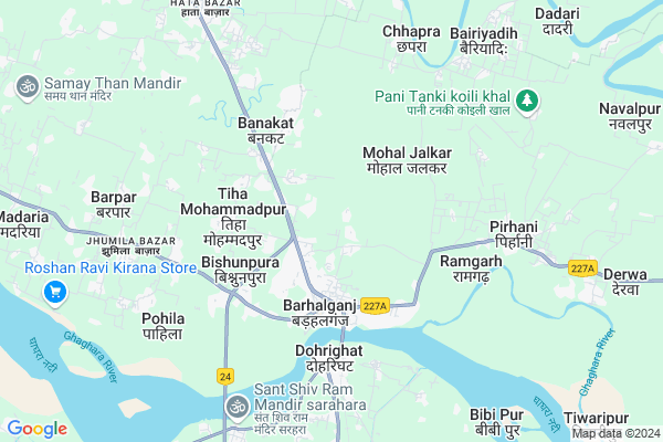
Barahata
Barahata Map
EDIT Map
Add Your House
 ..
..
Current Corona Virus Infected Patients Count in Gorakhpur District
| City Name | District Name | Total Covid cases |
|---|
Locality Name :
Barahata
( बरहटा )
Block Name : Barhalganj
District : Gorakhpur
State : Uttar Pradesh
Division : Gorakhpur
Language : Hindi and Urdu, Bhojpuri
Current Time 03:28 PM
Date: Tuesday , Apr 29,2025 (IST)
Time zone: IST (UTC+5:30)
Elevation / Altitude: 71 meters. Above Seal level
Telephone Code / Std Code: 05461
Assembly constituency : Chillupar assembly constituency
Assembly MLA : Rajesh Tripathi
Lok Sabha constituency : Bansgaon parliamentary constituency
Parliament MP : Kamlesh Paswan
Serpanch Name :
Pin Code : 273402
Post Office Name : Barhalganj
Main Village Name : Barahata
Commodities Prices : Barhaj Market / Mandi
Barahata Live Weather
Temperature: 36.4 °C
broken clouds
Humidity: 21%
Wind : 3.15 mt/sec towards SE
StationName : "ChillupÄ\u0081r"
observed on 2 Mins Back
Temperature: 36.4 °C
broken clouds
Humidity: 21%
Wind : 3.15 mt/sec towards SE
StationName : "ChillupÄ\u0081r"
observed on 2 Mins Back
Barahata Weather Forecast for Next 5 days
30-04-2025
27.8°C to 36.3°C
broken clouds, scattered clouds, clear sky
27.8°C to 36.3°C
broken clouds, scattered clouds, clear sky
01-05-2025
26.8°C to 38.7°C
clear sky, scattered clouds, broken clouds, few clouds
26.8°C to 38.7°C
clear sky, scattered clouds, broken clouds, few clouds
02-05-2025
28.8°C to 38.0°C
few clouds, broken clouds, overcast clouds, clear sky, scattered clouds
28.8°C to 38.0°C
few clouds, broken clouds, overcast clouds, clear sky, scattered clouds
03-05-2025
26.7°C to 38.1°C
light rain, broken clouds, scattered clouds, clear sky
26.7°C to 38.1°C
light rain, broken clouds, scattered clouds, clear sky
04-05-2025
28.7°C to 40.2°C
clear sky, broken clouds, few clouds, overcast clouds
28.7°C to 40.2°C
clear sky, broken clouds, few clouds, overcast clouds
National Highways Reachable To Barahata
Nationa High Way :NH727A;NH727B
Nationa High Way :NH727A
Nationa High Way :NH727A;NH727B
Nationa High Way :NH727A
Rivers Near Barahata
Rapti River :Rapti River
Aami
Rapti River :Rapti River
Aami
About Barahata
Correct below Info and add more info about BarahataBarahata is a small Village/hamlet in Barhalganj Block in Gorakhpur District of Uttar Pradesh State, India. It comes under Barahata Panchayath. It belongs to Gorakhpur Division . It is located 61 KM towards South from District head quarters Gorakhpur. 0 KM from Barhya Tikur. 306 KM from State capital Lucknow
Barahata Pin code is 273402 and postal head office is Barhalganj .
Sansarpar ( 2 KM ) , Beili ( 2 KM ) , Khajuri Pandey ( 2 KM ) , Lakhanapar Of Barhalganj ( 2 KM ) , Belsari ( 2 KM ) are the nearby Villages to Barahata. Barahata is surrounded by Gagaha Block towards North , Dohri Ghat Block towards South , Rudrapur Block towards North , Gola Block towards west .
Rudrapur , Deoria , Adari , Azamgarh are the near by Cities to Barahata.
This Place is in the border of the Gorakhpur District and Mau District. Mau District Dohri Ghat is South towards this place . Also it is in the Border of other district Deoria .
Barahata 2011 Census Details
Barahata Local Language is Hindi. Barahata Village Total population is 1500 and number of houses are 268. Female Population is 55.1%. Village literacy rate is 53.7% and the Female Literacy rate is 24.2%.
Population
| Census Parameter | Census Data |
| Total Population | 1500 |
| Total No of Houses | 268 |
| Female Population % | 55.1 % ( 826) |
| Total Literacy rate % | 53.7 % ( 805) |
| Female Literacy rate | 24.2 % ( 363) |
| Scheduled Tribes Population % | 0.0 % ( 0) |
| Scheduled Caste Population % | 36.7 % ( 551) |
| Working Population % | 18.7 % |
| Child(0 -6) Population by 2011 | 235 |
| Girl Child(0 -6) Population % by 2011 | 51.5 % ( 121) |
Barahata Census More Deatils.
Politics in Barahata
AIIC(T) , ABLTC , SP , BSP are the major political parties in this area.Polling Stations /Booths near Barahata
1)B. S. A.b. I. C. Gola Atraura Dakshin2)G. I. C. Mahuapar Madhay
3)K. P. M. V. Barhalganj Purav Madhya
4)K. P. M. V. Tihamuhammdpur Dakshin
5)Primary School Bhiti Dakshin
HOW TO REACH Barahata
By Rail
Dohrighat Rail Way Station is the very nearby railway stations to Barahata.Colleges near Barahata
Shree Gurkul Pg Collage
Address : Gurkul Nagar Dadari
Schools near Barahata
P.m.v. Durgapur
Address : durgapur , badhalganj , gorakhpur , Uttar Pradesh . PIN- 273402 , Post - Barhalganj
P.m.v. Basavan Pur
Address : basavan pur , badhalganj , gorakhpur , Uttar Pradesh . PIN- 273402 , Post - Barhalganj
P.m.v Pipardandi
Address : pipardandi , badhalganj , gorakhpur , Uttar Pradesh . PIN- 273402 , Post - Barhalganj
P.m.v Kodari
Address : kodari , badhalganj , gorakhpur , Uttar Pradesh . PIN- 273402 , Post - Barhalganj
Govt Health Centers near Barahata
1) Barhalganj-Derwa , BARAHALGANJ , ,2) Parashia Tara , Parashia Tara , Parashia Tara ,
3) Bhatpar , Bhatpar , ,
Sub Villages in Barahata
Hospitals in Barahata,Barhalganj
State Veterinary Hospital Saunkhor
saunkhor badhalganj u.p.; Gorakhpur; Uttar Pradesh; India
3.6 KM distance Detail
CHC Doharighat
Mau-Gorakhpur Rd; Saket; Dohrighat; Uttar Pradesh 273408; India
5.0 KM distance Detail
more ..
Petrol Bunks in Barahata,Barhalganj
Pandey Petrol Pump
Azamgarh - Dohrighat - Gorakhpur Rd; Bhatpar; Majhilawan; Uttar Pradesh 273402; India
4.7 KM distance Detail
USHA FILLING STATION
BETWEEN KM STONE 170-175 O; GORAKHPUR; Uttar Pradesh 273411; India
13.0 KM distance Detail
more ..
Colleges in Barahata,Barhalganj
kishan inter college ahiroili;sahuakol gorakhpur
Dheorparmus.; Uttar Pradesh 273412; India
8.0 KM distance Detail
Sri Gurukul Mahavidyalay; Dadari; Barahalganj
Dadari; Bahasua; Uttar Pradesh 273412; India
10.2 KM distance Detail
JCTI COMPUTER INSTITUTE
National Highway 29; Rawatpar; Uttar Pradesh 273412; India
11.5 KM distance Detail
more ..
Schools in Barahata,Barhalganj
مدَرصہ مکتب اسلامیہ Madarsa Maktab Islamia
Baiduali; Uttar Pradesh 273402; India
3.4 KM distance Detail
Electronic Shops in Barahata,Barhalganj
pappu tiwari electricals shop
; Bhatpar; Bhat Chak; Uttar Pradesh 273402; India
4.3 KM distance Detail
About Barahata &
History
How to reach Barahata
Tourist Places Near By Barahata
Schools in Barahata
Colleges in Barahata
Temperature & weather of Barahata
places in Barahata
Barahata photos
More Information
How to reach Barahata
Tourist Places Near By Barahata
Schools in Barahata
Colleges in Barahata
Temperature & weather of Barahata
places in Barahata
Barahata photos
More Information
Village Talk
Post News or Events about this Village
Near Cities
Rudrapur 19 KM near
Deoria 39 KM near
Adari 41 KM near
Azamgarh 48 KM near
Rudrapur 19 KM near
Deoria 39 KM near
Adari 41 KM near
Azamgarh 48 KM near
Near By Taluks
Barhalganj 0 KM near
Gagaha 14 KM near
Dohri Ghat 15 KM near
Gola 16 KM near
Barhalganj 0 KM near
Gagaha 14 KM near
Dohri Ghat 15 KM near
Gola 16 KM near
Near By Air Ports
Gorakhpur Airport 54 KM near
Varanasi Airport 129 KM near
Patna Airport 198 KM near
Bamrauli Airport 226 KM near
Gorakhpur Airport 54 KM near
Varanasi Airport 129 KM near
Patna Airport 198 KM near
Bamrauli Airport 226 KM near
Near By Tourist Places
Gorakhpur 57 KM near
Kushinagar 68 KM near
Basti 104 KM near
Jaunpur 117 KM near
Sarnath 127 KM near
Gorakhpur 57 KM near
Kushinagar 68 KM near
Basti 104 KM near
Jaunpur 117 KM near
Sarnath 127 KM near
Near By Districts
Deoria 38 KM near
Mau 48 KM near
Azamgarh 48 KM near
Gorakhpur 58 KM near
Deoria 38 KM near
Mau 48 KM near
Azamgarh 48 KM near
Gorakhpur 58 KM near
Near By RailWay Station
Dohrighat Rail Way Station 6.0 KM near
Muhammadabad Rail Way Station 38 KM near
Deoria Sadar Rail Way Station 39 KM near
Dohrighat Rail Way Station 6.0 KM near
Muhammadabad Rail Way Station 38 KM near
Deoria Sadar Rail Way Station 39 KM near