| Home | City Bus | Maps | Villages | Cities | Rail | Tourist Places | School | College | Pin Codes | Corona Cases Count |
| Distance Calculator Bus Services IFSC Codes Trace Mobile Number Weather Search Place Trace IP Available Cash ATM/Banks Locate Polling Booth Report an Error contact People |
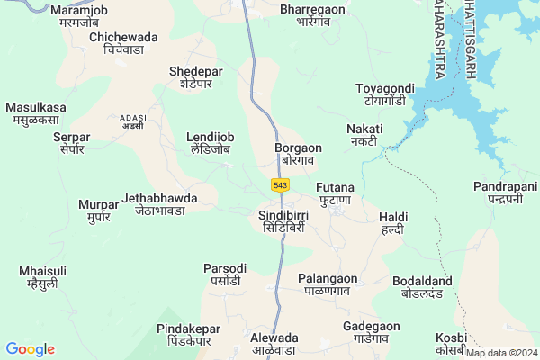
Nilaj
Nilaj Map
EDIT Map
Add Your House
 ..
..
Current Corona Virus Infected Patients Count in Gondia District
| City Name | District Name | Total Covid cases |
|---|
Locality Name :
Nilaj
( नाईलाज )
Taluka Name : Deori
District : Gondia
State : Maharashtra
Region : Vidarbh
Division : Nagpur
Language : Marathi
Current Time 08:18 PM
Date: Tuesday , Apr 29,2025 (IST)
Time zone: IST (UTC+5:30)
Elevation / Altitude: 287 meters. Above Seal level
Telephone Code / Std Code: 07199
Assembly constituency : Amgaon assembly constituency
Assembly MLA : Korote Sahasram Maroti
Lok Sabha constituency : Gadchiroli-Chimur parliamentary constituency
Parliament MP : ASHOK MAHADEORAO NETE
Serpanch Name :
Pin Code : 441901
Post Office Name : Deori (Gondia)
Main Village Name : Nilaj
Commodities Prices : Devri Market / Mandi
Nilaj Live Weather
Temperature: 40.3 °C
scattered clouds
Humidity: 9%
Wind : 3.17 mt/sec towards NW
StationName : "AmbÄ\u0081garh Chauki"
observed on 2 Hours Back
Temperature: 40.3 °C
scattered clouds
Humidity: 9%
Wind : 3.17 mt/sec towards NW
StationName : "AmbÄ\u0081garh Chauki"
observed on 2 Hours Back
Nilaj Weather Forecast for Next 5 days
30-04-2025
28.4°C to 36.6°C
scattered clouds, overcast clouds
28.4°C to 36.6°C
scattered clouds, overcast clouds
01-05-2025
27.3°C to 41.7°C
broken clouds, clear sky, scattered clouds, few clouds
27.3°C to 41.7°C
broken clouds, clear sky, scattered clouds, few clouds
02-05-2025
26.1°C to 42.6°C
clear sky, few clouds
26.1°C to 42.6°C
clear sky, few clouds
03-05-2025
26.1°C to 42.2°C
few clouds, clear sky, scattered clouds
26.1°C to 42.2°C
few clouds, clear sky, scattered clouds
04-05-2025
25.8°C to 43.0°C
scattered clouds, clear sky, few clouds, overcast clouds
25.8°C to 43.0°C
scattered clouds, clear sky, few clouds, overcast clouds
National Highways Reachable To Nilaj
Nationa High Way :NH53
Nationa High Way :NH53
Rivers Near Nilaj
Maramsud
Chilband
Maramsud
Chilband
About Nilaj
Correct below Info and add more info about NilajNilaj is a small Village/hamlet in Deori Taluka in Gondia District of Maharashtra State, India. It comes under Nilaj Panchayath. It belongs to Vidarbh region . It belongs to Nagpur Division . It is located 64 KM towards South from District head quarters Gondia. 954 KM from State capital Mumbai
Nilaj Pin code is 441901 and postal head office is Deori (Gondia).
Nilaj is surrounded by Sadak Arjuni Taluka towards west , Chhuriya Taluka towards East , Korchi Taluka towards South , Salekasa Taluka towards North .
Dongargarh , Gondiya , Tirora , Rajnandgaon are the near by Cities to Nilaj.
Nilaj 2011 Census Details
Nilaj Local Language is Marathi. Nilaj Village Total population is 702 and number of houses are 153. Female Population is 53.0%. Village literacy rate is 65.5% and the Female Literacy rate is 30.5%.
Population
| Census Parameter | Census Data |
| Total Population | 702 |
| Total No of Houses | 153 |
| Female Population % | 53.0 % ( 372) |
| Total Literacy rate % | 65.5 % ( 460) |
| Female Literacy rate | 30.5 % ( 214) |
| Scheduled Tribes Population % | 75.9 % ( 533) |
| Scheduled Caste Population % | 3.6 % ( 25) |
| Working Population % | 59.1 % |
| Child(0 -6) Population by 2011 | 87 |
| Girl Child(0 -6) Population % by 2011 | 56.3 % ( 49) |
Nilaj Census More Deatils.
Politics in Nilaj
BJP , NCP , INC are the major political parties in this area.Polling Stations /Booths near Nilaj
1)Shivani2)Borgaon
3)Padamapur
4)Fukkimeta
5)Futana
HOW TO REACH Nilaj
By Rail
There is no railway station near to Nilaj in less than 10 km. Nagradham P.h. Rail Way Station (near to Gondiya) , Gondia Junction Rail Way Station (near to Gondiya) , Raj Nandgaon Rail Way Station (near to Rajnandgaon) , Parmalkasa Rail Way Station (near to Rajnandgaon) are the Rail way stations reachable from near by towns.By Road
Gondiya , Rajnandgaon are the nearby by towns to Nilaj having road connectivity to NilajColleges near Nilaj
C S Institute Of Technology
Address :
Schools in Nilaj
Z.p. P. School
Address : nilaj , deori , gondiya , Maharashtra . PIN- 441901 , Post - Deori (Gondia)
Govt Health Centers near Nilaj
1) Borgaon , Subcentre Borgaon , ,2) RH Deori , Near Panchyat Sammit office , NH 6 ,
3) Chichewada , Subcentre Chichewada , ,
Sub Villages in Nilaj
Schools in Nilaj,Deori
Electronic Shops in Nilaj,Deori
Super Markets in Nilaj,Deori
Local Parks in Nilaj,Deori
Police Stations near Nilaj,Deori
Governement Offices near Nilaj,Deori
About Nilaj &
History
How to reach Nilaj
Tourist Places Near By Nilaj
Schools in Nilaj
Colleges in Nilaj
Temperature & weather of Nilaj
places in Nilaj
Nilaj photos
More Information
How to reach Nilaj
Tourist Places Near By Nilaj
Schools in Nilaj
Colleges in Nilaj
Temperature & weather of Nilaj
places in Nilaj
Nilaj photos
More Information
Village Talk
Post News or Events about this Village
Near Cities
Dongargarh 49 KM near
Gondiya 61 KM near
Tirora 73 KM near
Rajnandgaon 76 KM near
Dongargarh 49 KM near
Gondiya 61 KM near
Tirora 73 KM near
Rajnandgaon 76 KM near
Near By Taluks
Deori 0 KM near
Sadak Arjuni 32 KM near
Chhuriya 33 KM near
Korchi 39 KM near
Deori 0 KM near
Sadak Arjuni 32 KM near
Chhuriya 33 KM near
Korchi 39 KM near
Near By Air Ports
Sonegaon Airport 154 KM near
Raipur Airport 159 KM near
Jabalpur Airport 214 KM near
Nanded Airport 423 KM near
Sonegaon Airport 154 KM near
Raipur Airport 159 KM near
Jabalpur Airport 214 KM near
Nanded Airport 423 KM near
Near By Tourist Places
Rajnandgaon 76 KM near
Bhandara 87 KM near
Durg 107 KM near
Bhilai 118 KM near
Dhamtari 140 KM near
Rajnandgaon 76 KM near
Bhandara 87 KM near
Durg 107 KM near
Bhilai 118 KM near
Dhamtari 140 KM near
Near By Districts
Gondia 60 KM near
Rajnandgaon 76 KM near
Bhandara 86 KM near
Balaghat 104 KM near
Gondia 60 KM near
Rajnandgaon 76 KM near
Bhandara 86 KM near
Balaghat 104 KM near
Near By RailWay Station
Amgaon Rail Way Station 45 KM near
Dongargarh Rail Way Station 49 KM near
Amgaon Rail Way Station 45 KM near
Dongargarh Rail Way Station 49 KM near