| Home | City Bus | Maps | Villages | Cities | Rail | Tourist Places | School | College | Pin Codes | Corona Cases Count |
| Distance Calculator Bus Services IFSC Codes Trace Mobile Number Weather Search Place Trace IP Available Cash ATM/Banks Locate Polling Booth Report an Error contact People |
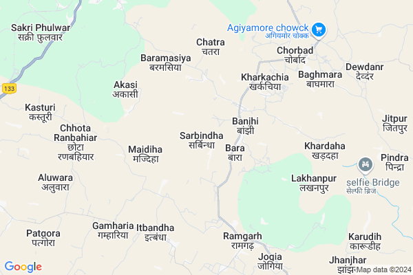
Sarbindha
Sarbindha Map
EDIT Map
Add Your House
 ..
..
Current Corona Virus Infected Patients Count in Godda District
| City Name | District Name | Total Covid cases |
|---|
Locality Name :
Sarbindha
( सरबिन्दा )
Block Name : Poraiyahat
District : Godda
State : Jharkhand
Language : Hindi and Santali
Current Time 07:15 PM
Date: Sunday , Apr 27,2025 (IST)
Time zone: IST (UTC+5:30)
Elevation / Altitude: 145 meters. Above Seal level
Telephone Code / Std Code: 06422
Assembly constituency : Poreyahat assembly constituency
Assembly MLA :
Lok Sabha constituency : Godda parliamentary constituency
Parliament MP :
Serpanch Name :
Pin Code : 814153
Post Office Name : Poraiyahat
Main Village Name : Sarbindha
Commodities Prices : Birbhum Market / Mandi
Sarbindha Live Weather
Temperature: 37.1 °C
overcast clouds
Humidity: 12%
Wind : 1.84 mt/sec towards S
StationName : "Godda"
observed on 1 Hours Back
Temperature: 37.1 °C
overcast clouds
Humidity: 12%
Wind : 1.84 mt/sec towards S
StationName : "Godda"
observed on 1 Hours Back
Sarbindha Weather Forecast for Next 5 days
28-04-2025
26.6°C to 35.5°C
overcast clouds, few clouds
26.6°C to 35.5°C
overcast clouds, few clouds
29-04-2025
23.8°C to 36.8°C
scattered clouds, overcast clouds, broken clouds, moderate rain
23.8°C to 36.8°C
scattered clouds, overcast clouds, broken clouds, moderate rain
30-04-2025
22.9°C to 31.1°C
scattered clouds, light rain, overcast clouds, broken clouds
22.9°C to 31.1°C
scattered clouds, light rain, overcast clouds, broken clouds
01-05-2025
22.9°C to 34.8°C
overcast clouds, clear sky, few clouds, light rain
22.9°C to 34.8°C
overcast clouds, clear sky, few clouds, light rain
02-05-2025
23.1°C to 34.4°C
overcast clouds, broken clouds, few clouds, scattered clouds, light rain
23.1°C to 34.4°C
overcast clouds, broken clouds, few clouds, scattered clouds, light rain
Rivers Near Sarbindha
Tribani
Gumani
Tribani
Gumani
About Sarbindha
Correct below Info and add more info about SarbindhaSarbindha is a small Village/hamlet in Poraiyahat Block in Godda District of Jharkhand State, India. It comes under Sarbindha Panchayath. It is located 28 KM towards South from District head quarters Godda. 9 KM from Poraiyahat. 281 KM from State capital Ranchi
Sarbindha Pin code is 814153 and postal head office is Poraiyahat .
Baghmara ( 7 KM ) , Poraiyahat ( 10 KM ) , Sundmara ( 13 KM ) , Lathibari ( 14 KM ) , Jhilua ( 16 KM ) are the nearby Villages to Sarbindha. Sarbindha is surrounded by Ramgarh Block towards South , Sunderpahari Block towards East , Saraiyahat Block towards west , Godda Block towards North .
Godda , Dumka , Banka , Deoghar are the near by Cities to Sarbindha.
This Place is in the border of the Godda District and Dumka District. Dumka District Ramgarh is South towards this place .
Sarbindha 2011 Census Details
Sarbindha Local Language is Hindi. Sarbindha Village Total population is 1432 and number of houses are 280. Female Population is 48.2%. Village literacy rate is 39.6% and the Female Literacy rate is 13.2%.
Population
| Census Parameter | Census Data |
| Total Population | 1432 |
| Total No of Houses | 280 |
| Female Population % | 48.2 % ( 690) |
| Total Literacy rate % | 39.6 % ( 567) |
| Female Literacy rate | 13.2 % ( 189) |
| Scheduled Tribes Population % | 41.8 % ( 599) |
| Scheduled Caste Population % | 1.5 % ( 22) |
| Working Population % | 50.0 % |
| Child(0 -6) Population by 2011 | 294 |
| Girl Child(0 -6) Population % by 2011 | 47.6 % ( 140) |
Sarbindha Census More Deatils.
Politics in Sarbindha
JVM , Bharatiya Janata Party , JVM(P) , BJP , JMM , JVMP , INC are the major political parties in this area.Polling Stations /Booths near Sarbindha
1)Upgraded Middle School Sanjhar (koyla Tola)2)Upgraded Middle School Sarbindha (east Side)
3)Primary School Baghmari
4)Urdu Primary School Babudih Tola Mandaldih
5)Sabha Bhawan Aamgachhi
HOW TO REACH Sarbindha
By Rail
There is no railway station near to Sarbindha in less than 10 km.Colleges near Sarbindha
Janajatiya Mahavidyalay Pathergama
Address :
M A K Azad College.basantroy
Address :
Schools near Sarbindha
Swami Ramtirth Public School Poraiyahat
Address : Dropad Road
Mont Assis School (eng Midd)
Address : MAIN ROAD ,NEAR PERTO PUMP , PORAIYAHAT
Utkramit Primary School Pindrahat
Address : pindrahat (hatiyatola)godda
Rajkiya Madhya Vidyalaya, Sarba
Address : AT-SARBA PO-SARBA
DIST-GODDA 814133
JHARKHAND
Govt Health Centers near Sarbindha
1) HSC BANJHI , BANJHI , BANJHI ,2) HSC BARI RANBAHIYAR , , ,
3) HSC BARMASIA , , ,
Sub Villages in Sarbindha
Hospitals in Sarbindha,Poraiyahat
Kisan Sewa Kendra (Podho Ka Aspatal & Dawakhana)
Hansdiha-Poreyahat Road; Hansdiha; Jharkhand 814145; India
17.8 KM distance Detail
more ..
Petrol Bunks in Sarbindha,Poraiyahat
Indian Oil Petrol Pump
Dumka; SH-17; Dumka Hansdiha Road; Hansdiha; Hansdiha; Jharkhand 814145; India
18.1 KM distance Detail
Bharat Petroleum
Dumka; SH-17; Dumka Hansdiha Road; Hansdiha; Hansdiha; Jharkhand 814145; India
18.1 KM distance Detail
Reliance Petroleum
SH-16; AT KM STONE NO 5; KHATIAN; Godda; Jharkhand 814133; India
23.2 KM distance Detail
more ..
Super Markets in Sarbindha,Poraiyahat
Annapoorna store&choudhary vehicles limited
Deoghar Pirpainti Rd; Hansdiha; Jharkhand 814145; India
18.2 KM distance Detail
Local Parks in Sarbindha,Poraiyahat
Police Stations near Sarbindha,Poraiyahat
Police Station Hansdiha
Dumka; SH-16; Dumka Hansdiha Road; Hansdiha; Hansdiha; Jharkhand 814145; India
17.9 KM distance Detail
Governement Offices near Sarbindha,Poraiyahat
About Sarbindha &
History
How to reach Sarbindha
Tourist Places Near By Sarbindha
Schools in Sarbindha
Colleges in Sarbindha
Temperature & weather of Sarbindha
places in Sarbindha
Sarbindha photos
More Information
How to reach Sarbindha
Tourist Places Near By Sarbindha
Schools in Sarbindha
Colleges in Sarbindha
Temperature & weather of Sarbindha
places in Sarbindha
Sarbindha photos
More Information
Village Talk
Post News or Events about this Village
Near Cities
Godda 27 KM near
Dumka 42 KM near
Banka 49 KM near
Deoghar 62 KM near
Godda 27 KM near
Dumka 42 KM near
Banka 49 KM near
Deoghar 62 KM near
Near By Taluks
Poraiyahat 9 KM near
Ramgarh 12 KM near
Sunderpahari 23 KM near
Saraiyahat 24 KM near
Poraiyahat 9 KM near
Ramgarh 12 KM near
Sunderpahari 23 KM near
Saraiyahat 24 KM near
Near By Air Ports
Gaya Airport 259 KM near
Ranchi Airport 270 KM near
Patna Airport 270 KM near
Netaji Subhas Chandra Bose Airport 280 KM near
Gaya Airport 259 KM near
Ranchi Airport 270 KM near
Patna Airport 270 KM near
Netaji Subhas Chandra Bose Airport 280 KM near
Near By Tourist Places
Dumka 43 KM near
Deoghar 62 KM near
Pakur 70 KM near
Bhagalpur 83 KM near
Sahibganj 91 KM near
Dumka 43 KM near
Deoghar 62 KM near
Pakur 70 KM near
Bhagalpur 83 KM near
Sahibganj 91 KM near
Near By Districts
Godda 27 KM near
Dumka 42 KM near
Banka 50 KM near
Deoghar 62 KM near
Godda 27 KM near
Dumka 42 KM near
Banka 50 KM near
Deoghar 62 KM near
Near By RailWay Station
Jasidih Junction Rail Way Station 67 KM near
Barharwa Junction Rail Way Station 68 KM near
Jasidih Junction Rail Way Station 67 KM near
Barharwa Junction Rail Way Station 68 KM near