| Home | City Bus | Maps | Villages | Cities | Rail | Tourist Places | School | College | Pin Codes | Corona Cases Count |
| Distance Calculator Bus Services IFSC Codes Trace Mobile Number Weather Search Place Trace IP Available Cash ATM/Banks Locate Polling Booth Report an Error contact People |
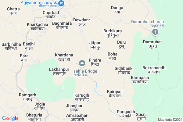
Pindra
Pindra Map
EDIT Map
Add Your House
 ..
..
Current Corona Virus Infected Patients Count in Godda District
| City Name | District Name | Total Covid cases |
|---|
Locality Name :
Pindra
( पिंडरा )
Block Name : Poraiyahat
District : Godda
State : Jharkhand
Language : Hindi and Santali
Current Time 07:18 PM
Date: Sunday , Apr 27,2025 (IST)
Time zone: IST (UTC+5:30)
Elevation / Altitude: 145 meters. Above Seal level
Telephone Code / Std Code: 06422
Assembly constituency : Poreyahat assembly constituency
Assembly MLA :
Lok Sabha constituency : Godda parliamentary constituency
Parliament MP :
Serpanch Name :
Pin Code : 814153
Post Office Name : Poraiyahat
Main Village Name : Pindra
Commodities Prices : Birbhum Market / Mandi
Rivers Near Pindra
Tribani
Gumani
Tribani
Gumani
About Pindra
Correct below Info and add more info about PindraPindra is a small Village/hamlet in Poraiyahat Block in Godda District of Jharkhand State, India. It comes under Pindra Panchayath. It is located 32 KM towards South from District head quarters Godda. 19 KM from Poraiyahat. 289 KM from State capital Ranchi
Pindra Pin code is 814153 and postal head office is Poraiyahat .
Jhilua ( 11 KM ) , Chatra ( 12 KM ) , Sundmara ( 14 KM ) are the nearby Villages to Pindra. Pindra is surrounded by Sunderpahari Block towards North , Poraiyahat Block towards west , Amrapara Block towards East , Godda Block towards North .
Godda , Dumka , Banka , Pakaur are the near by Cities to Pindra.
This Place is in the border of the Godda District and Dumka District. Dumka District Ramgarh is South towards this place .
Pindra 2011 Census Details
Pindra Local Language is Hindi. Pindra Village Total population is 2459 and number of houses are 463. Female Population is 48.8%. Village literacy rate is 48.1% and the Female Literacy rate is 18.2%.
Population
| Census Parameter | Census Data |
| Total Population | 2459 |
| Total No of Houses | 463 |
| Female Population % | 48.8 % ( 1199) |
| Total Literacy rate % | 48.1 % ( 1182) |
| Female Literacy rate | 18.2 % ( 448) |
| Scheduled Tribes Population % | 17.0 % ( 418) |
| Scheduled Caste Population % | 2.4 % ( 59) |
| Working Population % | 49.5 % |
| Child(0 -6) Population by 2011 | 418 |
| Girl Child(0 -6) Population % by 2011 | 50.7 % ( 212) |
Pindra Census More Deatils.
Politics in Pindra
JVM , Bharatiya Janata Party , JVM(P) , BJP , JMM , JVMP , INC are the major political parties in this area.Polling Stations /Booths near Pindra
1)Middle School Pasai (south Side)2)Middle School Pindrahat (east Side)
3)Upgraded Middle School Jaynagar Piparjoria
4)Primary School Varishtarh
5)Upgraded Middle School Dumarthar
HOW TO REACH Pindra
By Rail
There is no railway station near to Pindra in less than 10 km.Colleges near Pindra
Janajatiya Mahavidyalay Pathergama
Address :
M A K Azad College.basantroy
Address :
Schools near Pindra
Swami Ramtirth Public School Poraiyahat
Address : Dropad Road
Mont Assis School (eng Midd)
Address : MAIN ROAD ,NEAR PERTO PUMP , PORAIYAHAT
Utkramit Primary School Pindrahat
Address : pindrahat (hatiyatola)godda
Rajkiya Madhya Vidyalaya, Sarba
Address : AT-SARBA PO-SARBA
DIST-GODDA 814133
JHARKHAND
Govt Health Centers near Pindra
1) HSC KARUDIH , , ,2) HSC LAKHANPUR , , ,
3) PHC DEODAND , PHC DEODAND , ,
Sub Villages in Pindra
Local Parks in Pindra,Poraiyahat
Police Stations near Pindra,Poraiyahat
Governement Offices near Pindra,Poraiyahat
About Pindra &
History
How to reach Pindra
Tourist Places Near By Pindra
Schools in Pindra
Colleges in Pindra
Temperature & weather of Pindra
places in Pindra
Pindra photos
More Information
How to reach Pindra
Tourist Places Near By Pindra
Schools in Pindra
Colleges in Pindra
Temperature & weather of Pindra
places in Pindra
Pindra photos
More Information
Village Talk
Post News or Events about this Village
Near Cities
Godda 30 KM near
Dumka 41 KM near
Banka 58 KM near
Pakaur 60 KM near
Godda 30 KM near
Dumka 41 KM near
Banka 58 KM near
Pakaur 60 KM near
Near By Taluks
Ramgarh 14 KM near
Sunderpahari 16 KM near
Poraiyahat 18 KM near
Amrapara 27 KM near
Ramgarh 14 KM near
Sunderpahari 16 KM near
Poraiyahat 18 KM near
Amrapara 27 KM near
Near By Air Ports
Gaya Airport 269 KM near
Netaji Subhas Chandra Bose Airport 274 KM near
Ranchi Airport 277 KM near
Patna Airport 280 KM near
Gaya Airport 269 KM near
Netaji Subhas Chandra Bose Airport 274 KM near
Ranchi Airport 277 KM near
Patna Airport 280 KM near
Near By Tourist Places
Dumka 42 KM near
Pakur 60 KM near
Deoghar 71 KM near
Sahibganj 87 KM near
Bhagalpur 88 KM near
Dumka 42 KM near
Pakur 60 KM near
Deoghar 71 KM near
Sahibganj 87 KM near
Bhagalpur 88 KM near
Near By Districts
Godda 31 KM near
Dumka 42 KM near
Banka 59 KM near
Pakur 60 KM near
Godda 31 KM near
Dumka 42 KM near
Banka 59 KM near
Pakur 60 KM near
Near By RailWay Station
Barharwa Junction Rail Way Station 60 KM near
Pakur Rail Way Station 60 KM near
Barharwa Junction Rail Way Station 60 KM near
Pakur Rail Way Station 60 KM near