| Home | City Bus | Maps | Villages | Cities | Rail | Tourist Places | School | College | Pin Codes | Corona Cases Count |
| Distance Calculator Bus Services IFSC Codes Trace Mobile Number Weather Search Place Trace IP Available Cash ATM/Banks Locate Polling Booth Report an Error contact People |
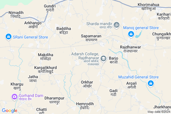
Gangapur Map
EDIT Map
Add Your House
 ..
..
Current Corona Virus Infected Patients Count in Giridih District
| City Name | District Name | Total Covid cases |
|---|---|---|
| Giridih District | Giridih | 1 |
Locality Name :
Gangapur
( गंगापुर )
Block Name : Dhanwar
District : Giridih
State : Jharkhand
Language : Hindi and Santali
Current Time 07:49 PM
Date: Friday , Apr 25,2025 (IST)
Time zone: IST (UTC+5:30)
Elevation / Altitude: 323 meters. Above Seal level
Telephone Code / Std Code: 06554
Assembly constituency : Dhanwar assembly constituency
Assembly MLA : BABULAL MARANDI
Lok Sabha constituency : Kodarma parliamentary constituency
Parliament MP : ANNPURNA DEVI
Serpanch Name :
Pin Code : 825412
Post Office Name : Rajdhanwarf
Main Village Name : Gangapur
Gangapur Live Weather
Temperature: 35.2 °C
clear sky
Humidity: 5%
Wind : 2.15 mt/sec towards NW
StationName : "DhanwÄ\u0081r"
observed on 1 Hours Back
Temperature: 35.2 °C
clear sky
Humidity: 5%
Wind : 2.15 mt/sec towards NW
StationName : "DhanwÄ\u0081r"
observed on 1 Hours Back
Gangapur Weather Forecast for Next 5 days
26-04-2025
28.8°C to 36.8°C
clear sky
28.8°C to 36.8°C
clear sky
27-04-2025
27.3°C to 42.0°C
clear sky
27.3°C to 42.0°C
clear sky
28-04-2025
25.2°C to 38.8°C
clear sky, overcast clouds, broken clouds
25.2°C to 38.8°C
clear sky, overcast clouds, broken clouds
29-04-2025
24.3°C to 37.8°C
overcast clouds, broken clouds, light rain
24.3°C to 37.8°C
overcast clouds, broken clouds, light rain
30-04-2025
21.4°C to 32.6°C
broken clouds, clear sky, light rain, overcast clouds
21.4°C to 32.6°C
broken clouds, clear sky, light rain, overcast clouds
Rivers Near Gangapur
Puthro
Barakar River
Puthro
Barakar River
About Gangapur
Correct below Info and add more info about GangapurGangapur is a small Village/hamlet in Dhanwar Block in Giridih District of Jharkhand State, India. It comes under Gangapur Panchayath. It is located 50 KM towards west from District head quarters Giridih. 156 KM from State capital Ranchi
Gangapur Pin code is 825412 and postal head office is Rajdhanwarf .
Gangapur is surrounded by Markacho Block towards west , Birni Block towards South , Jamua Block towards East , Gawan Block towards North .
Jhumri Tilaiya , Giridih , Jhajha , Gomoh are the near by Cities to Gangapur.
This Place is in the border of the Giridih District and Koderma District. Koderma District Markacho is west towards this place .
Gangapur 2011 Census Details
Gangapur Local Language is Hindi. Gangapur Village Total population is 1545 and number of houses are 209. Female Population is 49.3%. Village literacy rate is 39.4% and the Female Literacy rate is 14.8%.
Population
| Census Parameter | Census Data |
| Total Population | 1545 |
| Total No of Houses | 209 |
| Female Population % | 49.3 % ( 761) |
| Total Literacy rate % | 39.4 % ( 608) |
| Female Literacy rate | 14.8 % ( 228) |
| Scheduled Tribes Population % | 6.6 % ( 102) |
| Scheduled Caste Population % | 7.6 % ( 118) |
| Working Population % | 41.6 % |
| Child(0 -6) Population by 2011 | 402 |
| Girl Child(0 -6) Population % by 2011 | 47.5 % ( 191) |
Gangapur Census More Deatils.
Politics in Gangapur
JVM , Bharatiya Janata Party , CPI(ML)(L) , JVM(P) , BJP , CPI(M)(L) , JVMP are the major political parties in this area.Polling Stations /Booths near Gangapur
1)M.s. Nawadih South Part2)P.s. Garjasaran
3)U.m.s. Harni
4)M.s. Chihutiya
5)New P.s Chatniyawar
HOW TO REACH Gangapur
By Rail
There is no railway station near to Gangapur in less than 10 km.Colleges near Gangapur
Adarsh College Rajdhanwar
Address :
Schools near Gangapur
High Teach Modern Public School
Address : Parsan khijarsota dhanwar giridih
Super 40 Coaching Centre Dhanwar
Address : Nawadih road (ashtha clinic) Dhanwar Giridih
Shanti Niketan High School Gorhand
Address : Gorhand
R D Modern Public School Nawagarhdhanwar
Address : Nawagarh chatti
Govt Health Centers near Gangapur
1) HSC SIMARIYA , , SIMARIYA ,2) HSC BARWADIH , HSC Barwadih , Barwadih , Near Shiv Mandir
3) HSC ORKHAR , , ORKHAR ,
Sub Villages in Gangapur
Hospitals in Gangapur,Dhanwar
Modassir Bhai Setelment King
825412; Jharkhand State Highway 13; Gangapur; Jharkhand 815301; India
3.4 KM distance Detail
more ..
Colleges in Gangapur,Dhanwar
Adarsh College; Rajdhanwar
Rajdhanwar - Hazaribag Road; Rajdhanwar; Jharkhand 825412; India
2.7 KM distance Detail
more ..
Police Stations near Gangapur,Dhanwar
Markacho Police Station
Markacho - Baryardih Rd; Bichariya; Dardahi; Jharkhand 825318; India
13.9 KM distance Detail
Governement Offices near Gangapur,Dhanwar
National Human Rights Community of India
Tunmalki; Jharkhand 825412India; India
3.0 KM distance Detail
About Gangapur &
History
How to reach Gangapur
Tourist Places Near By Gangapur
Schools in Gangapur
Colleges in Gangapur
Temperature & weather of Gangapur
places in Gangapur
Gangapur photos
More Information
How to reach Gangapur
Tourist Places Near By Gangapur
Schools in Gangapur
Colleges in Gangapur
Temperature & weather of Gangapur
places in Gangapur
Gangapur photos
More Information
Village Talk
Post News or Events about this Village
Near Cities
Jhumri Tilaiya 46 KM near
Giridih 48 KM near
Jhajha 68 KM near
Gomoh 71 KM near
Jhumri Tilaiya 46 KM near
Giridih 48 KM near
Jhajha 68 KM near
Gomoh 71 KM near
Near By Taluks
Dhanwar 0 KM near
Markacho 14 KM near
Birni 18 KM near
Jamua 25 KM near
Dhanwar 0 KM near
Markacho 14 KM near
Birni 18 KM near
Jamua 25 KM near
Near By Air Ports
Gaya Airport 119 KM near
Ranchi Airport 151 KM near
Patna Airport 176 KM near
Netaji Subhas Chandra Bose Airport 360 KM near
Gaya Airport 119 KM near
Ranchi Airport 151 KM near
Patna Airport 176 KM near
Netaji Subhas Chandra Bose Airport 360 KM near
Near By Tourist Places
Hazaribagh 30 KM near
Jhumri telaiya 44 KM near
Koderma 46 KM near
Giridh 50 KM near
Kakolat 75 KM near
Hazaribagh 30 KM near
Jhumri telaiya 44 KM near
Koderma 46 KM near
Giridh 50 KM near
Kakolat 75 KM near
Near By Districts
Koderma 39 KM near
Giridih 48 KM near
Jamui 73 KM near
Nawada 74 KM near
Koderma 39 KM near
Giridih 48 KM near
Jamui 73 KM near
Nawada 74 KM near
Near By RailWay Station
Parsabad Rail Way Station 24 KM near
Hazaribagh Road Rail Way Station 28 KM near
Parsabad Rail Way Station 24 KM near
Hazaribagh Road Rail Way Station 28 KM near