| Home | City Bus | Maps | Villages | Cities | Rail | Tourist Places | School | College | Pin Codes | Corona Cases Count |
| Distance Calculator Bus Services IFSC Codes Trace Mobile Number Weather Search Place Trace IP Available Cash ATM/Banks Locate Polling Booth Report an Error contact People |
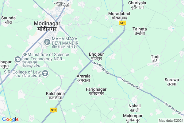
Kilodha
Kilodha Map
EDIT Map
Add Your House
 ..
..
Current Corona Virus Infected Patients Count in Ghaziabad District
| City Name | District Name | Total Covid cases |
|---|---|---|
| Ghaziabad District | Ghaziabad | 55 |
| Ghaziabad | Ghaziabad | 2 |
| Kaushambi | Ghaziabad | 1 |
Locality Name :
Kilodha
( किलोढा )
Block Name : Bhojpur
District : Ghaziabad
State : Uttar Pradesh
Division : Meerut
Language : Hindi and Urdu
Current Time 12:20 AM
Date: Thursday , Feb 06,2025 (IST)
Time zone: IST (UTC+5:30)
Elevation / Altitude: 221 meters. Above Seal level
Telephone Code / Std Code: 01232
Assembly constituency : Modinagar assembly constituency
Assembly MLA : Dr. Manju Shiwach
Lok Sabha constituency : Baghpat parliamentary constituency
Parliament MP : Dr. SATYAPAL SINGH
Serpanch Name :
Main Village Name : Kilodha
Commodities Prices : Muradnagar Market / Mandi
Kilodha Live Weather
Temperature: 13.3 °C
clear sky
Humidity: 30%
Wind : 3.83 mt/sec towards W
StationName : "Farīdnagar"
observed on 2 Hours Back
Temperature: 13.3 °C
clear sky
Humidity: 30%
Wind : 3.83 mt/sec towards W
StationName : "Farīdnagar"
observed on 2 Hours Back
Kilodha Weather Forecast for Next 5 days
06-02-2025
10.1°C to 13.3°C
clear sky
10.1°C to 13.3°C
clear sky
07-02-2025
9.2°C to 24.1°C
clear sky
9.2°C to 24.1°C
clear sky
08-02-2025
9.5°C to 24.3°C
clear sky, few clouds, scattered clouds, broken clouds
9.5°C to 24.3°C
clear sky, few clouds, scattered clouds, broken clouds
09-02-2025
11.0°C to 26.6°C
broken clouds, scattered clouds, few clouds, clear sky
11.0°C to 26.6°C
broken clouds, scattered clouds, few clouds, clear sky
10-02-2025
12.8°C to 28.0°C
few clouds, clear sky
12.8°C to 28.0°C
few clouds, clear sky
National Highways Reachable To Kilodha
Nationa High Way :NH9
Nationa High Way :NH44
Nationa High Way :NH9
Nationa High Way :NH44
Rivers Near Kilodha
यमुना :যমুনা :Yamuna River :યમુના :यमुना :ಯಮುನಾ :यमुना :யமுனை :Ямуна :https://1drv.ms/b/s!Ar-WXIFaX7UdgQuO6WpVrTr6YYsQ
यमुना :যমুনা :Yamuna River :યમુના :यमुना :ಯಮುನಾ :यमुना :யமுனை :Ямуна :https://1drv.ms/b/s!Ar-WXIFaX7UdgQuO6WpVrTr6YYsQ
यमुना :যমুনা :Yamuna River :યમુના :यमुना :ಯಮುನಾ :यमुना :யமுனை :Ямуна :https://1drv.ms/b/s!Ar-WXIFaX7UdgQuO6WpVrTr6YYsQ
यमुना :যমুনা :Yamuna River :યમુના :यमुना :ಯಮುನಾ :यमुना :யமுனை :Ямуна :https://1drv.ms/b/s!Ar-WXIFaX7UdgQuO6WpVrTr6YYsQ
About Kilodha
Correct below Info and add more info about KilodhaKilodha is a small Village/hamlet in Bhojpur Block in Ghaziabad District of Uttar Pradesh State, India. It comes under Kilodha Panchayath. It belongs to Meerut Division . It is located 29 KM towards East from District head quarters Ghaziabad. 458 KM from State capital Lucknow
Kilodha is surrounded by Modinagar Block towards west , Rajapur Block towards west , Muradnagar Block towards west , Kharkhoda Block towards East .
Modinagar , Pilkhuwa , Muradnagar , Hapur are the near by Cities to Kilodha.
This Place is in the border of the Ghaziabad District and Meerut District. Meerut District Kharkhoda is East towards this place .
Demographics of Kilodha
Hindi is the Local Language here.Politics in Kilodha
BJP , RLD , SP , BSP are the major political parties in this area.Polling Stations /Booths near Kilodha
1)Dalit Pri School Bakharva2)Pri. School Aurangabad Fazalgarh
3)Ginni Devi Junior High School Devenderpuri
4)Girls Jr. High School Didauli
5)Girls Jr. High School Didauli
HOW TO REACH Kilodha
By Rail
Modinagar Rail Way Station , Mohiuddinpur Rail Way Station are the very nearby railway stations to Kilodha.Pincodes near Kilodha
201201 ( Harmukhpuri ) , 245304 ( Pilkhauwa Post Office ) , 201204 ( Modipon )Colleges near Kilodha
Krishak Inter College, Churiyala
Address :
Schools near Kilodha
T R M P B A S Inter College
Address : modi nagar(ta) , bhojpur , ghaziabad , Uttar Pradesh . PIN- 201204 , Post - Modipon
U.p.s. Churiyala
Address : churiyala , bhojpur , ghaziabad , Uttar Pradesh . PIN- 201201 , Post - Harmukhpuri
U.r.s. Nahali
Address : nahali , bhojpur , ghaziabad , Uttar Pradesh . PIN- 245304 , Post - Pilkhauwa Post Office
U.p.s. Jagatpuri
Address : jagatpuri , bhojpur , ghaziabad , Uttar Pradesh . PIN- 201204 , Post - Modipon
Govt Health Centers near Kilodha
1) Fazalghar , sub center fazalghar , ,2) Bhojpur , sub center , ,
3) Amrala , sub center amrala , ,
Sub Villages in Kilodha
Schools in Kilodha,Bhojpur
Electronic Shops in Kilodha,Bhojpur
Super Markets in Kilodha,Bhojpur
Local Parks in Kilodha,Bhojpur
Police Stations near Kilodha,Bhojpur
Governement Offices near Kilodha,Bhojpur
About Kilodha &
History
How to reach Kilodha
Tourist Places Near By Kilodha
Schools in Kilodha
Colleges in Kilodha
Temperature & weather of Kilodha
places in Kilodha
Kilodha photos
More Information
How to reach Kilodha
Tourist Places Near By Kilodha
Schools in Kilodha
Colleges in Kilodha
Temperature & weather of Kilodha
places in Kilodha
Kilodha photos
More Information
Village Talk
Post News or Events about this Village
Near Cities
Modinagar 6 KM near
Pilkhuwa 11 KM near
Muradnagar 12 KM near
Hapur 20 KM near
Modinagar 6 KM near
Pilkhuwa 11 KM near
Muradnagar 12 KM near
Hapur 20 KM near
Near By Taluks
Bhojpur 0 KM near
Modinagar 6 KM near
Rajapur 12 KM near
Muradnagar 14 KM near
Bhojpur 0 KM near
Modinagar 6 KM near
Rajapur 12 KM near
Muradnagar 14 KM near
Near By Air Ports
Indira Gandhi International Airport 64 KM near
Muzaffarnagar Airport 79 KM near
Dehra Dun Airport 194 KM near
Pantnagar Airport 204 KM near
Indira Gandhi International Airport 64 KM near
Muzaffarnagar Airport 79 KM near
Dehra Dun Airport 194 KM near
Pantnagar Airport 204 KM near
Near By Tourist Places
Meerut 25 KM near
Noida 43 KM near
Delhi 47 KM near
Surajkund 51 KM near
Bulandshahr 55 KM near
Meerut 25 KM near
Noida 43 KM near
Delhi 47 KM near
Surajkund 51 KM near
Bulandshahr 55 KM near
Near By Districts
Meerut 24 KM near
Ghaziabad 27 KM near
North East Delhi 39 KM near
East Delhi 40 KM near
Meerut 24 KM near
Ghaziabad 27 KM near
North East Delhi 39 KM near
East Delhi 40 KM near
Near By RailWay Station
Modinagar Rail Way Station 6.6 KM near
Pilkhua Rail Way Station 12 KM near
Modinagar Rail Way Station 6.6 KM near
Pilkhua Rail Way Station 12 KM near