| Home | City Bus | Maps | Villages | Cities | Rail | Tourist Places | School | College | Pin Codes | Corona Cases Count |
| Distance Calculator Bus Services IFSC Codes Trace Mobile Number Weather Search Place Trace IP Available Cash ATM/Banks Locate Polling Booth Report an Error contact People |
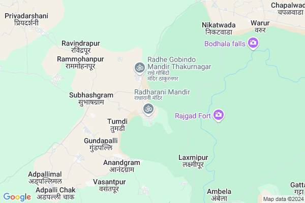
Somanpur
Somanpur Map
EDIT Map
Add Your House
 ..
..
Current Corona Virus Infected Patients Count in Gadchiroli District
| City Name | District Name | Total Covid cases |
|---|
Locality Name :
Somanpur
( सोमणपूर )
Taluka Name : Chamorshi
District : Gadchiroli
State : Maharashtra
Region : Vidarbh
Division : Nagpur
Language : Marathi and Hindi,gondi,bengali, Telgu
Current Time 07:25 AM
Date: Saturday , Apr 26,2025 (IST)
Time zone: IST (UTC+5:30)
Elevation / Altitude: 200 meters. Above Seal level
Telephone Code / Std Code: 07135
Assembly constituency : Gadchiroli assembly constituency
Assembly MLA : Deorao Madguji Holi
Lok Sabha constituency : Gadchiroli-Chimur parliamentary constituency
Parliament MP : ASHOK MAHADEORAO NETE
Serpanch Name :
Pin Code : 442603
Post Office Name : Chamorshi
Main Village Name : Somanpur
Commodities Prices : Chamorshi Market / Mandi
National Highways Reachable To Somanpur
Nationa High Way :NH930D
Nationa High Way :NH930D
Rivers Near Somanpur
Dongri
Sirpur Vagu
Dongri
Sirpur Vagu
About Somanpur
Correct below Info and add more info about SomanpurSomanpur is a small Village/hamlet in Chamorshi Taluka in Gadchiroli District of Maharashtra State, India. It comes under Somanpur Panchayath. It belongs to Vidarbh region . It belongs to Nagpur Division . It is located 57 KM towards South from District head quarters Gadchiroli. 15 KM from Chamorshi. 875 KM from State capital Mumbai
Somanpur Pin code is 442603 and postal head office is Chamorshi .
Kalinagar ( 7 KM ) , Adpalli Mal ( 9 KM ) , Ghot ( 10 KM ) , Mulchera ( 10 KM ) , Warur ( 10 KM ) are the nearby Villages to Somanpur. Somanpur is surrounded by Mulchera Taluka towards South , Gondpipri Taluka towards west , Kouthala Taluka towards South , Pombhurna Taluka towards west .
Mul , Gadchiroli , Kagaznagar , Rajura are the near by Cities to Somanpur.
This Place is in the border of the Gadchiroli District and Chandrapur District. Chandrapur District Saoli is North towards this place .
Somanpur 2011 Census Details
Somanpur Local Language is Marathi. Somanpur Village Total population is 259 and number of houses are 66. Female Population is 49.0%. Village literacy rate is 61.8% and the Female Literacy rate is 24.3%.
Population
| Census Parameter | Census Data |
| Total Population | 259 |
| Total No of Houses | 66 |
| Female Population % | 49.0 % ( 127) |
| Total Literacy rate % | 61.8 % ( 160) |
| Female Literacy rate | 24.3 % ( 63) |
| Scheduled Tribes Population % | 78.8 % ( 204) |
| Scheduled Caste Population % | 0.0 % ( 0) |
| Working Population % | 68.7 % |
| Child(0 -6) Population by 2011 | 26 |
| Girl Child(0 -6) Population % by 2011 | 61.5 % ( 16) |
Somanpur Census More Deatils.
Politics in Somanpur
BJP , NCP , INC are the major political parties in this area.Polling Stations /Booths near Somanpur
1)Nagari2)Thakari
3)Subhashgram
4)Sonapur
5)Govindpur
HOW TO REACH Somanpur
By Rail
There is no railway station near to Somanpur in less than 10 km. Mul Marora Rail Way Station (near to Mul) , Tolewahi Halt Rail Way Station (near to Mul) are the Rail way stations reachable from near by towns.By Road
Mul , Gadchiroli are the nearby by towns to Somanpur having road connectivity to SomanpurColleges near Somanpur
Namdeorao Poreddiwar College Of Engineering And Technology Gadchiroli
Address :
Yashwant Jr. College, Shankarpur
Address :
Shankarrao Bezalwar Mahvidylaya
Address :
Aadarsh College
Address :
Goverment Polythechnic Collage,gadchiroli
Address :
Schools in Somanpur
Z.p. Prm. School
Address : somanpur , chamorshi , gadchiroli , Maharashtra . PIN- 442707 , Post - Ashti (Gadchiroli)
Govt Health Centers near Somanpur
1) Virur , PHC Virur Gadegaon Building , Main Road , Near ZP Primary School2) Vitthalwada , Sub Centre Vitthalwada , On Asthi Road , Near Zilla Parishad School
3) Gomani , GOMNI , GOMNI , GOMNI
Sub Villages in Somanpur
Colleges in Somanpur,Chamorshi
S B S Junior And Science College Mulchera
Gadchiroli; Maharashtra 442703; India
11.2 KM distance Detail
Alpha Academy for Management Studies
Allapalli Road; Vishvanathnagar; Maharashtra 442703; India
11.5 KM distance Detail
Disha Computer Institute
Allapalli Road; Mulchera; Maharashtra 442703; India
11.7 KM distance Detail
more ..
About Somanpur &
History
How to reach Somanpur
Tourist Places Near By Somanpur
Schools in Somanpur
Colleges in Somanpur
Temperature & weather of Somanpur
places in Somanpur
Somanpur photos
More Information
How to reach Somanpur
Tourist Places Near By Somanpur
Schools in Somanpur
Colleges in Somanpur
Temperature & weather of Somanpur
places in Somanpur
Somanpur photos
More Information
Village Talk
Post News or Events about this Village
Near Cities
Mul 50 KM near
Gadchiroli 54 KM near
Kagaznagar 73 KM near
Rajura 73 KM near
Mul 50 KM near
Gadchiroli 54 KM near
Kagaznagar 73 KM near
Rajura 73 KM near
Near By Taluks
Chamorshi 13 KM near
Mulchera 18 KM near
Gondpipri 35 KM near
Kouthala 37 KM near
Chamorshi 13 KM near
Mulchera 18 KM near
Gondpipri 35 KM near
Kouthala 37 KM near
Near By Air Ports
Sonegaon Airport 196 KM near
Raipur Airport 274 KM near
Nanded Airport 317 KM near
Rajiv Gandhi International Airport 360 KM near
Sonegaon Airport 196 KM near
Raipur Airport 274 KM near
Nanded Airport 317 KM near
Rajiv Gandhi International Airport 360 KM near
Near By Tourist Places
Sirpur 54 KM near
Chandrapur 80 KM near
Bhamragarh Wildlife Sanctuary 86 KM near
Tadoba 87 KM near
Bhandara 180 KM near
Sirpur 54 KM near
Chandrapur 80 KM near
Bhamragarh Wildlife Sanctuary 86 KM near
Tadoba 87 KM near
Bhandara 180 KM near
Near By Districts
Gadchiroli 54 KM near
Chandrapur 77 KM near
Narayanpur 154 KM near
Bijapur 155 KM near
Gadchiroli 54 KM near
Chandrapur 77 KM near
Narayanpur 154 KM near
Bijapur 155 KM near
Near By RailWay Station
Balharshah Junction Rail Way Station 71 KM near
Sirpur Kaghaznagar Rail Way Station 73 KM near
Balharshah Junction Rail Way Station 71 KM near
Sirpur Kaghaznagar Rail Way Station 73 KM near