| Home | City Bus | Maps | Villages | Cities | Rail | Tourist Places | School | College | Pin Codes | Corona Cases Count |
| Distance Calculator Bus Services IFSC Codes Trace Mobile Number Weather Search Place Trace IP Available Cash ATM/Banks Locate Polling Booth Report an Error contact People |
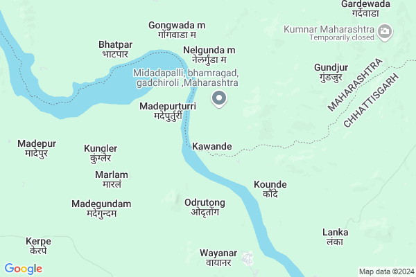
Kawande
Kawande Map
EDIT Map
Add Your House
 ..
..
Current Corona Virus Infected Patients Count in Gadchiroli District
| City Name | District Name | Total Covid cases |
|---|
Locality Name :
Kawande
( कवंडे )
Taluka Name : Bhamaragad
District : Gadchiroli
State : Maharashtra
Region : Vidarbh
Division : Nagpur
Language : Marathi and Hindi,gondi,bengali, Telgu
Current Time 01:58 PM
Date: Saturday , Apr 26,2025 (IST)
Time zone: IST (UTC+5:30)
Telephone Code / Std Code: 07134
Assembly constituency : Aheri assembly constituency
Assembly MLA : Aatram Dharamraobaba Bhagwantrao
Lok Sabha constituency : Gadchiroli-Chimur parliamentary constituency
Parliament MP : ASHOK MAHADEORAO NETE
Serpanch Name :
Pin Code : 442710
Post Office Name : Bhamragadh
Main Village Name : Kawande
Commodities Prices : Bharamgarh Market / Mandi
Kawande Live Weather
Temperature: 42.0 °C
clear sky
Humidity: 19%
Wind : 3.75 mt/sec towards SW
StationName : "AllÄ\u0081palli"
observed on Now
Temperature: 42.0 °C
clear sky
Humidity: 19%
Wind : 3.75 mt/sec towards SW
StationName : "AllÄ\u0081palli"
observed on Now
Kawande Weather Forecast for Next 5 days
27-04-2025
26.7°C to 40.3°C
scattered clouds, light rain, overcast clouds
26.7°C to 40.3°C
scattered clouds, light rain, overcast clouds
28-04-2025
26.4°C to 34.8°C
light rain, overcast clouds, broken clouds, scattered clouds
26.4°C to 34.8°C
light rain, overcast clouds, broken clouds, scattered clouds
29-04-2025
25.1°C to 41.0°C
broken clouds, clear sky, few clouds, scattered clouds
25.1°C to 41.0°C
broken clouds, clear sky, few clouds, scattered clouds
30-04-2025
25.5°C to 42.0°C
clear sky, scattered clouds, few clouds
25.5°C to 42.0°C
clear sky, scattered clouds, few clouds
01-05-2025
27.1°C to 41.5°C
scattered clouds, few clouds, clear sky
27.1°C to 41.5°C
scattered clouds, few clouds, clear sky
National Highways Reachable To Kawande
Nationa High Way :NH353C
Nationa High Way :NH353C
Rivers Near Kawande
Pathra
Pranhita
Pathra
Pranhita
About Kawande
Correct below Info and add more info about KawandeKawande is a small Village/hamlet in Bhamaragad Taluka in Gadchiroli District of Maharashtra State, India. It comes under Kawande Panchayath. It belongs to Vidarbh region . It belongs to Nagpur Division . It is located 145 KM towards South from District head quarters Gadchiroli. 25 KM from Bhamragad. 964 KM from State capital Mumbai
Kawande Pin code is 442710 and postal head office is Bhamragadh .
Kawande is surrounded by Bhairamgarh Taluka towards East , Orchha(Abhujmad) Taluka towards East , Etapalli Taluka towards west , Bijapur Taluka towards South .
Bade Bacheli , Kondagaon , Gadchiroli , Kagaznagar are the near by Cities to Kawande.
Kawande 2011 Census Details
Kawande Local Language is Marathi. Kawande Village Total population is 156 and number of houses are 26. Female Population is 57.1%. Village literacy rate is 7.1% and the Female Literacy rate is 2.6%.
Population
| Census Parameter | Census Data |
| Total Population | 156 |
| Total No of Houses | 26 |
| Female Population % | 57.1 % ( 89) |
| Total Literacy rate % | 7.1 % ( 11) |
| Female Literacy rate | 2.6 % ( 4) |
| Scheduled Tribes Population % | 100.0 % ( 156) |
| Scheduled Caste Population % | 0.0 % ( 0) |
| Working Population % | 64.7 % |
| Child(0 -6) Population by 2011 | 28 |
| Girl Child(0 -6) Population % by 2011 | 60.7 % ( 17) |
Kawande Census More Deatils.
Politics in Kawande
BJP , NCP , are the major political parties in this area.Polling Stations /Booths near Kawande
1)Nawegaon2)Gomani
3)Bhapada
4)Golakarji
5)Devda
HOW TO REACH Kawande
By Rail
There is no railway station near to Kawande in less than 10 km. are the Rail way stations reachable from near by towns.By Road
Gadchiroli are the nearby by towns to Kawande having road connectivity to KawandeColleges near Kawande
Namdeorao Poreddiwar College Of Engineering And Technology Gadchiroli
Address :
Yashwant Jr. College, Shankarpur
Address :
Shankarrao Bezalwar Mahvidylaya
Address :
Aadarsh College
Address :
Goverment Polythechnic Collage,gadchiroli
Address :
Schools in Kawande
Z.p. Prm School
Address : kawande , bhamragad , gadchiroli , Maharashtra . PIN- 442710 , Post - Bhamragadh
Govt Health Centers near Kawande
1) Dhodraj , Dhodraj , Dhodraj , Z.P. Primary School2) Gatta , Gatta , Gatta ,
3) Gomani , GOMNI , GOMNI , GOMNI
Sub Villages in Kawande
Schools in Kawande,Bhamaragad
Electronic Shops in Kawande,Bhamaragad
Super Markets in Kawande,Bhamaragad
Local Parks in Kawande,Bhamaragad
Police Stations near Kawande,Bhamaragad
Governement Offices near Kawande,Bhamaragad
About Kawande &
History
How to reach Kawande
Tourist Places Near By Kawande
Schools in Kawande
Colleges in Kawande
Temperature & weather of Kawande
places in Kawande
Kawande photos
More Information
How to reach Kawande
Tourist Places Near By Kawande
Schools in Kawande
Colleges in Kawande
Temperature & weather of Kawande
places in Kawande
Kawande photos
More Information
Village Talk
Post News or Events about this Village
Near Cities
Bade Bacheli 97 KM near
Kondagaon 121 KM near
Gadchiroli 138 KM near
Kagaznagar 142 KM near
Bade Bacheli 97 KM near
Kondagaon 121 KM near
Gadchiroli 138 KM near
Kagaznagar 142 KM near
Near By Taluks
Bhamaragad 23 KM near
Bhairamgarh 48 KM near
Orchha(Abhujmad) 51 KM near
Etapalli 60 KM near
Bhamaragad 23 KM near
Bhairamgarh 48 KM near
Orchha(Abhujmad) 51 KM near
Etapalli 60 KM near
Near By Air Ports
Raipur Airport 265 KM near
Sonegaon Airport 295 KM near
Rajahmundry Airport 302 KM near
Vijayawada Airport 343 KM near
Raipur Airport 265 KM near
Sonegaon Airport 295 KM near
Rajahmundry Airport 302 KM near
Vijayawada Airport 343 KM near
Near By Tourist Places
Bhamragarh Wildlife Sanctuary 19 KM near
Dantewada 91 KM near
Medaram 132 KM near
Sirpur 133 KM near
Bastar 151 KM near
Bhamragarh Wildlife Sanctuary 19 KM near
Dantewada 91 KM near
Medaram 132 KM near
Sirpur 133 KM near
Bastar 151 KM near
Near By Districts
Bijapur 62 KM near
Narayanpur 85 KM near
Dantewada 95 KM near
Gadchiroli 138 KM near
Bijapur 62 KM near
Narayanpur 85 KM near
Dantewada 95 KM near
Gadchiroli 138 KM near
Near By RailWay Station
Sirpur Kaghaznagar Rail Way Station 142 KM near
Bellampalli Rail Way Station 145 KM near
Sirpur Kaghaznagar Rail Way Station 142 KM near
Bellampalli Rail Way Station 145 KM near