| Home | City Bus | Maps | Villages | Cities | Rail | Tourist Places | School | College | Pin Codes | Corona Cases Count |
| Distance Calculator Bus Services IFSC Codes Trace Mobile Number Weather Search Place Trace IP Available Cash ATM/Banks Locate Polling Booth Report an Error contact People |
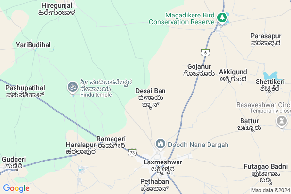
Desai Ban
Desai Ban Map
EDIT Map
Add Your House
 ..
..
Current Corona Virus Infected Patients Count in Gadag District
| City Name | District Name | Total Covid cases |
|---|---|---|
| Gadag District | Gadag | 4 |
Locality Name :
Desai Ban
( ದೇಸಾಯಿ ಬ್ಯಾನ್ )
Taluk Name : Shirahatti
District : Gadag
State : Karnataka
Division : Belgaum
Language : Kannada and English & Hindi
Current Time 04:39 AM
Date: Saturday , Apr 26,2025 (IST)
Time zone: IST (UTC+5:30)
Elevation / Altitude: 663 meters. Above Seal level
Telephone Code / Std Code: 08487
Assembly constituency : Shirahatti assembly constituency
Assembly MLA : Dr.Chandru Lamani
Lok Sabha constituency : Haveri parliamentary constituency
Parliament MP : UDASI. S.C.
Serpanch Name :
Main Village Name : Desai Ban
Alternate Village Name : Desaibana
Commodities Prices : Laxmeshwar Market / Mandi
Desai Ban Live Weather
Temperature: 26.2 °C
few clouds
Humidity: 65%
Wind : 2.19 mt/sec towards W
StationName : "Mulgund"
observed on Now
Temperature: 26.2 °C
few clouds
Humidity: 65%
Wind : 2.19 mt/sec towards W
StationName : "Mulgund"
observed on Now
Desai Ban Weather Forecast for Next 5 days
27-04-2025
25.0°C to 36.0°C
clear sky, few clouds, broken clouds, light rain, overcast clouds
25.0°C to 36.0°C
clear sky, few clouds, broken clouds, light rain, overcast clouds
28-04-2025
25.0°C to 35.4°C
overcast clouds, light rain, scattered clouds
25.0°C to 35.4°C
overcast clouds, light rain, scattered clouds
29-04-2025
24.6°C to 37.5°C
broken clouds, few clouds, clear sky, scattered clouds
24.6°C to 37.5°C
broken clouds, few clouds, clear sky, scattered clouds
30-04-2025
23.0°C to 38.1°C
scattered clouds, few clouds, clear sky, broken clouds
23.0°C to 38.1°C
scattered clouds, few clouds, clear sky, broken clouds
National Highways Reachable To Desai Ban
Nationa High Way :NH52
Nationa High Way :NH52
Rivers Near Desai Ban
Bedti nala :ಬೇಡ್ತಿ
Nigari :ನಿಗರಿ
Bedti nala :ಬೇಡ್ತಿ
Nigari :ನಿಗರಿ
About Desai Ban
Correct below Info and add more info about Desai BanDesai Ban is a small Village/hamlet in Shirahatti Taluk in Gadag District of Karnataka State, India. It comes under Desai Ban Panchayath. It belongs to Belgaum Division . It is located 40 KM towards South from District head quarters Gadag. 16 KM from Shirahatti. 392 KM from State capital Bangalore
Haralapur ( 7 KM ) , Batturu ( 9 KM ) , Magadi ( 9 KM ) , Yalavatti ( 11 KM ) , Shigli ( 13 KM ) are the nearby Villages to Desai Ban. Desai Ban is surrounded by Kundgol Taluk towards west , Savanur Taluk towards South , Gadag Taluk towards North , Shiggaon Taluk towards west .
Lakshmeshwar , Savanur , Shiggaon , Gadag are the near by Cities to Desai Ban.
Desai Ban 2011 Census Details
Desai Ban Local Language is Kannada. Desai Ban Village Total population is 48 and number of houses are 10. Female Population is 43.8%. Village literacy rate is 77.1% and the Female Literacy rate is 27.1%.
Population
| Census Parameter | Census Data |
| Total Population | 48 |
| Total No of Houses | 10 |
| Female Population % | 43.8 % ( 21) |
| Total Literacy rate % | 77.1 % ( 37) |
| Female Literacy rate | 27.1 % ( 13) |
| Scheduled Tribes Population % | 0.0 % ( 0) |
| Scheduled Caste Population % | 25.0 % ( 12) |
| Working Population % | 47.9 % |
| Child(0 -6) Population by 2011 | 7 |
| Girl Child(0 -6) Population % by 2011 | 85.7 % ( 6) |
Desai Ban Census More Deatils.
Politics in Desai Ban
Bharatiya Janata Party , BJP , Bharatiya Janata Party (BJP) , INC are the major political parties in this area.Polling Stations /Booths near Desai Ban
1)Govt Higher Primary School Vadavi2)Govt Higher Primary School Kallaganur
3)Govt Ashram School Shigli
4)Govt Model Primary Boy
5)Govt Model Primary Boys School No 1 (west Wing) Tagore Hall Old Building (new Room) Laxmeshwar (hir
HOW TO REACH Desai Ban
By Road
Lingsugur is the Nearest Town to Desai Ban. Road connectivity is there from Lingsugur to Desai Ban.By Rail
There is no railway station near to Desai Ban in less than 10 km.Pincodes near Desai Ban
582116 ( Lakshmeshwar ) , 581107 ( Gudgeri ) , 582210 ( Shigli )Colleges near Desai Ban
Basaveswarae Arsts And Commars College Dharawad
Address : Basaveswara College In Dharawad
Shree Banashankari Devi Pree University Hebbal
Address :
Schools near Desai Ban
F.m.dabali Co.jr.col.shirhatti
Address : shirhatti , shirhatti , gadag , Karnataka . PIN- 582120 , Post - Shiratti
National Public Highschool
Address : lakshmeshwar , shirhatti , gadag , Karnataka . PIN- 582116 , Post - Lakshmeshwar
B.d.tatti (a)mct(r)d&d Lxr
Address : lakshmeshwar , shirhatti , gadag , Karnataka . PIN- 582116 , Post - Lakshmeshwar
Murarji Residential School
Address : lakshmeshwar , shirhatti , gadag , Karnataka . PIN- 582116 , Post - Lakshmeshwar
Govt Health Centers near Desai Ban
1) Pashupatihal , Pashupatihal , Pashupatihal , Pashupatihal2) Yarebudihal , Yarebudihal , Yarebudihal , Yarebudihal
3) Hiregunjal , Hiregunjal , Hiregunjal , Hiregunjal
Sub Villages in Desai Ban
Hospitals in Desai Ban,Shirahatti
Shri Laxmi Venteshwar Clinic
Near Municipality. New bus stand road. beside Jagadellamma temple; Laxmeshwar; Karnataka; India
6.1 KM distance Detail
Shri Laxmi Venkash Clinic
New Bus Stand Rd; Main Bazar; Near Municipalty; Laxmeshwar; Karnataka 582116; India
6.1 KM distance Detail
more ..
Petrol Bunks in Desai Ban,Shirahatti
MEKKI PETROLEUMS
State Highway 23; ISHWER NAGAR; Lakshmeshwar;; Karnataka 582116; India
5.5 KM distance Detail
someshwarnagar 1st cross; Laxmeshwar
Pampa Circle;; Desai Ban; Karnataka; India
5.7 KM distance Detail
more ..
Colleges in Desai Ban,Shirahatti
Munciple Arts and Commerce College
SH 23; Lakshmeshwar; Karnataka 582116; India
6.8 KM distance Detail
Government DEd College
Haripur road to shirahatti; Shirahatti; Karnataka 582120; India
15.5 KM distance Detail
more ..
Schools in Desai Ban,Shirahatti
Seventh day adventist english high school laxmeshwara
Laxmeshwar; Karnataka 582116; India
4.2 KM distance Detail
Electronic Shops in Desai Ban,Shirahatti
P K Computers
Bazar Road Near Padagatti; Laxmeshwar;; Tq Shirahatti Dist Gadag; Laxmeshwar; Karnataka 582116; India
5.7 KM distance Detail
Super Markets in Desai Ban,Shirahatti
Local Parks in Desai Ban,Shirahatti
Magadi Bird Sanctury (ಮಾಗಡಿ ವಲಸೆ ಪಕ್ಷಿಗಳ ತಾಣ)
SH 6; Magdi; Karnataka 582117; India
9.3 KM distance Detail
About Desai Ban &
History
How to reach Desai Ban
Tourist Places Near By Desai Ban
Schools in Desai Ban
Colleges in Desai Ban
Temperature & weather of Desai Ban
places in Desai Ban
Desai Ban photos
More Information
How to reach Desai Ban
Tourist Places Near By Desai Ban
Schools in Desai Ban
Colleges in Desai Ban
Temperature & weather of Desai Ban
places in Desai Ban
Desai Ban photos
More Information
Village Talk
Post News or Events about this Village
Near Cities
Lakshmeshwar 5 KM near
Savanur 28 KM near
Shiggaon 37 KM near
Gadag 38 KM near
Lakshmeshwar 5 KM near
Savanur 28 KM near
Shiggaon 37 KM near
Gadag 38 KM near
Near By Taluks
Shirahatti 16 KM near
Kundgol 24 KM near
Savanur 28 KM near
Gadag 36 KM near
Shirahatti 16 KM near
Kundgol 24 KM near
Savanur 28 KM near
Gadag 36 KM near
Near By Air Ports
Hubli Airport 50 KM near
Sambre Airport 132 KM near
Dabolim Airport 196 KM near
Kolhapur Airport 230 KM near
Hubli Airport 50 KM near
Sambre Airport 132 KM near
Dabolim Airport 196 KM near
Kolhapur Airport 230 KM near
Near By Tourist Places
Hubli 50 KM near
Dandeli 94 KM near
Badami 96 KM near
Pattadakkal 106 KM near
Hospet 112 KM near
Hubli 50 KM near
Dandeli 94 KM near
Badami 96 KM near
Pattadakkal 106 KM near
Hospet 112 KM near
Near By Districts
Gadag 38 KM near
Haveri 47 KM near
Dharwad 63 KM near
Koppal 86 KM near
Gadag 38 KM near
Haveri 47 KM near
Dharwad 63 KM near
Koppal 86 KM near
Near By RailWay Station
Annigeri Rail Way Station 32 KM near
Gadag Junction Rail Way Station 39 KM near
Annigeri Rail Way Station 32 KM near
Gadag Junction Rail Way Station 39 KM near