| Home | City Bus | Maps | Villages | Cities | Rail | Tourist Places | School | College | Pin Codes | Corona Cases Count |
| Distance Calculator Bus Services IFSC Codes Trace Mobile Number Weather Search Place Trace IP Available Cash ATM/Banks Locate Polling Booth Report an Error contact People |
Ramchandrapur
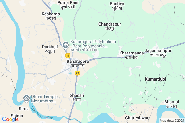
Ramchandrapur Map
EDIT Map
Add Your House
 ..
..
Current Corona Virus Infected Patients Count in East Singhbum District
| City Name | District Name | Total Covid cases |
|---|
Locality Name :
Ramchandrapur
( रामचंद्रपुर )
Block Name : Bahragora
District : East Singhbum
State : Jharkhand
Language : Hindi and Urdu, Bengali, Oriya, Gujrati, Nepali, Marwari, Punjabi
Current Time 12:54 PM
Date: Friday , Mar 14,2025 (IST)
Time zone: IST (UTC+5:30)
Elevation / Altitude: 102 meters. Above Seal level
Telephone Code / Std Code: 06594
Assembly constituency : Baharagora assembly constituency
Assembly MLA : SAMIR Kr. MOHANTY
Lok Sabha constituency : Jamshedpur parliamentary constituency
Parliament MP : Bidyut Baran Mahato
Serpanch Name :
Main Village Name : Ramchandrapur
Commodities Prices : Saraskana Market / Mandi
Ramchandrapur Live Weather
Temperature: 39.7 °C
clear sky
Humidity: 10%
Wind : 1.83 mt/sec towards N
StationName : "ChÄ\u0081kuliÄ\u0081"
observed on Now
Temperature: 39.7 °C
clear sky
Humidity: 10%
Wind : 1.83 mt/sec towards N
StationName : "ChÄ\u0081kuliÄ\u0081"
observed on Now
Ramchandrapur Weather Forecast for Next 5 days
15-03-2025
24.7°C to 40.5°C
clear sky
24.7°C to 40.5°C
clear sky
16-03-2025
23.5°C to 41.7°C
clear sky
23.5°C to 41.7°C
clear sky
17-03-2025
25.0°C to 42.1°C
scattered clouds, broken clouds, few clouds
25.0°C to 42.1°C
scattered clouds, broken clouds, few clouds
18-03-2025
26.0°C to 41.6°C
few clouds, clear sky, scattered clouds, broken clouds
26.0°C to 41.6°C
few clouds, clear sky, scattered clouds, broken clouds
19-03-2025
26.3°C to 42.4°C
clear sky
26.3°C to 42.4°C
clear sky
National Highways Reachable To Ramchandrapur
Nationa High Way :NH14
Nationa High Way :NH16
Nationa High Way :NH14
Nationa High Way :NH16
Rivers Near Ramchandrapur
Swarnarekha :Subarnarekha River
Dulung
Swarnarekha :Subarnarekha River
Dulung
About Ramchandrapur
Correct below Info and add more info about RamchandrapurRamchandrapur is a small Village/hamlet in Bahragora Block in East Singhbum District of Jharkhand State, India. It comes under Ramchandrapur Panchayath. It is located 95 KM towards South from District head quarters Jamshedpur. 220 KM from State capital Ranchi
Ramchandrapur is surrounded by Saraskana Block towards west , Gopiballavpur-I Block towards East , Gopiballav Pur -Ii Block towards East , Chakulia Block towards North .
Jhargram , Baripada , Musabani , Ghatshila are the near by Cities to Ramchandrapur.
This Place is in the border of the East Singhbum District and Mayurbhanj District. Mayurbhanj District Saraskana is west towards this place . Also it is in the Border of other district Medinipur West . It is in the border of two states. First State is Odisha State towards west and second state is West Bengal State towards west .
Ramchandrapur 2011 Census Details
Ramchandrapur Local Language is Hindi. Ramchandrapur Village Total population is 330 and number of houses are 75. Female Population is 50.0%. Village literacy rate is 55.8% and the Female Literacy rate is 23.3%.
Population
| Census Parameter | Census Data |
| Total Population | 330 |
| Total No of Houses | 75 |
| Female Population % | 50.0 % ( 165) |
| Total Literacy rate % | 55.8 % ( 184) |
| Female Literacy rate | 23.3 % ( 77) |
| Scheduled Tribes Population % | 0.0 % ( 0) |
| Scheduled Caste Population % | 0.0 % ( 0) |
| Working Population % | 63.0 % |
| Child(0 -6) Population by 2011 | 36 |
| Girl Child(0 -6) Population % by 2011 | 44.4 % ( 16) |
Ramchandrapur Census More Deatils.
Politics in Ramchandrapur
JVM , Bharatiya Janata Party , J.V.M (P) , JVM(P) , BJP , JMM are the major political parties in this area.Polling Stations /Booths near Ramchandrapur
1)Middle School Balijuri Room No.-22)Middle School Guhiyapal Room No.-1
3)Upgraded Middle School Benasoli Room No.-2
4)High School Kaimi Room No.-1
5)Upgraded Middle School Kenduapal
HOW TO REACH Ramchandrapur
By Rail
There is no railway station near to Ramchandrapur in less than 10 km.Pincodes near Ramchandrapur
832101 ( Baharagora ) , 832301 ( Chakulia ) , 832302 ( Dhalbhumgarh )Colleges near Ramchandrapur
Musabani Mines Inter College, Musabani
Address : Musabani Mines Inter College, Po+ps-musabani, Jharkhand-832104
Al Kabir Polytechnic
Address :
Ghatshila College Ghatshila
Address : Ghatshila
Digi Excellence Academy
Address : Station Road, Dhalbhumgarh, East Singbhum
Schools near Ramchandrapur
Balijuri Middle School Balijuri
Address : Balijuri
Kumardubi Darkhuli High School
Address : School name-Kumardubi Darkhuli High School
via-Kumardubi
Dist-East Singhbhum(Jharkhand)
Pin-832101
website-www.kumardubi.blogspot.com
https://www.facebook.com/groups/kumardubi/
Govt Health Centers near Ramchandrapur
1) HSC Koutusole , Koutusole , ,2) HSC MATIHANA , MATIHANA , ,
3) HSC ICHARASHOL , ICHARASHOL , ,
Sub Villages in Ramchandrapur
Hospitals in Ramchandrapur,Bahragora
Giri Homoeo
near swargabaudimaa mandir; kesharda; via; mohuli; Jharkhand; India
1.8 KM distance Detail
Rabindra Nath Pani Memorial Hospital & Research Centre
Baharagora; Jharkhand 832101; India
2.1 KM distance Detail
more ..
Petrol Bunks in Ramchandrapur,Bahragora
HP PETROL PUMP - N K PAUL
HP Petrol Pump Post Baharagora; Ranchi; Jharkhand 832101; India
1.5 KM distance Detail
more ..
Colleges in Ramchandrapur,Bahragora
iact computer education Baharagora
Near Baharagora college; Baharagora; Rajlabandh; Jharkhand 832101; India
2.2 KM distance Detail
Parsuram Academy Of Technology ITI ;Jamirdiha ;Baharagora ;jharkhand
Dharampur; Jharkhand 832101; India
2.9 KM distance Detail
DREAMLINE SOFTWARE SOLUTION
PATPUR; MARKET ROAD; BAHARAGORA; Baharagora; Jharkhand 832101; India
3.0 KM distance Detail
more ..
Schools in Ramchandrapur,Bahragora
Vivekananda International School; Bahragora
NH6; Barshol; Jharkhand 832101; India
1.3 KM distance Detail
Electronic Shops in Ramchandrapur,Bahragora
Sudhangshu Auto Service (GREGE)
Mumbai - Kolkata Hwy; Baharagora; Jharkhand 832101; India
1.5 KM distance Detail
Police Stations near Ramchandrapur,Bahragora
Baharagora Police Station
Patpur; National Highway 6&33; Baharagora; Jharkhand 832101; India
2.9 KM distance Detail
About Ramchandrapur &
History
How to reach Ramchandrapur
Tourist Places Near By Ramchandrapur
Schools in Ramchandrapur
Colleges in Ramchandrapur
Temperature & weather of Ramchandrapur
places in Ramchandrapur
Ramchandrapur photos
More Information
How to reach Ramchandrapur
Tourist Places Near By Ramchandrapur
Schools in Ramchandrapur
Colleges in Ramchandrapur
Temperature & weather of Ramchandrapur
places in Ramchandrapur
Ramchandrapur photos
More Information
Village Talk
Post News or Events about this Village
Near Cities
Jhargram 35 KM near
Baripada 42 KM near
Musabani 42 KM near
Ghatshila 48 KM near
Jhargram 35 KM near
Baripada 42 KM near
Musabani 42 KM near
Ghatshila 48 KM near
Near By Taluks
Bahragora 0 KM near
Gopiballavpur-I 17 KM near
Saraskana 18 KM near
Gopiballav Pur -Ii 23 KM near
Bahragora 0 KM near
Gopiballavpur-I 17 KM near
Saraskana 18 KM near
Gopiballav Pur -Ii 23 KM near
Near By Air Ports
Netaji Subhas Chandra Bose Airport 200 KM near
Ranchi Airport 207 KM near
Bhubaneswar Airport 274 KM near
Gaya Airport 369 KM near
Netaji Subhas Chandra Bose Airport 200 KM near
Ranchi Airport 207 KM near
Bhubaneswar Airport 274 KM near
Gaya Airport 369 KM near
Near By Tourist Places
Baripada 42 KM near
Medinipur 69 KM near
East Medinipur 69 KM near
Midnapore 71 KM near
Barehipani & Joranda Barehipani & Joranda Falls 80 KM near
Baripada 42 KM near
Medinipur 69 KM near
East Medinipur 69 KM near
Midnapore 71 KM near
Barehipani & Joranda Barehipani & Joranda Falls 80 KM near
Near By Districts
Mayurbhanj 43 KM near
Medinipur West 69 KM near
East Singhbum 91 KM near
Baleshwar 99 KM near
Mayurbhanj 43 KM near
Medinipur West 69 KM near
East Singhbum 91 KM near
Baleshwar 99 KM near
Near By RailWay Station
Chakulia Rail Way Station 24 KM near
Jhargram Rail Way Station 36 KM near
Chakulia Rail Way Station 24 KM near
Jhargram Rail Way Station 36 KM near