| Home | City Bus | Maps | Villages | Cities | Rail | Tourist Places | School | College | Pin Codes | Corona Cases Count |
| Distance Calculator Bus Services IFSC Codes Trace Mobile Number Weather Search Place Trace IP Available Cash ATM/Banks Locate Polling Booth Report an Error contact People |
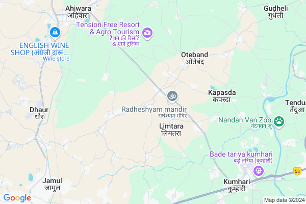
Chetuwa
Chetuwa Map
EDIT Map
Add Your House
 ..
..
Current Corona Virus Infected Patients Count in Durg District
| City Name | District Name | Total Covid cases |
|---|---|---|
| Bhilai | Durg | 1 |
Locality Name :
Chetuwa
( चेतुवा )
Tehsil Name : Dhamdha
District : Durg
State : Chattisgarh
Language : Chhattisgarhi and Hindi, Urdu
Current Time 01:31 PM
Date: Tuesday , Apr 29,2025 (IST)
Time zone: IST (UTC+5:30)
Elevation / Altitude: 312 meters. Above Seal level
Telephone Code / Std Code: 07821
Assembly constituency : Ahiwara assembly constituency
Assembly MLA : Domanlal Korsewada
Lok Sabha constituency : Durg parliamentary constituency
Parliament MP : VIJAY BAGHEL
Serpanch Name :
Main Village Name : Chetuwa
Commodities Prices : Raipur Market / Mandi
Rivers Near Chetuwa
Kulhan
Kharun River
Kulhan
Kharun River
About Chetuwa
Correct below Info and add more info about ChetuwaChetuwa is a small Village/hamlet in Dhamdha Tehsil in Durg District of Chattisgarh State, India. It comes under Chetuwa Panchayath. It is located 25 KM towards East from District head quarters Durg. 18 KM from Dhamdha. 21 KM from State capital Raipur
Limtara ( 2 KM ) , Kandarka ( 2 KM ) , Nardha ( 3 KM ) , Nandauri ( 3 KM ) , Kherdha ( 5 KM ) are the nearby Villages to Chetuwa. Chetuwa is surrounded by Bhilai Tehsil towards west , Raipur Tehsil towards East , Dharsiwa Tehsil towards East , Durg Tehsil towards west .
Durg-Bhilai Nagar , Bhilai , Birgaon , Raipur are the near by Cities to Chetuwa.
Chatua 2011 Census Details
Chetuwa Local Language is Chhattisgarhi. Chatua Village Total population is 985 and number of houses are 211. Female Population is 50.6%. Village literacy rate is 73.2% and the Female Literacy rate is 34.4%.
Population
| Census Parameter | Census Data |
| Total Population | 985 |
| Total No of Houses | 211 |
| Female Population % | 50.6 % ( 498) |
| Total Literacy rate % | 73.2 % ( 721) |
| Female Literacy rate | 34.4 % ( 339) |
| Scheduled Tribes Population % | 3.1 % ( 31) |
| Scheduled Caste Population % | 18.6 % ( 183) |
| Working Population % | 49.5 % |
| Child(0 -6) Population by 2011 | 126 |
| Girl Child(0 -6) Population % by 2011 | 46.8 % ( 59) |
Chatua Census More Deatils.
Politics in Chetuwa
Bharatiya Janata Party , BJP , INC are the major political parties in this area.Polling Stations /Booths near Chetuwa
1)Charoda~di2)Morid ~kh
3)Mudhpar
4)Kachandur Kh
5)Kandarka- K
HOW TO REACH Chetuwa
By Rail
Bhilai Cabin Rail Way Station , Kumhari Rail Way Station are the very nearby railway stations to Chetuwa.Pincodes near Chetuwa
490024 ( Jamul Cement Works ) , 490042 ( Kumhari ) , 490025 ( Bhilai Marshalling Yard )Colleges near Chetuwa
Govt. College Bori Bujurg
Address : Vill & Post-bori
thana- Bori
dist- Durg
chattisgarh
pin-491001
Sri Sai Polytechnic Nandini Road Durg 490036 (c.g)
Address : Ward-14 Banbarad-ahiwara
Schools near Chetuwa
Govt Ms Sukharikala (ssa)
Address : sukrikala , dhamdha , durg , Chattisgarh . PIN- 490331
(pvt) R.b.s.v. Dangnihia
Address : danganihia , dhamdha , durg , Chattisgarh . PIN- 491331 , Post - Dhamdha
(pvt) P.r.b.s.v.khilorakala
Address : khilorakala , dhamdha , durg , Chattisgarh . PIN- 491331 , Post - Dhamdha
D.a.v.ispat Public School
Address : nandini nagar , dhamdha , durg , Chattisgarh . PIN- 490036 , Post - Nandini
Govt Health Centers near Chetuwa
1) PHC Murmunda , Murmunda , ,2) SHC Limtara Godhi , SHC Limtara Godhi , ,
3) SHC Kandarka , Kandarka , ,
Sub Villages in Chetuwa
Petrol Bunks in Chetuwa,Dhamdha
Shri Sai petroleum (Petrol Pump) Murmunda
Kumhari; Ahiwara; Road; Kandraka; Chhattisgarh 490042; India
1.2 KM distance Detail
Indian Oil Petrol Pump
Durg; NH-6; Armori Bhandara Highway; Kumhari; Kumhari; Chhattisgarh 490042; India
8.5 KM distance Detail
more ..
Colleges in Chetuwa,Dhamdha
Sandipani Academy;Durg
Post-murmunda;Kumhari-Ahiwara Road; Achhoti; Chhattisgarh 490036; India
2.5 KM distance Detail
Chhattisgarh Kalyan Shiksha Mahavidyalaya
Nandini Road; Aheri; PO: Dhor (JSW); Durg; Chhattisgarh 490024; India
7.1 KM distance Detail
Chhattisgarh Kalyan Education College
Village-Aheri; Post-Dhour (J.C.W.); Bhilai; Durg; Chhattisgarh 490001; India
7.1 KM distance Detail
Shri Rawatpura Sarkar Institute of Pharmacy
Power grid Kumhari; Kumhari NP Part; Chhattisgarh 490042; India
7.7 KM distance Detail
more ..
Schools in Chetuwa,Dhamdha
sh. primary school chetwa (cg)
Chetwa Rd; Chetuwa; Chhattisgarh 490024; India
0.7 KM distance Detail
Local Parks in Chetuwa,Dhamdha
Osho Upban
Padum Nagar; Bhilai Marshalling Yard; Bhilai; Chhattisgarh 490025; India
10.7 KM distance Detail
Police Stations near Chetuwa,Dhamdha
GRP Police Station
Charoda; Bhilai Marshalling Yard; Bhilai; Chhattisgarh 490025; India
9.2 KM distance Detail
KUMHARI Police station
Station Rd; Saraswati Nagar; Kumhari; Raipur; Chhattisgarh 490042; India
9.9 KM distance Detail
Governement Offices near Chetuwa,Dhamdha
Tiwari R.T.O. Agent
Station Rd; Shankar Nagar; Raipur; Chhattisgarh 492001; India
9.7 KM distance Detail
Raipur-Durg-Bhilai Tri city metro Area
Raipur-Durg-Bhilai Tri city; metro Area; Bhilai; Chhattisgarh; India
10.9 KM distance Detail
About Chetuwa &
History
How to reach Chetuwa
Tourist Places Near By Chetuwa
Schools in Chetuwa
Colleges in Chetuwa
Temperature & weather of Chetuwa
places in Chetuwa
Chetuwa photos
More Information
How to reach Chetuwa
Tourist Places Near By Chetuwa
Schools in Chetuwa
Colleges in Chetuwa
Temperature & weather of Chetuwa
places in Chetuwa
Chetuwa photos
More Information
Village Talk
Post News or Events about this Village
Near Cities
Durg-Bhilai Nagar 10 KM near
Bhilai 19 KM near
Birgaon 19 KM near
Raipur 19 KM near
Durg-Bhilai Nagar 10 KM near
Bhilai 19 KM near
Birgaon 19 KM near
Raipur 19 KM near
Near By Taluks
Dhamdha 17 KM near
Bhilai 18 KM near
Raipur 21 KM near
Dharsiwa 27 KM near
Dhamdha 17 KM near
Bhilai 18 KM near
Raipur 21 KM near
Dharsiwa 27 KM near
Near By Air Ports
Raipur Airport 35 KM near
Jabalpur Airport 245 KM near
Sonegaon Airport 280 KM near
Khajuraho Airport 472 KM near
Raipur Airport 35 KM near
Jabalpur Airport 245 KM near
Sonegaon Airport 280 KM near
Khajuraho Airport 472 KM near
Near By Tourist Places
Bhilai 14 KM near
Raipur 20 KM near
Durg 24 KM near
Rajnandgaon 55 KM near
Dhamtari 74 KM near
Bhilai 14 KM near
Raipur 20 KM near
Durg 24 KM near
Rajnandgaon 55 KM near
Dhamtari 74 KM near
Near By Districts
Raipur 21 KM near
Durg 24 KM near
Rajnandgaon 55 KM near
Dhamtari 75 KM near
Raipur 21 KM near
Durg 24 KM near
Rajnandgaon 55 KM near
Dhamtari 75 KM near
Near By RailWay Station
Bhilai Power House Rail Way Station 15 KM near
Raipur Junction Rail Way Station 20 KM near
Bhilai Power House Rail Way Station 15 KM near
Raipur Junction Rail Way Station 20 KM near