| Home | City Bus | Maps | Villages | Cities | Rail | Tourist Places | School | College | Pin Codes | Corona Cases Count |
| Distance Calculator Bus Services IFSC Codes Trace Mobile Number Weather Search Place Trace IP Available Cash ATM/Banks Locate Polling Booth Report an Error contact People |
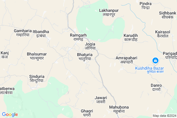
Bhaturia Map
EDIT Map
Add Your House
 ..
..
Current Corona Virus Infected Patients Count in Dumka District
| City Name | District Name | Total Covid cases |
|---|
Locality Name :
Bhaturia
( भटुरिअ )
Block Name : Ramgarh
District : Dumka
State : Jharkhand
Language : Hindi and Santali
Current Time 01:11 PM
Date: Tuesday , Apr 29,2025 (IST)
Time zone: IST (UTC+5:30)
Elevation / Altitude: 145 meters. Above Seal level
Telephone Code / Std Code: 06431
Assembly constituency : Jama assembly constituency
Assembly MLA : SITA MURMU
Lok Sabha constituency : Dumka parliamentary constituency
Parliament MP : SUNIL SOREN
Serpanch Name :
Pin Code : 814102
Post Office Name : Ramgarah
Main Village Name : Bhaturia
Commodities Prices : Birbhum Market / Mandi
Rivers Near Bhaturia
Ajay
Chandan
Ajay
Chandan
About Bhaturia
Correct below Info and add more info about BhaturiaBhaturia is a small Village/hamlet in Ramgarh Block in Dumka District of Jharkhand State, India. It comes under Bhaturia Panchayath. It is located 35 KM towards North from District head quarters Dumka. 5 KM from Ramgarh. 278 KM from State capital Ranchi
Bhaturia Pin code is 814102 and postal head office is Ramgarah .
Bhalsumar ( 6 KM ) , Lakhanpur ( 6 KM ) , Karudih ( 6 KM ) , Patharia ( 8 KM ) , Bandarjora ( 9 KM ) are the nearby Villages to Bhaturia. Bhaturia is surrounded by Poraiyahat Block towards North , Saraiyahat Block towards west , Sunderpahari Block towards North , Jama Block towards South .
Dumka , Godda , Banka , Deoghar are the near by Cities to Bhaturia.
This Place is in the border of the Dumka District and Godda District. Godda District Poraiyahat is North towards this place .
Bhaturia 2011 Census Details
Bhaturia Local Language is Hindi. Bhaturia Village Total population is 1053 and number of houses are 228. Female Population is 49.9%. Village literacy rate is 56.5% and the Female Literacy rate is 23.7%.
Population
| Census Parameter | Census Data |
| Total Population | 1053 |
| Total No of Houses | 228 |
| Female Population % | 49.9 % ( 525) |
| Total Literacy rate % | 56.5 % ( 595) |
| Female Literacy rate | 23.7 % ( 250) |
| Scheduled Tribes Population % | 10.8 % ( 114) |
| Scheduled Caste Population % | 8.4 % ( 88) |
| Working Population % | 46.5 % |
| Child(0 -6) Population by 2011 | 168 |
| Girl Child(0 -6) Population % by 2011 | 48.2 % ( 81) |
Bhaturia Census More Deatils.
Politics in Bhaturia
Bharatiya Janata Party , BJP , JMM are the major political parties in this area.Polling Stations /Booths near Bhaturia
1)Madhya Vidyalay Kakani2)Utkarmit Madhya Vidyalay Padapani Sitha Po
3)Prathamik Vidyalay Paoudaipani
4)Utkarmit Madhya Vidyalay China Madapa
5)Rajkiya Buniyadi Vidyalay U. Bhag Bhavan Kadvindha
HOW TO REACH Bhaturia
By Rail
There is no railway station near to Bhaturia in less than 10 km.Colleges near Bhaturia
Mayurakshi Gramin College,ranishwar
Address :
S.p College
Address :
Shikaripara Inter College Shikaripara
Address :
Schools near Bhaturia
Amrapahari Midle School
Address : Amrapahari
Mahubana
Address :
Govt Health Centers near Bhaturia
1) CHC RAMGARH , , ,2) HSC MOHARIA , , ,
3) HSC AMRAPAHARI , , ,
Sub Villages in Bhaturia
Petrol Bunks in Bhaturia,Ramgarh
Bharat Petroleum
Nunihat; Dumka; SH-17; Dumka Hansdiha Road; Jarmundi; Jarmundi; Jharkhand 814153; India
16.7 KM distance Detail
Indian Oil Petrol Pump
Bhagalpur - Dumka Rd; Hansdiha; Jharkhand 814153; India
20.1 KM distance Detail
more ..
Electronic Shops in Bhaturia,Ramgarh
S&B Mobile Centre (Manoj)
Ramgarh - Nonihat Road; Sinduria; Jharkhand 814102; India
7.8 KM distance Detail
Super Markets in Bhaturia,Ramgarh
Dutta Store
PURANA BAZAR (NEAR DURGA MANDIR) Nonihat; Jharkhand 814145; India
17.9 KM distance Detail
Local Parks in Bhaturia,Ramgarh
Police Stations near Bhaturia,Ramgarh
About Bhaturia &
History
How to reach Bhaturia
Tourist Places Near By Bhaturia
Schools in Bhaturia
Colleges in Bhaturia
Temperature & weather of Bhaturia
places in Bhaturia
Bhaturia photos
More Information
How to reach Bhaturia
Tourist Places Near By Bhaturia
Schools in Bhaturia
Colleges in Bhaturia
Temperature & weather of Bhaturia
places in Bhaturia
Bhaturia photos
More Information
Village Talk
Post News or Events about this Village
Near Cities
Dumka 33 KM near
Godda 36 KM near
Banka 58 KM near
Deoghar 63 KM near
Dumka 33 KM near
Godda 36 KM near
Banka 58 KM near
Deoghar 63 KM near
Near By Taluks
Ramgarh 4 KM near
Poraiyahat 18 KM near
Sunderpahari 26 KM near
Saraiyahat 26 KM near
Ramgarh 4 KM near
Poraiyahat 18 KM near
Sunderpahari 26 KM near
Saraiyahat 26 KM near
Near By Air Ports
Gaya Airport 263 KM near
Ranchi Airport 267 KM near
Netaji Subhas Chandra Bose Airport 271 KM near
Patna Airport 277 KM near
Gaya Airport 263 KM near
Ranchi Airport 267 KM near
Netaji Subhas Chandra Bose Airport 271 KM near
Patna Airport 277 KM near
Near By Tourist Places
Dumka 34 KM near
Deoghar 64 KM near
Pakur 67 KM near
Suri 83 KM near
Jamtara 88 KM near
Dumka 34 KM near
Deoghar 64 KM near
Pakur 67 KM near
Suri 83 KM near
Jamtara 88 KM near
Near By Districts
Dumka 34 KM near
Godda 36 KM near
Banka 59 KM near
Deoghar 64 KM near
Dumka 34 KM near
Godda 36 KM near
Banka 59 KM near
Deoghar 64 KM near
Near By RailWay Station
Pakur Rail Way Station 68 KM near
Murarai Rail Way Station 68 KM near
Pakur Rail Way Station 68 KM near
Murarai Rail Way Station 68 KM near