| Home | City Bus | Maps | Villages | Cities | Rail | Tourist Places | School | College | Pin Codes | Corona Cases Count |
| Distance Calculator Bus Services IFSC Codes Trace Mobile Number Weather Search Place Trace IP Available Cash ATM/Banks Locate Polling Booth Report an Error contact People |
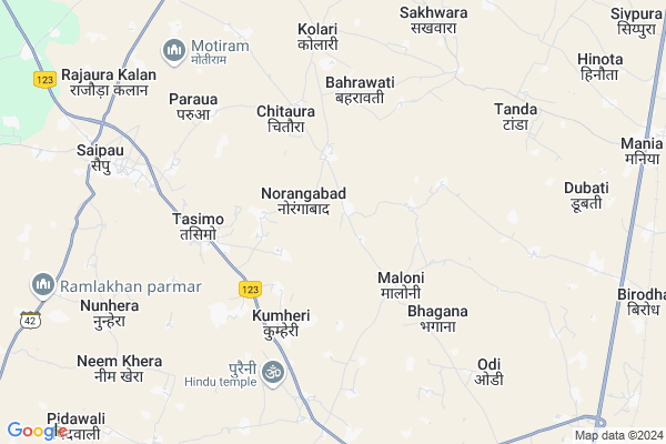
Barapura Map
EDIT Map
Add Your House
 ..
..
Current Corona Virus Infected Patients Count in Dholpur District
| City Name | District Name | Total Covid cases |
|---|
Locality Name :
Barapura
( बरपुरा )
Tehsil Name : Dhaulpur
District : Dholpur
State : Rajasthan
Division : Bharatpur
Language : Hindi and Rajasthani
Current Time 11:34 AM
Date: Wednesday , Feb 05,2025 (IST)
Time zone: IST (UTC+5:30)
Elevation / Altitude: 177 meters. Above Seal level
Telephone Code / Std Code: 05642
Assembly constituency : Dholpur assembly constituency
Assembly MLA : Shobharani Kushwah
Lok Sabha constituency : Karauli-Dholpur parliamentary constituency
Parliament MP : MANOJ RAJORIA
Serpanch Name :
Main Village Name : Barapura
Commodities Prices : Dholpur Market / Mandi
Barapura Live Weather
Temperature: 18.2 °C
clear sky
Humidity: 37%
Wind : 4.74 mt/sec towards NW
StationName : "Dhaulpur"
observed on 2 Hours Back
Temperature: 18.2 °C
clear sky
Humidity: 37%
Wind : 4.74 mt/sec towards NW
StationName : "Dhaulpur"
observed on 2 Hours Back
Barapura Weather Forecast for Next 5 days
06-02-2025
10.7°C to 24.8°C
clear sky
10.7°C to 24.8°C
clear sky
07-02-2025
9.7°C to 24.9°C
clear sky, broken clouds
9.7°C to 24.9°C
clear sky, broken clouds
08-02-2025
10.4°C to 25.2°C
broken clouds, clear sky, few clouds, overcast clouds
10.4°C to 25.2°C
broken clouds, clear sky, few clouds, overcast clouds
09-02-2025
11.9°C to 27.1°C
overcast clouds, broken clouds, scattered clouds, clear sky
11.9°C to 27.1°C
overcast clouds, broken clouds, scattered clouds, clear sky
10-02-2025
13.4°C to 29.0°C
clear sky, few clouds, scattered clouds
13.4°C to 29.0°C
clear sky, few clouds, scattered clouds
Rivers Near Barapura
Chambal River :चम्बल
Bamni
Chambal River :चम्बल
Bamni
About Barapura
Correct below Info and add more info about BarapuraBarapura is a small Village/hamlet in Dhaulpur Tehsil in Dholpur District of Rajasthan State, India. It comes under Barapura Panchayath. It belongs to Bharatpur Division . It is located 16 KM towards North from District head quarters Dholpur. 232 KM from State capital Jaipur
Barapura is surrounded by Dholpur Tehsil towards South , Kheragarh Tehsil towards North , Rajakhera Tehsil towards East , Bari Tehsil towards South .
Rajakhera , Fatehpur Sikri , Morena , Shamsabad, Agra are the near by Cities to Barapura.
Barapura 2011 Census Details
Barapura Local Language is Hindi. Barapura Village Total population is 1177 and number of houses are 169. Female Population is 40.2%. Village literacy rate is 48.7% and the Female Literacy rate is 12.2%.
Population
| Census Parameter | Census Data |
| Total Population | 1177 |
| Total No of Houses | 169 |
| Female Population % | 40.2 % ( 473) |
| Total Literacy rate % | 48.7 % ( 573) |
| Female Literacy rate | 12.2 % ( 144) |
| Scheduled Tribes Population % | 0.0 % ( 0) |
| Scheduled Caste Population % | 0.0 % ( 0) |
| Working Population % | 28.5 % |
| Child(0 -6) Population by 2011 | 269 |
| Girl Child(0 -6) Population % by 2011 | 39.8 % ( 107) |
Barapura Census More Deatils.
Politics in Barapura
BJP , BSP , INC are the major political parties in this area.Polling Stations /Booths near Barapura
1)Government Girls Secondary School Pachgaun Room No.22)Atal Sewa Kendra Panchayat Samiti Dholpur
3)Government Senior Secondary School Tasimo Left Side
4)Kamla College Girraj Colony Dholpur Room No.5
5)Government Senior Secondary School Tagawali Right Side
HOW TO REACH Barapura
By Rail
There is no railway station near to Barapura in less than 10 km.Pincodes near Barapura
328030 ( Panch Gaon ) , 328027 ( Saipau ) , 328023 ( Basai Nabab )Colleges near Barapura
Shri Vishwa Nath College Saipau.dholpur
Address :
Master Vidyaram College Tasimo Dholpur
Address : Village & Post - Tasimo Tah.-saipau
Schools near Barapura
Pathak Koching Classes
Address : near by choraha
Subodh Shikshan Sansthan Saipau Dholpur
Address : SAIPAU
Keshav Das Vidhya Mandir
Address : Ab road tor daniyal
Govt Sr. Sec School Basai Nawab
Address : Main market
Govt Health Centers near Barapura
1) Chaura kheda , Chaura kheda , Chaura kheda ,2) Kumheri , Kumheri , Kumheri ,
3) NOTIONAL Tasimo , Tasimo , Tasimo , Tasimo
Sub Villages in Barapura
Schools in Barapura,Dhaulpur
Electronic Shops in Barapura,Dhaulpur
Super Markets in Barapura,Dhaulpur
Local Parks in Barapura,Dhaulpur
Police Stations near Barapura,Dhaulpur
Governement Offices near Barapura,Dhaulpur
About Barapura &
History
How to reach Barapura
Tourist Places Near By Barapura
Schools in Barapura
Colleges in Barapura
Temperature & weather of Barapura
places in Barapura
Barapura photos
More Information
How to reach Barapura
Tourist Places Near By Barapura
Schools in Barapura
Colleges in Barapura
Temperature & weather of Barapura
places in Barapura
Barapura photos
More Information
Village Talk
Post News or Events about this Village
Near Cities
Rajakhera 39 KM near
Fatehpur Sikri 39 KM near
Morena 41 KM near
Shamsabad, Agra 43 KM near
Rajakhera 39 KM near
Fatehpur Sikri 39 KM near
Morena 41 KM near
Shamsabad, Agra 43 KM near
Near By Taluks
Dhaulpur 0 KM near
Dholpur 15 KM near
Kheragarh 21 KM near
Rajakhera 23 KM near
Dhaulpur 0 KM near
Dholpur 15 KM near
Kheragarh 21 KM near
Rajakhera 23 KM near
Near By Air Ports
Kheria Airport 47 KM near
Gwalior Airport 77 KM near
Sanganeer Airport 224 KM near
Indira Gandhi International Airport 232 KM near
Kheria Airport 47 KM near
Gwalior Airport 77 KM near
Sanganeer Airport 224 KM near
Indira Gandhi International Airport 232 KM near
Near By Tourist Places
Fatehpur Sikri 40 KM near
Agra 51 KM near
Bharatpur 63 KM near
Gwalior 82 KM near
Mathura 87 KM near
Fatehpur Sikri 40 KM near
Agra 51 KM near
Bharatpur 63 KM near
Gwalior 82 KM near
Mathura 87 KM near
Near By Districts
Dholpur 15 KM near
Morena 42 KM near
Agra 51 KM near
Bharatpur 63 KM near
Dholpur 15 KM near
Morena 42 KM near
Agra 51 KM near
Bharatpur 63 KM near
Near By RailWay Station
Dholpur Junction Rail Way Station 16 KM near
Morena Rail Way Station 42 KM near
Dholpur Junction Rail Way Station 16 KM near
Morena Rail Way Station 42 KM near