| Home | City Bus | Maps | Villages | Cities | Rail | Tourist Places | School | College | Pin Codes | Corona Cases Count |
| Distance Calculator Bus Services IFSC Codes Trace Mobile Number Weather Search Place Trace IP Available Cash ATM/Banks Locate Polling Booth Report an Error contact People |
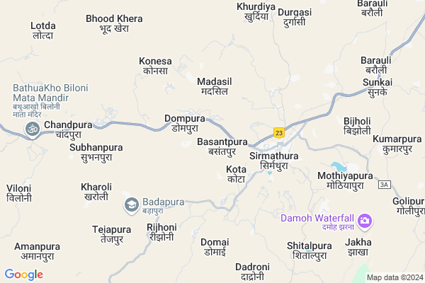
Kota Map
EDIT Map
Add Your House
 ..
..
Current Corona Virus Infected Patients Count in Dholpur District
| City Name | District Name | Total Covid cases |
|---|
Locality Name :
Kota
( कोटा )
Tehsil Name : Baseri
District : Dholpur
State : Rajasthan
Division : Bharatpur
Language : Hindi and Rajasthani
Current Time 12:30 PM
Date: Tuesday , Apr 29,2025 (IST)
Time zone: IST (UTC+5:30)
Elevation / Altitude: 206 meters. Above Seal level
Telephone Code / Std Code: 05646
Assembly constituency : Baseri assembly constituency
Assembly MLA : Sanjay Kumar
Lok Sabha constituency : Karauli-Dholpur parliamentary constituency
Parliament MP : MANOJ RAJORIA
Serpanch Name :
Pin Code : 328026
Post Office Name : Sarmathura
Main Village Name : Kota
Commodities Prices : Sabalgarh Market / Mandi
Rivers Near Kota
Gambhir
Kunwari
Gambhir
Kunwari
About Kota
Correct below Info and add more info about KotaKota is a small Village/hamlet in Baseri Tehsil in Dholpur District of Rajasthan State, India. It comes under Kota Panchayath. It belongs to Bharatpur Division . It is located 68 KM towards west from District head quarters Dholpur. 29 KM from Baseri. 184 KM from State capital Jaipur
Kota Pin code is 328026 and postal head office is Sarmathura .
Sarmathura ( 3 KM ) , Domai ( 5 KM ) , Kharoli ( 8 KM ) , Barauli ( 10 KM ) , Rahrai ( 14 KM ) are the nearby Villages to Kota. Kota is surrounded by Karauli Tehsil towards west , Sabalgarh Tehsil towards South , Bari Tehsil towards East , Hindaun Tehsil towards west .
Sabalgarh , Kailaras , Morena , Todabhim are the near by Cities to Kota.
This Place is in the border of the Dholpur District and Agra District. Agra District Jagner is North towards this place . It is near to the Uttar Pradesh State Border.
Kota 2011 Census Details
Kota Local Language is Hindi. Kota Village Total population is 775 and number of houses are 133. Female Population is 46.3%. Village literacy rate is 41.0% and the Female Literacy rate is 12.9%.
Population
| Census Parameter | Census Data |
| Total Population | 775 |
| Total No of Houses | 133 |
| Female Population % | 46.3 % ( 359) |
| Total Literacy rate % | 41.0 % ( 318) |
| Female Literacy rate | 12.9 % ( 100) |
| Scheduled Tribes Population % | 33.2 % ( 257) |
| Scheduled Caste Population % | 20.0 % ( 155) |
| Working Population % | 46.6 % |
| Child(0 -6) Population by 2011 | 157 |
| Girl Child(0 -6) Population % by 2011 | 43.9 % ( 69) |
Kota Census More Deatils.
Politics in Kota
BJP , INC , NPP are the major political parties in this area.Polling Stations /Booths near Kota
1)Govt.u.p.s.school Dadi Pura2)Govt.sec.school .phooth Pura Right Part
3)Govt.p.s.school Narsingpur
4)Govt.sec.school .pattipura
5)Govt.sec.school Harjoopura Left Part
HOW TO REACH Kota
By Rail
Sirmuttra Rail Way Station is the very nearby railway stations to Kota.Colleges near Kota
Khatu Shyam Mahavidyalaya Sarmathura
Address : In Front Of Power House Karauli Road Sarmathura
C.l College Baseri
Address : Bari Road Baseri
Maharana Pratap
Address :
Jln Pg. Collage
Address :
Schools in Kota
G.p.s. Indrpura
Address : kota , baseri , dhaulpur , Rajasthan . PIN- 328026 , Post - Sarmathura
G.p.s. Kota
Address : kota , baseri , dhaulpur , Rajasthan . PIN- 328026 , Post - Sarmathura
Govt Health Centers near Kota
1) Sarmathura , CHC Sarmathura , ,2) NOTIONAL Sarmathura , Sarmathura , Sarmathura , Sarmathura
3) Bada Gaon , Bada Gaon , Bada Gaon ,
Sub Villages in Kota
Electronic Shops in Kota,Baseri
Super Markets in Kota,Baseri
Local Parks in Kota,Baseri
Police Stations near Kota,Baseri
Governement Offices near Kota,Baseri
About Kota &
History
How to reach Kota
Tourist Places Near By Kota
Schools in Kota
Colleges in Kota
Temperature & weather of Kota
places in Kota
Kota photos
More Information
How to reach Kota
Tourist Places Near By Kota
Schools in Kota
Colleges in Kota
Temperature & weather of Kota
places in Kota
Kota photos
More Information
Village Talk
Post News or Events about this Village
Near Cities
Sabalgarh 36 KM near
Kailaras 39 KM near
Morena 72 KM near
Todabhim 76 KM near
Sabalgarh 36 KM near
Kailaras 39 KM near
Morena 72 KM near
Todabhim 76 KM near
Near By Taluks
Baseri 28 KM near
Karauli 35 KM near
Sabalgarh 36 KM near
Bari 39 KM near
Baseri 28 KM near
Karauli 35 KM near
Sabalgarh 36 KM near
Bari 39 KM near
Near By Air Ports
Gwalior Airport 103 KM near
Kheria Airport 105 KM near
Sanganeer Airport 175 KM near
Indira Gandhi International Airport 254 KM near
Gwalior Airport 103 KM near
Kheria Airport 105 KM near
Sanganeer Airport 175 KM near
Indira Gandhi International Airport 254 KM near
Near By Tourist Places
Karauli 34 KM near
Fatehpur Sikri 79 KM near
Bharatpur 88 KM near
Gwalior 100 KM near
Kalakho 106 KM near
Karauli 34 KM near
Fatehpur Sikri 79 KM near
Bharatpur 88 KM near
Gwalior 100 KM near
Kalakho 106 KM near
Near By Districts
Karauli 34 KM near
Dholpur 64 KM near
Morena 73 KM near
Bharatpur 89 KM near
Karauli 34 KM near
Dholpur 64 KM near
Morena 73 KM near
Bharatpur 89 KM near
Near By RailWay Station
Sirmuttra Rail Way Station 4.2 KM near
Hindaun City Rail Way Station 45 KM near
Shri Mahabirji Rail Way Station 46 KM near
Sirmuttra Rail Way Station 4.2 KM near
Hindaun City Rail Way Station 45 KM near
Shri Mahabirji Rail Way Station 46 KM near