| Home | City Bus | Maps | Villages | Cities | Rail | Tourist Places | School | College | Pin Codes | Corona Cases Count |
| Distance Calculator Bus Services IFSC Codes Trace Mobile Number Weather Search Place Trace IP Available Cash ATM/Banks Locate Polling Booth Report an Error contact People |
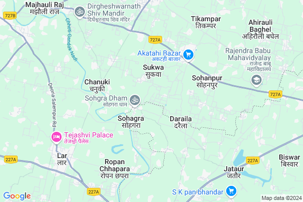
Manjharia
Manjharia Map
EDIT Map
Add Your House
 ..
..
Current Corona Virus Infected Patients Count in Deoria District
| City Name | District Name | Total Covid cases |
|---|
Locality Name :
Manjharia
( मंझरिआ )
Block Name : Lar
District : Deoria
State : Uttar Pradesh
Division : Gorakhpur
Language : Hindi and Urdu, Bhojpuri
Current Time 10:02 AM
Date: Tuesday , Apr 29,2025 (IST)
Time zone: IST (UTC+5:30)
Elevation / Altitude: 74 meters. Above Seal level
Telephone Code / Std Code: 05566
Assembly constituency : Bhatpar Rani assembly constituency
Assembly MLA : Sabhakunwar
Lok Sabha constituency : Salempur parliamentary constituency
Parliament MP : RAVINDER
Serpanch Name :
Pin Code : 274702
Post Office Name : Bhatpar Rani
Main Village Name : Manjharia
Commodities Prices : Vilthararoad Market / Mandi
Manjharia Live Weather
Temperature: 27.0 °C
overcast clouds
Humidity: 47%
Wind : 5.57 mt/sec towards E
StationName : "Lar"
observed on 2 Hours Back
Temperature: 27.0 °C
overcast clouds
Humidity: 47%
Wind : 5.57 mt/sec towards E
StationName : "Lar"
observed on 2 Hours Back
Manjharia Weather Forecast for Next 5 days
30-04-2025
27.4°C to 35.6°C
overcast clouds, broken clouds, scattered clouds, few clouds, clear sky
27.4°C to 35.6°C
overcast clouds, broken clouds, scattered clouds, few clouds, clear sky
01-05-2025
26.0°C to 38.8°C
scattered clouds, few clouds, clear sky
26.0°C to 38.8°C
scattered clouds, few clouds, clear sky
02-05-2025
28.3°C to 38.8°C
clear sky, scattered clouds, broken clouds, few clouds
28.3°C to 38.8°C
clear sky, scattered clouds, broken clouds, few clouds
03-05-2025
27.4°C to 39.4°C
clear sky, few clouds, scattered clouds, overcast clouds, broken clouds, light rain
27.4°C to 39.4°C
clear sky, few clouds, scattered clouds, overcast clouds, broken clouds, light rain
04-05-2025
28.4°C to 40.5°C
clear sky, light rain, broken clouds, overcast clouds, few clouds, scattered clouds
28.4°C to 40.5°C
clear sky, light rain, broken clouds, overcast clouds, few clouds, scattered clouds
National Highways Reachable To Manjharia
Nationa High Way :NH227A
Nationa High Way :NH727A;NH727B
Nationa High Way :NH227A
Nationa High Way :NH727A;NH727B
Rivers Near Manjharia
Rapti River :Rapti River
Tamsa
Rapti River :Rapti River
Tamsa
About Manjharia
Correct below Info and add more info about ManjhariaManjharia is a small Village/hamlet in Lar Block in Deoria District of Uttar Pradesh State, India. It comes under Manjharia Panchayath. It belongs to Gorakhpur Division . It is located 44 KM towards South from District head quarters Deoria. 8 KM from Lar. 366 KM from State capital Lucknow
Manjharia Pin code is 274702 and postal head office is Bhatpar Rani .
Mahuja ( 1 KM ) , Nonar Pandey ( 1 KM ) , Kurmauli ( 2 KM ) , Karmua ( 3 KM ) , Bhedapakar ( 3 KM ) are the nearby Villages to Manjharia. Manjharia is surrounded by Lar Block towards west , Guthani Block towards South , Bankata Block towards East , Salempur Block towards west .
Lar , Siwan , Mirganj , Deoria are the near by Cities to Manjharia.
This Place is in the border of the Deoria District and Siwan District. Siwan District Guthani is South towards this place . It is near to the Bihar State Border.
Manjharia 2011 Census Details
Manjharia Local Language is Hindi. Manjharia Village Total population is 312 and number of houses are 36. Female Population is 52.6%. Village literacy rate is 59.0% and the Female Literacy rate is 25.3%.
Population
| Census Parameter | Census Data |
| Total Population | 312 |
| Total No of Houses | 36 |
| Female Population % | 52.6 % ( 164) |
| Total Literacy rate % | 59.0 % ( 184) |
| Female Literacy rate | 25.3 % ( 79) |
| Scheduled Tribes Population % | 15.7 % ( 49) |
| Scheduled Caste Population % | 0.0 % ( 0) |
| Working Population % | 46.5 % |
| Child(0 -6) Population by 2011 | 51 |
| Girl Child(0 -6) Population % by 2011 | 52.9 % ( 27) |
Manjharia Census More Deatils.
Politics in Manjharia
SBSP , SP , BSP , INC are the major political parties in this area.Polling Stations /Booths near Manjharia
1)Bramhchari I.c. Ahirauli Tiwari2)J.h.s. Pipara Babu Patti
3)J.h.s. Raghunathpur R.n.-3
4)J.h.s. Raghunathpur R.n.-4
5)J.h.s. Raghunatpur R.n.-1
HOW TO REACH Manjharia
By Rail
Bhatpar Rani Rail Way Station , Bankata Rail Way Station are the very nearby railway stations to Manjharia.Colleges near Manjharia
S D Inter College Math Lar
Address :
Chandika Inter College Nema
Address :
Darul Oloom Mohammadiya Ramnagar Lar Deoria
Address :
S P Memorial Public School Ramnagar Lar
Address :
Shri Tej Bhadur Singh Shikshan Sansthan Ramnagar Lar
Address :
Schools near Manjharia
J H S Ratanpura
Address : ratanpura , lar , deoria , Uttar Pradesh . PIN- 274502 , Post - Lar
J.h.s.ravatpar Raghen
Address : ravatpar raghen , lar , deoria , Uttar Pradesh . PIN- 274502 , Post - Lar
J.h.s.manikpur
Address : manikpur , lar , deoria , Uttar Pradesh . PIN- 274502 , Post - Lar
J H S Saraiya
Address : kausad , lar , deoria , Uttar Pradesh . PIN- 274508 , Post - Pindi
Govt Health Centers near Manjharia
1) Bhudwar , Bhudwar , Bhudwar ,2) Bheda Pakad , Bheda Pakad , Bheda Pakad ,
3) Shankarpura , Shankarpura , Shankarpura ,
Sub Villages in Manjharia
Petrol Bunks in Manjharia,Lar
Essar Petrol Pump Phulwaria
Salempur - Mairwa Rd; Phulwaria; Uttar Pradesh 274703; India
6.4 KM distance Detail
SAKTI TENT HOUSE LAR DEORIA UP
Deoria Salempur Rd; Bhrigusari; Uttar Pradesh 274502; India
8.0 KM distance Detail
more ..
Colleges in Manjharia,Lar
Tulsi Intermediate College
Akatahi Bazar; Nonar Pandey; Deoria District; Kothilawa; Uttar Pradesh 274704; India
4.2 KM distance Detail
Raghuraj Singh Inter college; Bahiyari
Salempur - Mairwa Rd; Bahiyari Baghel Ka Tola; Uttar Pradesh 274703; India
5.3 KM distance Detail
Sri Bapu Inter College
Salempur - Mairwa Rd; Sohanpur; Uttar Pradesh 274704; India
5.4 KM distance Detail
Kadma Sati High School
Aktahi-Khadesar Rd; Khadesar; Uttar Pradesh 274703; India
6.7 KM distance Detail
more ..
Super Markets in Manjharia,Lar
Khushi Mobile Centre And Western Union (Govind Gupta)
Sohgara Rd; Sohagra; Uttar Pradesh 274506; India
1.4 KM distance Detail
Nirala Fruit Center
Chanuki-Phulwaria Rd; Chanuki; Uttar Pradesh 274506; India
4.2 KM distance Detail
Aaditay Bij Bhander
Chanuki-Phulwaria Rd; Chanuki; Uttar Pradesh 274506; India
4.2 KM distance Detail
Police Stations near Manjharia,Lar
Bhatpar Rani Police Station
Chanuki-Phulwaria Rd; Bhatpar Rani; Uttar Pradesh 274702; India
7.9 KM distance Detail
Police Station Bhatpar Rani
Chanuki Phulwaria Road; Lakhna Urf Domdih; Uttar Pradesh 274702; India
7.9 KM distance Detail
Governement Offices near Manjharia,Lar
Subdistric office(tehsil)
Bhatpar Rani - Salempur Rd; Barka Gaon; Uttar Pradesh 274702; India
10.1 KM distance Detail
About Manjharia &
History
How to reach Manjharia
Tourist Places Near By Manjharia
Schools in Manjharia
Colleges in Manjharia
Temperature & weather of Manjharia
places in Manjharia
Manjharia photos
More Information
How to reach Manjharia
Tourist Places Near By Manjharia
Schools in Manjharia
Colleges in Manjharia
Temperature & weather of Manjharia
places in Manjharia
Manjharia photos
More Information
Village Talk
Post News or Events about this Village
Near Cities
Lar 8 KM near
Siwan 36 KM near
Mirganj 38 KM near
Deoria 42 KM near
Lar 8 KM near
Siwan 36 KM near
Mirganj 38 KM near
Deoria 42 KM near
Near By Taluks
Bhatpar Rani 6 KM near
Lar 7 KM near
Guthani 8 KM near
Bankata 12 KM near
Bhatpar Rani 6 KM near
Lar 7 KM near
Guthani 8 KM near
Bankata 12 KM near
Near By Air Ports
Gorakhpur Airport 90 KM near
Patna Airport 143 KM near
Varanasi Airport 164 KM near
Gaya Airport 212 KM near
Gorakhpur Airport 90 KM near
Patna Airport 143 KM near
Varanasi Airport 164 KM near
Gaya Airport 212 KM near
Near By Tourist Places
Kushinagar 64 KM near
Kesariya 95 KM near
Buddha Stupa 95 KM near
Gorakhpur 97 KM near
Lauria Nandangarh 101 KM near
Kushinagar 64 KM near
Kesariya 95 KM near
Buddha Stupa 95 KM near
Gorakhpur 97 KM near
Lauria Nandangarh 101 KM near
Near By Districts
Siwan 34 KM near
Deoria 43 KM near
Gopalganj 54 KM near
Ballia 63 KM near
Siwan 34 KM near
Deoria 43 KM near
Gopalganj 54 KM near
Ballia 63 KM near
Near By RailWay Station
Bankata Rail Way Station 8.3 KM near
Bhatpar Rani Rail Way Station 9.1 KM near
Mairwa Rail Way Station 13 KM near
Bankata Rail Way Station 8.3 KM near
Bhatpar Rani Rail Way Station 9.1 KM near
Mairwa Rail Way Station 13 KM near