| Home | City Bus | Maps | Villages | Cities | Rail | Tourist Places | School | College | Pin Codes | Corona Cases Count |
| Distance Calculator Bus Services IFSC Codes Trace Mobile Number Weather Search Place Trace IP Available Cash ATM/Banks Locate Polling Booth Report an Error contact People |
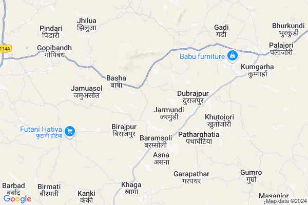
Ghormara Map
EDIT Map
Add Your House
 ..
..
Current Corona Virus Infected Patients Count in Deoghar District
| City Name | District Name | Total Covid cases |
|---|---|---|
| Deoghar District | Deoghar | 2 |
Locality Name :
Ghormara
( घोरमारा )
Block Name : Palojori
District : Deoghar
State : Jharkhand
Language : Hindi and Santali
Current Time 07:22 AM
Date: Saturday , Apr 26,2025 (IST)
Time zone: IST (UTC+5:30)
Elevation / Altitude: 145 meters. Above Seal level
Telephone Code / Std Code: 06431
Assembly constituency : Sarath assembly constituency
Assembly MLA :
Lok Sabha constituency : Dumka parliamentary constituency
Parliament MP :
Serpanch Name :
Main Village Name : Ghormara
Commodities Prices : Asansol Market / Mandi
Ghormara Live Weather
Temperature: 26.8 °C
clear sky
Humidity: 61%
Wind : 3.25 mt/sec towards S
StationName : "Madhupur"
observed on 2 Hours Back
Temperature: 26.8 °C
clear sky
Humidity: 61%
Wind : 3.25 mt/sec towards S
StationName : "Madhupur"
observed on 2 Hours Back
Ghormara Weather Forecast for Next 5 days
27-04-2025
25.6°C to 41.1°C
clear sky
25.6°C to 41.1°C
clear sky
28-04-2025
24.0°C to 38.3°C
few clouds, scattered clouds, light rain, moderate rain, broken clouds
24.0°C to 38.3°C
few clouds, scattered clouds, light rain, moderate rain, broken clouds
29-04-2025
23.8°C to 31.7°C
overcast clouds, light rain, broken clouds, scattered clouds
23.8°C to 31.7°C
overcast clouds, light rain, broken clouds, scattered clouds
30-04-2025
22.1°C to 31.9°C
overcast clouds, clear sky, scattered clouds, light rain
22.1°C to 31.9°C
overcast clouds, clear sky, scattered clouds, light rain
Rivers Near Ghormara
Puthro
Barakar River
Puthro
Barakar River
About Ghormara
Correct below Info and add more info about GhormaraGhormara is a small Village/hamlet in Palojori Block in Deoghar District of Jharkhand State, India. It comes under Ghormara Panchayath. It is located 47 KM towards South from District head quarters Deoghar. 224 KM from State capital Ranchi
Ghormara is surrounded by Sarath Block towards west , Masaliya Block towards East , Sarwan Block towards North , Jarmundi Block towards North .
Madhupur , Jamtara , Dumka , Mihijam are the near by Cities to Ghormara.
This Place is in the border of the Deoghar District and Dumka District. Dumka District Masaliya is East towards this place .
Ghormara 2011 Census Details
Ghormara Local Language is Hindi. Ghormara Village Total population is 244 and number of houses are 38. Female Population is 52.5%. Village literacy rate is 34.4% and the Female Literacy rate is 13.1%.
Population
| Census Parameter | Census Data |
| Total Population | 244 |
| Total No of Houses | 38 |
| Female Population % | 52.5 % ( 128) |
| Total Literacy rate % | 34.4 % ( 84) |
| Female Literacy rate | 13.1 % ( 32) |
| Scheduled Tribes Population % | 100.0 % ( 244) |
| Scheduled Caste Population % | 0.0 % ( 0) |
| Working Population % | 62.3 % |
| Child(0 -6) Population by 2011 | 48 |
| Girl Child(0 -6) Population % by 2011 | 47.9 % ( 23) |
Ghormara Census More Deatils.
Politics in Ghormara
Bharatiya Janata Party , BJP , JMM , JVMP , INC are the major political parties in this area.Polling Stations /Booths near Ghormara
1)U. P.s. Building Farayam2)Community Building Dhamna
3)U.m.s. Building Silgariya
4)U. P.s. Building Pindari(niche)
5)U.m S. Building Kanki (w. Part)
HOW TO REACH Ghormara
By Rail
There is no railway station near to Ghormara in less than 10 km.Pincodes near Ghormara
814146 ( Palojori ) , 814149 ( Sarath ) , 814166 ( Fatehpur (Jamtara) )Colleges near Ghormara
Madhupur Collge Madhupur
Address :
Rupeshwoods Private School
Address :
Rupeshwoods Colldge Madhupur
Address :
Chitra Inter College Tharhi,chitra
Address :
Schools near Ghormara
Gyandeep School Palojori
Address : PALOJORI
Primary School Rampur Chandraidih
Address : Maridi, dubrajpur, nawadih village road rampur
Smt Anarkali +2 High School Palojori.
Address : JAMTARA ROAD ,PALOJORI
Govt Health Centers near Ghormara
1) HSC BHERO , , ,2) HSC TAALGARHA , , ,
3) HSC DUBRAJPUR , , ,
Sub Villages in Ghormara
Hospitals in Ghormara,Palojori
Nikhil Medical Jhagrahi Sarath
Sarath Road; KurumtonrChak Nawadih; Jharkhand 814146; India
6.8 KM distance Detail
more ..
Schools in Ghormara,Palojori
Jamia Israilia Gulshan-e-Gharib Nawaj Baramsoli
Baramsoli; Jharkhand 814146; India
3.5 KM distance Detail
Electronic Shops in Ghormara,Palojori
Club factory Dumak
Dumka - Jamtara Road; Raghunathpur; Jharkhand 814146; India
3.6 KM distance Detail
Alam Mobile Elecronics Dumka-Jamtara Road Raghunathapur
Raghunathpur; Jharkhand 814146; India
4.7 KM distance Detail
Local Parks in Ghormara,Palojori
Chitra Park
SP Mines(ECL); Chitra; Deoghar; Jharkhand; Chitra; Jharkhand 815351; India
14.3 KM distance Detail
Mahatma Narayan Das Grover Uddyaan (Garden)
Bhawanipur; Jharkhand 815357; India
14.4 KM distance Detail
Police Stations near Ghormara,Palojori
Chitra Police Station
Near Gandhi Chowk; S.P. Mines (ECL); 815351; Chitra; Jharkhand; India
14.4 KM distance Detail
Governement Offices near Ghormara,Palojori
PANCHAYAT BHAWAN THARHI
Dudhichuwa - Thari - Chikinia Road; Dudhichuwa; Jharkhand 815357; India
12.2 KM distance Detail
About Ghormara &
History
How to reach Ghormara
Tourist Places Near By Ghormara
Schools in Ghormara
Colleges in Ghormara
Temperature & weather of Ghormara
places in Ghormara
Ghormara photos
More Information
How to reach Ghormara
Tourist Places Near By Ghormara
Schools in Ghormara
Colleges in Ghormara
Temperature & weather of Ghormara
places in Ghormara
Ghormara photos
More Information
Village Talk
Post News or Events about this Village
Near Cities
Madhupur 33 KM near
Jamtara 36 KM near
Dumka 36 KM near
Mihijam 43 KM near
Madhupur 33 KM near
Jamtara 36 KM near
Dumka 36 KM near
Mihijam 43 KM near
Near By Taluks
Palojori 0 KM near
Sarath 12 KM near
Masaliya 22 KM near
Sarwan 23 KM near
Palojori 0 KM near
Sarath 12 KM near
Masaliya 22 KM near
Sarwan 23 KM near
Near By Air Ports
Ranchi Airport 215 KM near
Gaya Airport 235 KM near
Netaji Subhas Chandra Bose Airport 259 KM near
Patna Airport 270 KM near
Ranchi Airport 215 KM near
Gaya Airport 235 KM near
Netaji Subhas Chandra Bose Airport 259 KM near
Patna Airport 270 KM near
Near By Tourist Places
Dumka 35 KM near
Jamtara 35 KM near
Deoghar 44 KM near
Maithan 56 KM near
Asansol 66 KM near
Dumka 35 KM near
Jamtara 35 KM near
Deoghar 44 KM near
Maithan 56 KM near
Asansol 66 KM near
Near By Districts
Jamtara 34 KM near
Dumka 35 KM near
Deoghar 45 KM near
Giridih 73 KM near
Jamtara 34 KM near
Dumka 35 KM near
Deoghar 45 KM near
Giridih 73 KM near
Near By RailWay Station
Vidyasagar Rail Way Station 31 KM near
Madhupur Junction Rail Way Station 34 KM near
Vidyasagar Rail Way Station 31 KM near
Madhupur Junction Rail Way Station 34 KM near