| Home | City Bus | Maps | Villages | Cities | Rail | Tourist Places | School | College | Pin Codes | Corona Cases Count |
| Distance Calculator Bus Services IFSC Codes Trace Mobile Number Weather Search Place Trace IP Available Cash ATM/Banks Locate Polling Booth Report an Error contact People |
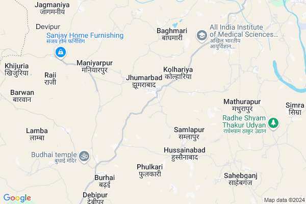
Jamua Map
EDIT Map
Add Your House
 ..
..
Current Corona Virus Infected Patients Count in Deoghar District
| City Name | District Name | Total Covid cases |
|---|---|---|
| Deoghar District | Deoghar | 2 |
Locality Name :
Jamua
( जमुआ )
Block Name : Devipur
District : Deoghar
State : Jharkhand
Language : Hindi and Santali
Current Time 10:03 AM
Date: Thursday , Apr 24,2025 (IST)
Time zone: IST (UTC+5:30)
Elevation / Altitude: 242 meters. Above Seal level
Telephone Code / Std Code: 06432
Assembly constituency : Deoghar assembly constituency
Assembly MLA : NARAYAN DAS
Lok Sabha constituency : Godda parliamentary constituency
Parliament MP : Nishikant Dubey
Serpanch Name :
Main Village Name : Jamua
Commodities Prices : Asansol Market / Mandi
Rivers Near Jamua
Sakri
Puthro
Sakri
Puthro
About Jamua
Correct below Info and add more info about JamuaJamua is a small Village/hamlet in Devipur Block in Deoghar District of Jharkhand State, India. It comes under Jamua Panchayath. It is located 17 KM towards west from District head quarters Deoghar. 204 KM from State capital Ranchi
Jamua is surrounded by Deoghar Block towards East , Madhupur Block towards South , Mohanpur Block towards East , Sarwan Block towards East .
Deoghar , Madhupur , Giridih , Jhajha are the near by Cities to Jamua.
This Place is in the border of the Deoghar District and Jamui District. Jamui District Chakai is North towards this place . It is near to the Bihar State Border.
Jamua 2011 Census Details
Jamua Local Language is Hindi. Jamua Village Total population is 394 and number of houses are 81. Female Population is 48.0%. Village literacy rate is 61.7% and the Female Literacy rate is 27.2%.
Population
| Census Parameter | Census Data |
| Total Population | 394 |
| Total No of Houses | 81 |
| Female Population % | 48.0 % ( 189) |
| Total Literacy rate % | 61.7 % ( 243) |
| Female Literacy rate | 27.2 % ( 107) |
| Scheduled Tribes Population % | 0.0 % ( 0) |
| Scheduled Caste Population % | 1.8 % ( 7) |
| Working Population % | 29.4 % |
| Child(0 -6) Population by 2011 | 64 |
| Girl Child(0 -6) Population % by 2011 | 42.2 % ( 27) |
Jamua Census More Deatils.
Politics in Jamua
JVM , Bharatiya Janata Party , BJP , RJD , INC are the major political parties in this area.Polling Stations /Booths near Jamua
1)U.ucch.s. Building Ward No. 6 (s. Part)2)Uhs Building Kendwa (pachchimi Part)
3)Ums Building Jamuniatand
4)Community Building Kisnidih
5)Ums Building Panchrukhi
HOW TO REACH Jamua
By Rail
Sankarpur Rail Way Station , Mathurapur Rail Way Station are the very nearby railway stations to Jamua.Pincodes near Jamua
814152 ( Rohani ) , 814114 ( Deosang B.T ) , 814116 ( Satsang )Colleges near Jamua
Madhupur Collge Madhupur
Address :
Rupeshwoods Private School
Address :
Rupeshwoods Colldge Madhupur
Address :
Chitra Inter College Tharhi,chitra
Address :
Schools near Jamua
Madhya Vidyalaya ,baghmari
Address :
Utkramit +2 High School Kendua,devipur
Address :
Govt Health Centers near Jamua
1) HSC HUSAINABAD , , ,2) HSC MATHURAPUR , , ,
3) HSC BHALGARHA , , ,
Sub Villages in Jamua
Colleges in Jamua,Devipur
IGNOU Regional Center; Mandakani Sadan; Basuwadih
Jasidih - Rohini Road; Mandakini Sadan; Basuwadih; Jharkhand 814142; India
14.2 KM distance Detail
Sri Ramayana shaikhanik sansthan /Sri Ramayana Tuition ( Academic & Computer Training Institute)
Near dewan baba mandir;bariyar bandhi;bompass town;po: devsangha; Dt:; Deoghar; jharkhand; Deoghar; Jharkhand 814112; India
14.6 KM distance Detail
more ..
Police Stations near Jamua,Devipur
Yatayat Choura
SSM Jalan Rd; Castairs Town; Bompas Town; Deoghar; Jharkhand 814112; India
16.9 KM distance Detail
Composite Control Room
Indira Nagar; Belabagan; Deoghar; Jharkhand 814116; India
17.0 KM distance Detail
Governement Offices near Jamua,Devipur
Department of Forest and Environment; Kalyanpur; Deoghar Government of Jharkhand.
Satsang Nagar; Deoghar; Jharkhand 814112; India
15.4 KM distance Detail
About Jamua &
History
How to reach Jamua
Tourist Places Near By Jamua
Schools in Jamua
Colleges in Jamua
Temperature & weather of Jamua
places in Jamua
Jamua photos
More Information
How to reach Jamua
Tourist Places Near By Jamua
Schools in Jamua
Colleges in Jamua
Temperature & weather of Jamua
places in Jamua
Jamua photos
More Information
Village Talk
Post News or Events about this Village
Near Cities
Deoghar 17 KM near
Madhupur 20 KM near
Giridih 41 KM near
Jhajha 52 KM near
Deoghar 17 KM near
Madhupur 20 KM near
Giridih 41 KM near
Jhajha 52 KM near
Near By Taluks
Devipur 0 KM near
Deoghar 14 KM near
Madhupur 14 KM near
Mohanpur 25 KM near
Devipur 0 KM near
Deoghar 14 KM near
Madhupur 14 KM near
Mohanpur 25 KM near
Near By Air Ports
Gaya Airport 190 KM near
Ranchi Airport 196 KM near
Patna Airport 224 KM near
Netaji Subhas Chandra Bose Airport 304 KM near
Gaya Airport 190 KM near
Ranchi Airport 196 KM near
Patna Airport 224 KM near
Netaji Subhas Chandra Bose Airport 304 KM near
Near By Tourist Places
Deoghar 17 KM near
Giridh 41 KM near
Jamtara 63 KM near
Dhanbad 77 KM near
Dumka 77 KM near
Deoghar 17 KM near
Giridh 41 KM near
Jamtara 63 KM near
Dhanbad 77 KM near
Dumka 77 KM near
Near By Districts
Deoghar 17 KM near
Giridih 41 KM near
Jamtara 60 KM near
Banka 71 KM near
Deoghar 17 KM near
Giridih 41 KM near
Jamtara 60 KM near
Banka 71 KM near
Near By RailWay Station
Sankarpur Rail Way Station 7.3 KM near
Mathurapur Rail Way Station 8.0 KM near
Jasidih Junction Rail Way Station 16 KM near
Madhupur Junction Rail Way Station 17 KM near
Sankarpur Rail Way Station 7.3 KM near
Mathurapur Rail Way Station 8.0 KM near
Jasidih Junction Rail Way Station 16 KM near
Madhupur Junction Rail Way Station 17 KM near