| Home | City Bus | Maps | Villages | Cities | Rail | Tourist Places | School | College | Pin Codes | Corona Cases Count |
| Distance Calculator Bus Services IFSC Codes Trace Mobile Number Weather Search Place Trace IP Available Cash ATM/Banks Locate Polling Booth Report an Error contact People |
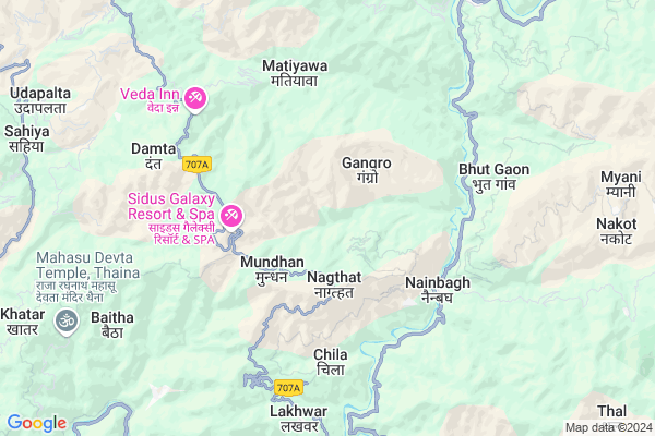
Khato
Khato Map
EDIT Map
Add Your House
 ..
..
Current Corona Virus Infected Patients Count in Dehradun District
| City Name | District Name | Total Covid cases |
|---|---|---|
| Dehradun District | Dehradun | 22 |
| Dehradun | Dehradun | 3 |
Locality Name :
Khato
( खातों )
Block Name : Kalsi
District : Dehradun
State : Uttarakhand
Language : Hindu and Sindhi, Punjabi, Garhwali And Urdu.
Current Time 09:54 AM
Date: Wednesday , Mar 12,2025 (IST)
Time zone: IST (UTC+5:30)
Elevation / Altitude: 648 meters. Above Seal level
Telephone Code / Std Code: 01360
Assembly constituency : Chakrata assembly constituency
Assembly MLA : Pritam Singh
Lok Sabha constituency : Tehri Garhwal parliamentary constituency
Parliament MP : MALA RAJYA LAXMI SHAH
Serpanch Name :
Pin Code : 248158
Post Office Name : Kalsi
Main Village Name : Khato
Commodities Prices : Vikasnagar Market / Mandi
Khato Live Weather
Temperature: 20.1 °C
clear sky
Humidity: 28%
Wind : 1.91 mt/sec towards NE
StationName : "ChakrÄ\u0081ta"
observed on 44 Mins Back
Temperature: 20.1 °C
clear sky
Humidity: 28%
Wind : 1.91 mt/sec towards NE
StationName : "ChakrÄ\u0081ta"
observed on 44 Mins Back
Khato Weather Forecast for Next 5 days
13-03-2025
10.1°C to 22.0°C
clear sky, scattered clouds, broken clouds, overcast clouds
10.1°C to 22.0°C
clear sky, scattered clouds, broken clouds, overcast clouds
14-03-2025
7.2°C to 20.2°C
overcast clouds, light rain, scattered clouds
7.2°C to 20.2°C
overcast clouds, light rain, scattered clouds
15-03-2025
6.7°C to 20.7°C
clear sky, scattered clouds, overcast clouds, light rain, broken clouds
6.7°C to 20.7°C
clear sky, scattered clouds, overcast clouds, light rain, broken clouds
16-03-2025
7.6°C to 18.4°C
broken clouds, overcast clouds, light rain, moderate rain
7.6°C to 18.4°C
broken clouds, overcast clouds, light rain, moderate rain
17-03-2025
6.1°C to 15.0°C
light rain
6.1°C to 15.0°C
light rain
National Highways Reachable To Khato
Nationa High Way :NH707A
Nationa High Way :NH707A
Rivers Near Khato
Dhanpati Gad
Khuniyar ka Nala
Dhanpati Gad
Khuniyar ka Nala
About Khato
Correct below Info and add more info about KhatoKhato is a small Village/hamlet in Kalsi Block in Dehradun District of Uttarakhand State, India. It comes under Khato Panchayath. It is located 34 KM towards North from District head quarters Dehradun. 7 KM from Kalsi. 35 KM from State capital Dehradun
Khato Pin code is 248158 and postal head office is Kalsi .
Kachta ( 2 KM ) , Mundhan ( 2 KM ) , Bisoi ( 3 KM ) , Sawai ( 3 KM ) , Gadol ( 3 KM ) are the nearby Villages to Khato. Khato is surrounded by Jaunpur Block towards East , Mussoorie Block towards South , Chakrata Block towards North , Sahaspur Block towards South .
Mussoorie , Dehradun , Chamba , Tehri are the near by Cities to Khato.
Demographics of Khato
Hindu is the Local Language here.Politics in Khato
UJP , INC are the major political parties in this area.Polling Stations /Booths near Khato
1)Mohna2)Kharsi
3)Badhana
4)Chilhad
5)Simoge
HOW TO REACH Khato
By Rail
There is no railway station near to Khato in less than 10 km.Colleges near Khato
Paras International Public School
Address :
Dayanand Anglo Vedic Post Greguate Collage Vikasnagar
Address :
Will Field School
Address :
Mahadevi Institute Of Technology, Dehradun
Address : 10-new Road, Dehradun
Schools near Khato
Govt Girls Inter College Sahiya
Address : sahiya , kalsi , dehradun , Uttarakhand . PIN- 248196 , Post - Sahiya
Gic Koti Colony
Address : koti , kalsi , dehradun , Uttarakhand . PIN- 248165 , Post - Koti
Gic Nagookhet
Address : nagaoo , kalsi , dehradun , Uttarakhand . PIN- 248123 , Post - Kailana
Gic Panjitalani
Address : pajitilani , kalsi , dehradun , Uttarakhand . PIN- 248165 , Post - Koti
Govt Health Centers near Khato
1) Gadugad , Sub center Gadugaad , Gadugaad , Near telephone tower2) Naugaon , Naugaon CHC , Naugaon , Near BDO Office
3) Naugoan-MCH , Naugaon MCH , Naugaon , CHC Naugaon
Sub Villages in Khato
Hospitals in Khato,Kalsi
Narayan Medical Center Kempty Falls
Kempty Fall Road; Lakhwad; Kempty; Siya Kempti; Uttarakhand 248179; India
15.0 KM distance Detail
more ..
Petrol Bunks in Khato,Kalsi
HP PETROL PUMP - JASPAL RANA BULLSEYE S/S
Sumankyari; Nainbagh Dist:tehri Grwl Uttaranchal; Dehradun; 249186; India
5.2 KM distance Detail
Hindustan Petroleum
Sumankyari; Tehri Garhwal; NH-123; Vikash Nagar Barkot Road; Tehri Garhwal; Tehri Garhwal; Uttarakhand 249186; India
5.3 KM distance Detail
HP PETROL PUMP - KEMPTY FILLING STATION
HP Petrol Pump 7TH Mile Stone; Mussorie Kempty; Siya Kempty Road Tehsil Dhanauli; Dehradun; UL 248001; India
15.5 KM distance Detail
more ..
Colleges in Khato,Kalsi
Sardar Singh Rawat Inter College
Vikasnagar - Barkot Rd; Khairada; Uttarakhand 249186; India
4.7 KM distance Detail
more ..
Electronic Shops in Khato,Kalsi
Rana Electronics; Damta
Vikasnagar - Barkot Rd; Damta; Rikhaun; Uttarakhand 249171; India
9.3 KM distance Detail
rana and senwal electrician senter keppty
; Kempty; Ram Gaon; Uttarakhand 248179; India
15.4 KM distance Detail
Super Markets in Khato,Kalsi
Jodhput
Chamba - Mussoorie Rd; Library Road; Mussoorie; Uttarakhand 248179; India
20.1 KM distance Detail
Mussoorie Jhil Crop
Mussoorie Rd; Tundhar Village; Sher Garhi; Mussoorie; Uttarakhand 248179; India
21.6 KM distance Detail
Local Parks in Khato,Kalsi
Yamuna Valley Park Kattapathar
Vikasnagar - Barkot Rd; Badowala; Katapatthar; Uttarakhand 248125; India
16.7 KM distance Detail
SURBEE RESORTS MUSSOORIE
6 Mile Stone; Kempty Fall Road; Mussoorie; 248179; India
16.7 KM distance Detail
Police Stations near Khato,Kalsi
Police Station
Dehradun; NH-123; Vikasnagar Barkot Road; Dehradun; Dehradun; Uttarakhand 248159; India
16.2 KM distance Detail
Police Chowki Library
Kotwali; Janpad; Mall Road; Kitab Ghar; The Mall Road; Mussoorie; Uttarakhand 248079; India
20.0 KM distance Detail
Governement Offices near Khato,Kalsi
Employment Exchange Office
Sahiya; Dehradun; NH-123; Vikash Nagar Barkot Road; Dehradun; Dehradun; Uttarakhand 248159; India
15.9 KM distance Detail
Sahayak Abhiyanta Chakrata Upmandal
Chakrati; Uttarkashi; SH-1; Chakrata Road; Dehradun; Dehradun; Uttarakhand 248001; India
17.8 KM distance Detail
Mussoorie Landscape
Camels Back Rd; The Mall Road; Mussoorie; Uttarakhand 248179; India
19.9 KM distance Detail
About Khato &
History
How to reach Khato
Tourist Places Near By Khato
Schools in Khato
Colleges in Khato
Temperature & weather of Khato
places in Khato
Khato photos
More Information
How to reach Khato
Tourist Places Near By Khato
Schools in Khato
Colleges in Khato
Temperature & weather of Khato
places in Khato
Khato photos
More Information
Village Talk
Post News or Events about this Village
Near Cities
Mussoorie 21 KM near
Dehradun 37 KM near
Chamba 56 KM near
Tehri 60 KM near
Mussoorie 21 KM near
Dehradun 37 KM near
Chamba 56 KM near
Tehri 60 KM near
Near By Taluks
Kalsi 7 KM near
Jaunpur 19 KM near
Mussoorie 19 KM near
Chakrata 22 KM near
Kalsi 7 KM near
Jaunpur 19 KM near
Mussoorie 19 KM near
Chakrata 22 KM near
Near By Air Ports
Dehra Dun Airport 34 KM near
Simla Airport 109 KM near
Chandigarh Airport 126 KM near
Muzaffarnagar Airport 147 KM near
Dehra Dun Airport 34 KM near
Simla Airport 109 KM near
Chandigarh Airport 126 KM near
Muzaffarnagar Airport 147 KM near
Near By Tourist Places
Kalsi 16 KM near
Chakrata 17 KM near
Mussoorie 20 KM near
Dehradun 34 KM near
Dhanaulti 36 KM near
Kalsi 16 KM near
Chakrata 17 KM near
Mussoorie 20 KM near
Dehradun 34 KM near
Dhanaulti 36 KM near
Near By Districts
Dehradun 32 KM near
Uttar Kashi 53 KM near
Tehri Garhwal 58 KM near
Sirmaur 72 KM near
Dehradun 32 KM near
Uttar Kashi 53 KM near
Tehri Garhwal 58 KM near
Sirmaur 72 KM near
Near By RailWay Station
Dehradun Rail Way Station 34 KM near
Doiwala Rail Way Station 54 KM near
Dehradun Rail Way Station 34 KM near
Doiwala Rail Way Station 54 KM near