| Home | City Bus | Maps | Villages | Cities | Rail | Tourist Places | School | College | Pin Codes | Corona Cases Count |
| Distance Calculator Bus Services IFSC Codes Trace Mobile Number Weather Search Place Trace IP Available Cash ATM/Banks Locate Polling Booth Report an Error contact People |
Sanda
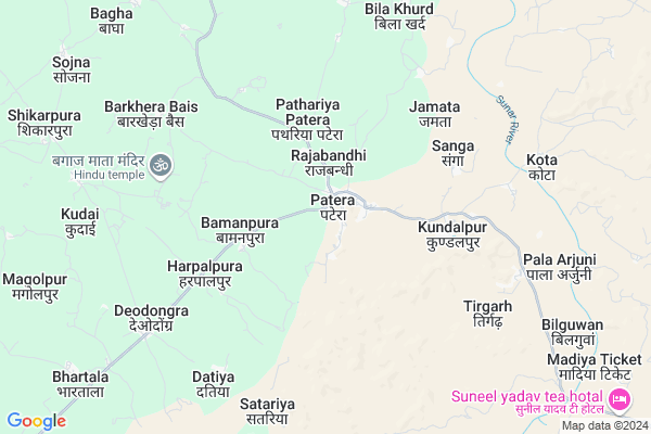
Sanda Map
EDIT Map
Add Your House
 ..
..
Current Corona Virus Infected Patients Count in Damoh District
| City Name | District Name | Total Covid cases |
|---|
Locality Name :
Sanda
( संडे )
Tehsil Name : Patera
District : Damoh
State : Madhya Pradesh
Division : Sagar
Language : Hindi and Urdu
Current Time 05:17 AM
Date: Monday , Apr 28,2025 (IST)
Time zone: IST (UTC+5:30)
Elevation / Altitude: 332 meters. Above Seal level
Telephone Code / Std Code: 07605
Assembly constituency : Hatta assembly constituency
Assembly MLA : Smt Umadevi Lalchand Khatik
Lok Sabha constituency : Damoh parliamentary constituency
Parliament MP : PRAHALAD SINGH PATEL
Serpanch Name :
Main Village Name : Sanda
Commodities Prices : Hata Market / Mandi
Sanda Live Weather
Temperature: 27.4 °C
clear sky
Humidity: 33%
Wind : 3.06 mt/sec towards S
StationName : "Hatta"
observed on 1 Hours Back
Temperature: 27.4 °C
clear sky
Humidity: 33%
Wind : 3.06 mt/sec towards S
StationName : "Hatta"
observed on 1 Hours Back
Sanda Weather Forecast for Next 5 days
29-04-2025
26.4°C to 41.4°C
clear sky, broken clouds
26.4°C to 41.4°C
clear sky, broken clouds
30-04-2025
27.3°C to 42.7°C
clear sky, few clouds, overcast clouds, broken clouds
27.3°C to 42.7°C
clear sky, few clouds, overcast clouds, broken clouds
01-05-2025
27.4°C to 43.4°C
clear sky, few clouds
27.4°C to 43.4°C
clear sky, few clouds
02-05-2025
28.2°C to 42.7°C
clear sky, few clouds
28.2°C to 42.7°C
clear sky, few clouds
Rivers Near Sanda
Ken
Kopra Nadi
Ken
Kopra Nadi
About Sanda
Correct below Info and add more info about SandaSanda is a small Village/hamlet in Patera Tehsil in Damoh District of Madhya Pradesh State, India. It comes under Sanda Panchayath. It belongs to Sagar Division . It is located 35 KM towards East from District head quarters Damoh. 286 KM from State capital Bhopal
Sanda is surrounded by Hatta Tehsil towards North , Damoh Tehsil towards South , Batiyagarh Tehsil towards west , Jabera Tehsil towards South .
Damoh , Sihora , Rehli , Murwara are the near by Cities to Sanda.
Sanda 2011 Census Details
Sanda Local Language is Hindi. Sanda Village Total population is 246 and number of houses are 56. Female Population is 45.9%. Village literacy rate is 30.9% and the Female Literacy rate is 12.6%.
Population
| Census Parameter | Census Data |
| Total Population | 246 |
| Total No of Houses | 56 |
| Female Population % | 45.9 % ( 113) |
| Total Literacy rate % | 30.9 % ( 76) |
| Female Literacy rate | 12.6 % ( 31) |
| Scheduled Tribes Population % | 2.4 % ( 6) |
| Scheduled Caste Population % | 95.9 % ( 236) |
| Working Population % | 58.9 % |
| Child(0 -6) Population by 2011 | 42 |
| Girl Child(0 -6) Population % by 2011 | 45.2 % ( 19) |
Sanda Census More Deatils.
Politics in Sanda
Bharatiya Janata Party , BJP , INC are the major political parties in this area.Polling Stations /Booths near Sanda
1)Bhainsa2)Madhou
3)Sarangapura
4)Satariya
5)Sanakuiya
HOW TO REACH Sanda
By Rail
There is no railway station near to Sanda in less than 10 km.Pincodes near Sanda
470772 ( Patera ) , 470771 ( Hindoriya ) , 470664 ( Bandakpur )Colleges near Sanda
Ojaswini Women Management & Engineering College
Address : Gram- Pathariya, Jat Devri Road, Sagar
Ojaswini Institute Par Excellence Damoh Mp
Address : Malaiya Mal Parisar Damoh Mp
J. L. Verma Law College
Address : J. L. Verma Law Collegedamohdistrict- Damohmadhya
Schools in Sanda
Primary School Sanda
Address : sanda , patera , damoh , Madhya Pradesh . PIN- 470775 , Post - Hatta (Damoh)
Govt Health Centers near Sanda
1) SHC Kota , SHC kota , Sector kumhari , near by river2) SHC Rajabandi , , ,
3) SHC Bamanpura , SHC Bamanpura , SHC Bamanpura , near Govt School
Sub Villages in Sanda
Petrol Bunks in Sanda,Patera
HP PETROL PUMP - AMBIKA PETROL PUMP
Damoh Patera; Patera Rd; Jabalpur; Madhya Pradesh 470772; India
0.3 KM distance Detail
more ..
Schools in Sanda,Patera
sarvoday shiksha mandir Patera
near realance tower; kundalpur road; Patera; Patera; Damoh (M.P.); Madhya Pradesh 470772; India
0.5 KM distance Detail
Electronic Shops in Sanda,Patera
Patel Electronics Patera
Near global public school; Patera; Madhya Pradesh 470772; India
0.5 KM distance Detail
Aman Computer And Photocopy
Damoh-Patera Rd; Patera; Madhya Pradesh 470772; India
0.7 KM distance Detail
About Sanda &
History
How to reach Sanda
Tourist Places Near By Sanda
Schools in Sanda
Colleges in Sanda
Temperature & weather of Sanda
places in Sanda
Sanda photos
More Information
How to reach Sanda
Tourist Places Near By Sanda
Schools in Sanda
Colleges in Sanda
Temperature & weather of Sanda
places in Sanda
Sanda photos
More Information
Village Talk
Post News or Events about this Village
Near Cities
Damoh 31 KM near
Sihora 80 KM near
Rehli 81 KM near
Murwara 82 KM near
Damoh 31 KM near
Sihora 80 KM near
Rehli 81 KM near
Murwara 82 KM near
Near By Taluks
Patera 0 KM near
Hatta 28 KM near
Damoh 33 KM near
Batiyagarh 35 KM near
Patera 0 KM near
Hatta 28 KM near
Damoh 33 KM near
Batiyagarh 35 KM near
Near By Air Ports
Khajuraho Airport 106 KM near
Jabalpur Airport 167 KM near
Bhopal Airport 280 KM near
Bamrauli Airport 294 KM near
Khajuraho Airport 106 KM near
Jabalpur Airport 167 KM near
Bhopal Airport 280 KM near
Bamrauli Airport 294 KM near
Near By Tourist Places
Bandhavgarh National Park 93 KM near
Panna 107 KM near
Jabalpur 107 KM near
Khajuraho 108 KM near
Bhedaghat 109 KM near
Bandhavgarh National Park 93 KM near
Panna 107 KM near
Jabalpur 107 KM near
Khajuraho 108 KM near
Bhedaghat 109 KM near
Near By Districts
Damoh 33 KM near
Katni 83 KM near
Panna 107 KM near
Jabalpur 108 KM near
Damoh 33 KM near
Katni 83 KM near
Panna 107 KM near
Jabalpur 108 KM near
Near By RailWay Station
Bandakpur Rail Way Station 21 KM near
Damoh Rail Way Station 34 KM near
Bandakpur Rail Way Station 21 KM near
Damoh Rail Way Station 34 KM near