| Home | City Bus | Maps | Villages | Cities | Rail | Tourist Places | School | College | Pin Codes | Corona Cases Count |
| Distance Calculator Bus Services IFSC Codes Trace Mobile Number Weather Search Place Trace IP Available Cash ATM/Banks Locate Polling Booth Report an Error contact People |
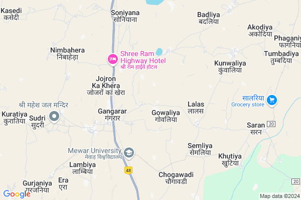
Nimbahera
Nimbahera Map
EDIT Map
Add Your House
 ..
..
Current Corona Virus Infected Patients Count in Chittorgarh District
| City Name | District Name | Total Covid cases |
|---|
Locality Name :
Nimbahera
( निम्बाहेड़ा )
Tehsil Name : Gangrar
District : Chittorgarh
State : Rajasthan
Division : Udaipur
Language : Hindi and Rajasthani
Current Time 12:40 PM
Date: Sunday , Apr 27,2025 (IST)
Time zone: IST (UTC+5:30)
Elevation / Altitude: 412 meters. Above Seal level
Telephone Code / Std Code: 01472
Assembly constituency : assembly constituency
Assembly MLA :
Lok Sabha constituency : parliamentary constituency
Parliament MP :
Serpanch Name :
Pin Code : 312601
Post Office Name : Nimbahera
Main Village Name : Nimbahera
Commodities Prices : Pratapgarh Market / Mandi
Rivers Near Nimbahera
Ruparel Nadi
Menali Nadi
Ruparel Nadi
Menali Nadi
About Nimbahera
Correct below Info and add more info about NimbaheraNimbahera is a small Village/hamlet in Gangrar Tehsil in Chittorgarh District of Rajasthan State, India. It comes under Nimbahera Panchayath. It belongs to Udaipur Division . It is located 23 KM towards North from District head quarters Chittorgarh. 277 KM from State capital Jaipur
Nimbahera Pin code is 312601 and postal head office is Nimbahera .
Nimbahera is surrounded by Suwana Tehsil towards North , Chittaurgarh Tehsil towards South , Rashmi Tehsil towards west , Bhilwara Tehsil towards North .
Bhilwara , Mandalgarh , Nimbahera , Shahpura are the near by Cities to Nimbahera.
Nimbahera 2011 Census Details
Nimbahera Local Language is Hindi. Nimbahera Village Total population is 441 and number of houses are 89. Female Population is 48.8%. Village literacy rate is 46.7% and the Female Literacy rate is 16.8%.
Population
| Census Parameter | Census Data |
| Total Population | 441 |
| Total No of Houses | 89 |
| Female Population % | 48.8 % ( 215) |
| Total Literacy rate % | 46.7 % ( 206) |
| Female Literacy rate | 16.8 % ( 74) |
| Scheduled Tribes Population % | 8.4 % ( 37) |
| Scheduled Caste Population % | 2.9 % ( 13) |
| Working Population % | 50.8 % |
| Child(0 -6) Population by 2011 | 69 |
| Girl Child(0 -6) Population % by 2011 | 44.9 % ( 31) |
Nimbahera Census More Deatils.
HOW TO REACH Nimbahera
By Rail
Gangrar Rail Way Station , Soniyana Rail Way Station are the very nearby railway stations to Nimbahera.Colleges near Nimbahera
Bhagwati Mahila Shikshak Prashikshan Maha Vidyalaya Bassi
Address :
Om Shiv Ayurved Nurse / Compounder College
Address : Om Shiv Ayurved Nurse / Compounder College , Chitt
Maharana Pratap Government Post Graduate College
Address : Dist.:chittaurgarh Rajasthan - 312 001
Sanwarjit Govt. Girls College
Address : Dist. Chittorgarh Rajasthan
Government Girls College Of Chittorgarh
Address : Gandhi Nagar, , Chittorgarh - 312001
Schools near Nimbahera
G.p.s Devda
Address : devda2 , gangrar , chittaurgarh , Rajasthan . PIN- 312901 , Post - Gangrar
Ups Harsa Public School Kharknda
Address : kharknda , gangrar , chittaurgarh , Rajasthan . PIN- 312901 , Post - Gangrar
G.p.s.sanskrit,station Gangrar
Address : gangrar , gangrar , chittaurgarh , Rajasthan . PIN- 312901 , Post - Gangrar
Kgbav Gangrar
Address : gangrar , gangrar , chittaurgarh , Rajasthan . PIN- 312901 , Post - Gangrar
Govt Health Centers near Nimbahera
1) NOTIONAL Gangarar , CHC CAMPUS GANGRAR , GANGRAR , STATION GANGRAR2) Gangarar , CHC GANGRAR , GANGRAR , STATION GANGRAR
3) Baldarkha , SC Baldarkha , , On the Street
Sub Villages in Nimbahera
Hospitals in Nimbahera,Gangrar
Riddhi Siddhi Agences; Patanjali Pashu Aahar
Gangarar; Rajasthan 312901; India
4.8 KM distance Detail
more ..
Petrol Bunks in Nimbahera,Gangrar
OM VINAAYAK FILLING STATION
GANGRAR; CHITTORGARH; CHITTORGARH; Rajasthan 312901; India
6.9 KM distance Detail
more ..
Colleges in Nimbahera,Gangrar
Mewar College of Teacher's Training
Chugawadi Road; Gangrar; Chittorgarh; Rajasthan 312901; India
3.3 KM distance Detail
Mewar University Workshop Block
Mewar University; Chittorgarh; Rajasthan; India
5.1 KM distance Detail
more ..
Schools in Nimbahera,Gangrar
Sterling Academy English Medium School
NH48; Gangarar; Rajasthan 312901; India
3.1 KM distance Detail
Police Stations near Nimbahera,Gangrar
Police Station Chanderiya
Bhilwara Rd; Chanderiya; Chittorgarh; Rajasthan 312021; India
20.5 KM distance Detail
Governement Offices near Nimbahera,Gangrar
Civil Judge and Judicial Magistrate Office
Gangrar; Chittorgarh; NH-79; Chittorgarh Road; Chittorgarh; Chittorgarh; Rajasthan 312022; India
3.8 KM distance Detail
About Nimbahera &
History
How to reach Nimbahera
Tourist Places Near By Nimbahera
Schools in Nimbahera
Colleges in Nimbahera
Temperature & weather of Nimbahera
places in Nimbahera
Nimbahera photos
More Information
How to reach Nimbahera
Tourist Places Near By Nimbahera
Schools in Nimbahera
Colleges in Nimbahera
Temperature & weather of Nimbahera
places in Nimbahera
Nimbahera photos
More Information
Village Talk
Post News or Events about this Village
Near Cities
Bhilwara 34 KM near
Mandalgarh 53 KM near
Nimbahera 55 KM near
Shahpura 76 KM near
Bhilwara 34 KM near
Mandalgarh 53 KM near
Nimbahera 55 KM near
Shahpura 76 KM near
Near By Taluks
Gangrar 0 KM near
Suwana 23 KM near
Chittaurgarh 25 KM near
Rashmi 28 KM near
Gangrar 0 KM near
Suwana 23 KM near
Chittaurgarh 25 KM near
Rashmi 28 KM near
Near By Air Ports
Dabok Airport 102 KM near
Jodhpur Airport 233 KM near
Sanganeer Airport 253 KM near
Indore Airport 320 KM near
Dabok Airport 102 KM near
Jodhpur Airport 233 KM near
Sanganeer Airport 253 KM near
Indore Airport 320 KM near
Near By Tourist Places
Bhilwara 34 KM near
Bijolia 77 KM near
Neemuch 79 KM near
Nathdwara 94 KM near
Bundi 120 KM near
Bhilwara 34 KM near
Bijolia 77 KM near
Neemuch 79 KM near
Nathdwara 94 KM near
Bundi 120 KM near
Near By Districts
Chittorgarh 23 KM near
Bhilwara 34 KM near
Neemuch 80 KM near
Rajsamand 87 KM near
Chittorgarh 23 KM near
Bhilwara 34 KM near
Neemuch 80 KM near
Rajsamand 87 KM near
Near By RailWay Station
Gangrar Rail Way Station 3.3 KM near
Soniyana Rail Way Station 8.3 KM near
Chanderiya Rail Way Station 17 KM near
Chittaurgarh Junction Rail Way Station 24 KM near
Gangrar Rail Way Station 3.3 KM near
Soniyana Rail Way Station 8.3 KM near
Chanderiya Rail Way Station 17 KM near
Chittaurgarh Junction Rail Way Station 24 KM near