| Home | City Bus | Maps | Villages | Cities | Rail | Tourist Places | School | College | Pin Codes | Corona Cases Count |
| Distance Calculator Bus Services IFSC Codes Trace Mobile Number Weather Search Place Trace IP Available Cash ATM/Banks Locate Polling Booth Report an Error contact People |
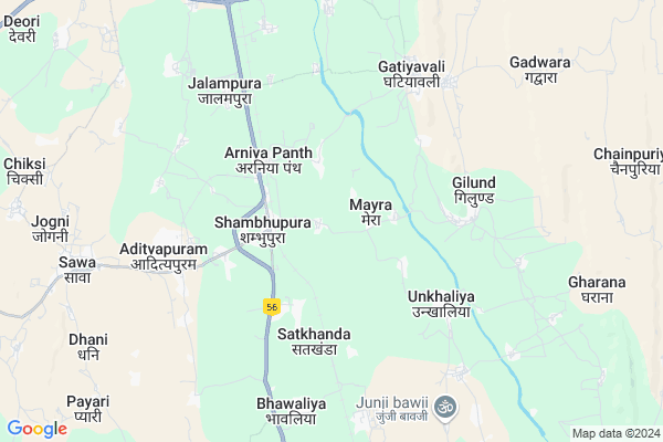
Bamniya
Bamniya Map
EDIT Map
Add Your House
 ..
..
Current Corona Virus Infected Patients Count in Chittorgarh District
| City Name | District Name | Total Covid cases |
|---|
Locality Name :
Bamniya
( बामनिया )
Tehsil Name : Chittaurgarh
District : Chittorgarh
State : Rajasthan
Division : Udaipur
Language : Hindi and Rajasthani
Current Time 04:32 AM
Date: Saturday , Apr 26,2025 (IST)
Time zone: IST (UTC+5:30)
Elevation / Altitude: 403 meters. Above Seal level
Telephone Code / Std Code: 01472
Assembly constituency : Nimbahera assembly constituency
Assembly MLA : Shrichand Kriplani
Lok Sabha constituency : Chittorgarh parliamentary constituency
Parliament MP : Chandra Prakash Joshi
Serpanch Name :
Pin Code : 312612
Post Office Name : Shabhupura
Main Village Name : Bamniya
Commodities Prices : Chittorgarh Market / Mandi
Bamniya Live Weather
Temperature: 25.9 °C
clear sky
Humidity: 18%
Wind : 2.54 mt/sec towards SW
StationName : "Chittaurgarh"
observed on Now
Temperature: 25.9 °C
clear sky
Humidity: 18%
Wind : 2.54 mt/sec towards SW
StationName : "Chittaurgarh"
observed on Now
Bamniya Weather Forecast for Next 5 days
27-04-2025
25.3°C to 40.3°C
clear sky, scattered clouds
25.3°C to 40.3°C
clear sky, scattered clouds
28-04-2025
25.6°C to 41.9°C
clear sky
25.6°C to 41.9°C
clear sky
29-04-2025
26.1°C to 43.5°C
clear sky
26.1°C to 43.5°C
clear sky
30-04-2025
26.7°C to 43.9°C
clear sky, few clouds, scattered clouds
26.7°C to 43.9°C
clear sky, few clouds, scattered clouds
National Highways Reachable To Bamniya
Nationa High Way :NH48
Nationa High Way :NH48
Rivers Near Bamniya
Berach
Wagli Nadi
Berach
Wagli Nadi
About Bamniya
Correct below Info and add more info about BamniyaBamniya is a small Village/hamlet in Chittaurgarh Tehsil in Chittorgarh District of Rajasthan State, India. It comes under Bamniya Panchayath. It belongs to Udaipur Division . It is located 15 KM towards South from District head quarters Chittorgarh. 13 KM from Chittaurgarh. 310 KM from State capital Jaipur
Bamniya Pin code is 312612 and postal head office is Shabhupura .
Satkhanda ( 3 KM ) , Gilund ( 5 KM ) , Ghatiyawali ( 6 KM ) , Ukhaliya ( 6 KM ) , Tai ( 7 KM ) are the nearby Villages to Bamniya. Bamniya is surrounded by Nimbahera Tehsil towards South , Bhadesar Tehsil towards west , Kapasan Tehsil towards west , Jawad Tehsil towards East .
Nimbahera , Neemuch , Manasa , Bhilwara are the near by Cities to Bamniya.
Bamniya 2011 Census Details
Bamniya Local Language is Hindi. Bamniya Village Total population is 1207 and number of houses are 212. Female Population is 49.6%. Village literacy rate is 50.3% and the Female Literacy rate is 16.2%.
Population
| Census Parameter | Census Data |
| Total Population | 1207 |
| Total No of Houses | 212 |
| Female Population % | 49.6 % ( 599) |
| Total Literacy rate % | 50.3 % ( 607) |
| Female Literacy rate | 16.2 % ( 195) |
| Scheduled Tribes Population % | 14.8 % ( 179) |
| Scheduled Caste Population % | 7.5 % ( 91) |
| Working Population % | 58.8 % |
| Child(0 -6) Population by 2011 | 160 |
| Girl Child(0 -6) Population % by 2011 | 44.4 % ( 71) |
Bamniya Census More Deatils.
Politics in Bamniya
Bharatiya Janata Party , BJP , INC are the major political parties in this area.Polling Stations /Booths near Bamniya
1)Govt. Upper Primary School (east Part) Satkhanda2)Govt. Upper Primary School Sakriya
3)Govt. Primary School Biliya
4)Govt. Upper Primary School Sarlai
5)Govt. Higher Secondry School (north Part) Kesunda
HOW TO REACH Bamniya
By Rail
Shambhupura Rail Way Station , Ordi Rail Way Station are the very nearby railway stations to Bamniya.Colleges near Bamniya
Bhagwati Mahila Shikshak Prashikshan Maha Vidyalaya Bassi
Address :
Om Shiv Ayurved Nurse / Compounder College
Address : Om Shiv Ayurved Nurse / Compounder College , Chitt
Schools near Bamniya
Inani Public School
Address : np chittorgarh_ward no.17 , chittorgarh , chittaurgarh , Rajasthan . PIN- 312001 , Post - Chittorgarh
Gups Dhanatkala Sanskrit
Address : danatkala , chittorgarh , chittaurgarh , Rajasthan . PIN- 312001 , Post - Chittorgarh
K.g..b.v. Vijaipur
Address : vijaypur3 , chittorgarh , chittaurgarh , Rajasthan . PIN- 312605 , Post - Pratap garh (Chittorgarh)
Kalyani Akadmi School Senthi
Address : np chittorgarh_ward no.17 , chittorgarh , chittaurgarh , Rajasthan . PIN- 312001 , Post - Chittorgarh
Govt Health Centers near Bamniya
1) Samri , SC Samri , ,2) NOTIONAL Arniyapanth , PHC Arniyapanth , , Nimbheda Road
3) Arniyapanth , PHC Arniyapanth , , High Secondary School Near
Sub Villages in Bamniya
Hospitals in Bamniya,Chittaurgarh
Mateswari Nursing Center
Aditya Puram Rd; Shambhupura; Rajasthan 312612; India
3.0 KM distance Detail
more ..
Petrol Bunks in Bamniya,Chittaurgarh
HP PETROL PUMP - HIMALAYA PRABHU KRIPA PETROL PUMP
Hpcl Retail Outlet NH 79; Mahmoodganj Mahmoodganj; Udaipur; Rajasthan 312601; India
4.7 KM distance Detail
more ..
Colleges in Bamniya,Chittaurgarh
RNT Law College
Sector 5; Gandhi Nagar; Chittorgarh; Rajasthan 312001; India
13.6 KM distance Detail
Samarth ITI chittorgarh
Ghatyavali Rd; Sector5; Gandhi Nagar; Chittorgarh; Rajasthan 312001; India
13.6 KM distance Detail
Law College
70; Chamti Kheda Rd; Krishna Colony; Chittorgarh; Rajasthan 312001; India
13.9 KM distance Detail
more ..
Schools in Bamniya,Chittaurgarh
Government Secondary School
Shambhupura; Chittorgarh; NH-79; Chittorgarh Road; Chittorgarh; Chittorgarh; Rajasthan 312024; India
3.3 KM distance Detail
Electronic Shops in Bamniya,Chittaurgarh
Sun Info Solutions a Computer Shop
Chittorgarh Road; Sawa Chouraha; Shambhupura; Chittorgarh; Rajasthan 312612; India
2.2 KM distance Detail
Police Stations near Bamniya,Chittaurgarh
Police Station
Somnagar; Madhuban Extension; Chittorgarh; Rajasthan 312025; India
11.9 KM distance Detail
Governement Offices near Bamniya,Chittaurgarh
Patwari Office
Nimbahera; Chittorgarh; NH-79; Chittorgarh Road; Chittorgarh; Chittorgarh; Rajasthan 312024; India
3.4 KM distance Detail
Atal Seva Center
Chittor; Chittorgarh; NH-79; Chittorgarh Road; Chittorgarh; Chittorgarh; Rajasthan 312024; India
9.3 KM distance Detail
About Bamniya &
History
How to reach Bamniya
Tourist Places Near By Bamniya
Schools in Bamniya
Colleges in Bamniya
Temperature & weather of Bamniya
places in Bamniya
Bamniya photos
More Information
How to reach Bamniya
Tourist Places Near By Bamniya
Schools in Bamniya
Colleges in Bamniya
Temperature & weather of Bamniya
places in Bamniya
Bamniya photos
More Information
Village Talk
Post News or Events about this Village
Near Cities
Nimbahera 18 KM near
Neemuch 44 KM near
Manasa 65 KM near
Bhilwara 71 KM near
Nimbahera 18 KM near
Neemuch 44 KM near
Manasa 65 KM near
Bhilwara 71 KM near
Near By Taluks
Chittaurgarh 12 KM near
Nimbahera 16 KM near
Bhadesar 22 KM near
Kapasan 35 KM near
Chittaurgarh 12 KM near
Nimbahera 16 KM near
Bhadesar 22 KM near
Kapasan 35 KM near
Near By Air Ports
Dabok Airport 88 KM near
Jodhpur Airport 259 KM near
Sanganeer Airport 285 KM near
Indore Airport 285 KM near
Dabok Airport 88 KM near
Jodhpur Airport 259 KM near
Sanganeer Airport 285 KM near
Indore Airport 285 KM near
Near By Tourist Places
Neemuch 44 KM near
Bhilwara 71 KM near
Bijolia 89 KM near
Nathdwara 96 KM near
Udaipur 112 KM near
Neemuch 44 KM near
Bhilwara 71 KM near
Bijolia 89 KM near
Nathdwara 96 KM near
Udaipur 112 KM near
Near By Districts
Chittorgarh 14 KM near
Neemuch 45 KM near
Bhilwara 71 KM near
Pratapgarh 92 KM near
Chittorgarh 14 KM near
Neemuch 45 KM near
Bhilwara 71 KM near
Pratapgarh 92 KM near
Near By RailWay Station
Shambhupura Rail Way Station 2.1 KM near
Ordi Rail Way Station 8.6 KM near
Chittaurgarh Junction Rail Way Station 13 KM near
Nimbahera Rail Way Station 18 KM near
Shambhupura Rail Way Station 2.1 KM near
Ordi Rail Way Station 8.6 KM near
Chittaurgarh Junction Rail Way Station 13 KM near
Nimbahera Rail Way Station 18 KM near