| Home | City Bus | Maps | Villages | Cities | Rail | Tourist Places | School | College | Pin Codes | Corona Cases Count |
| Distance Calculator Bus Services IFSC Codes Trace Mobile Number Weather Search Place Trace IP Available Cash ATM/Banks Locate Polling Booth Report an Error contact People |
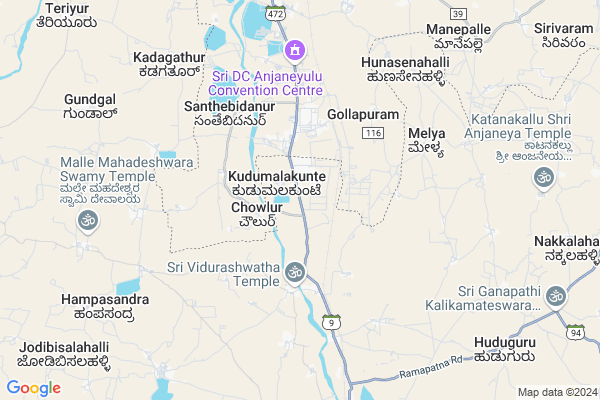
Kudumalakunte
Kudumalakunte Map
EDIT Map
Add Your House
 ..
..
Current Corona Virus Infected Patients Count in Chikballapur District
| City Name | District Name | Total Covid cases |
|---|---|---|
| Chikkaballapura District | Chikkaballapura | 11 |
| Gauribidanur | Chikkaballapura | 4 |
| Gowribidanur | Chikkaballapura | 2 |
| Chikkaballapura | Chikkaballapura | 1 |
Locality Name :
Kudumalakunte
( ಕುಡುಮಲಕುಂಟೆ )
Taluk Name : Gauribidanur
District : Chikballapur
State : Karnataka
Language : Kannada and English
Current Time 11:30 AM
Date: Tuesday , Apr 29,2025 (IST)
Time zone: IST (UTC+5:30)
Elevation / Altitude: 684 meters. Above Seal level
Telephone Code / Std Code: 08155
Assembly constituency : Gauribidanur assembly constituency
Assembly MLA : K.H.Puttaswamy Gowda (KHP)
Lok Sabha constituency : Chikkaballapur parliamentary constituency
Parliament MP : B.N.Bache Gowda
Serpanch Name :
Pin Code : 561208
Post Office Name : Gauribidanur
Main Village Name : Kudumalakunte
Commodities Prices : Gowribidanoor Market / Mandi
Edit below overview about Kudumalakunte
Edit below overview about Kudumalakunte
OverView of Kudumalakunte
Kudumalakunte now become a industrial area KIADB ,there is garments ,medicala related factory ,steel,rubber,factoryEdit below overview about Kudumalakunte
National Highways Reachable To Kudumalakunte
Nationa High Way :NH44
Nationa High Way :NH69
Nationa High Way :NH44
Nationa High Way :NH69
Rivers Near Kudumalakunte
Papagni :ಪಾಪಾಗ್ನಿ :పాపాగ్ని
Uttara Pinakini :ಉತ್ತರ ಪಿನಾಕಿನಿ
Papagni :ಪಾಪಾಗ್ನಿ :పాపాగ్ని
Uttara Pinakini :ಉತ್ತರ ಪಿನಾಕಿನಿ
About Kudumalakunte
Kudumalakunte is a small Village/hamlet in Gauribidanur Taluk in Chikballapur District of Karnataka State, India. It comes under Kudumalakunte Panchayath. It is located 46 KM towards North from District head quarters Chikballapur. 15 KM from Gauribidanur. 95 KM from State capital Bangalore
Kudumalakunte Pin code is 561208 and postal head office is Gauribidanur .
Melya ( 5 KM ) , Chikkakurugodu ( 6 KM ) , Bychapura ( 7 KM ) , Karekallahalli ( 9 KM ) , Prashant Nagar ( 10 KM ) are the nearby Villages to Kudumalakunte. Kudumalakunte is surrounded by Gauribidanur Taluk towards South , Lepakshi Taluk towards North , Parigi Taluk towards North , Gudibanda Taluk towards East .
Hindupur , Madhugiri , Nelamangala , Chikkaballapur are the near by Cities to Kudumalakunte.
Kudumalakunte 2011 Census Details
Kudumalakunte Local Language is Kannada. Kudumalakunte Village Total population is 1999 and number of houses are 489. Female Population is 48.9%. Village literacy rate is 53.0% and the Female Literacy rate is 22.4%.
Population
| Census Parameter | Census Data |
| Total Population | 1999 |
| Total No of Houses | 489 |
| Female Population % | 48.9 % ( 978) |
| Total Literacy rate % | 53.0 % ( 1059) |
| Female Literacy rate | 22.4 % ( 448) |
| Scheduled Tribes Population % | 11.0 % ( 219) |
| Scheduled Caste Population % | 26.8 % ( 536) |
| Working Population % | 52.9 % |
| Child(0 -6) Population by 2011 | 231 |
| Girl Child(0 -6) Population % by 2011 | 47.2 % ( 109) |
Kudumalakunte Census More Deatils.
Politics in Kudumalakunte
Bharatiya Janata Party , JD(S) , BJP , Indian National Congress (INC) , INC are the major political parties in this area.Polling Stations /Booths near Kudumalakunte
1)Government Higher Primary School2)Government Higher Primary School North Side
3)Government Lower Primary School
4)Government Higher Primary School
5)Government Higher Primary School
HOW TO REACH Kudumalakunte
By Rail
Devarapalle Rail Way Station , Viduraswattha Rail Way Station are the very nearby railway stations to Kudumalakunte. Someshwara Rail Way Station (near to Gauribidanur) , Hindupur Rail Way Station (near to Hindupur) , Oddarahalli Rail Way Station (near to Dod Ballapur) , Dodballapur Rail Way Station (near to Dod Ballapur) , Malugur Rail Way Station (near to Hindupur) , Gauribidanur Rail Way Station (near to Gauribidanur) are the Rail way stations reachable from near by towns.By Road
Gauribidanur , Gudibanda , Hindupur , Dod Ballapur are the nearby by towns to Kudumalakunte having road connectivity to KudumalakunteColleges near Kudumalakunte
A .v . N . R . Pre Univercity College
Address :
Ssea Govt College
Address :
Zainabiya Composite Pu Collage
Address :
Nobel Collage Alipur
Address :
Schools in Kudumalakunte
Ghps Kudumalakunte
Address : kudumalakunte , gowribidanur , chikkaballapura , Karnataka . PIN- 513201
Govt Health Centers near Kudumalakunte
1) CHINAKAVAJRA , Chenakavajra, MARUVEKERE , Chenakavajra, MARUVEKERE , Chenakavajra, MARUVEKERE2) Madhugiri GH , Madhugiri GH , Madhugiri GH , Madhugiri GH
3) NEERAKALLU , Nirakallu , Nirakallu , Nirakallu
Sub Villages in Kudumalakunte
Petrol Bunks in Kudumalakunte,Gauribidanur
Indian Oil Petrol Bunk
Thumakunta Checkpost; Main rd; Andhra Pradesh 515211; India
2.8 KM distance Detail
HP PETROL PUMP - INTERNATIONAL ENTERPRISES
HPC Dealers; Sy.no111& 145 Thumkunta Vil;bangalore RD Hindupur Mandal; Andhra Pradesh 515211; India
2.8 KM distance Detail
Bharath Petroleum
3; SH 9; Prashant Nagar; Gauribidanur; Karnataka 561208; India
9.9 KM distance Detail
more ..
Colleges in Kudumalakunte,Gauribidanur
Govt Tool Room &Training Centre
Kudumalkunte industrial Area; Gauribidanur; Karnataka; India
1.0 KM distance Detail
Dr.B.V. Syamala Rathnam College of Education
Plot No. 369/02; Srinivasa Nagar; Post Kirikera; Hindupur Mandal; Anantapur District; Appala Kunta; Andhra Pradesh 515211; India
7.3 KM distance Detail
BVSR medical ;paramedical educational and charity
Kirikera; Andhra Pradesh 515211; India
8.3 KM distance Detail
more ..
Electronic Shops in Kudumalakunte,Gauribidanur
Mandovi Motors
Pushpanjali Theatre; B H Road; Chikkaballapur -561208; Gauribidanur; Karnataka; India
9.7 KM distance Detail
Super Markets in Kudumalakunte,Gauribidanur
Adinarayana Provision Stores (CHANDRA ANGADI)
Teachers Colony; Housing Board Colony; Hindupur; Andhra Pradesh 515201; India
13.8 KM distance Detail
Local Parks in Kudumalakunte,Gauribidanur
ಸ್ವತಂತ್ರ ಉದ್ಯಾನವನ (ದಕ್ಷಿಣದ ಜಲಿಯನ್ವಾಲ ಬಾಘ್ )
Halaganahalli; Karnataka 561208; India
3.8 KM distance Detail
Police Stations near Kudumalakunte,Gauribidanur
Gauribidanur town police station
NH206; Gauribidanur; Karnataka 561208; India
12.1 KM distance Detail
Gauribidanur Rural Police Station
SH 9; Gauribidanur; Karnataka 561208; India
12.9 KM distance Detail
Governement Offices near Kudumalakunte,Gauribidanur
Padmavathi Kalyana Mantapa; Gowribidnaur
13°37'15. 77°30'33.; 2; Rd Number 2; Seetharampalya; Hoodi; Bengaluru; Karnataka; India
10.4 KM distance Detail
About Kudumalakunte &
History
How to reach Kudumalakunte
Tourist Places Near By Kudumalakunte
Schools in Kudumalakunte
Colleges in Kudumalakunte
Temperature & weather of Kudumalakunte
places in Kudumalakunte
Kudumalakunte photos
More Information
How to reach Kudumalakunte
Tourist Places Near By Kudumalakunte
Schools in Kudumalakunte
Colleges in Kudumalakunte
Temperature & weather of Kudumalakunte
places in Kudumalakunte
Kudumalakunte photos
More Information
Village Talk
Post News or Events about this Village
Near Cities
Hindupur 15 KM near
Madhugiri 34 KM near
Nelamangala 41 KM near
Chikkaballapur 42 KM near
Hindupur 15 KM near
Madhugiri 34 KM near
Nelamangala 41 KM near
Chikkaballapur 42 KM near
Near By Taluks
Gauribidanur 14 KM near
Hindupur 15 KM near
Lepakshi 15 KM near
Parigi 24 KM near
Gauribidanur 14 KM near
Hindupur 15 KM near
Lepakshi 15 KM near
Parigi 24 KM near
Near By Air Ports
Bengaluru International Airport 67 KM near
Mysore Airport 202 KM near
Tirupati Airport 247 KM near
Salem Airport 267 KM near
Bengaluru International Airport 67 KM near
Mysore Airport 202 KM near
Tirupati Airport 247 KM near
Salem Airport 267 KM near
Near By Tourist Places
Lepakshi 18 KM near
Nandi Hills 46 KM near
Puttaparthi 68 KM near
Shivagange 72 KM near
Bangalore 91 KM near
Lepakshi 18 KM near
Nandi Hills 46 KM near
Puttaparthi 68 KM near
Shivagange 72 KM near
Bangalore 91 KM near
Near By Districts
Chikballapur 44 KM near
Bangalore Rural 61 KM near
Tumkur 66 KM near
Bangalore 91 KM near
Chikballapur 44 KM near
Bangalore Rural 61 KM near
Tumkur 66 KM near
Bangalore 91 KM near
Near By RailWay Station
Viduraswattha Rail Way Station 4.3 KM near
Devarapalle Rail Way Station 4.5 KM near
Gauribidanur Rail Way Station 11 KM near
Hindupur Rail Way Station 14 KM near
Viduraswattha Rail Way Station 4.3 KM near
Devarapalle Rail Way Station 4.5 KM near
Gauribidanur Rail Way Station 11 KM near
Hindupur Rail Way Station 14 KM near