| Home | City Bus | Maps | Villages | Cities | Rail | Tourist Places | School | College | Pin Codes | Corona Cases Count |
| Distance Calculator Bus Services IFSC Codes Trace Mobile Number Weather Search Place Trace IP Available Cash ATM/Banks Locate Polling Booth Report an Error contact People |
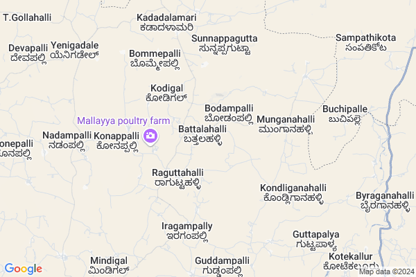
Battalahalli
Battalahalli Map
EDIT Map
Add Your House
 ..
..
Current Corona Virus Infected Patients Count in Chikballapur District
| City Name | District Name | Total Covid cases |
|---|---|---|
| Chikkaballapura District | Chikkaballapura | 11 |
| Gauribidanur | Chikkaballapura | 4 |
| Gowribidanur | Chikkaballapura | 2 |
| Chikkaballapura | Chikkaballapura | 1 |
Locality Name :
Battalahalli
( ಬಟ್ಟಲಹಳ್ಳಿ )
Taluk Name : Chintamani
District : Chikballapur
State : Karnataka
Language : Kannada and English
Current Time 10:43 AM
Date: Friday , Apr 25,2025 (IST)
Time zone: IST (UTC+5:30)
Elevation / Altitude: 879 meters. Above Seal level
Telephone Code / Std Code: 08154
Assembly constituency : Chintamani assembly constituency
Assembly MLA : Dr. M.C. Sudhakar
Lok Sabha constituency : Kolar parliamentary constituency
Parliament MP : S. MUNISWAMY
Serpanch Name :
Pin Code : 563123
Post Office Name : Batlahalli
Main Village Name : Battalahalli
Alternate Village Name : Batlahalli
Commodities Prices : Mulakalacheruvu Market / Mandi
Battalahalli Live Weather
Temperature: 33.3 °C
broken clouds
Humidity: 28%
Wind : 3.34 mt/sec towards SE
StationName : "Chintamani"
observed on 17 Mins Back
Temperature: 33.3 °C
broken clouds
Humidity: 28%
Wind : 3.34 mt/sec towards SE
StationName : "Chintamani"
observed on 17 Mins Back
Battalahalli Weather Forecast for Next 5 days
26-04-2025
25.0°C to 37.7°C
broken clouds, scattered clouds
25.0°C to 37.7°C
broken clouds, scattered clouds
27-04-2025
23.2°C to 37.4°C
broken clouds, scattered clouds, overcast clouds
23.2°C to 37.4°C
broken clouds, scattered clouds, overcast clouds
28-04-2025
23.7°C to 37.3°C
scattered clouds, broken clouds, overcast clouds, light rain
23.7°C to 37.3°C
scattered clouds, broken clouds, overcast clouds, light rain
29-04-2025
24.5°C to 34.6°C
broken clouds, scattered clouds, light rain, overcast clouds
24.5°C to 34.6°C
broken clouds, scattered clouds, light rain, overcast clouds
30-04-2025
25.4°C to 36.9°C
scattered clouds, clear sky, few clouds, broken clouds
25.4°C to 36.9°C
scattered clouds, clear sky, few clouds, broken clouds
National Highways Reachable To Battalahalli
Nationa High Way :NH44
Nationa High Way :NH42
Nationa High Way :NH44
Nationa High Way :NH42
Rivers Near Battalahalli
Uttara Pinakini :ಉತ್ತರ ಪಿನಾಕಿನಿ
Uttara Pinakini :ಉತ್ತರ ಪಿನಾಕಿನಿ
Uttara Pinakini :ಉತ್ತರ ಪಿನಾಕಿನಿ
Uttara Pinakini :ಉತ್ತರ ಪಿನಾಕಿನಿ
About Battalahalli
Correct below Info and add more info about BattalahalliBattalahalli is a small Village/hamlet in Chintamani Taluk in Chikballapur District of Karnataka State, India. It comes under Battalahalli Panchayath. It is located 55 KM towards East from District head quarters Chikballapur. 18 KM from Chintamani. 105 KM from State capital Bangalore
Battalahalli Pin code is 563123 and postal head office is Batlahalli .
Iragampalli ( 6 KM ) , Mitta Halli ( 11 KM ) , Chilakalanerpu ( 12 KM ) , Kotagal ( 15 KM ) are the nearby Villages to Battalahalli. Battalahalli is surrounded by Peddathippasamudram Taluk towards North , B.Kothakota Taluk towards East , Srinivaspur Taluk towards South , Mulakalacheruvu Taluk towards North .
Chintamani , Srinivaspur , Sidlaghatta , Madanapalle are the near by Cities to Battalahalli.
Demographics of Battalahalli
Kannada is the Local Language here.Politics in Battalahalli
Bharatiya Janata Party , JD(S) , Janata Dal (Secular) (JD(S)) , BJP , INC are the major political parties in this area.Polling Stations /Booths near Battalahalli
1)Batlahalli2)Bangalore Road Chintamani Town
3)Masthenahalli
4)Raguttahalli 1
5)Rachapura
HOW TO REACH Battalahalli
By Rail
There is no railway station near to Battalahalli in less than 10 km. Chintamani Rail Way Station (near to Chintamani) are the Rail way stations reachable from near by towns.By Road
Chintamani are the nearby by towns to Battalahalli having road connectivity to BattalahalliColleges near Battalahalli
Varadadri P U College. Chintamani
Address : Anjani Extension Chintamani Chikkaballapur District-563125
Gpuc For Boys Chintamani Chikkaballapur Dist
Address : Govt Pu College For Boys Chintamani Mc089 Chikkaballapur Dist
Schools near Battalahalli
Adithya Education Trust
Address : oolavadi , chintamani , chikkaballapura , Karnataka . PIN- 563125 , Post - Chintamani
Vikram Composite High School
Address : ward no:20 , chintamani , chikkaballapura , Karnataka . PIN- 563126 , Post - Dalasanur
Doliphins Delhi Public School
Address : chintamani , chintamani , chikkaballapura , Karnataka . PIN- 563125 , Post - Chintamani
Morarji Desai School Masthenahalli
Address : masthenahalli , chintamani , chikkaballapura , Karnataka . PIN- 563128 , Post - Kaiwara
Govt Health Centers near Battalahalli
1) SIDDLAGHATTA PRIVATE UNIT , General Hospital Sidlaghatta , TB Road, Dibburhalli Road , Near Railway station,2) Ambedakarnagar , SUB CENTRE AMBEDEKARNAGAR , AMBEDEKARNAGAR , AMBEDEKARNAGAR
3) Pulshamohalla , SUB CENTRE PULSHAMOHALLA , PULSHAMOHALLA , PULSHAMOHALLA
Sub Villages in Battalahalli
Petrol Bunks in Battalahalli,Chintamani
HP PETROL PUMP - PMR FILLING STATION T.SADUM
Hpcl Dealers T Sadum Village P T M Mandal; Nellore; Andhra Pradesh 517391; India
11.8 KM distance Detail
more ..
Governement Offices near Battalahalli,Chintamani
Panchayath Office Raghuttahalli
School Road; Raguttahalli; Karnataka 563123; India
2.9 KM distance Detail
MeeSeva Center
Bus Stand; Peddathippasamudram(V); Peddathippasamudram(M); Chittoor(D); 2-113; Pedda Tippa Samudram; Andhra Pradesh 517391; India
19.4 KM distance Detail
About Battalahalli &
History
How to reach Battalahalli
Tourist Places Near By Battalahalli
Schools in Battalahalli
Colleges in Battalahalli
Temperature & weather of Battalahalli
places in Battalahalli
Battalahalli photos
More Information
How to reach Battalahalli
Tourist Places Near By Battalahalli
Schools in Battalahalli
Colleges in Battalahalli
Temperature & weather of Battalahalli
places in Battalahalli
Battalahalli photos
More Information
Village Talk
Post News or Events about this Village
Near Cities
Chintamani 24 KM near
Srinivaspur 32 KM near
Sidlaghatta 40 KM near
Madanapalle 43 KM near
Chintamani 24 KM near
Srinivaspur 32 KM near
Sidlaghatta 40 KM near
Madanapalle 43 KM near
Near By Taluks
Chintamani 17 KM near
Peddathippasamudram 18 KM near
B.Kothakota 23 KM near
Srinivaspur 25 KM near
Chintamani 17 KM near
Peddathippasamudram 18 KM near
B.Kothakota 23 KM near
Srinivaspur 25 KM near
Near By Air Ports
Bengaluru International Airport 70 KM near
Tirupati Airport 169 KM near
Salem Airport 240 KM near
Mysore Airport 241 KM near
Bengaluru International Airport 70 KM near
Tirupati Airport 169 KM near
Salem Airport 240 KM near
Mysore Airport 241 KM near
Near By Tourist Places
Horsley Hills 32 KM near
Nandi Hills 62 KM near
Lepakshi 69 KM near
Puttaparthi 84 KM near
Bangalore 100 KM near
Horsley Hills 32 KM near
Nandi Hills 62 KM near
Lepakshi 69 KM near
Puttaparthi 84 KM near
Bangalore 100 KM near
Near By Districts
Chikballapur 53 KM near
Kolar 55 KM near
Bangalore Rural 66 KM near
Bangalore 99 KM near
Chikballapur 53 KM near
Kolar 55 KM near
Bangalore Rural 66 KM near
Bangalore 99 KM near
Near By RailWay Station
Madanapalle Road Rail Way Station 50 KM near
Kadiri Rail Way Station 66 KM near
Madanapalle Road Rail Way Station 50 KM near
Kadiri Rail Way Station 66 KM near