| Home | City Bus | Maps | Villages | Cities | Rail | Tourist Places | School | College | Pin Codes | Corona Cases Count |
| Distance Calculator Bus Services IFSC Codes Trace Mobile Number Weather Search Place Trace IP Available Cash ATM/Banks Locate Polling Booth Report an Error contact People |
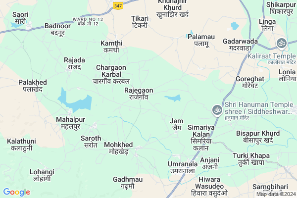
Gadarwada
Gadarwada Map
EDIT Map
Add Your House
 ..
..
Current Corona Virus Infected Patients Count in Chhindwara District
| City Name | District Name | Total Covid cases |
|---|---|---|
| Chhindwara District | Chhindwara | 5 |
Locality Name :
Gadarwada
( गाडरवाड़ा )
Tehsil Name : Mohkhed
District : Chhindwara
State : Madhya Pradesh
Division : Jabalpur
Language : Hindi and Bagheli,dravidian,devanagari
Current Time 10:38 AM
Date: Friday , Apr 25,2025 (IST)
Time zone: IST (UTC+5:30)
Elevation / Altitude: 642 meters. Above Seal level
Telephone Code / Std Code: 07162
Assembly constituency : Saunsar assembly constituency
Assembly MLA : Vijay Revnath Chore
Lok Sabha constituency : Chhindwara parliamentary constituency
Parliament MP : NAKUL KAMAL NATH
Serpanch Name :
Main Village Name : Gadarwada
Commodities Prices : Chhindwara Market / Mandi
Gadarwada Live Weather
Temperature: 36.3 °C
clear sky
Humidity: 8%
Wind : 3.12 mt/sec towards N
StationName : "ChhindwÄ\u0081ra"
observed on 58 Mins Back
Temperature: 36.3 °C
clear sky
Humidity: 8%
Wind : 3.12 mt/sec towards N
StationName : "ChhindwÄ\u0081ra"
observed on 58 Mins Back
Gadarwada Weather Forecast for Next 5 days
26-04-2025
29.9°C to 40.1°C
clear sky, few clouds, scattered clouds
29.9°C to 40.1°C
clear sky, few clouds, scattered clouds
27-04-2025
28.9°C to 39.3°C
clear sky, overcast clouds, broken clouds, scattered clouds, light rain
28.9°C to 39.3°C
clear sky, overcast clouds, broken clouds, scattered clouds, light rain
28-04-2025
24.2°C to 36.8°C
broken clouds, overcast clouds, scattered clouds, few clouds, clear sky
24.2°C to 36.8°C
broken clouds, overcast clouds, scattered clouds, few clouds, clear sky
29-04-2025
23.8°C to 40.1°C
few clouds, clear sky, scattered clouds, broken clouds
23.8°C to 40.1°C
few clouds, clear sky, scattered clouds, broken clouds
30-04-2025
25.6°C to 41.2°C
scattered clouds, clear sky, broken clouds, few clouds
25.6°C to 41.2°C
scattered clouds, clear sky, broken clouds, few clouds
National Highways Reachable To Gadarwada
Nationa High Way :NH547
Nationa High Way :NH347;NH547
Nationa High Way :NH547
Nationa High Way :NH347;NH547
Rivers Near Gadarwada
Neori
Kulbehera
Neori
Kulbehera
About Gadarwada
Correct below Info and add more info about GadarwadaGadarwada is a small Village/hamlet in Mohkhed Tehsil in Chhindwara District of Madhya Pradesh State, India. It comes under Gadarwada Panchayath. It belongs to Jabalpur Division . It is located 20 KM towards South from District head quarters Chhindwara. 245 KM from State capital Bhopal
Gadarwada is surrounded by Chhindwara Tehsil towards North , Parasia Tehsil towards North , Bichhua Tehsil towards East , Sausar Tehsil towards South .
Chhindwara , Sausar , Pandhurna , Savner are the near by Cities to Gadarwada.
Gadarwada 2011 Census Details
Gadarwada Local Language is Hindi. Gadarwada Village Total population is 659 and number of houses are 150. Female Population is 48.7%. Village literacy rate is 66.6% and the Female Literacy rate is 27.0%.
Population
| Census Parameter | Census Data |
| Total Population | 659 |
| Total No of Houses | 150 |
| Female Population % | 48.7 % ( 321) |
| Total Literacy rate % | 66.6 % ( 439) |
| Female Literacy rate | 27.0 % ( 178) |
| Scheduled Tribes Population % | 74.8 % ( 493) |
| Scheduled Caste Population % | 12.4 % ( 82) |
| Working Population % | 48.7 % |
| Child(0 -6) Population by 2011 | 77 |
| Girl Child(0 -6) Population % by 2011 | 55.8 % ( 43) |
Gadarwada Census More Deatils.
Politics in Gadarwada
Indian National Congress , BJP , INC are the major political parties in this area.Polling Stations /Booths near Gadarwada
1)Raganri Talab2)Rajegaon
3)Bramhan Pipla
4)Beradi
5)Umaranala
HOW TO REACH Gadarwada
By Rail
Umra Nala Rail Way Station , Bisapur Kalan Halt Rail Way Station are the very nearby railway stations to Gadarwada.Pincodes near Gadarwada
480107 ( Umaranala ) , 480001 ( Chhindwara ) , 480331 ( Saori Bazaar )Colleges near Gadarwada
Arts And Coollege
Address :
Vidhya Devi Shukla Mahavidhyalay
Address :
Govt. College Bichhua
Address :
Priyadarshni Science & Management Technology College Sausar
Address :
S S College
Address :
Schools in Gadarwada
Ps Gadarwara
Address : gadarwada , mohkhed , chhindwara , Madhya Pradesh . PIN- 480002
Govt Health Centers near Gadarwada
1) SHC Rajegao , 10 , CHIKHLIKALA ROAD , OPP.HIGH SCHOOL RAJEGAOWN2) SHC Jam , 15 , SHC Jam , MAIN ROAD NEAR WATER TANK IN VILLAGE
3) SHC Mau , 125 , SHC Mau , BESIDE ICDS OFFICE
Sub Villages in Gadarwada
Petrol Bunks in Gadarwada,Mohkhed
HP PETROL PUMP - SHRI SAINATH PET UMRANALA
HPC Dealers Village Tansramal Tehsil; Jabalpur; Madhya Pradesh 480107; India
7.6 KM distance Detail
Shri Sainath Petroleum
Madhya Pradesh State Highway 250; Tansara Mal; Madhya Pradesh 480107; India
7.9 KM distance Detail
more ..
Colleges in Gadarwada,Mohkhed
Govt HIGH SCHOOL CHARGAON KARBAL
Chargaon Karbal; Madhya Pradesh 480107; India
3.6 KM distance Detail
Govt Hs school Chargaon karbal 480107
Chargaon Karbal; Madhya Pradesh 480107; India
3.6 KM distance Detail
Vishal Computers Institute Of Information Technology
Nagpur Road; Umranala; Madhya Pradesh 480107; India
6.4 KM distance Detail
more ..
Schools in Gadarwada,Mohkhed
Smt. Indira Gandhi Higher Secondary School Rajegaon
Rajegaon; Madhya Pradesh 480107; India
0.7 KM distance Detail
About Gadarwada &
History
How to reach Gadarwada
Tourist Places Near By Gadarwada
Schools in Gadarwada
Colleges in Gadarwada
Temperature & weather of Gadarwada
places in Gadarwada
Gadarwada photos
More Information
How to reach Gadarwada
Tourist Places Near By Gadarwada
Schools in Gadarwada
Colleges in Gadarwada
Temperature & weather of Gadarwada
places in Gadarwada
Gadarwada photos
More Information
Village Talk
Post News or Events about this Village
Near Cities
Chhindwara 20 KM near
Sausar 32 KM near
Pandhurna 55 KM near
Savner 67 KM near
Chhindwara 20 KM near
Sausar 32 KM near
Pandhurna 55 KM near
Savner 67 KM near
Near By Taluks
Mohkhed 0 KM near
Chhindwara 23 KM near
Parasia 32 KM near
Bichhua 33 KM near
Mohkhed 0 KM near
Chhindwara 23 KM near
Parasia 32 KM near
Bichhua 33 KM near
Near By Air Ports
Sonegaon Airport 106 KM near
Jabalpur Airport 154 KM near
Bhopal Airport 242 KM near
Raipur Airport 347 KM near
Sonegaon Airport 106 KM near
Jabalpur Airport 154 KM near
Bhopal Airport 242 KM near
Raipur Airport 347 KM near
Near By Tourist Places
Seoni 83 KM near
Pachmarhi 83 KM near
Pench National Park 88 KM near
Nagpur 99 KM near
Bhandara 131 KM near
Seoni 83 KM near
Pachmarhi 83 KM near
Pench National Park 88 KM near
Nagpur 99 KM near
Bhandara 131 KM near
Near By Districts
Chhindwara 20 KM near
Seoni 83 KM near
Nagpur 100 KM near
Betul 110 KM near
Chhindwara 20 KM near
Seoni 83 KM near
Nagpur 100 KM near
Betul 110 KM near
Near By RailWay Station
Umra Nala Rail Way Station 6.9 KM near
Bisapur Kalan Halt Rail Way Station 8.9 KM near
Pandhurna Rail Way Station 55 KM near
Narkher Junction Rail Way Station 67 KM near
Umra Nala Rail Way Station 6.9 KM near
Bisapur Kalan Halt Rail Way Station 8.9 KM near
Pandhurna Rail Way Station 55 KM near
Narkher Junction Rail Way Station 67 KM near