| Home | City Bus | Maps | Villages | Cities | Rail | Tourist Places | School | College | Pin Codes | Corona Cases Count |
| Distance Calculator Bus Services IFSC Codes Trace Mobile Number Weather Search Place Trace IP Available Cash ATM/Banks Locate Polling Booth Report an Error contact People |
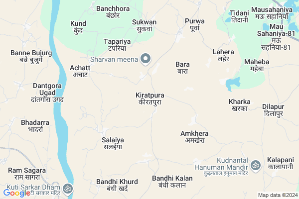
Kiratpura
Kiratpura Map
EDIT Map
Add Your House
 ..
..
Current Corona Virus Infected Patients Count in Chhatarpur District
| City Name | District Name | Total Covid cases |
|---|
Locality Name :
Kiratpura
( कीरतपुरा )
Tehsil Name : Chhatarpur
District : Chhatarpur
State : Madhya Pradesh
Division : Sagar
Language : Hindi and Urdu, Bharia,devanagari
Current Time 04:39 AM
Date: Saturday , Apr 26,2025 (IST)
Time zone: IST (UTC+5:30)
Elevation / Altitude: 226 meters. Above Seal level
Telephone Code / Std Code: 07682
Assembly constituency : Chhatarpur assembly constituency
Assembly MLA : Lalita Yadav
Lok Sabha constituency : Tikamgarh parliamentary constituency
Parliament MP : Dr Virendra Kumar
Serpanch Name :
Pin Code : 471201
Post Office Name : Nowgong
Main Village Name : Kiratpura
Commodities Prices : Palera Market / Mandi
Kiratpura Live Weather
Temperature: 29.4 °C
clear sky
Humidity: 13%
Wind : 3.47 mt/sec towards SW
StationName : "Palera"
observed on Now
Temperature: 29.4 °C
clear sky
Humidity: 13%
Wind : 3.47 mt/sec towards SW
StationName : "Palera"
observed on Now
Kiratpura Weather Forecast for Next 5 days
27-04-2025
28.9°C to 41.8°C
clear sky, scattered clouds, overcast clouds, broken clouds
28.9°C to 41.8°C
clear sky, scattered clouds, overcast clouds, broken clouds
28-04-2025
29.2°C to 40.0°C
clear sky, overcast clouds, broken clouds, light rain
29.2°C to 40.0°C
clear sky, overcast clouds, broken clouds, light rain
29-04-2025
28.4°C to 42.8°C
broken clouds, clear sky, few clouds
28.4°C to 42.8°C
broken clouds, clear sky, few clouds
30-04-2025
29.0°C to 44.4°C
clear sky, scattered clouds, broken clouds, overcast clouds
29.0°C to 44.4°C
clear sky, scattered clouds, broken clouds, overcast clouds
National Highways Reachable To Kiratpura
Nationa High Way :NH39
Nationa High Way :NH39
Rivers Near Kiratpura
Khudar River
Dhasan
Khudar River
Dhasan
About Kiratpura
Correct below Info and add more info about KiratpuraKiratpura is a small Village/hamlet in Chhatarpur Tehsil in Chhatarpur District of Madhya Pradesh State, India. It comes under Kiratpura Panchayath. It belongs to Sagar Division . It is located 23 KM towards west from District head quarters Chhatarpur. 18 KM from Chhatarpur. 323 KM from State capital Bhopal
Kiratpura Pin code is 471201 and postal head office is Nowgong .
Bandhi Kala ( 5 KM ) , Purwa ( 5 KM ) , Sukwan ( 5 KM ) , Kharka ( 7 KM ) , Banchhora ( 7 KM ) are the nearby Villages to Kiratpura. Kiratpura is surrounded by Nowgong Tehsil towards North , Palera Tehsil towards west , Jaitpur Tehsil towards North , Baldeogarh Tehsil towards west .
Nowgong , Chhatarpur , Mahoba , Charkhari are the near by Cities to Kiratpura.
Kiratpura 2011 Census Details
Kiratpura Local Language is Hindi. Kiratpura Village Total population is 1656 and number of houses are 333. Female Population is 47.9%. Village literacy rate is 46.5% and the Female Literacy rate is 19.3%.
Population
| Census Parameter | Census Data |
| Total Population | 1656 |
| Total No of Houses | 333 |
| Female Population % | 47.9 % ( 793) |
| Total Literacy rate % | 46.5 % ( 770) |
| Female Literacy rate | 19.3 % ( 319) |
| Scheduled Tribes Population % | 0.0 % ( 0) |
| Scheduled Caste Population % | 23.2 % ( 384) |
| Working Population % | 33.5 % |
| Child(0 -6) Population by 2011 | 259 |
| Girl Child(0 -6) Population % by 2011 | 52.1 % ( 135) |
Kiratpura Census More Deatils.
Politics in Kiratpura
Bharatiya Janata Party , BJP , INC are the major political parties in this area.Polling Stations /Booths near Kiratpura
1)Aamkhera2)Vanpura
3)Khonp
4)Bangay
5)Naiguva
HOW TO REACH Kiratpura
By Rail
There is no railway station near to Kiratpura in less than 10 km.Colleges near Kiratpura
Jatayu Computer Center
Address :
Schools in Kiratpura
Saraswati Bal Ms Kiratpura
Address : kiratpura , ishanagaar , chhatarpur , Madhya Pradesh . PIN- 471201 , Post - Nowgong
Ms Kiratpura
Address : kiratpura , ishanagaar , chhatarpur , Madhya Pradesh . PIN- 471201 , Post - Nowgong
Govt Health Centers near Kiratpura
1) SHC Nadgay , SHC Nadgay , KENDI , KENDI2) SHC Sailaiya , Sailaiya , ,
3) PHC Lahera Purwa , PHC Lahera Purwa , ISHANAGAR NOWGONG ROAD LAHERA ,
Sub Villages in Kiratpura
Hospitals in Kiratpura,Chhatarpur
Gov.Hospial ishanagar सरकारी हस्पताल ईशानगर
Isha Nagar; Madhya Pradesh 471315; India
13.1 KM distance Detail
Sub Health Centre
Mausahaniya; Chhatarpur; NH-75; Chhatarpur; Chhatarpur; Madhya Pradesh 471201; India
13.1 KM distance Detail
more ..
Petrol Bunks in Kiratpura,Chhatarpur
Indian Oil Petrol Pump
Nowgoan; Chhatarpur; NH-75; Chhatarpur; Chhatarpur; Madhya Pradesh 471408; India
13.8 KM distance Detail
more ..
Colleges in Kiratpura,Chhatarpur
Campus road Nowgong Engineering College
; Nowgong; Madhya Pradesh 471201; India
13.4 KM distance Detail
more ..
Schools in Kiratpura,Chhatarpur
Shashkiya Prathmik Shala-Bunkar Purva
Village-Surkwan;madhya Pradesh; Sukwan; Madhya Pradesh 471201; India
5.1 KM distance Detail
Electronic Shops in Kiratpura,Chhatarpur
Anamika Computer
Dhubela Museum Road; Mausahaniya; Madhya Pradesh 471202; India
12.1 KM distance Detail
Jagdish House Sahaniya ( Jai Raykwar )
Mau Sahaniya-81; Madhya Pradesh 471201; India
12.5 KM distance Detail
Super Markets in Kiratpura,Chhatarpur
MADHYA PRADESH NOWGONG
Dhourra Mandir Rd; Nowgong; Madhya Pradesh 471201; India
13.0 KM distance Detail
Shree Ganesh Ice Cream Parlour & Kirana
Isha Nagar; Madhya Pradesh 471315; India
13.2 KM distance Detail
Local Parks in Kiratpura,Chhatarpur
Maharaja Chhatrasal Shaurya Peeth
Mau Sahaniya-81; Madhya Pradesh 471201; India
12.9 KM distance Detail
About Kiratpura &
History
How to reach Kiratpura
Tourist Places Near By Kiratpura
Schools in Kiratpura
Colleges in Kiratpura
Temperature & weather of Kiratpura
places in Kiratpura
Kiratpura photos
More Information
How to reach Kiratpura
Tourist Places Near By Kiratpura
Schools in Kiratpura
Colleges in Kiratpura
Temperature & weather of Kiratpura
places in Kiratpura
Kiratpura photos
More Information
Village Talk
Post News or Events about this Village
Near Cities
Nowgong 13 KM near
Chhatarpur 21 KM near
Mahoba 65 KM near
Charkhari 66 KM near
Nowgong 13 KM near
Chhatarpur 21 KM near
Mahoba 65 KM near
Charkhari 66 KM near
Near By Taluks
Chhatarpur 17 KM near
Nowgong 17 KM near
Palera 31 KM near
Jaitpur 35 KM near
Chhatarpur 17 KM near
Nowgong 17 KM near
Palera 31 KM near
Jaitpur 35 KM near
Near By Air Ports
Khajuraho Airport 60 KM near
Gwalior Airport 211 KM near
Kanpur Airport 212 KM near
Bamrauli Airport 269 KM near
Khajuraho Airport 60 KM near
Gwalior Airport 211 KM near
Kanpur Airport 212 KM near
Bamrauli Airport 269 KM near
Near By Tourist Places
Khajuraho 60 KM near
Panna 93 KM near
Ajaigarh 97 KM near
Orchha 99 KM near
Jhansi 111 KM near
Khajuraho 60 KM near
Panna 93 KM near
Ajaigarh 97 KM near
Orchha 99 KM near
Jhansi 111 KM near
Near By Districts
Chhatarpur 22 KM near
Mahoba 67 KM near
Tikamgarh 69 KM near
Panna 94 KM near
Chhatarpur 22 KM near
Mahoba 67 KM near
Tikamgarh 69 KM near
Panna 94 KM near
Near By RailWay Station
Harpalpur Rail Way Station 41 KM near
Mau Ranipur Rail Way Station 48 KM near
Harpalpur Rail Way Station 41 KM near
Mau Ranipur Rail Way Station 48 KM near