| Home | City Bus | Maps | Villages | Cities | Rail | Tourist Places | School | College | Pin Codes | Corona Cases Count |
| Distance Calculator Bus Services IFSC Codes Trace Mobile Number Weather Search Place Trace IP Available Cash ATM/Banks Locate Polling Booth Report an Error contact People |
Partoli
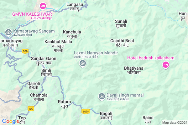
Partoli Map
EDIT Map
Add Your House
 ..
..
Current Corona Virus Infected Patients Count in Chamoli District
| City Name | District Name | Total Covid cases |
|---|
Locality Name :
Partoli
( पारटोली )
Block Name : Karnaprayag
District : Chamoli
State : Uttarakhand
Language : Hindi and Urdu
Current Time 12:42 PM
Date: Sunday , Apr 27,2025 (IST)
Time zone: IST (UTC+5:30)
Elevation / Altitude: 369 meters. Above Seal level
Telephone Code / Std Code: 01372
Assembly constituency : Karanprayag assembly constituency
Assembly MLA : Anil Nautiyal
Lok Sabha constituency : Garhwal parliamentary constituency
Parliament MP : Tirath Singh Rawat
Serpanch Name :
Pin Code : 246488
Post Office Name : Nainisain
Main Village Name : Partoli
Commodities Prices : Ramnagar Market / Mandi
Partoli Live Weather
Temperature: 34.0 °C
overcast clouds
Humidity: 10%
Wind : 1.31 mt/sec towards W
StationName : "Uttarakhand"
observed on Now
Temperature: 34.0 °C
overcast clouds
Humidity: 10%
Wind : 1.31 mt/sec towards W
StationName : "Uttarakhand"
observed on Now
Partoli Weather Forecast for Next 5 days
28-04-2025
13.0°C to 28.8°C
overcast clouds, broken clouds, clear sky
13.0°C to 28.8°C
overcast clouds, broken clouds, clear sky
29-04-2025
12.3°C to 30.4°C
clear sky, few clouds, scattered clouds, broken clouds
12.3°C to 30.4°C
clear sky, few clouds, scattered clouds, broken clouds
30-04-2025
13.1°C to 30.9°C
broken clouds, clear sky, scattered clouds, overcast clouds
13.1°C to 30.9°C
broken clouds, clear sky, scattered clouds, overcast clouds
01-05-2025
13.3°C to 31.0°C
few clouds, clear sky, light rain, overcast clouds
13.3°C to 31.0°C
few clouds, clear sky, light rain, overcast clouds
02-05-2025
11.9°C to 28.3°C
broken clouds, light rain, moderate rain, heavy intensity rain, overcast clouds
11.9°C to 28.3°C
broken clouds, light rain, moderate rain, heavy intensity rain, overcast clouds
National Highways Reachable To Partoli
Nationa High Way :NH107
Nationa High Way :NH309
Nationa High Way :NH107
Nationa High Way :NH309
Rivers Near Partoli
Kuman Gad
Alaknanda :Alaknanda River :अलकनन्दा नदी :ಅಲಕನಂದಾ
Kuman Gad
Alaknanda :Alaknanda River :अलकनन्दा नदी :ಅಲಕನಂದಾ
About Partoli
Correct below Info and add more info about PartoliPartoli is a small Village/hamlet in Karnaprayag Block in Chamoli District of Uttarakhand State, India. It comes under Partoli Panchayath. It is located 22 KM towards South from District head quarters Chamoli Gopeshwar. 4 KM from Karnaprayag. 143 KM from State capital Dehradun
Partoli Pin code is 246488 and postal head office is Nainisain .
Ganoli ( 3 KM ) , Khatyari ( 3 KM ) , Kankhul Talla ( 3 KM ) , Kuneth ( 3 KM ) , Kankhul Malla ( 4 KM ) are the nearby Villages to Partoli. Partoli is surrounded by Ghat Block towards East , Pokhari Block towards North , Narayanbagar Block towards South , Dasholi Block towards North .
Pauri , Almora , Tehri , Chamba are the near by Cities to Partoli.
This Place is in the border of the Chamoli District and Tehri Garhwal District. Tehri Garhwal District Deoprayag is west towards this place .
Partoli 2011 Census Details
Partoli Local Language is Hindi. Partoli Village Total population is 104 and number of houses are 26. Female Population is 51.9%. Village literacy rate is 73.1% and the Female Literacy rate is 29.8%.
Population
| Census Parameter | Census Data |
| Total Population | 104 |
| Total No of Houses | 26 |
| Female Population % | 51.9 % ( 54) |
| Total Literacy rate % | 73.1 % ( 76) |
| Female Literacy rate | 29.8 % ( 31) |
| Scheduled Tribes Population % | 0.0 % ( 0) |
| Scheduled Caste Population % | 0.0 % ( 0) |
| Working Population % | 13.5 % |
| Child(0 -6) Population by 2011 | 10 |
| Girl Child(0 -6) Population % by 2011 | 50.0 % ( 5) |
Partoli Census More Deatils.
Politics in Partoli
BJP , NCP , INC are the major political parties in this area.Polling Stations /Booths near Partoli
1)Kheti2)Jakh
3)Silanga
4)Pindwali
5)Kirsal
HOW TO REACH Partoli
By Rail
There is no railway station near to Partoli in less than 10 km.Colleges near Partoli
Govt Inter College Ghandiyal, Karnprayg, Chamoli
Address : Ghandiyal
Schools in Partoli
Ps Partoli
Address : partoli , karanprayag , chamoli , Uttarakhand . PIN- 246488 , Post - Nainisain
Govt Health Centers near Partoli
1) Health Sub Center Erani , SC Erani , ,2) APHC Pipalkhoti , APHC Pipalkhoti , ,
3) Health Sub Center Gadora , Gadora , Panchayat Bhawan ,
Sub Villages in Partoli
Hospitals in Partoli,Karnaprayag
Government Hospital
Almora-Bageshwar-Gopeshwar Road; Chopata; Uttarakhand 246453; India
10.4 KM distance Detail
D.R Memorial ortho Physio Care
Karanprayag Padli Rd; Simli; Uttarakhand 246444; India
10.5 KM distance Detail
more ..
Petrol Bunks in Partoli,Karnaprayag
Gmou Filling Station Hindustan Petroleum
Chamoli; NH-58; Badrinath Road; Joshimath; Joshimath; Uttarakhand 246474; India
11.0 KM distance Detail
HP PETROL PUMP - GARHWAL MOTOR OWNERS UNION LTD.
Karanprayag DT. Badrinath Road; Dehradun; 246444; India
11.1 KM distance Detail
more ..
Colleges in Partoli,Karnaprayag
Govt. Degree College
Pokhari Road; Devtoli; Karnaprayag; Chamoli; Uttarakhand 246444; India
10.6 KM distance Detail
more ..
Schools in Partoli,Karnaprayag
Government Primary School
Ased - Chopata Road; Pharkot; Uttarakhand 246453; India
9.4 KM distance Detail
Government Girls Junior High School
Chopta; Khaintoli; Uttarakhand 246453; India
10.2 KM distance Detail
Electronic Shops in Partoli,Karnaprayag
Asha Radios
Karanprayag Main Bazar Rd; Karnaprayag; Uttarakhand 246444; India
10.7 KM distance Detail
Super Markets in Partoli,Karnaprayag
Gunjan Daily Need Store
upper market;near sab medical;karnprayag; uttrakhand; 246444; India
10.8 KM distance Detail
Governement Offices near Partoli,Karnaprayag
Uttarakhand Forest Authority
Nagrasu; Chamoli; NH-58; Badrinath Road; Joshimath; Joshimath; Uttarakhand 246422; India
10.8 KM distance Detail
About Partoli &
History
How to reach Partoli
Tourist Places Near By Partoli
Schools in Partoli
Colleges in Partoli
Temperature & weather of Partoli
places in Partoli
Partoli photos
More Information
How to reach Partoli
Tourist Places Near By Partoli
Schools in Partoli
Colleges in Partoli
Temperature & weather of Partoli
places in Partoli
Partoli photos
More Information
Village Talk
Post News or Events about this Village
Near Cities
Pauri 58 KM near
Almora 87 KM near
Tehri 90 KM near
Chamba 97 KM near
Pauri 58 KM near
Almora 87 KM near
Tehri 90 KM near
Chamba 97 KM near
Near By Taluks
Karnaprayag 4 KM near
Ghat 15 KM near
Narayanbagar 16 KM near
Pokhari 16 KM near
Karnaprayag 4 KM near
Ghat 15 KM near
Narayanbagar 16 KM near
Pokhari 16 KM near
Near By Air Ports
Dehra Dun Airport 137 KM near
Pantnagar Airport 151 KM near
Muzaffarnagar Airport 203 KM near
Simla Airport 255 KM near
Dehra Dun Airport 137 KM near
Pantnagar Airport 151 KM near
Muzaffarnagar Airport 203 KM near
Simla Airport 255 KM near
Near By Tourist Places
Gauchar 17 KM near
Valley of Flowers 20 KM near
Gairsain 21 KM near
Gopeshwar 22 KM near
Chopta 31 KM near
Gauchar 17 KM near
Valley of Flowers 20 KM near
Gairsain 21 KM near
Gopeshwar 22 KM near
Chopta 31 KM near
Near By Districts
Chamoli 21 KM near
Rudra Prayag 35 KM near
Pauri Garhwal 58 KM near
Bageshwar 70 KM near
Chamoli 21 KM near
Rudra Prayag 35 KM near
Pauri Garhwal 58 KM near
Bageshwar 70 KM near
Near By RailWay Station
Ramnagar Rail Way Station 107 KM near
Raiwala Junction Rail Way Station 121 KM near
Ramnagar Rail Way Station 107 KM near
Raiwala Junction Rail Way Station 121 KM near