| Home | City Bus | Maps | Villages | Cities | Rail | Tourist Places | School | College | Pin Codes | Corona Cases Count |
| Distance Calculator Bus Services IFSC Codes Trace Mobile Number Weather Search Place Trace IP Available Cash ATM/Banks Locate Polling Booth Report an Error contact People |
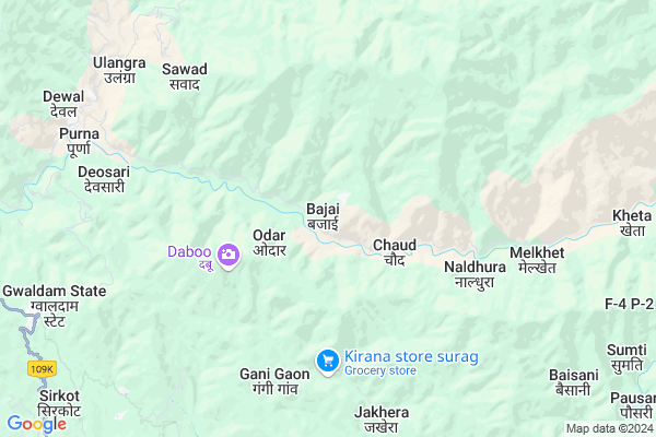
Bajai
Bajai Map
EDIT Map
Add Your House
 ..
..
Current Corona Virus Infected Patients Count in Chamoli District
| City Name | District Name | Total Covid cases |
|---|
Locality Name :
Bajai
( बजे )
Block Name : Dewal
District : Chamoli
State : Uttarakhand
Language : Hindi and Urdu
Current Time 06:09 AM
Date: Saturday , Apr 26,2025 (IST)
Time zone: IST (UTC+5:30)
Elevation / Altitude: 345 meters. Above Seal level
Telephone Code / Std Code: 05963
Assembly constituency : Tharali assembly constituency
Assembly MLA : Bhupal Ram Tamta
Lok Sabha constituency : Garhwal parliamentary constituency
Parliament MP : Tirath Singh Rawat
Serpanch Name :
Pin Code : 246427
Post Office Name : Debal
Main Village Name : Bajai
Commodities Prices : Ramnagar Market / Mandi
Bajai Live Weather
Temperature: 11.9 °C
overcast clouds
Humidity: 22%
Wind : 2.91 mt/sec towards N
StationName : "BÄ\u0081geshwar"
observed on 1 Hours Back
Temperature: 11.9 °C
overcast clouds
Humidity: 22%
Wind : 2.91 mt/sec towards N
StationName : "BÄ\u0081geshwar"
observed on 1 Hours Back
Bajai Weather Forecast for Next 5 days
27-04-2025
11.2°C to 25.5°C
overcast clouds, broken clouds, scattered clouds
11.2°C to 25.5°C
overcast clouds, broken clouds, scattered clouds
28-04-2025
12.8°C to 24.7°C
broken clouds, overcast clouds, light rain
12.8°C to 24.7°C
broken clouds, overcast clouds, light rain
29-04-2025
12.6°C to 25.6°C
overcast clouds, broken clouds, scattered clouds, light rain, few clouds, clear sky
12.6°C to 25.6°C
overcast clouds, broken clouds, scattered clouds, light rain, few clouds, clear sky
30-04-2025
12.9°C to 26.1°C
clear sky, few clouds, light rain, scattered clouds, broken clouds, overcast clouds
12.9°C to 26.1°C
clear sky, few clouds, light rain, scattered clouds, broken clouds, overcast clouds
Rivers Near Bajai
Ramganga
Saryu
Ramganga
Saryu
About Bajai
Correct below Info and add more info about BajaiBajai is a small Village/hamlet in Dewal Block in Chamoli District of Uttarakhand State, India. It comes under Bajai Panchayath. It is located 62 KM towards South from District head quarters Chamoli Gopeshwar. 5 KM from Dewal (Selkhola). 186 KM from State capital Dehradun
Bajai Pin code is 246427 and postal head office is Debal .
Mopata ( 4 KM ) , Palwara ( 5 KM ) , Padmala ( 5 KM ) , Naldhura ( 6 KM ) , Sawad ( 6 KM ) are the nearby Villages to Bajai. Bajai is surrounded by Garur Block towards South , Tharali Block towards west , Narayanbagar Block towards west , Takula Block towards South .
Almora , Pithoragarh , Nainital , Pauri are the near by Cities to Bajai.
This Place is in the border of the Chamoli District and Pauri Garhwal District. Pauri Garhwal District Thalisain is west towards this place .
Bajai 2011 Census Details
Bajai Local Language is Hindi. Bajai Village Total population is 44 and number of houses are 14. Female Population is 56.8%. Village literacy rate is 68.2% and the Female Literacy rate is 25.0%.
Population
| Census Parameter | Census Data |
| Total Population | 44 |
| Total No of Houses | 14 |
| Female Population % | 56.8 % ( 25) |
| Total Literacy rate % | 68.2 % ( 30) |
| Female Literacy rate | 25.0 % ( 11) |
| Scheduled Tribes Population % | 0.0 % ( 0) |
| Scheduled Caste Population % | 0.0 % ( 0) |
| Working Population % | 0.0 % |
| Child(0 -6) Population by 2011 | 1 |
| Girl Child(0 -6) Population % by 2011 | 100.0 % ( 1) |
Bajai Census More Deatils.
Politics in Bajai
BJP , BJP , INC are the major political parties in this area.Polling Stations /Booths near Bajai
1)Ramni2)Geri
3)Sitel
4)Lankhi
5)Tharali
HOW TO REACH Bajai
By Rail
There is no railway station near to Bajai in less than 10 km.Colleges near Bajai
Govt Inter College Ghandiyal, Karnprayg, Chamoli
Address : Ghandiyal
Government Inter Collage
Address :
Govt Inter Collage Rohida
Address :
Gic Bhagawati
Address :
G I C Lolti
Address :
Schools near Bajai
Gms Rain
Address : rain , dewal , chamoli , Uttarakhand . PIN- 246427 , Post - Debal
Gic Melkhet
Address : melkhet , dewal , chamoli , Uttarakhand . PIN- 246427 , Post - Debal
Gic Mundoli
Address : mundoli , dewal , chamoli , Uttarakhand . PIN- 246427 , Post - Debal
Gic Dewal
Address : selkhola , dewal , chamoli , Uttarakhand . PIN- 246427 , Post - Debal
Govt Health Centers near Bajai
1) Bamsera SC , Bamsera ANM Center , Ayartoli Road ,2) Health Sub Center Harmal , SC Harmal , ,
3) Health Sub Center Ghes , SC Ghes , , Near Water Tank
Sub Villages in Bajai
Petrol Bunks in Bajai,Dewal
HP PETROL PUMP - BAJRANG OILS BAIJNATH
Baijnath Garur PO Baijnath DT U.A.; Dehradun; 263641; India
16.4 KM distance Detail
Bajrang Oil Hindustan Petroleum
Bajnath; Bageshwar; SH-11; Bageshwar Road; Bageshwar; Bageshwar; Uttarakhand 263669; India
16.5 KM distance Detail
Bajrang Oils
Karanprayag Gwaldam Bageshwar Almora Nainital Rd; Syalde; Uttarakhand 263641; India
16.5 KM distance Detail
more ..
Super Markets in Bajai,Dewal
Police Stations near Bajai,Dewal
Police Station Baijnath
Karanprayag Gwaldam Bageshwar Almora Nainital Rd; Syalde; Uttarakhand 263641; India
16.6 KM distance Detail
Governement Offices near Bajai,Dewal
Sub Treasury Office Garur
Garur - Bageshwar Rd; Syalde; Uttarakhand 263641; India
16.6 KM distance Detail
District Magistrate Office
Bajnath; Bageshwar; SH-11; Bageshwar Road; Bageshwar; Bageshwar; Uttarakhand 263669; India
16.6 KM distance Detail
About Bajai &
History
How to reach Bajai
Tourist Places Near By Bajai
Schools in Bajai
Colleges in Bajai
Temperature & weather of Bajai
places in Bajai
Bajai photos
More Information
How to reach Bajai
Tourist Places Near By Bajai
Schools in Bajai
Colleges in Bajai
Temperature & weather of Bajai
places in Bajai
Bajai photos
More Information
Village Talk
Post News or Events about this Village
Near Cities
Almora 53 KM near
Pithoragarh 82 KM near
Nainital 83 KM near
Pauri 96 KM near
Almora 53 KM near
Pithoragarh 82 KM near
Nainital 83 KM near
Pauri 96 KM near
Near By Taluks
Dewal 5 KM near
Garur 15 KM near
Tharali 17 KM near
Bageshwar 31 KM near
Dewal 5 KM near
Garur 15 KM near
Tharali 17 KM near
Bageshwar 31 KM near
Near By Air Ports
Pantnagar Airport 125 KM near
Dehra Dun Airport 178 KM near
Muzaffarnagar Airport 227 KM near
Simla Airport 301 KM near
Pantnagar Airport 125 KM near
Dehra Dun Airport 178 KM near
Muzaffarnagar Airport 227 KM near
Simla Airport 301 KM near
Near By Tourist Places
Kasauni 24 KM near
Bageshwar 26 KM near
Dwarahat 39 KM near
Binsar 40 KM near
Gairsain 40 KM near
Kasauni 24 KM near
Bageshwar 26 KM near
Dwarahat 39 KM near
Binsar 40 KM near
Gairsain 40 KM near
Near By Districts
Bageshwar 26 KM near
Almora 53 KM near
Chamoli 60 KM near
Rudra Prayag 79 KM near
Bageshwar 26 KM near
Almora 53 KM near
Chamoli 60 KM near
Rudra Prayag 79 KM near
Near By RailWay Station
Kathgodam Rail Way Station 95 KM near
Ramnagar Rail Way Station 98 KM near
Kathgodam Rail Way Station 95 KM near
Ramnagar Rail Way Station 98 KM near