| Home | City Bus | Maps | Villages | Cities | Rail | Tourist Places | School | College | Pin Codes | Corona Cases Count |
| Distance Calculator Bus Services IFSC Codes Trace Mobile Number Weather Search Place Trace IP Available Cash ATM/Banks Locate Polling Booth Report an Error contact People |
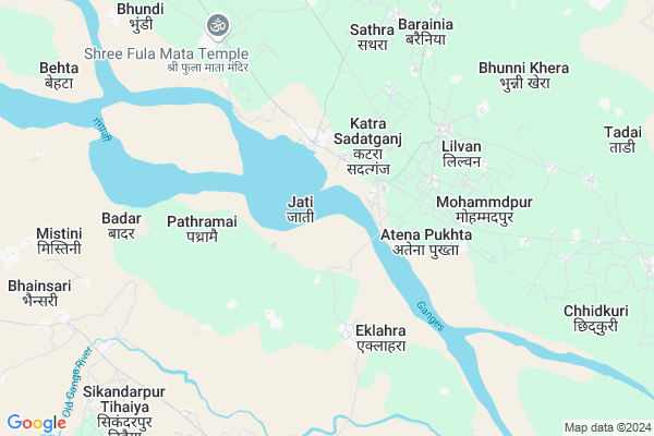
Khajura Kham
Khajura Kham Map
EDIT Map
Add Your House
 ..
..
Current Corona Virus Infected Patients Count in Budaun District
| City Name | District Name | Total Covid cases |
|---|---|---|
| Budaun District | Budaun | 14 |
Locality Name :
Khajura Kham
( खजुरा ख़म )
Block Name : Usawan
District : Budaun
State : Uttar Pradesh
Division : Bareilly
Language : Hindi and Urdu
Current Time 03:28 PM
Date: Tuesday , Apr 29,2025 (IST)
Time zone: IST (UTC+5:30)
Elevation / Altitude: 161 meters. Above Seal level
Telephone Code / Std Code: 05831
Assembly constituency : Dataganj assembly constituency
Assembly MLA : Rajeev Singh Urf Babbu Bhaiya
Lok Sabha constituency : Aonla parliamentary constituency
Parliament MP : DHARMENDRA KASHYAP
Serpanch Name :
Main Village Name : Khajura Kham
Commodities Prices : Kayamganj Market / Mandi
Khajura Kham Live Weather
Temperature: 38.1 °C
broken clouds
Humidity: 18%
Wind : 4.87 mt/sec towards E
StationName : "Kampil"
observed on 1 Hours Back
Temperature: 38.1 °C
broken clouds
Humidity: 18%
Wind : 4.87 mt/sec towards E
StationName : "Kampil"
observed on 1 Hours Back
Khajura Kham Weather Forecast for Next 5 days
30-04-2025
28.8°C to 38.5°C
scattered clouds, few clouds, clear sky
28.8°C to 38.5°C
scattered clouds, few clouds, clear sky
01-05-2025
27.0°C to 40.5°C
clear sky, broken clouds
27.0°C to 40.5°C
clear sky, broken clouds
02-05-2025
28.6°C to 41.7°C
scattered clouds, clear sky, few clouds
28.6°C to 41.7°C
scattered clouds, clear sky, few clouds
03-05-2025
28.4°C to 41.3°C
scattered clouds, broken clouds, clear sky, light rain
28.4°C to 41.3°C
scattered clouds, broken clouds, clear sky, light rain
04-05-2025
28.3°C to 41.5°C
broken clouds
28.3°C to 41.5°C
broken clouds
Rivers Near Khajura Kham
East Bahgul Nadi
Deoha River :Deoha River
East Bahgul Nadi
Deoha River :Deoha River
About Khajura Kham
Correct below Info and add more info about Khajura KhamKhajura Kham is a small Village/hamlet in Usawan Block in Budaun District of Uttar Pradesh State, India. It comes under Khajura Kham Panchayath. It belongs to Bareilly Division . It is located 49 KM towards South from District head quarters Budaun. 10 KM from Usawan Dehat. 220 KM from State capital Lucknow
Bhakroli ( 2 KM ) , Katra Sadatganj ( 2 KM ) , Atena Pukhta ( 3 KM ) , Kheda Jalalpur Kham ( 3 KM ) , Mugarra Mahanagar ( 3 KM ) are the nearby Villages to Khajura Kham. Khajura Kham is surrounded by Kaimganj Block towards South , Kalan Block towards East , Mion Block towards North , Aliganj Block towards South .
Shamsabad, Farrukhabad , Budaun , Sahawar , Farrukhabad are the near by Cities to Khajura Kham.
Khajura Kham 2011 Census Details
Khajura Kham Local Language is Hindi. Khajura Kham Village Total population is 197 and number of houses are 44. Female Population is 46.2%. Village literacy rate is 11.2% and the Female Literacy rate is 1.5%.
Population
| Census Parameter | Census Data |
| Total Population | 197 |
| Total No of Houses | 44 |
| Female Population % | 46.2 % ( 91) |
| Total Literacy rate % | 11.2 % ( 22) |
| Female Literacy rate | 1.5 % ( 3) |
| Scheduled Tribes Population % | 0.0 % ( 0) |
| Scheduled Caste Population % | 0.0 % ( 0) |
| Working Population % | 28.9 % |
| Child(0 -6) Population by 2011 | 31 |
| Girl Child(0 -6) Population % by 2011 | 48.4 % ( 15) |
Khajura Kham Census More Deatils.
Politics in Khajura Kham
BJP , SP , BSP , INC are the major political parties in this area.Polling Stations /Booths near Khajura Kham
1)Pr. School Room No. 1 Karimpur Pactaur2)Pr. School Room No. 1 Nagla Gujar M. Basela
3)Pr. School Room No. 1 Khetal Nagla M. Kheda Kishni Pukhta
4)Pr. School Room No. 2 Kaman
5)Pr. School Room No 1. Kheda Kishni Pukhta
HOW TO REACH Khajura Kham
By Rail
There is no railway station near to Khajura Kham in less than 10 km.Pincodes near Khajura Kham
243641 ( Usehat ) , 243621 ( Usawan ) , 207505 ( Kampil )Colleges near Khajura Kham
Choudhary Niyaz Muhammad Degree College
Address :
Hari Ram Satya Narayan Istitute Of Higher Education
Address :
Radhika Devi Inter College
Address :
Shanti Devi Memorial Kanya Inter College
Address :
Shree Ramchandra Shastri Memorial Inter College Kakora Budaun
Address : Vill And Post Kakora
Schools near Khajura Kham
Mahatma Gandhi Inter College
Address : usanwa , usawa , budaun , Uttar Pradesh . PIN- 243641 , Post - Usehat
Ups. Babai Bhatpura
Address : babai bhatpura , usawa , budaun , Uttar Pradesh . PIN- 243641 , Post - Usehat
Ups. Garia Chaura
Address : garia choora , usawa , budaun , Uttar Pradesh . PIN- 243641 , Post - Usehat
Ups. Tikra
Address : tikra , usawa , budaun , Uttar Pradesh . PIN- 243641 , Post - Usehat
Govt Health Centers near Khajura Kham
1) Pilua , , ,2) Barakala , , , SUB CENTRVILLAGE .BARAKALA
3) Jakhiya , , village jakhiya , sub centre jakhiya
Sub Villages in Khajura Kham
Petrol Bunks in Khajura Kham,Usawan
HP PETROL PUMP - HUMARA PUMP KHEDAJALALPUR
Khedajalalpur Usait; Moti katra Road; Mantola; Agra; Uttar Pradesh 243641; India
6.3 KM distance Detail
HP PETROL PUMP - SHRI SHYAM HAMARA PUMP
Ushait Kakarala Road Ushait Ushait; Agra; Uttar Pradesh 243641; India
15.2 KM distance Detail
HP PETROL PUMP - SHIV HP POINT
Hpcl Dealer Vill- Bharramai; ON SH 43 Kalan-badaun Road; Kalan; Lucknow; Uttar Pradesh 242237; India
16.1 KM distance Detail
Shiv Shakti Filling Station Indian Oil Petrol Pump
Usawan; Budaun; SH-43; Badaun Farrukhabad Road; Budaun; Budaun; Uttar Pradesh 243641; India
18.6 KM distance Detail
more ..
Colleges in Khajura Kham,Usawan
Gautam Buddh Nemchandra Singh Inter college Bhakroli Budaun
Bhakroli; Uttar Pradesh 243641; India
3.4 KM distance Detail
Bhagwan and Singh Memorial Inter College
Dharampur; Budaun; SH-43; Badaun Farrukhabad Road; Budaun; Budaun; Uttar Pradesh 243641; India
21.9 KM distance Detail
Satyadev Vidhya Peeth Inter College
Jawhar Nagla; Budaun; SH-43; Badaun Farrukhabad Road; Budaun; Budaun; Uttar Pradesh 243641; India
22.7 KM distance Detail
more ..
Schools in Khajura Kham,Usawan
A.S.PUBLIC SCHOOL
Ushait-Kacchapul Road; Usahait; Uttar Pradesh 243641; India
15.0 KM distance Detail
Local Parks in Khajura Kham,Usawan
Governement Offices near Khajura Kham,Usawan
About Khajura Kham &
History
How to reach Khajura Kham
Tourist Places Near By Khajura Kham
Schools in Khajura Kham
Colleges in Khajura Kham
Temperature & weather of Khajura Kham
places in Khajura Kham
Khajura Kham photos
More Information
How to reach Khajura Kham
Tourist Places Near By Khajura Kham
Schools in Khajura Kham
Colleges in Khajura Kham
Temperature & weather of Khajura Kham
places in Khajura Kham
Khajura Kham photos
More Information
Village Talk
Post News or Events about this Village
Near Cities
Shamsabad, Farrukhabad 24 KM near
Budaun 47 KM near
Sahawar 51 KM near
Farrukhabad 54 KM near
Shamsabad, Farrukhabad 24 KM near
Budaun 47 KM near
Sahawar 51 KM near
Farrukhabad 54 KM near
Near By Taluks
Usawan 10 KM near
Kaimganj 13 KM near
Kalan 16 KM near
Mion 24 KM near
Usawan 10 KM near
Kaimganj 13 KM near
Kalan 16 KM near
Mion 24 KM near
Near By Air Ports
Kheria Airport 160 KM near
Pantnagar Airport 168 KM near
Kanpur Airport 202 KM near
Gwalior Airport 209 KM near
Kheria Airport 160 KM near
Pantnagar Airport 168 KM near
Kanpur Airport 202 KM near
Gwalior Airport 209 KM near
Near By Tourist Places
Kannauj 103 KM near
Aligarh 135 KM near
Moradabad 152 KM near
Naimisharanya 154 KM near
Agra 155 KM near
Kannauj 103 KM near
Aligarh 135 KM near
Moradabad 152 KM near
Naimisharanya 154 KM near
Agra 155 KM near
Near By Districts
Budaun 46 KM near
Farrukhabad 50 KM near
Mainpuri 64 KM near
Etah 71 KM near
Budaun 46 KM near
Farrukhabad 50 KM near
Mainpuri 64 KM near
Etah 71 KM near
Near By RailWay Station
Farrukhabad Junction Rail Way Station 49 KM near
Fatehgarh Rail Way Station 54 KM near
Farrukhabad Junction Rail Way Station 49 KM near
Fatehgarh Rail Way Station 54 KM near