| Home | City Bus | Maps | Villages | Cities | Rail | Tourist Places | School | College | Pin Codes | Corona Cases Count |
| Distance Calculator Bus Services IFSC Codes Trace Mobile Number Weather Search Place Trace IP Available Cash ATM/Banks Locate Polling Booth Report an Error contact People |
Sekar
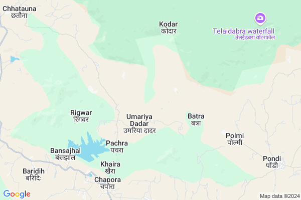
Sekar Map
EDIT Map
Add Your House
 ..
..
Current Corona Virus Infected Patients Count in Bilaspur District
| City Name | District Name | Total Covid cases |
|---|---|---|
| Bilaspur | Bilaspur | 1 |
Locality Name :
Sekar
( सेकर )
Tehsil Name : Kota
District : Bilaspur
State : Chattisgarh
Language : Chhattisgarhi and Hindi, Agariya, Bagheli
Current Time 09:32 AM
Date: Wednesday , Apr 30,2025 (IST)
Time zone: IST (UTC+5:30)
Elevation / Altitude: 325 meters. Above Seal level
Telephone Code / Std Code: 07753
Assembly constituency : Kota assembly constituency
Assembly MLA : Atal Shrivastava
Lok Sabha constituency : Bilaspur parliamentary constituency
Parliament MP : ARUN SAO
Serpanch Name :
Main Village Name : Sekar
Alternate Village Name : SEKAR
Commodities Prices : Ratanpur Market / Mandi
Sekar Live Weather
Temperature: 26.3 °C
overcast clouds
Humidity: 49%
Wind : 1.58 mt/sec towards SE
StationName : "Ratanpur"
observed on 1 Hours Back
Temperature: 26.3 °C
overcast clouds
Humidity: 49%
Wind : 1.58 mt/sec towards SE
StationName : "Ratanpur"
observed on 1 Hours Back
Sekar Weather Forecast for Next 5 days
01-05-2025
25.4°C to 38.1°C
broken clouds, few clouds, light rain, clear sky
25.4°C to 38.1°C
broken clouds, few clouds, light rain, clear sky
02-05-2025
24.0°C to 40.5°C
clear sky, light rain, broken clouds, scattered clouds
24.0°C to 40.5°C
clear sky, light rain, broken clouds, scattered clouds
03-05-2025
23.6°C to 40.7°C
clear sky, light rain, broken clouds
23.6°C to 40.7°C
clear sky, light rain, broken clouds
04-05-2025
22.9°C to 38.9°C
scattered clouds, clear sky, moderate rain, broken clouds
22.9°C to 38.9°C
scattered clouds, clear sky, moderate rain, broken clouds
05-05-2025
25.1°C to 42.2°C
scattered clouds, broken clouds, light rain, overcast clouds
25.1°C to 42.2°C
scattered clouds, broken clouds, light rain, overcast clouds
Rivers Near Sekar
Arharan
Arpa
Arharan
Arpa
About Sekar
Correct below Info and add more info about SekarSekar is a small Village/hamlet in Kota Tehsil in Bilaspur District of Chattisgarh State, India. It comes under Sekar Panchayath. It is located 46 KM towards North from District head quarters Bilaspur. 19 KM from Kota. 165 KM from State capital Raipur
Pudu ( 6 KM ) , Chapora ( 8 KM ) , Khaira ( 9 KM ) , Parsa Pani ( 10 KM ) , Baridih ( 11 KM ) are the nearby Villages to Sekar. Sekar is surrounded by Pali Tehsil towards East , Takhatpur Tehsil towards South , Bilaspur Tehsil towards South , Gaurella-1 Tehsil towards North .
Bilaspur , Bilaspur , Dipka , Akaltara are the near by Cities to Sekar.
Sekar 2011 Census Details
Sekar Local Language is Chhattisgarhi. Sekar Village Total population is 591 and number of houses are 143. Female Population is 48.6%. Village literacy rate is 55.7% and the Female Literacy rate is 20.5%.
Population
| Census Parameter | Census Data |
| Total Population | 591 |
| Total No of Houses | 143 |
| Female Population % | 48.6 % ( 287) |
| Total Literacy rate % | 55.7 % ( 329) |
| Female Literacy rate | 20.5 % ( 121) |
| Scheduled Tribes Population % | 78.8 % ( 466) |
| Scheduled Caste Population % | 4.7 % ( 28) |
| Working Population % | 51.3 % |
| Child(0 -6) Population by 2011 | 97 |
| Girl Child(0 -6) Population % by 2011 | 49.5 % ( 48) |
Sekar Census More Deatils.
Politics in Sekar
Bharatiya Janata Party , BJP , INC are the major political parties in this area.Polling Stations /Booths near Sekar
1)Sargodh2)Umaria
3)Navagaon(podi)
4)Tekarsani Vard No. 10 Gorela
5)Rigringa
HOW TO REACH Sekar
By Rail
There is no railway station near to Sekar in less than 10 km.Pincodes near Sekar
495449 ( Pali (Korba) ) , 495009 ( Koni ) , 495001 ( Bilaspur (Bilaspur-CGH) )Colleges near Sekar
Niranjan Kesharwani Collage
Address :
Schools near Sekar
Mahamaya Pub Sch Ratanpur
Address : ratanpur , kota , bilaspur (chhattisgarh) , Chattisgarh . PIN- 495442 , Post - Ratanpur (Bilaspur)
Mahamaya Sanskrity Vid Ratanpur
Address : ratanpur , kota , bilaspur (chhattisgarh) , Chattisgarh . PIN- 495442 , Post - Ratanpur (Bilaspur)
Netaji Shu.chand. Bose Ratanpu
Address : karaiha para , kota , bilaspur (chhattisgarh) , Chattisgarh . PIN- 495442 , Post - Ratanpur (Bilaspur)
Ps Ms, Adarsh Vaidik Vidya Pee
Address : kota , kota , bilaspur (chhattisgarh) , Chattisgarh . PIN- 495113 , Post - Kargi Road
Govt Health Centers near Sekar
1) SHC Pudu , , ,2) PHC Chapora , , ,
3) SHC Chapora , , ,
Sub Villages in Sekar
Hospitals in Sekar,Kota
Primary Hospital
Village - Chapora Distt - Bilaspur; Chhattisgarh; Chapora; Chhattisgarh 495442; India
8.0 KM distance Detail
more ..
Petrol Bunks in Sekar,Kota
NEW NATIONAL COMPUTER TRANING CENTER RATANPUR
Ratanpur; Chhattisgarh 495442; India
18.1 KM distance Detail
HP PETROL PUMP - SUBHASH PETROLEUM
Hpcl Petrol Pump Near Bhairon Baba Mandir Ratanpur Road; Raipur; Chhattisgarh 495442; India
20.9 KM distance Detail
more ..
Colleges in Sekar,Kota
Govt.niranjan Kesharwani College Kota
Kota-Lormi Rd; Kargi Kalan; Chhattisgarh 495113; India
23.0 KM distance Detail
Govt. Niranjan Kesharwani Arts & Comm. College Kota
Kargi Road; Kota; Bilaspur; Chhattisgarh 495113; India
23.1 KM distance Detail
more ..
Schools in Sekar,Kota
Kasturba Gandhi School
Village - Chapora Distt - Bilaspur; Chhattisgarh; Chhattisgarh; India
7.9 KM distance Detail
Government Higher Secondary School
Village - Chapora Distt - Bilaspur; Chhattisgarh; Chapora; Chhattisgarh 495442; India
8.0 KM distance Detail
Electronic Shops in Sekar,Kota
reena electricals chapora
Bilaspur - Marwahi Bypass Road; Chapora; Chhattisgarh 495442; India
7.9 KM distance Detail
Manushri Computer
Near; Gram Panchayat Bhavan; Chapora; Chhattisgarh 495442; India
8.1 KM distance Detail
KAMLESH ELECTRONIC KHAIRA
Bilaspur - Marwahi Bypass Road; Khaira; Chhattisgarh 495442; India
8.5 KM distance Detail
Super Markets in Sekar,Kota
Santosh Mobile Point
Teacher SKY Sir HN-112 Silli; Parsada; Ratanpur; Chhattisgarh 495442; India
9.1 KM distance Detail
Police Stations near Sekar,Kota
Ratanpur Police Station
NH130; BIlaspur pendra road; bhim chowk; Ratanpur; Chhattisgarh 495442; India
16.9 KM distance Detail
About Sekar &
History
How to reach Sekar
Tourist Places Near By Sekar
Schools in Sekar
Colleges in Sekar
Temperature & weather of Sekar
places in Sekar
Sekar photos
More Information
How to reach Sekar
Tourist Places Near By Sekar
Schools in Sekar
Colleges in Sekar
Temperature & weather of Sekar
places in Sekar
Sekar photos
More Information
Village Talk
Post News or Events about this Village
Near Cities
Bilaspur 41 KM near
Bilaspur 43 KM near
Dipka 45 KM near
Akaltara 56 KM near
Bilaspur 41 KM near
Bilaspur 43 KM near
Dipka 45 KM near
Akaltara 56 KM near
Near By Taluks
Kota 19 KM near
Pali 24 KM near
Takhatpur 39 KM near
Bilaspur 41 KM near
Kota 19 KM near
Pali 24 KM near
Takhatpur 39 KM near
Bilaspur 41 KM near
Near By Air Ports
Raipur Airport 161 KM near
Jabalpur Airport 260 KM near
Ranchi Airport 378 KM near
Bamrauli Airport 379 KM near
Raipur Airport 161 KM near
Jabalpur Airport 260 KM near
Ranchi Airport 378 KM near
Bamrauli Airport 379 KM near
Near By Tourist Places
Bilaspur 42 KM near
Janjgir-Champa 50 KM near
Amarkantak 56 KM near
Korba 59 KM near
Janjgir 69 KM near
Bilaspur 42 KM near
Janjgir-Champa 50 KM near
Amarkantak 56 KM near
Korba 59 KM near
Janjgir 69 KM near
Near By Districts
Bilaspur 44 KM near
Korba 61 KM near
Janjgir-Champa 92 KM near
Anuppur 101 KM near
Bilaspur 44 KM near
Korba 61 KM near
Janjgir-Champa 92 KM near
Anuppur 101 KM near
Near By RailWay Station
Belgahna Rail Way Station 15 KM near
Kargi Road Rail Way Station 22 KM near
Belgahna Rail Way Station 15 KM near
Kargi Road Rail Way Station 22 KM near