| Home | City Bus | Maps | Villages | Cities | Rail | Tourist Places | School | College | Pin Codes | Corona Cases Count |
| Distance Calculator Bus Services IFSC Codes Trace Mobile Number Weather Search Place Trace IP Available Cash ATM/Banks Locate Polling Booth Report an Error contact People |
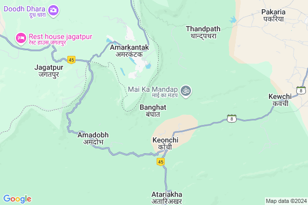
Banghat
Banghat Map
EDIT Map
Add Your House
 ..
..
Current Corona Virus Infected Patients Count in Bilaspur District
| City Name | District Name | Total Covid cases |
|---|---|---|
| Bilaspur | Bilaspur | 1 |
Locality Name :
Banghat
( बांघात )
Tehsil Name : Gaurella-2
District : Bilaspur
State : Chattisgarh
Language : Chhattisgarhi and Hindi, Agariya, Bagheli
Current Time 04:34 AM
Date: Saturday , Apr 26,2025 (IST)
Time zone: IST (UTC+5:30)
Elevation / Altitude: 589 meters. Above Seal level
Telephone Code / Std Code: 07751
Assembly constituency : Kota assembly constituency
Assembly MLA : Atal Shrivastava
Lok Sabha constituency : Bilaspur parliamentary constituency
Parliament MP : ARUN SAO
Serpanch Name :
Pin Code : 495117
Post Office Name : Pendra Road
Main Village Name : Banghat
Commodities Prices : Pendraroad Market / Mandi
Banghat Live Weather
Temperature: 26.5 °C
clear sky
Humidity: 13%
Wind : 1.52 mt/sec towards NW
StationName : "Amarkantak"
observed on Now
Temperature: 26.5 °C
clear sky
Humidity: 13%
Wind : 1.52 mt/sec towards NW
StationName : "Amarkantak"
observed on Now
Banghat Weather Forecast for Next 5 days
27-04-2025
23.2°C to 38.1°C
clear sky, broken clouds, overcast clouds, scattered clouds, light rain
23.2°C to 38.1°C
clear sky, broken clouds, overcast clouds, scattered clouds, light rain
28-04-2025
20.8°C to 33.8°C
overcast clouds, scattered clouds, few clouds, light rain, broken clouds
20.8°C to 33.8°C
overcast clouds, scattered clouds, few clouds, light rain, broken clouds
29-04-2025
19.3°C to 35.2°C
few clouds, clear sky, broken clouds, overcast clouds, scattered clouds
19.3°C to 35.2°C
few clouds, clear sky, broken clouds, overcast clouds, scattered clouds
30-04-2025
19.0°C to 35.7°C
scattered clouds, clear sky, broken clouds
19.0°C to 35.7°C
scattered clouds, clear sky, broken clouds
Rivers Near Banghat
Seoni
Chakrar
Seoni
Chakrar
About Banghat
Correct below Info and add more info about BanghatBanghat is a small Village/hamlet in Gaurella-2 Tehsil in Bilaspur District of Chattisgarh State, India. It comes under Banghat Panchayath. It is located 88 KM towards North from District head quarters Bilaspur. 21 KM from Gaurella-2. 182 KM from State capital Raipur
Banghat Pin code is 495117 and postal head office is Pendra Road .
Badhawandand ( 16 KM ) are the nearby Villages to Banghat. Banghat is surrounded by Gaurella-2 Tehsil towards East , Gaurella-1 Tehsil towards East , Pushprajgarh Tehsil towards North , Marwahi Tehsil towards North .
Pasan , Mungeli , Kotma , Bilaspur are the near by Cities to Banghat.
Banghat 2011 Census Details
Banghat Local Language is Chhattisgarhi. Banghat Village Total population is 548 and number of houses are 146. Female Population is 46.9%. Village literacy rate is 47.8% and the Female Literacy rate is 16.4%.
Population
| Census Parameter | Census Data |
| Total Population | 548 |
| Total No of Houses | 146 |
| Female Population % | 46.9 % ( 257) |
| Total Literacy rate % | 47.8 % ( 262) |
| Female Literacy rate | 16.4 % ( 90) |
| Scheduled Tribes Population % | 94.3 % ( 517) |
| Scheduled Caste Population % | 0.0 % ( 0) |
| Working Population % | 61.3 % |
| Child(0 -6) Population by 2011 | 111 |
| Girl Child(0 -6) Population % by 2011 | 45.0 % ( 50) |
Banghat Census More Deatils.
Politics in Banghat
Bharatiya Janata Party , BJP , INC are the major political parties in this area.Polling Stations /Booths near Banghat
1)Kendadand2)Amadob
3)Vicharpur
4)Tenganmuda
5)Pachara
HOW TO REACH Banghat
By Rail
There is no railway station near to Banghat in less than 10 km.Colleges near Banghat
Govt. Pataleshwar College Masturi
Address :
Institute Of Technology Guru Ghasidas University Bilaspur
Address :
Governmet Iti Takhatpur
Address :
Niranjan Kesharwani Collage
Address :
Governmet Jpm College Takhatpur
Address :
Schools near Banghat
Ps Ms, Oxford Sch. Pendraroad
Address : pendra road , gourela , bilaspur (chhattisgarh) , Chattisgarh . PIN- 495117 , Post - Pendra Road
Govt.ups.modal School Sarbahara
Address : sar bahra , gourela , bilaspur (chhattisgarh) , Chattisgarh . PIN- 495117 , Post - Pendra Road
Pvt, Wisdom Wey School Gourela
Address : gourela , gourela , bilaspur (chhattisgarh) , Chattisgarh . PIN- 495117 , Post - Pendra Road
Pvt, Parmanad Sanskrit S.gorakhpur
Address : gourela , gourela , bilaspur (chhattisgarh) , Chattisgarh . PIN- 495117 , Post - Pendra Road
Govt Health Centers near Banghat
1) PHC Keonchi , , ,2) SHC Keonchi , , ,
3) SHC Thadpathara , , ,
Sub Villages in Banghat
Hospitals in Banghat,Gaurella-2
Onkar Shobha Multi Speciality Hospital
SH 8; Gaurella; Chhattisgarh 495117; India
20.4 KM distance Detail
ONKAR SHOBHA HOSPITAL PENDRA ROAD GAURELLA
AMARKANTAK ROAD GAURELLA; NEAR GOYAL PETROL PUMP; GAURELLA; Chhattisgarh 495117; India
20.5 KM distance Detail
Tamrakar clinic and Dental care
SH 8; Bilaspur; Gaurella; Chhattisgarh 495117; India
20.8 KM distance Detail
more ..
Petrol Bunks in Banghat,Gaurella-2
HP PETROL PUMP - GOYAL AUTOMOBILES
HPC Dealer P.O. Dist. (CG); Pendra Rd; Bilaspur; Gaurella; Chhattisgarh 495117; India
20.1 KM distance Detail
Hindustan Petroleum
Tikarsani; Bilaspur; SH-8; Gareilla Road; Gareilla; Gareilla; Chhattisgarh 495117; India
20.3 KM distance Detail
more ..
Colleges in Banghat,Gaurella-2
Pt. Madhav Rao Sapre Govt. Girls College
Pendra Road; Bilaspur; Chhattisgarh 495117; India
20.7 KM distance Detail
Govt. Pt. Madhav Rao Sapre College
Bilaspur; Gaurella; Chhattisgarh 495117; India
21.8 KM distance Detail
more ..
Schools in Banghat,Gaurella-2
Government Primary School
Padarkoni; Bilaspur; SH-8; Bilaspur; Bilaspur; Chhattisgarh 495117; India
17.4 KM distance Detail
Govt. P. S. Kasaibahra Sadhwani
Sadhwani; Pendraroad; Chhattisgarh 495117; India
19.1 KM distance Detail
Electronic Shops in Banghat,Gaurella-2
Ambey Computers
Ambey bhavan; Rest House Road; Bilaspur; Pendraroad; Chhattisgarh 495117; India
20.9 KM distance Detail
Governement Offices near Banghat,Gaurella-2
water resourses divition marwahi (head quater -PENDRAROAD)
Gaurella; Chhattisgarh 495117; India
19.3 KM distance Detail
About Banghat &
History
How to reach Banghat
Tourist Places Near By Banghat
Schools in Banghat
Colleges in Banghat
Temperature & weather of Banghat
places in Banghat
Banghat photos
More Information
How to reach Banghat
Tourist Places Near By Banghat
Schools in Banghat
Colleges in Banghat
Temperature & weather of Banghat
places in Banghat
Banghat photos
More Information
Village Talk
Post News or Events about this Village
Near Cities
Pasan 67 KM near
Mungeli 73 KM near
Kotma 73 KM near
Bilaspur 81 KM near
Pasan 67 KM near
Mungeli 73 KM near
Kotma 73 KM near
Bilaspur 81 KM near
Near By Taluks
Karanjiya 19 KM near
Gaurella-2 19 KM near
Gaurella-1 32 KM near
Pushprajgarh 39 KM near
Karanjiya 19 KM near
Gaurella-2 19 KM near
Gaurella-1 32 KM near
Pushprajgarh 39 KM near
Near By Air Ports
Raipur Airport 182 KM near
Jabalpur Airport 212 KM near
Khajuraho Airport 342 KM near
Bamrauli Airport 347 KM near
Raipur Airport 182 KM near
Jabalpur Airport 212 KM near
Khajuraho Airport 342 KM near
Bamrauli Airport 347 KM near
Near By Tourist Places
Amarkantak 3 KM near
Bilaspur 82 KM near
Kawardha 100 KM near
Janjgir-Champa 103 KM near
Korba 111 KM near
Amarkantak 3 KM near
Bilaspur 82 KM near
Kawardha 100 KM near
Janjgir-Champa 103 KM near
Korba 111 KM near
Near By Districts
Anuppur 58 KM near
Bilaspur 85 KM near
Dindori 86 KM near
Shahdol 94 KM near
Anuppur 58 KM near
Bilaspur 85 KM near
Dindori 86 KM near
Shahdol 94 KM near
Near By RailWay Station
Pendra Road Rail Way Station 19 KM near
Belgahna Rail Way Station 40 KM near
Pendra Road Rail Way Station 19 KM near
Belgahna Rail Way Station 40 KM near