| Home | City Bus | Maps | Villages | Cities | Rail | Tourist Places | School | College | Pin Codes | Corona Cases Count |
| Distance Calculator Bus Services IFSC Codes Trace Mobile Number Weather Search Place Trace IP Available Cash ATM/Banks Locate Polling Booth Report an Error contact People |
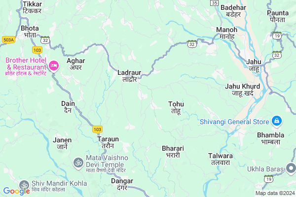
Samlah
Samlah Map
EDIT Map
Add Your House
 ..
..
Current Corona Virus Infected Patients Count in Bilaspur District District
| City Name | District Name | Total Covid cases |
|---|
Locality Name :
Samlah
( सामलाः )
Tehsil Name : Ghumarwin
District : Bilaspur District
State : Himachal Pradesh
Language : Hindi
Current Time 03:13 PM
Date: Tuesday , Apr 29,2025 (IST)
Time zone: IST (UTC+5:30)
Elevation / Altitude: 375 meters. Above Seal level
Telephone Code / Std Code: 01978
Assembly constituency : Ghumarwin assembly constituency
Assembly MLA : Rajesh Dharmani
Lok Sabha constituency : Hamirpur parliamentary constituency
Parliament MP : ANURAG SINGH THAKUR
Serpanch Name :
Pin Code : 174028
Post Office Name : Hatwar
Main Village Name : Samlah
Commodities Prices : Hamirpur Market / Mandi
National Highways Reachable To Samlah
Nationa High Way :NH205
Nationa High Way :NH503A
Nationa High Way :NH205
Nationa High Way :NH503A
Rivers Near Samlah
Sutlej :Sutlej River :सतलुज नदी :ਸਤਲੁਜ :ستلج
Bakhli Khad
Sutlej :Sutlej River :सतलुज नदी :ਸਤਲੁਜ :ستلج
Bakhli Khad
About Samlah
Correct below Info and add more info about SamlahSamlah is a small Village/hamlet in Ghumarwin Tehsil in Bilaspur District District of Himachal Pradesh State, India. It comes under Samlah Panchayath. It is located 32 KM towards North from District head quarters Bilaspur,. 17 KM from Ghumarwin. 84 KM from State capital Shimla
Samlah Pin code is 174028 and postal head office is Hatwar .
Hambot ( 3 KM ) , Pantehra ( 3 KM ) , Taroun ( 3 KM ) , Hatwar ( 4 KM ) , Lehri Sarail ( 4 KM ) are the nearby Villages to Samlah. Samlah is surrounded by Bijhri Tehsil towards west , Bamson Tehsil towards North , Ghumarwin Tehsil towards South , Hamirpur Tehsil towards North .
Hamirpur , Sundarnagar , Mandi , Nangal are the near by Cities to Samlah.
This Place is in the border of the Bilaspur District District and Hamirpur District. Hamirpur District Bijhri is west towards this place . Also it is in the Border of other district Mandi .
Samlah 2011 Census Details
Samlah Local Language is Hindi. Samlah Village Total population is 225 and number of houses are 57. Female Population is 48.9%. Village literacy rate is 84.0% and the Female Literacy rate is 39.1%.
Population
| Census Parameter | Census Data |
| Total Population | 225 |
| Total No of Houses | 57 |
| Female Population % | 48.9 % ( 110) |
| Total Literacy rate % | 84.0 % ( 189) |
| Female Literacy rate | 39.1 % ( 88) |
| Scheduled Tribes Population % | 3.6 % ( 8) |
| Scheduled Caste Population % | 16.9 % ( 38) |
| Working Population % | 46.7 % |
| Child(0 -6) Population by 2011 | 25 |
| Girl Child(0 -6) Population % by 2011 | 56.0 % ( 14) |
Samlah Census More Deatils.
Politics in Samlah
Bharatiya Janata Party , BJP , INC are the major political parties in this area.Polling Stations /Booths near Samlah
1)G.m.s.-chhanjiyar2)Mahila Mandal Bhawan-duhgali
3)G.p.s.-susnal
4)G.s.s.s.-kothi (nothern Part)
5)G.p.s.-kathlag
HOW TO REACH Samlah
By Rail
There is no railway station near to Samlah in less than 10 km.Colleges near Samlah
G.d.c. Jukhala
Address :
Schools near Samlah
Gsss Barota
Address : barota , ghumarwin-i , bilaspur (h.p.) , Himachal Pradesh . PIN- 174027 , Post - Lehri Sarail
Shiksha Academy Pub.sch. Ghumarwin
Address : ghumarwin , ghumarwin-ii , bilaspur (h.p.) , Himachal Pradesh . PIN- 174001 , Post - Bilaspur (Bilaspur- HP)
Gsss Malyawer
Address : malyawar , ghumarwin-ii , bilaspur (h.p.) , Himachal Pradesh . PIN- 174004 , Post - Kandraur
Gsss Marhana
Address : marhana , ghumarwin-i , bilaspur (h.p.) , Himachal Pradesh . PIN- 174028 , Post - Hatwar
Govt Health Centers near Samlah
1) Karer SC , VPO Karer Tehsil Barsar Distt. Hamirpur H.P. , Karer ,2) Dhaned Seribaloni PHC , VPO Dhaned Tehsil &Distt. Hamirpur H.P. , Dhaned ,
3) Phahal SC , V.P.O. Phahal Tehsil Nadaun Distt. Hamirpur H.P. , Phahal ,
Sub Villages in Samlah
Hospitals in Samlah,Ghumarwin
Health Care Ayurvedic Clinic
Ladraur - Ghumarwin Link Road; Ghandalwin; Himachal Pradesh 176043; India
1.7 KM distance Detail
Aapka Hospital
Lathwan; Hamirpur; SH-32; Una Jahu Nerchowk Road; Jahu; Jahu; Himachal Pradesh 176043; India
1.8 KM distance Detail
more ..
Petrol Bunks in Samlah,Ghumarwin
Hindustan Petroleum
32; Una - Jahu - Nerchowk Rd; Jahu; Himachal Pradesh 176043; India
2.1 KM distance Detail
HP PETROL PUMP - SATPAL FILLING STATION
H PC Petrol Pump Village AND Post Office Dangar Tehsil Ghumarwin; Shimla; Himachal Pradesh 174023; India
6.6 KM distance Detail
Hindustan Petroleum
Dangar; Bilaspur; NH-88; Shimla Kangra Road; Lehri Sarel; Lehri Sarel; Himachal Pradesh 174021; India
7.0 KM distance Detail
more ..
Colleges in Samlah,Ghumarwin
Shri Saraswati Sanskrit Degree College
Nihari - Dadhol Kalan Rd; Dangar; Himachal Pradesh 174023; India
7.1 KM distance Detail
Career Point University
Bhoranj (Tikker - kharwarian); MDR 35; Himachal Pradesh 176041; India
7.4 KM distance Detail
Republic College of India
Una - Jahu - Nerchowk Rd; Jahu; Himachal Pradesh 176048; India
7.9 KM distance Detail
more ..
Schools in Samlah,Ghumarwin
Government Middle School
Una-Jahu-Nerchowk Rd; Himachal Pradesh 176049; India
0.2 KM distance Detail
Radha Krishan Senior Secondry Public School
Ghandalwin; Himachal Pradesh 176049; India
0.8 KM distance Detail
Santoshi Mata Public School
Lathwan; Hamirpur; SH-32; Una Jahu Nerchowk Road; Jahu; Jahu; Himachal Pradesh 176043; India
1.8 KM distance Detail
Electronic Shops in Samlah,Ghumarwin
SHREE KRISHNA ELECTRICAL PATTA
Una - Jahu - Nerchowk Rd; Jharlog; Patta; Himachal Pradesh 176041; India
5.2 KM distance Detail
Governement Offices near Samlah,Ghumarwin
Panchayat Office
Una - Jahu - Nerchowk Rd; Jahu; Himachal Pradesh 176048; India
8.1 KM distance Detail
About Samlah &
History
How to reach Samlah
Tourist Places Near By Samlah
Schools in Samlah
Colleges in Samlah
Temperature & weather of Samlah
places in Samlah
Samlah photos
More Information
How to reach Samlah
Tourist Places Near By Samlah
Schools in Samlah
Colleges in Samlah
Temperature & weather of Samlah
places in Samlah
Samlah photos
More Information
Village Talk
Post News or Events about this Village
Near Cities
Hamirpur 19 KM near
Sundarnagar 25 KM near
Mandi 35 KM near
Nangal 37 KM near
Hamirpur 19 KM near
Sundarnagar 25 KM near
Mandi 35 KM near
Nangal 37 KM near
Near By Taluks
Bhoranj 5 KM near
Bijhri 13 KM near
Bamson 14 KM near
Ghumarwin 16 KM near
Bhoranj 5 KM near
Bijhri 13 KM near
Bamson 14 KM near
Ghumarwin 16 KM near
Near By Air Ports
Bhuntar Airport 70 KM near
Simla Airport 77 KM near
Gaggal Airport 99 KM near
Chandigarh Airport 112 KM near
Bhuntar Airport 70 KM near
Simla Airport 77 KM near
Gaggal Airport 99 KM near
Chandigarh Airport 112 KM near
Near By Tourist Places
Rewalsar 21 KM near
Mandi 35 KM near
Una 42 KM near
Jawalaji 51 KM near
Chindi 60 KM near
Rewalsar 21 KM near
Mandi 35 KM near
Una 42 KM near
Jawalaji 51 KM near
Chindi 60 KM near
Near By Districts
Hamirpur 19 KM near
Bilaspur District 30 KM near
Mandi 33 KM near
Una 42 KM near
Hamirpur 19 KM near
Bilaspur District 30 KM near
Mandi 33 KM near
Una 42 KM near
Near By RailWay Station
Nangal Dam Rail Way Station 38 KM near
Anandpur Sahib Rail Way Station 45 KM near
Nangal Dam Rail Way Station 38 KM near
Anandpur Sahib Rail Way Station 45 KM near