| Home | City Bus | Maps | Villages | Cities | Rail | Tourist Places | School | College | Pin Codes | Corona Cases Count |
| Distance Calculator Bus Services IFSC Codes Trace Mobile Number Weather Search Place Trace IP Available Cash ATM/Banks Locate Polling Booth Report an Error contact People |
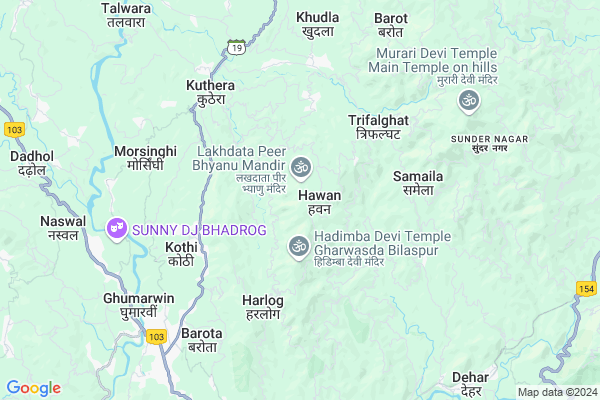
Nunahli
Nunahli Map
EDIT Map
Add Your House
 ..
..
Current Corona Virus Infected Patients Count in Bilaspur District District
| City Name | District Name | Total Covid cases |
|---|
Locality Name :
Nunahli
( नुनहली )
Tehsil Name : Ghumarwin
District : Bilaspur District
State : Himachal Pradesh
Language : Hindi
Current Time 03:23 PM
Date: Tuesday , Apr 29,2025 (IST)
Time zone: IST (UTC+5:30)
Elevation / Altitude: 375 meters. Above Seal level
Telephone Code / Std Code: 01978
Assembly constituency : Bilaspur assembly constituency
Assembly MLA : Trilok Jamwal
Lok Sabha constituency : Hamirpur parliamentary constituency
Parliament MP : ANURAG SINGH THAKUR
Serpanch Name :
Pin Code : 174021
Post Office Name : Ghumarwin
Main Village Name : Nunahli
Commodities Prices : Bilaspur Market / Mandi
Nunahli Live Weather
Temperature: 33.9 °C
clear sky
Humidity: 15%
Wind : 6.57 mt/sec towards SW
StationName : "Sundarnagar"
observed on 1 Hours Back
Temperature: 33.9 °C
clear sky
Humidity: 15%
Wind : 6.57 mt/sec towards SW
StationName : "Sundarnagar"
observed on 1 Hours Back
Nunahli Weather Forecast for Next 5 days
30-04-2025
21.0°C to 34.1°C
clear sky
21.0°C to 34.1°C
clear sky
01-05-2025
20.1°C to 36.6°C
few clouds, broken clouds, scattered clouds, clear sky
20.1°C to 36.6°C
few clouds, broken clouds, scattered clouds, clear sky
02-05-2025
18.7°C to 36.9°C
broken clouds, scattered clouds, few clouds, light rain, overcast clouds
18.7°C to 36.9°C
broken clouds, scattered clouds, few clouds, light rain, overcast clouds
03-05-2025
18.7°C to 36.5°C
overcast clouds, broken clouds, moderate rain, light rain
18.7°C to 36.5°C
overcast clouds, broken clouds, moderate rain, light rain
04-05-2025
20.0°C to 34.1°C
overcast clouds, light rain, broken clouds
20.0°C to 34.1°C
overcast clouds, light rain, broken clouds
National Highways Reachable To Nunahli
Nationa High Way :NH205
Nationa High Way :NH503A
Nationa High Way :NH205
Nationa High Way :NH503A
Rivers Near Nunahli
Sutlej :Sutlej River :सतलुज नदी :ਸਤਲੁਜ :ستلج
Bakhli Khad
Sutlej :Sutlej River :सतलुज नदी :ਸਤਲੁਜ :ستلج
Bakhli Khad
About Nunahli
Correct below Info and add more info about NunahliNunahli is a small Village/hamlet in Ghumarwin Tehsil in Bilaspur District District of Himachal Pradesh State, India. It comes under Nunahli Panchayath. It is located 17 KM towards North from District head quarters Bilaspur,. 9 KM from Ghumarwin. 67 KM from State capital Shimla
Nunahli Pin code is 174021 and postal head office is Ghumarwin .
Talyana ( 3 KM ) , Harlog ( 3 KM ) , Bhulswai ( 4 KM ) , Kothi ( 4 KM ) , Kuthera ( 5 KM ) are the nearby Villages to Nunahli. Nunahli is surrounded by Jhandutta Tehsil towards west , Bhoranj Tehsil towards North , Balh Tehsil towards East , Bilaspur Tehsil towards South .
Sundarnagar , Mandi , Hamirpur , Nangal are the near by Cities to Nunahli.
This Place is in the border of the Bilaspur District District and Hamirpur District. Hamirpur District Bijhri is west towards this place . Also it is in the Border of other district Mandi .
Nunahli 2011 Census Details
Nunahli Local Language is Hindi. Nunahli Village Total population is 147 and number of houses are 32. Female Population is 51.0%. Village literacy rate is 72.1% and the Female Literacy rate is 34.7%.
Population
| Census Parameter | Census Data |
| Total Population | 147 |
| Total No of Houses | 32 |
| Female Population % | 51.0 % ( 75) |
| Total Literacy rate % | 72.1 % ( 106) |
| Female Literacy rate | 34.7 % ( 51) |
| Scheduled Tribes Population % | 0.0 % ( 0) |
| Scheduled Caste Population % | 0.0 % ( 0) |
| Working Population % | 59.9 % |
| Child(0 -6) Population by 2011 | 17 |
| Girl Child(0 -6) Population % by 2011 | 35.3 % ( 6) |
Nunahli Census More Deatils.
Politics in Nunahli
Bharatiya Janata Party , BJP , INC are the major political parties in this area.Polling Stations /Booths near Nunahli
1)G.s.s.s.- Bahlchurani2)G.s.s.s.- Gavalmuthani
3)G.p.s.-raura
4)G.m.s.- Parnali
5)G.m.s.- Badhyat
HOW TO REACH Nunahli
By Rail
There is no railway station near to Nunahli in less than 10 km.Colleges near Nunahli
G.d.c. Jukhala
Address :
Schools near Nunahli
Gsss Barota
Address : barota , ghumarwin-i , bilaspur (h.p.) , Himachal Pradesh . PIN- 174027 , Post - Lehri Sarail
Shiksha Academy Pub.sch. Ghumarwin
Address : ghumarwin , ghumarwin-ii , bilaspur (h.p.) , Himachal Pradesh . PIN- 174001 , Post - Bilaspur (Bilaspur- HP)
Gsss Malyawer
Address : malyawar , ghumarwin-ii , bilaspur (h.p.) , Himachal Pradesh . PIN- 174004 , Post - Kandraur
Gsss Marhana
Address : marhana , ghumarwin-i , bilaspur (h.p.) , Himachal Pradesh . PIN- 174028 , Post - Hatwar
Govt Health Centers near Nunahli
1) Battal PHC , NA , NA , Near GDC2) Karer SC , VPO Karer Tehsil Barsar Distt. Hamirpur H.P. , Karer ,
3) Dhaned Seribaloni PHC , VPO Dhaned Tehsil &Distt. Hamirpur H.P. , Dhaned ,
Sub Villages in Nunahli
Hospitals in Nunahli,Ghumarwin
Harlog Hospital
Smaila - Talyana - Harlog Rd; Harlog; Himachal Pradesh 174003; India
4.0 KM distance Detail
more ..
Petrol Bunks in Nunahli,Ghumarwin
Reliance Petroleum
NH-88;MS-101;VILL ABDHANI; PO-TAKREHRA; DISTT; Ghumarwin; Himachal Pradesh 174021; India
7.3 KM distance Detail
RAJINDRA FILLING STATION
GHUMARWIN; BILASPURH; Himachal Pradesh 174021; India
7.7 KM distance Detail
more ..
Colleges in Nunahli,Ghumarwin
Ma Santoshi Private Industrial Training Institutes
SH 19; Balaur; Himachal Pradesh 174021; India
6.0 KM distance Detail
Adarsh College of Education
V.P.O Dehar;Mandi District; Sundar Nagar; Himachal Pradesh 175030; India
6.8 KM distance Detail
Shiv Hari Chadda Industrial Training Institute
Harkukar; SH 19; Ghumarwin; Himachal Pradesh 174021; India
6.9 KM distance Detail
Government Industrial Training Institute
SH 19; Ghumarwin; Himachal Pradesh 174021; India
7.2 KM distance Detail
more ..
Electronic Shops in Nunahli,Ghumarwin
Paras Electricals
samaila road; opp. primary govt. school;; Trifalghat; Himachal Pradesh 174021; India
3.9 KM distance Detail
Local Parks in Nunahli,Ghumarwin
Forest
Harlog To Kuh; Jangal Mehfuja Mehduda Nain Gujran; Himachal Pradesh 174003; India
6.4 KM distance Detail
Police Stations near Nunahli,Ghumarwin
Ghumarwin Police Station
Tehsil Rd; Bilaspur; Ghumarwin; Himachal Pradesh 174021; India
7.5 KM distance Detail
Sub Divisional Police Officer
Ghumarwin Link Rd; Ghumarwin; Himachal Pradesh 174021; India
7.8 KM distance Detail
Governement Offices near Nunahli,Ghumarwin
Gram Panchayat Smaila
Kuthera-Smaila Rd; Smaila; Himachal Pradesh 175034; India
5.1 KM distance Detail
About Nunahli &
History
How to reach Nunahli
Tourist Places Near By Nunahli
Schools in Nunahli
Colleges in Nunahli
Temperature & weather of Nunahli
places in Nunahli
Nunahli photos
More Information
How to reach Nunahli
Tourist Places Near By Nunahli
Schools in Nunahli
Colleges in Nunahli
Temperature & weather of Nunahli
places in Nunahli
Nunahli photos
More Information
Village Talk
Post News or Events about this Village
Near Cities
Sundarnagar 14 KM near
Mandi 34 KM near
Hamirpur 35 KM near
Nangal 42 KM near
Sundarnagar 14 KM near
Mandi 34 KM near
Hamirpur 35 KM near
Nangal 42 KM near
Near By Taluks
Ghumarwin 9 KM near
Jhandutta 16 KM near
Bhoranj 19 KM near
Balh 21 KM near
Ghumarwin 9 KM near
Jhandutta 16 KM near
Bhoranj 19 KM near
Balh 21 KM near
Near By Air Ports
Simla Airport 61 KM near
Bhuntar Airport 72 KM near
Chandigarh Airport 100 KM near
Gaggal Airport 114 KM near
Simla Airport 61 KM near
Bhuntar Airport 72 KM near
Chandigarh Airport 100 KM near
Gaggal Airport 114 KM near
Near By Tourist Places
Rewalsar 20 KM near
Mandi 34 KM near
Chindi 46 KM near
Una 52 KM near
Naldehra 58 KM near
Rewalsar 20 KM near
Mandi 34 KM near
Chindi 46 KM near
Una 52 KM near
Naldehra 58 KM near
Near By Districts
Bilaspur District 16 KM near
Mandi 33 KM near
Hamirpur 36 KM near
Una 52 KM near
Bilaspur District 16 KM near
Mandi 33 KM near
Hamirpur 36 KM near
Una 52 KM near
Near By RailWay Station
Anandpur Sahib Rail Way Station 41 KM near
Nangal Dam Rail Way Station 43 KM near
Anandpur Sahib Rail Way Station 41 KM near
Nangal Dam Rail Way Station 43 KM near