| Home | City Bus | Maps | Villages | Cities | Rail | Tourist Places | School | College | Pin Codes | Corona Cases Count |
| Distance Calculator Bus Services IFSC Codes Trace Mobile Number Weather Search Place Trace IP Available Cash ATM/Banks Locate Polling Booth Report an Error contact People |
Nihan
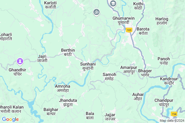
Nihan Map
EDIT Map
Add Your House
 ..
..
Current Corona Virus Infected Patients Count in Bilaspur District District
| City Name | District Name | Total Covid cases |
|---|
Locality Name :
Nihan
( निहं )
Tehsil Name : Ghumarwin
District : Bilaspur District
State : Himachal Pradesh
Language : Hindi
Current Time 03:15 PM
Date: Tuesday , Apr 29,2025 (IST)
Time zone: IST (UTC+5:30)
Elevation / Altitude: 375 meters. Above Seal level
Telephone Code / Std Code: 01978
Assembly constituency : Jhanduta assembly constituency
Assembly MLA : Jeet Ram Katwal
Lok Sabha constituency : Hamirpur parliamentary constituency
Parliament MP : ANURAG SINGH THAKUR
Serpanch Name :
Pin Code : 174034
Post Office Name : Geharwin
Main Village Name : Nihan
Commodities Prices : Bilaspur Market / Mandi
Nihan Live Weather
Temperature: 35.2 °C
clear sky
Humidity: 15%
Wind : 5.53 mt/sec towards SW
StationName : "GhumÄ\u0081rwÄ«n"
observed on 27 Mins Back
Temperature: 35.2 °C
clear sky
Humidity: 15%
Wind : 5.53 mt/sec towards SW
StationName : "GhumÄ\u0081rwÄ«n"
observed on 27 Mins Back
Nihan Weather Forecast for Next 5 days
30-04-2025
22.4°C to 34.9°C
clear sky
22.4°C to 34.9°C
clear sky
01-05-2025
21.5°C to 37.7°C
few clouds, broken clouds, scattered clouds, clear sky
21.5°C to 37.7°C
few clouds, broken clouds, scattered clouds, clear sky
02-05-2025
19.8°C to 38.0°C
broken clouds, scattered clouds, few clouds, light rain, overcast clouds
19.8°C to 38.0°C
broken clouds, scattered clouds, few clouds, light rain, overcast clouds
03-05-2025
20.0°C to 37.5°C
overcast clouds, broken clouds, moderate rain, light rain
20.0°C to 37.5°C
overcast clouds, broken clouds, moderate rain, light rain
04-05-2025
21.2°C to 35.2°C
overcast clouds, light rain, broken clouds
21.2°C to 35.2°C
overcast clouds, light rain, broken clouds
National Highways Reachable To Nihan
Nationa High Way :NH205
Nationa High Way :NH503A
Nationa High Way :NH205
Nationa High Way :NH503A
Rivers Near Nihan
Sutlej :Sutlej River :सतलुज नदी :ਸਤਲੁਜ :ستلج
Bakhli Khad
Sutlej :Sutlej River :सतलुज नदी :ਸਤਲੁਜ :ستلج
Bakhli Khad
About Nihan
Correct below Info and add more info about NihanNihan is a small Village/hamlet in Ghumarwin Tehsil in Bilaspur District District of Himachal Pradesh State, India. It comes under Nihan Panchayath. It is located 12 KM towards west from District head quarters Bilaspur,. 4 KM from Ghumarwin. 68 KM from State capital Shimla
Nihan Pin code is 174034 and postal head office is Geharwin .
Badgaon ( 3 KM ) , Jhandutta ( 3 KM ) , Barthin ( 3 KM ) , Binaula ( 3 KM ) , Amarpur ( 4 KM ) are the nearby Villages to Nihan. Nihan is surrounded by Ghumarwin Tehsil towards North , Bilaspur Tehsil towards South , Bijhri Tehsil towards North , Bhoranj Tehsil towards North .
Sundarnagar , Nangal , Hamirpur , Mandi are the near by Cities to Nihan.
This Place is in the border of the Bilaspur District District and Hamirpur District. Hamirpur District Bijhri is North towards this place . Also it is in the Border of other district Mandi .
Nihan 2011 Census Details
Nihan Local Language is Hindi. Nihan Village Total population is 75 and number of houses are 16. Female Population is 54.7%. Village literacy rate is 74.7% and the Female Literacy rate is 41.3%.
Population
| Census Parameter | Census Data |
| Total Population | 75 |
| Total No of Houses | 16 |
| Female Population % | 54.7 % ( 41) |
| Total Literacy rate % | 74.7 % ( 56) |
| Female Literacy rate | 41.3 % ( 31) |
| Scheduled Tribes Population % | 0.0 % ( 0) |
| Scheduled Caste Population % | 0.0 % ( 0) |
| Working Population % | 74.7 % |
| Child(0 -6) Population by 2011 | 9 |
| Girl Child(0 -6) Population % by 2011 | 44.4 % ( 4) |
Nihan Census More Deatils.
Politics in Nihan
Bharatiya Janata Party , BJP , INC are the major political parties in this area.Polling Stations /Booths near Nihan
1)G.p.s.-maruda2)G.p.s.-silh
3)G.p.s.-malari
4)G.m.s.-badgaon
5)G.p.s.-salasi
HOW TO REACH Nihan
By Rail
There is no railway station near to Nihan in less than 10 km.Colleges near Nihan
G.d.c. Jukhala
Address :
Schools in Nihan
Gps Nihan
Address : nihan , ghumarwin-ii , bilaspur (h.p.) , Himachal Pradesh . PIN- 174021 , Post - Ghumarwin
Govt Health Centers near Nihan
1) Karer SC , VPO Karer Tehsil Barsar Distt. Hamirpur H.P. , Karer ,2) Battal PHC , NA , NA , Near GDC
3) Dhaned Seribaloni PHC , VPO Dhaned Tehsil &Distt. Hamirpur H.P. , Dhaned ,
Sub Villages in Nihan
Hospitals in Nihan,Ghumarwin
JHARERI
A276SUNHANI-BERTHINA296SUNHANI; BERTHIN-; BERTHIN-TIHRA-SUNHANI; Berthin; Himachal Pradesh 174029; India
2.5 KM distance Detail
Bhusampada Plant Health Centre
Sahtalai road; Berthin;; Berthin; Himachal Pradesh 174029; India
3.6 KM distance Detail
Primary Hospital Amrapur
Bhager - Jhandutta Rd; Amarpur; Himachal Pradesh 174034; India
4.8 KM distance Detail
more ..
Petrol Bunks in Nihan,Ghumarwin
Shahid Ashawani Chandel Filling Station
Sargal; Himachal Pradesh 174029; India
1.9 KM distance Detail
more ..
Colleges in Nihan,Ghumarwin
Government Industrial Training Institute
Sunhani-Berthin Rd; Berthin; Himachal Pradesh 174029; India
1.9 KM distance Detail
BIT INSTITUTE BERTHIN
Bus Stop; Berthin; Berthin; Himachal Pradesh 174029; India
3.3 KM distance Detail
Shiva College of Education; Ghumarwin
National Highway 88; Ghumarwin; Bilaspur; Himachal Pradesh 174021; India
5.5 KM distance Detail
Government Degree College Jhandutta
Jhanduta Awal; Himachal Pradesh 174031; India
5.6 KM distance Detail
more ..
Electronic Shops in Nihan,Ghumarwin
himachal security service
bus stand; Ghumarwin; Himachal Pradesh 174029; India
2.9 KM distance Detail
CSC Aadhaar Kendra
Village and Post office 174003; Berthin; Himachal Pradesh 174003; India
3.1 KM distance Detail
Gautam Electrical Store
school road Berthin District-Bilaspur Himachal pardesh; Berthin; Himachal Pradesh 174024; India
3.2 KM distance Detail
Local Parks in Nihan,Ghumarwin
Reserved Forest Area Ghumarwin
Ghumarwin-Berthin-Talai-Bhakra Rd; Ghumarwin; Himachal Pradesh 174021; India
5.5 KM distance Detail
Forest
Harlog To Kuh; Jangal Mehfuja Mehduda Nain Gujran; Himachal Pradesh 174003; India
10.9 KM distance Detail
Police Stations near Nihan,Ghumarwin
Sub Divisional Police Officer
Ghumarwin Link Rd; Ghumarwin; Himachal Pradesh 174021; India
5.8 KM distance Detail
Governement Offices near Nihan,Ghumarwin
Himachal Pradesh Public Works Department
Sunhani-Berthin Rd; Gocher; Berthin; Himachal Pradesh 174029; India
2.6 KM distance Detail
About Nihan &
History
How to reach Nihan
Tourist Places Near By Nihan
Schools in Nihan
Colleges in Nihan
Temperature & weather of Nihan
places in Nihan
Nihan photos
More Information
How to reach Nihan
Tourist Places Near By Nihan
Schools in Nihan
Colleges in Nihan
Temperature & weather of Nihan
places in Nihan
Nihan photos
More Information
Village Talk
Post News or Events about this Village
Near Cities
Sundarnagar 27 KM near
Nangal 31 KM near
Hamirpur 37 KM near
Mandi 47 KM near
Sundarnagar 27 KM near
Nangal 31 KM near
Hamirpur 37 KM near
Mandi 47 KM near
Near By Taluks
Jhandutta 3 KM near
Ghumarwin 4 KM near
Bilaspur 17 KM near
Bijhri 21 KM near
Jhandutta 3 KM near
Ghumarwin 4 KM near
Bilaspur 17 KM near
Bijhri 21 KM near
Near By Air Ports
Simla Airport 62 KM near
Bhuntar Airport 84 KM near
Chandigarh Airport 92 KM near
Ludhiana Airport 108 KM near
Simla Airport 62 KM near
Bhuntar Airport 84 KM near
Chandigarh Airport 92 KM near
Ludhiana Airport 108 KM near
Near By Tourist Places
Rewalsar 32 KM near
Una 43 KM near
Mandi 47 KM near
Chindi 53 KM near
Rupnagar 57 KM near
Rewalsar 32 KM near
Una 43 KM near
Mandi 47 KM near
Chindi 53 KM near
Rupnagar 57 KM near
Near By Districts
Bilaspur District 12 KM near
Hamirpur 37 KM near
Una 43 KM near
Mandi 45 KM near
Bilaspur District 12 KM near
Hamirpur 37 KM near
Una 43 KM near
Mandi 45 KM near
Near By RailWay Station
Anandpur Sahib Rail Way Station 28 KM near
Nangal Dam Rail Way Station 31 KM near
Anandpur Sahib Rail Way Station 28 KM near
Nangal Dam Rail Way Station 31 KM near