| Home | City Bus | Maps | Villages | Cities | Rail | Tourist Places | School | College | Pin Codes | Corona Cases Count |
| Distance Calculator Bus Services IFSC Codes Trace Mobile Number Weather Search Place Trace IP Available Cash ATM/Banks Locate Polling Booth Report an Error contact People |
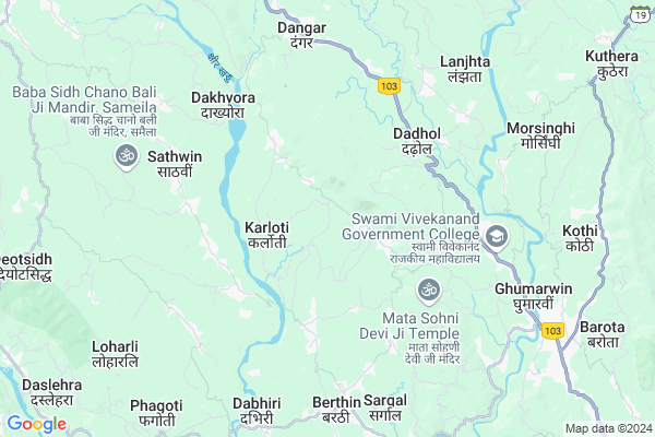
Khungan
Khungan Map
EDIT Map
Add Your House
 ..
..
Current Corona Virus Infected Patients Count in Bilaspur District District
| City Name | District Name | Total Covid cases |
|---|
Locality Name :
Khungan
( कहुंगाँ )
Tehsil Name : Ghumarwin
District : Bilaspur District
State : Himachal Pradesh
Language : Hindi
Current Time 03:23 PM
Date: Tuesday , Apr 29,2025 (IST)
Time zone: IST (UTC+5:30)
Elevation / Altitude: 375 meters. Above Seal level
Telephone Code / Std Code: 01978
Assembly constituency : Ghumarwin assembly constituency
Assembly MLA : Rajesh Dharmani
Lok Sabha constituency : Hamirpur parliamentary constituency
Parliament MP : ANURAG SINGH THAKUR
Serpanch Name :
Main Village Name : Khungan
Commodities Prices : Bilaspur Market / Mandi
Khungan Live Weather
Temperature: 35.6 °C
clear sky
Humidity: 14%
Wind : 4.98 mt/sec towards SW
StationName : "GhumÄ\u0081rwÄ«n"
observed on 57 Mins Back
Temperature: 35.6 °C
clear sky
Humidity: 14%
Wind : 4.98 mt/sec towards SW
StationName : "GhumÄ\u0081rwÄ«n"
observed on 57 Mins Back
Khungan Weather Forecast for Next 5 days
30-04-2025
22.2°C to 35.8°C
clear sky
22.2°C to 35.8°C
clear sky
01-05-2025
21.2°C to 38.3°C
few clouds, scattered clouds, clear sky
21.2°C to 38.3°C
few clouds, scattered clouds, clear sky
02-05-2025
20.4°C to 38.7°C
broken clouds, scattered clouds, few clouds, clear sky, light rain, overcast clouds
20.4°C to 38.7°C
broken clouds, scattered clouds, few clouds, clear sky, light rain, overcast clouds
03-05-2025
20.0°C to 37.7°C
overcast clouds, broken clouds, moderate rain, light rain
20.0°C to 37.7°C
overcast clouds, broken clouds, moderate rain, light rain
04-05-2025
20.6°C to 35.8°C
overcast clouds, light rain, broken clouds, moderate rain
20.6°C to 35.8°C
overcast clouds, light rain, broken clouds, moderate rain
National Highways Reachable To Khungan
Nationa High Way :NH205
Nationa High Way :NH503A
Nationa High Way :NH205
Nationa High Way :NH503A
Rivers Near Khungan
Sutlej :Sutlej River :सतलुज नदी :ਸਤਲੁਜ :ستلج
Bakhli Khad
Sutlej :Sutlej River :सतलुज नदी :ਸਤਲੁਜ :ستلج
Bakhli Khad
About Khungan
Correct below Info and add more info about KhunganKhungan is a small Village/hamlet in Ghumarwin Tehsil in Bilaspur District District of Himachal Pradesh State, India. It comes under Khungan Panchayath. It is located 21 KM towards North from District head quarters Bilaspur,. 5 KM from Ghumarwin. 76 KM from State capital Shimla
Dadhol ( 3 KM ) , Chhat ( 4 KM ) , Padyalag ( 4 KM ) , Seu ( 4 KM ) , Kotlu Brahmna ( 4 KM ) are the nearby Villages to Khungan. Khungan is surrounded by Jhandutta Tehsil towards South , Bijhri Tehsil towards west , Bhoranj Tehsil towards North , Bamson Tehsil towards North .
Sundarnagar , Hamirpur , Nangal , Mandi are the near by Cities to Khungan.
This Place is in the border of the Bilaspur District District and Hamirpur District. Hamirpur District Bijhri is west towards this place . Also it is in the Border of other district Mandi .
Demographics of Khungan
Hindi is the Local Language here.Politics in Khungan
Bharatiya Janata Party , BJP , INC are the major political parties in this area.Polling Stations /Booths near Khungan
1)Panchayat Ghar Lehari Sarhel2)G.p.s.-kanjyan
3)G.h.s.-amarpur
4)G.p.s.-peharwin
5)G.m.s.-bum (saletposh)
HOW TO REACH Khungan
By Rail
There is no railway station near to Khungan in less than 10 km.Pincodes near Khungan
176039 ( Chakmoh ) , 176040 ( Bijhari ) , 176042 ( Mair )Colleges near Khungan
G.d.c. Jukhala
Address :
Schools near Khungan
Gsss Barota
Address : barota , ghumarwin-i , bilaspur (h.p.) , Himachal Pradesh . PIN- 174027 , Post - Lehri Sarail
Shiksha Academy Pub.sch. Ghumarwin
Address : ghumarwin , ghumarwin-ii , bilaspur (h.p.) , Himachal Pradesh . PIN- 174001 , Post - Bilaspur (Bilaspur- HP)
Gsss Malyawer
Address : malyawar , ghumarwin-ii , bilaspur (h.p.) , Himachal Pradesh . PIN- 174004 , Post - Kandraur
Gsss Marhana
Address : marhana , ghumarwin-i , bilaspur (h.p.) , Himachal Pradesh . PIN- 174028 , Post - Hatwar
Govt Health Centers near Khungan
1) Karer SC , VPO Karer Tehsil Barsar Distt. Hamirpur H.P. , Karer ,2) Dhaned Seribaloni PHC , VPO Dhaned Tehsil &Distt. Hamirpur H.P. , Dhaned ,
3) Phahal SC , V.P.O. Phahal Tehsil Nadaun Distt. Hamirpur H.P. , Phahal ,
Sub Villages in Khungan
Hospitals in Khungan,Ghumarwin
Govt. Dispensary
Vill. Gugga Mohra; P.O. Kaphara; Tehsil : Ghumarwin;; Khungan; Himachal Pradesh 174029; India
0.7 KM distance Detail
Govt.Ayurvedic Health Center Sandynar
Berthin-Barot Rd; Sandyar; Himachal Pradesh 174029; India
3.9 KM distance Detail
Vashisht Medical Center
Padyalag; Bilaspur; NH-88; Shimla Kangra Road; Ghumarwin; Ghumarwin; Himachal Pradesh 174021; India
4.4 KM distance Detail
more ..
Petrol Bunks in Khungan,Ghumarwin
Indian Oil Petrol Pump
Bhadrog; Bilaspur; NH-88; Shimla Kangra Road; Ghumarwin; Ghumarwin; Himachal Pradesh 174021; India
5.4 KM distance Detail
Lt Raj Kumar Petrol Pump
Shimla-Kangra Rd; Ghumarwin; Himachal Pradesh 174026; India
5.4 KM distance Detail
more ..
Colleges in Khungan,Ghumarwin
Swami Vivekanand Government College
Shimla-Kangra Rd; Ghumarwin; Himachal Pradesh 174021; India
6.0 KM distance Detail
Shri Saraswati Sanskrit Degree College
Nihari - Dadhol Kalan Rd; Dangar; Himachal Pradesh 174023; India
6.1 KM distance Detail
BIT INSTITUTE BERTHIN
Bus Stop; Berthin; Berthin; Himachal Pradesh 174029; India
6.8 KM distance Detail
more ..
Schools in Khungan,Ghumarwin
Government Senior Secondary School
Kaphara; Plasla-Chhat Link Rd; Himachal Pradesh 174029; India
0.4 KM distance Detail
Government Senior Secondary School Gallian
Karloti; Himachal Pradesh 174029; India
2.5 KM distance Detail
Electronic Shops in Khungan,Ghumarwin
Lokmitra Kendra Kasaru
Nihari-Berthin Rd; Ghumarwin; Himachal Pradesh 174023; India
3.9 KM distance Detail
Super Markets in Khungan,Ghumarwin
R/c Hardware Store
Padyalag Chowk; Shimla-Kangra Rd; Chumarwin; Himachal Pradesh 174023; India
4.4 KM distance Detail
Local Parks in Khungan,Ghumarwin
Reserved Forest Area Ghumarwin
Ghumarwin-Berthin-Talai-Bhakra Rd; Ghumarwin; Himachal Pradesh 174021; India
8.3 KM distance Detail
Forest
Harlog To Kuh; Jangal Mehfuja Mehduda Nain Gujran; Himachal Pradesh 174003; India
14.7 KM distance Detail
Police Stations near Khungan,Ghumarwin
Sub Divisional Police Officer
Ghumarwin Link Rd; Ghumarwin; Himachal Pradesh 174021; India
7.8 KM distance Detail
Ghumarwin Police Station
Tehsil Rd; Bilaspur; Ghumarwin; Himachal Pradesh 174021; India
8.3 KM distance Detail
Governement Offices near Khungan,Ghumarwin
Patwar Khana
Vill. Gugga Mohra; P.O. Kaphara; Tehsil : Ghumarwin;; Khungan; Himachal Pradesh 174029; India
0.7 KM distance Detail
About Khungan &
History
How to reach Khungan
Tourist Places Near By Khungan
Schools in Khungan
Colleges in Khungan
Temperature & weather of Khungan
places in Khungan
Khungan photos
More Information
How to reach Khungan
Tourist Places Near By Khungan
Schools in Khungan
Colleges in Khungan
Temperature & weather of Khungan
places in Khungan
Khungan photos
More Information
Village Talk
Post News or Events about this Village
Near Cities
Sundarnagar 27 KM near
Hamirpur 29 KM near
Nangal 30 KM near
Mandi 43 KM near
Sundarnagar 27 KM near
Hamirpur 29 KM near
Nangal 30 KM near
Mandi 43 KM near
Near By Taluks
Ghumarwin 5 KM near
Jhandutta 10 KM near
Bijhri 14 KM near
Bhoranj 17 KM near
Ghumarwin 5 KM near
Jhandutta 10 KM near
Bijhri 14 KM near
Bhoranj 17 KM near
Near By Air Ports
Simla Airport 69 KM near
Bhuntar Airport 80 KM near
Chandigarh Airport 100 KM near
Ludhiana Airport 110 KM near
Simla Airport 69 KM near
Bhuntar Airport 80 KM near
Chandigarh Airport 100 KM near
Ludhiana Airport 110 KM near
Near By Tourist Places
Rewalsar 28 KM near
Una 39 KM near
Mandi 43 KM near
Chindi 58 KM near
Jawalaji 60 KM near
Rewalsar 28 KM near
Una 39 KM near
Mandi 43 KM near
Chindi 58 KM near
Jawalaji 60 KM near
Near By Districts
Bilaspur District 20 KM near
Hamirpur 29 KM near
Una 39 KM near
Mandi 42 KM near
Bilaspur District 20 KM near
Hamirpur 29 KM near
Una 39 KM near
Mandi 42 KM near
Near By RailWay Station
Nangal Dam Rail Way Station 30 KM near
Anandpur Sahib Rail Way Station 33 KM near
Nangal Dam Rail Way Station 30 KM near
Anandpur Sahib Rail Way Station 33 KM near