| Home | City Bus | Maps | Villages | Cities | Rail | Tourist Places | School | College | Pin Codes | Corona Cases Count |
| Distance Calculator Bus Services IFSC Codes Trace Mobile Number Weather Search Place Trace IP Available Cash ATM/Banks Locate Polling Booth Report an Error contact People |
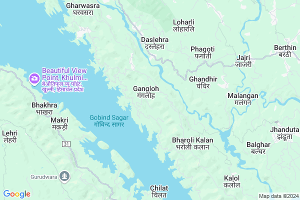
Gangloh
Gangloh Map
EDIT Map
Add Your House
 ..
..
Current Corona Virus Infected Patients Count in Bilaspur District District
| City Name | District Name | Total Covid cases |
|---|
Locality Name :
Gangloh
( गंगलाह )
Tehsil Name : Ghumarwin
District : Bilaspur District
State : Himachal Pradesh
Language : Hindi
Current Time 03:26 PM
Date: Tuesday , Apr 29,2025 (IST)
Time zone: IST (UTC+5:30)
Elevation / Altitude: 375 meters. Above Seal level
Telephone Code / Std Code: 01978
Assembly constituency : Jhanduta assembly constituency
Assembly MLA : Jeet Ram Katwal
Lok Sabha constituency : Hamirpur parliamentary constituency
Parliament MP : ANURAG SINGH THAKUR
Serpanch Name :
Pin Code : 174030
Post Office Name : Tallai
Main Village Name : Gangloh
Commodities Prices : Anandpur Sahib Market / Mandi
Gangloh Live Weather
Temperature: 37.9 °C
clear sky
Humidity: 13%
Wind : 3.4 mt/sec towards SW
StationName : "Nangal"
observed on Now
Temperature: 37.9 °C
clear sky
Humidity: 13%
Wind : 3.4 mt/sec towards SW
StationName : "Nangal"
observed on Now
Gangloh Weather Forecast for Next 5 days
30-04-2025
23.3°C to 36.1°C
clear sky
23.3°C to 36.1°C
clear sky
01-05-2025
22.2°C to 38.7°C
few clouds, broken clouds, scattered clouds, clear sky
22.2°C to 38.7°C
few clouds, broken clouds, scattered clouds, clear sky
02-05-2025
21.2°C to 39.3°C
broken clouds, scattered clouds, few clouds, clear sky, light rain, overcast clouds
21.2°C to 39.3°C
broken clouds, scattered clouds, few clouds, clear sky, light rain, overcast clouds
03-05-2025
21.0°C to 38.0°C
overcast clouds, broken clouds, moderate rain, light rain
21.0°C to 38.0°C
overcast clouds, broken clouds, moderate rain, light rain
04-05-2025
22.2°C to 36.4°C
overcast clouds, light rain, broken clouds, moderate rain
22.2°C to 36.4°C
overcast clouds, light rain, broken clouds, moderate rain
Edit below overview about Gangloh
Edit below overview about Gangloh
OverView of Gangloh
Yes I am from Village Gangloh, Present Details mentioned here is totally wrong. The correct details about Village Gangloh is as under :- (a) Sichwaytied in district Bilaspur PIN Code No 174030. (b) Nearest railway station is Una(Himachal) and Nangal dam. Shimla isvery away from Himachal. (c) Gangloh village Tehsil is now Kalol not Ghumarwin, There is High school in Village Gangloh. Nearest Primary dispensary is at Bheri, and prime health centre are at Kalol and Talai. (d) Gangloh come under Gram panchayat Sanihara and presently Mr Ram Paul is elected Pradhan of the gram panchayat sanihara. There are two colleges near village Gangloh. Govt college Jhandutta and Deot sidh college and chkmoh running under the administration of Baba balak nath trust. (e) Historic places. Shivji Mandir, at Bechhratu,Shani Mandir in Bharoli Kalan,Baba balak nath mandir talai. Bhakra Bandh etc (f) Traffic. It is linked with raod and govt buses and private transport are available.Edit below overview about Gangloh
National Highways Reachable To Gangloh
Nationa High Way :NH205
Nationa High Way :NH503A
Nationa High Way :NH205
Nationa High Way :NH503A
Rivers Near Gangloh
Sutlej :Sutlej River :सतलुज नदी :ਸਤਲੁਜ :ستلج
Bakhli Khad
Sutlej :Sutlej River :सतलुज नदी :ਸਤਲੁਜ :ستلج
Bakhli Khad
About Gangloh
Gangloh is a small Village/hamlet in Ghumarwin Tehsil in Bilaspur District District of Himachal Pradesh State, India. It comes under Gangloh Panchayath. It is located 24 KM towards west from District head quarters Bilaspur,. 15 KM from Ghumarwin. 79 KM from State capital Shimla
Gangloh Pin code is 174030 and postal head office is Tallai .
Bharoli Kalan ( 5 KM ) , Saloa ( 7 KM ) , Malangan ( 7 KM ) , Bhakhra ( 7 KM ) , Baloh ( 8 KM ) are the nearby Villages to Gangloh. Gangloh is surrounded by Ghumarwin Tehsil towards East , Anandpur Sahib Tehsil towards South , Bijhri Tehsil towards North , Bilaspur Tehsil towards East .
Nangal , Hamirpur , Sundarnagar , Rupnagar are the near by Cities to Gangloh.
This Place is in the border of the Bilaspur District District and Hamirpur District. Hamirpur District Bijhri is North towards this place . Also it is in the Border of other district Mandi .
Demographics of Gangloh
Hindi is the Local Language here.Politics in Gangloh
Bharatiya Janata Party , BJP , INC are the major political parties in this area.Polling Stations /Booths near Gangloh
1)G.h.s.-jabalu2)G.m.s.-serwa
3)G.p.s.- Dholag Chaknad
4)G.s.s.s.-gharan (nakhlehra)
5)G.h.s.-dhani
HOW TO REACH Gangloh
By Rail
There is no railway station near to Gangloh in less than 10 km.Colleges near Gangloh
G.d.c. Jukhala
Address :
Schools near Gangloh
Gsss Barota
Address : barota , ghumarwin-i , bilaspur (h.p.) , Himachal Pradesh . PIN- 174027 , Post - Lehri Sarail
Shiksha Academy Pub.sch. Ghumarwin
Address : ghumarwin , ghumarwin-ii , bilaspur (h.p.) , Himachal Pradesh . PIN- 174001 , Post - Bilaspur (Bilaspur- HP)
Gsss Malyawer
Address : malyawar , ghumarwin-ii , bilaspur (h.p.) , Himachal Pradesh . PIN- 174004 , Post - Kandraur
Gsss Marhana
Address : marhana , ghumarwin-i , bilaspur (h.p.) , Himachal Pradesh . PIN- 174028 , Post - Hatwar
Govt Health Centers near Gangloh
1) Karer SC , VPO Karer Tehsil Barsar Distt. Hamirpur H.P. , Karer ,2) Dhaned Seribaloni PHC , VPO Dhaned Tehsil &Distt. Hamirpur H.P. , Dhaned ,
3) Phahal SC , V.P.O. Phahal Tehsil Nadaun Distt. Hamirpur H.P. , Phahal ,
Sub Villages in Gangloh
Petrol Bunks in Gangloh,Ghumarwin
Shahid Ashawani Chandel Filling Station
Sargal; Himachal Pradesh 174029; India
11.8 KM distance Detail
more ..
Colleges in Gangloh,Ghumarwin
Government Degree College Jhandutta
Jhanduta Awal; Himachal Pradesh 174031; India
10.0 KM distance Detail
BIT INSTITUTE BERTHIN
Bus Stop; Berthin; Berthin; Himachal Pradesh 174029; India
10.8 KM distance Detail
Government Industrial Training Institute
Sunhani-Berthin Rd; Berthin; Himachal Pradesh 174029; India
11.9 KM distance Detail
more ..
Schools in Gangloh,Ghumarwin
Government Primary School
Berthin-Deotsidh Rd; Jangal Gangloh; Himachal Pradesh 174030; India
0.9 KM distance Detail
Government Primary School
Berthin-Deotsidh Rd; Jhamrariarn; Himachal Pradesh 176039; India
2.5 KM distance Detail
Local Parks in Gangloh,Ghumarwin
Reserved Forest Area Ghumarwin
Ghumarwin-Berthin-Talai-Bhakra Rd; Ghumarwin; Himachal Pradesh 174021; India
18.4 KM distance Detail
Police Stations near Gangloh,Ghumarwin
Sub Divisional Police Officer
Ghumarwin Link Rd; Ghumarwin; Himachal Pradesh 174021; India
18.5 KM distance Detail
Ghumarwin Police Station
Tehsil Rd; Bilaspur; Ghumarwin; Himachal Pradesh 174021; India
18.8 KM distance Detail
Governement Offices near Gangloh,Ghumarwin
Cooperative Society Bharoli Kalan
Bhater Kalan; Himachal Pradesh 174030; India
5.0 KM distance Detail
About Gangloh &
History
How to reach Gangloh
Tourist Places Near By Gangloh
Schools in Gangloh
Colleges in Gangloh
Temperature & weather of Gangloh
places in Gangloh
Gangloh photos
More Information
How to reach Gangloh
Tourist Places Near By Gangloh
Schools in Gangloh
Colleges in Gangloh
Temperature & weather of Gangloh
places in Gangloh
Gangloh photos
More Information
Village Talk
Post News or Events about this Village
Near Cities
Nangal 18 KM near
Hamirpur 36 KM near
Sundarnagar 39 KM near
Rupnagar 48 KM near
Nangal 18 KM near
Hamirpur 36 KM near
Sundarnagar 39 KM near
Rupnagar 48 KM near
Near By Taluks
Jhandutta 10 KM near
Ghumarwin 15 KM near
Anandpur Sahib 17 KM near
Bijhri 18 KM near
Jhandutta 10 KM near
Ghumarwin 15 KM near
Anandpur Sahib 17 KM near
Bijhri 18 KM near
Near By Air Ports
Simla Airport 72 KM near
Chandigarh Airport 92 KM near
Bhuntar Airport 94 KM near
Ludhiana Airport 96 KM near
Simla Airport 72 KM near
Chandigarh Airport 92 KM near
Bhuntar Airport 94 KM near
Ludhiana Airport 96 KM near
Near By Tourist Places
Una 31 KM near
Rewalsar 42 KM near
Rupnagar 52 KM near
Nawanshehar 56 KM near
Mandi 57 KM near
Una 31 KM near
Rewalsar 42 KM near
Rupnagar 52 KM near
Nawanshehar 56 KM near
Mandi 57 KM near
Near By Districts
Bilaspur District 23 KM near
Una 31 KM near
Hamirpur 37 KM near
Rupnagar 52 KM near
Bilaspur District 23 KM near
Una 31 KM near
Hamirpur 37 KM near
Rupnagar 52 KM near
Near By RailWay Station
Nangal Dam Rail Way Station 18 KM near
Anandpur Sahib Rail Way Station 20 KM near
Nangal Dam Rail Way Station 18 KM near
Anandpur Sahib Rail Way Station 20 KM near