| Home | City Bus | Maps | Villages | Cities | Rail | Tourist Places | School | College | Pin Codes | Corona Cases Count |
| Distance Calculator Bus Services IFSC Codes Trace Mobile Number Weather Search Place Trace IP Available Cash ATM/Banks Locate Polling Booth Report an Error contact People |
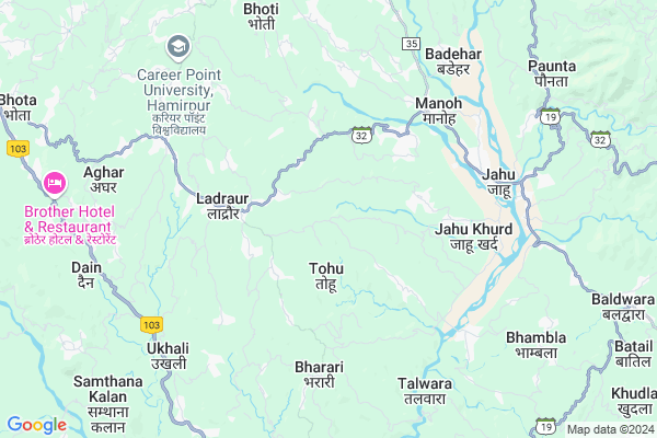
Bhatwara
Bhatwara Map
EDIT Map
Add Your House
 ..
..
Current Corona Virus Infected Patients Count in Bilaspur District District
| City Name | District Name | Total Covid cases |
|---|
Locality Name :
Bhatwara
( भटवारा )
Tehsil Name : Ghumarwin
District : Bilaspur District
State : Himachal Pradesh
Language : Hindi
Current Time 03:21 PM
Date: Tuesday , Apr 29,2025 (IST)
Time zone: IST (UTC+5:30)
Elevation / Altitude: 375 meters. Above Seal level
Telephone Code / Std Code: 01978
Assembly constituency : Ghumarwin assembly constituency
Assembly MLA : Rajesh Dharmani
Lok Sabha constituency : Hamirpur parliamentary constituency
Parliament MP : ANURAG SINGH THAKUR
Serpanch Name :
Pin Code : 174028
Post Office Name : Hatwar
Main Village Name : Bhatwara
Commodities Prices : Hamirpur Market / Mandi
Bhatwara Live Weather
Temperature: 35.4 °C
clear sky
Humidity: 14%
Wind : 4.73 mt/sec towards W
StationName : "Sarka GhÄ\u0081t"
observed on 2 Mins Back
Temperature: 35.4 °C
clear sky
Humidity: 14%
Wind : 4.73 mt/sec towards W
StationName : "Sarka GhÄ\u0081t"
observed on 2 Mins Back
Bhatwara Weather Forecast for Next 5 days
30-04-2025
20.9°C to 35.0°C
clear sky
20.9°C to 35.0°C
clear sky
01-05-2025
19.8°C to 37.8°C
few clouds, scattered clouds, clear sky
19.8°C to 37.8°C
few clouds, scattered clouds, clear sky
02-05-2025
19.3°C to 38.1°C
broken clouds, scattered clouds, few clouds, light rain, overcast clouds
19.3°C to 38.1°C
broken clouds, scattered clouds, few clouds, light rain, overcast clouds
03-05-2025
19.2°C to 37.5°C
overcast clouds, broken clouds, light rain, moderate rain
19.2°C to 37.5°C
overcast clouds, broken clouds, light rain, moderate rain
04-05-2025
19.1°C to 35.2°C
overcast clouds, light rain, broken clouds
19.1°C to 35.2°C
overcast clouds, light rain, broken clouds
National Highways Reachable To Bhatwara
Nationa High Way :NH205
Nationa High Way :NH503A
Nationa High Way :NH205
Nationa High Way :NH503A
Rivers Near Bhatwara
Sutlej :Sutlej River :सतलुज नदी :ਸਤਲੁਜ :ستلج
Bakhli Khad
Sutlej :Sutlej River :सतलुज नदी :ਸਤਲੁਜ :ستلج
Bakhli Khad
About Bhatwara
Correct below Info and add more info about BhatwaraBhatwara is a small Village/hamlet in Ghumarwin Tehsil in Bilaspur District District of Himachal Pradesh State, India. It comes under Bhatwara Panchayath. It is located 32 KM towards North from District head quarters Bilaspur,. 17 KM from Ghumarwin. 83 KM from State capital Shimla
Bhatwara Pin code is 174028 and postal head office is Hatwar .
Hambot ( 2 KM ) , Pantehra ( 2 KM ) , Hatwar ( 3 KM ) , Kot ( 4 KM ) , Bharari ( 4 KM ) are the nearby Villages to Bhatwara. Bhatwara is surrounded by Bamson Tehsil towards North , Bijhri Tehsil towards west , Ghumarwin Tehsil towards South , Hamirpur Tehsil towards west .
Hamirpur , Sundarnagar , Mandi , Nangal are the near by Cities to Bhatwara.
This Place is in the border of the Bilaspur District District and Hamirpur District. Hamirpur District Bijhri is west towards this place . Also it is in the Border of other district Mandi .
Bhatwara 2011 Census Details
Bhatwara Local Language is Hindi. Bhatwara Village Total population is 252 and number of houses are 53. Female Population is 48.0%. Village literacy rate is 80.6% and the Female Literacy rate is 34.1%.
Population
| Census Parameter | Census Data |
| Total Population | 252 |
| Total No of Houses | 53 |
| Female Population % | 48.0 % ( 121) |
| Total Literacy rate % | 80.6 % ( 203) |
| Female Literacy rate | 34.1 % ( 86) |
| Scheduled Tribes Population % | 0.0 % ( 0) |
| Scheduled Caste Population % | 7.5 % ( 19) |
| Working Population % | 58.7 % |
| Child(0 -6) Population by 2011 | 20 |
| Girl Child(0 -6) Population % by 2011 | 50.0 % ( 10) |
Bhatwara Census More Deatils.
Politics in Bhatwara
Bharatiya Janata Party , BJP , INC are the major political parties in this area.Polling Stations /Booths near Bhatwara
1)G.p.s.-susnal2)Mahila Mandal Bhawan-duhgali
3)G.m.s.-chhanjiyar
4)G.p.s.- Ghumarwin (north Part)
5)G.s.s.s.-kothi (nothern Part)
HOW TO REACH Bhatwara
By Rail
There is no railway station near to Bhatwara in less than 10 km.Colleges near Bhatwara
G.d.c. Jukhala
Address :
Schools in Bhatwara
Gms Bhatwara
Address : bhatwara , ghumarwin-i , bilaspur (h.p.) , Himachal Pradesh . PIN- 174028 , Post - Hatwar
Govt Health Centers near Bhatwara
1) Karer SC , VPO Karer Tehsil Barsar Distt. Hamirpur H.P. , Karer ,2) Dhaned Seribaloni PHC , VPO Dhaned Tehsil &Distt. Hamirpur H.P. , Dhaned ,
3) Phahal SC , V.P.O. Phahal Tehsil Nadaun Distt. Hamirpur H.P. , Phahal ,
Sub Villages in Bhatwara
Hospitals in Bhatwara,Ghumarwin
Aapka Hospital
Lathwan; Hamirpur; SH-32; Una Jahu Nerchowk Road; Jahu; Jahu; Himachal Pradesh 176043; India
3.0 KM distance Detail
more ..
Petrol Bunks in Bhatwara,Ghumarwin
Hindustan Petroleum
32; Una - Jahu - Nerchowk Rd; Jahu; Himachal Pradesh 176043; India
3.4 KM distance Detail
SHAHID DEEP FILLING STATION
JAHOO; JAHOO; HAMIRPUR; Himachal Pradesh 176048; India
6.3 KM distance Detail
Shaheed Deep Filling Station Petrol Pump
Una - Jahu - Nerchowk Rd; Lower Bhambla; Jahu; Himachal Pradesh 176048; India
6.4 KM distance Detail
more ..
Colleges in Bhatwara,Ghumarwin
Republic College of India
Una - Jahu - Nerchowk Rd; Jahu; Himachal Pradesh 176048; India
5.4 KM distance Detail
Career Point University
Bhoranj (Tikker - kharwarian); MDR 35; Himachal Pradesh 176041; India
7.5 KM distance Detail
more ..
Schools in Bhatwara,Ghumarwin
Primary School JAR BAKHUTA
Jar (Shayam Nagar; Bhoranj; Himachal Pradesh 176044; India
1.2 KM distance Detail
Radha Krishan Senior Secondry Public School
Ghandalwin; Himachal Pradesh 176049; India
2.2 KM distance Detail
Government Middle School
Una-Jahu-Nerchowk Rd; Himachal Pradesh 176049; India
2.3 KM distance Detail
Electronic Shops in Bhatwara,Ghumarwin
Bansal Electrical
Sulgwan - Bhareri Rd; Sulgwan; Himachal Pradesh 176048; India
5.1 KM distance Detail
Governement Offices near Bhatwara,Ghumarwin
Panchayat Office
Una - Jahu - Nerchowk Rd; Jahu; Himachal Pradesh 176048; India
5.5 KM distance Detail
About Bhatwara &
History
How to reach Bhatwara
Tourist Places Near By Bhatwara
Schools in Bhatwara
Colleges in Bhatwara
Temperature & weather of Bhatwara
places in Bhatwara
Bhatwara photos
More Information
How to reach Bhatwara
Tourist Places Near By Bhatwara
Schools in Bhatwara
Colleges in Bhatwara
Temperature & weather of Bhatwara
places in Bhatwara
Bhatwara photos
More Information
Village Talk
Post News or Events about this Village
Near Cities
Hamirpur 20 KM near
Sundarnagar 23 KM near
Mandi 32 KM near
Nangal 40 KM near
Hamirpur 20 KM near
Sundarnagar 23 KM near
Mandi 32 KM near
Nangal 40 KM near
Near By Taluks
Bhoranj 3 KM near
Bamson 13 KM near
Bijhri 15 KM near
Ghumarwin 17 KM near
Bhoranj 3 KM near
Bamson 13 KM near
Bijhri 15 KM near
Ghumarwin 17 KM near
Near By Air Ports
Bhuntar Airport 67 KM near
Simla Airport 77 KM near
Gaggal Airport 99 KM near
Chandigarh Airport 113 KM near
Bhuntar Airport 67 KM near
Simla Airport 77 KM near
Gaggal Airport 99 KM near
Chandigarh Airport 113 KM near
Near By Tourist Places
Rewalsar 18 KM near
Mandi 32 KM near
Una 44 KM near
Jawalaji 51 KM near
Chindi 59 KM near
Rewalsar 18 KM near
Mandi 32 KM near
Una 44 KM near
Jawalaji 51 KM near
Chindi 59 KM near
Near By Districts
Hamirpur 20 KM near
Bilaspur District 30 KM near
Mandi 31 KM near
Una 44 KM near
Hamirpur 20 KM near
Bilaspur District 30 KM near
Mandi 31 KM near
Una 44 KM near
Near By RailWay Station
Nangal Dam Rail Way Station 40 KM near
Anandpur Sahib Rail Way Station 47 KM near
Nangal Dam Rail Way Station 40 KM near
Anandpur Sahib Rail Way Station 47 KM near