| Home | City Bus | Maps | Villages | Cities | Rail | Tourist Places | School | College | Pin Codes | Corona Cases Count |
| Distance Calculator Bus Services IFSC Codes Trace Mobile Number Weather Search Place Trace IP Available Cash ATM/Banks Locate Polling Booth Report an Error contact People |
Bani Pandtan
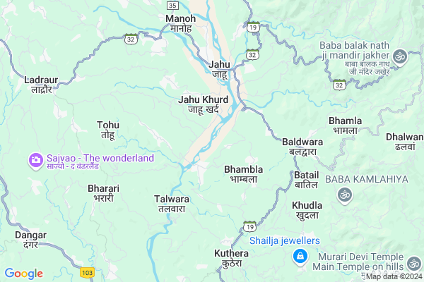
Bani Pandtan Map
EDIT Map
Add Your House
 ..
..
Current Corona Virus Infected Patients Count in Bilaspur District District
| City Name | District Name | Total Covid cases |
|---|
Locality Name :
Bani Pandtan
( बानी पंडतां )
Tehsil Name : Ghumarwin
District : Bilaspur District
State : Himachal Pradesh
Language : Hindi
Current Time 03:20 PM
Date: Tuesday , Apr 29,2025 (IST)
Time zone: IST (UTC+5:30)
Elevation / Altitude: 375 meters. Above Seal level
Telephone Code / Std Code: 01978
Assembly constituency : Ghumarwin assembly constituency
Assembly MLA : Rajesh Dharmani
Lok Sabha constituency : Hamirpur parliamentary constituency
Parliament MP : ANURAG SINGH THAKUR
Serpanch Name :
Main Village Name : Bani Pandtan
Commodities Prices : Dhanotu (Mandi) Market / Mandi
Bani Pandtan Live Weather
Temperature: 35.4 °C
clear sky
Humidity: 14%
Wind : 4.73 mt/sec towards W
StationName : "Sarka GhÄ\u0081t"
observed on 2 Mins Back
Temperature: 35.4 °C
clear sky
Humidity: 14%
Wind : 4.73 mt/sec towards W
StationName : "Sarka GhÄ\u0081t"
observed on 2 Mins Back
Bani Pandtan Weather Forecast for Next 5 days
30-04-2025
20.9°C to 35.0°C
clear sky
20.9°C to 35.0°C
clear sky
01-05-2025
19.8°C to 37.8°C
few clouds, scattered clouds, clear sky
19.8°C to 37.8°C
few clouds, scattered clouds, clear sky
02-05-2025
19.3°C to 38.1°C
broken clouds, scattered clouds, few clouds, light rain, overcast clouds
19.3°C to 38.1°C
broken clouds, scattered clouds, few clouds, light rain, overcast clouds
03-05-2025
19.2°C to 37.5°C
overcast clouds, broken clouds, light rain, moderate rain
19.2°C to 37.5°C
overcast clouds, broken clouds, light rain, moderate rain
04-05-2025
19.1°C to 35.2°C
overcast clouds, light rain, broken clouds
19.1°C to 35.2°C
overcast clouds, light rain, broken clouds
National Highways Reachable To Bani Pandtan
Nationa High Way :NH205
Nationa High Way :NH503A
Nationa High Way :NH205
Nationa High Way :NH503A
Rivers Near Bani Pandtan
Sutlej :Sutlej River :सतलुज नदी :ਸਤਲੁਜ :ستلج
Bakhli Khad
Sutlej :Sutlej River :सतलुज नदी :ਸਤਲੁਜ :ستلج
Bakhli Khad
About Bani Pandtan
Correct below Info and add more info about Bani PandtanBani Pandtan is a small Village/hamlet in Ghumarwin Tehsil in Bilaspur District District of Himachal Pradesh State, India. It comes under Bani Pandtan Panchayath. It is located 28 KM towards North from District head quarters Bilaspur,. 16 KM from Ghumarwin. 78 KM from State capital Shimla
Salaon Uparli ( 3 KM ) , Pantehra ( 3 KM ) , Kot ( 3 KM ) , Ladda ( 3 KM ) , Makri ( 4 KM ) are the nearby Villages to Bani Pandtan. Bani Pandtan is surrounded by Ghumarwin Tehsil towards South , Bamson Tehsil towards North , Bijhri Tehsil towards west , Balh Tehsil towards East .
Sundarnagar , Hamirpur , Mandi , Nangal are the near by Cities to Bani Pandtan.
This Place is in the border of the Bilaspur District District and Hamirpur District. Hamirpur District Bijhri is west towards this place . Also it is in the Border of other district Mandi .
Bani Pandtan 2011 Census Details
Bani Pandtan Local Language is Hindi. Bani Pandtan Village Total population is 166 and number of houses are 37. Female Population is 48.2%. Village literacy rate is 79.5% and the Female Literacy rate is 36.1%.
Population
| Census Parameter | Census Data |
| Total Population | 166 |
| Total No of Houses | 37 |
| Female Population % | 48.2 % ( 80) |
| Total Literacy rate % | 79.5 % ( 132) |
| Female Literacy rate | 36.1 % ( 60) |
| Scheduled Tribes Population % | 0.0 % ( 0) |
| Scheduled Caste Population % | 59.0 % ( 98) |
| Working Population % | 66.3 % |
| Child(0 -6) Population by 2011 | 9 |
| Girl Child(0 -6) Population % by 2011 | 55.6 % ( 5) |
Bani Pandtan Census More Deatils.
Politics in Bani Pandtan
Bharatiya Janata Party , BJP , INC are the major political parties in this area.Polling Stations /Booths near Bani Pandtan
1)G.m.s.-bum (salaib Wala)2)G.m.s.-bari
3)G.p.s.-dayra (north Part)
4)G.p.s.-damehar
5)G.p.s.-haritalyangar
HOW TO REACH Bani Pandtan
By Rail
There is no railway station near to Bani Pandtan in less than 10 km.Pincodes near Bani Pandtan
175007 ( Gopalpur (Mandi) ) , 176048 ( Jahu ) , 175033 ( Baldwara )Colleges near Bani Pandtan
G.d.c. Jukhala
Address :
Schools near Bani Pandtan
Gsss Barota
Address : barota , ghumarwin-i , bilaspur (h.p.) , Himachal Pradesh . PIN- 174027 , Post - Lehri Sarail
Shiksha Academy Pub.sch. Ghumarwin
Address : ghumarwin , ghumarwin-ii , bilaspur (h.p.) , Himachal Pradesh . PIN- 174001 , Post - Bilaspur (Bilaspur- HP)
Gsss Malyawer
Address : malyawar , ghumarwin-ii , bilaspur (h.p.) , Himachal Pradesh . PIN- 174004 , Post - Kandraur
Gsss Marhana
Address : marhana , ghumarwin-i , bilaspur (h.p.) , Himachal Pradesh . PIN- 174028 , Post - Hatwar
Govt Health Centers near Bani Pandtan
1) Karer SC , VPO Karer Tehsil Barsar Distt. Hamirpur H.P. , Karer ,2) Dhaned Seribaloni PHC , VPO Dhaned Tehsil &Distt. Hamirpur H.P. , Dhaned ,
3) Phahal SC , V.P.O. Phahal Tehsil Nadaun Distt. Hamirpur H.P. , Phahal ,
Sub Villages in Bani Pandtan
Hospitals in Bani Pandtan,Ghumarwin
Dr Dinanath Sharma Hospital
Baladwara; Mandi; SH-19; Joginder Nagar Sarkaghat Ghumarwin Road; Jahu; Jahu; Himachal Pradesh 175001; India
2.6 KM distance Detail
Sri Baradu Vaidya Natural Paralysis Treatment Centre
Mandi; Himachal Pradesh 175033; India
2.6 KM distance Detail
more ..
Petrol Bunks in Bani Pandtan,Ghumarwin
Shaheed Deep Filling Station Petrol Pump
Una - Jahu - Nerchowk Rd; Lower Bhambla; Jahu; Himachal Pradesh 176048; India
3.9 KM distance Detail
Indian Oil Petrol Pump Bhambla
Una - Jahu - Nerchowk Rd; Himachal Pradesh 175033; India
4.2 KM distance Detail
SHAHID DEEP FILLING STATION
JAHOO; JAHOO; HAMIRPUR; Himachal Pradesh 176048; India
5.3 KM distance Detail
more ..
Colleges in Bani Pandtan,Ghumarwin
Republic College of India
Una - Jahu - Nerchowk Rd; Jahu; Himachal Pradesh 176048; India
4.5 KM distance Detail
Industrial Training Institute
Joginder Nagar - Sarkaghat - Ghumarwin; Mohin; Himachal Pradesh 175024; India
10.8 KM distance Detail
more ..
Schools in Bani Pandtan,Ghumarwin
Government Middle School
Bum-Salaon Uparli-Bhadret-Bauni Dhalyani-Bharari Rd; Bum; Himachal Pradesh 174028; India
1.8 KM distance Detail
Electronic Shops in Bani Pandtan,Ghumarwin
RK Enterprises
Bum-Salaon Uparli-Bhadret-Bauni Dhalyani-Bharari Rd; Bum; Himachal Pradesh 174023; India
1.8 KM distance Detail
BUM
Bum-Salaon Uparli-Bhadret-Bauni Dhalyani-Bharari Rd; Bum; Himachal Pradesh 174023; India
2.0 KM distance Detail
Super Markets in Bani Pandtan,Ghumarwin
Thakur Vegetables And Mushrooms Farm Pater
Kuthera - Ladher Road; Pater; Himachal Pradesh 174026; India
6.5 KM distance Detail
About Bani Pandtan &
History
How to reach Bani Pandtan
Tourist Places Near By Bani Pandtan
Schools in Bani Pandtan
Colleges in Bani Pandtan
Temperature & weather of Bani Pandtan
places in Bani Pandtan
Bani Pandtan photos
More Information
How to reach Bani Pandtan
Tourist Places Near By Bani Pandtan
Schools in Bani Pandtan
Colleges in Bani Pandtan
Temperature & weather of Bani Pandtan
places in Bani Pandtan
Bani Pandtan photos
More Information
Village Talk
Post News or Events about this Village
Near Cities
Sundarnagar 18 KM near
Hamirpur 25 KM near
Mandi 29 KM near
Nangal 43 KM near
Sundarnagar 18 KM near
Hamirpur 25 KM near
Mandi 29 KM near
Nangal 43 KM near
Near By Taluks
Bhoranj 8 KM near
Ghumarwin 15 KM near
Bamson 18 KM near
Bijhri 20 KM near
Bhoranj 8 KM near
Ghumarwin 15 KM near
Bamson 18 KM near
Bijhri 20 KM near
Near By Air Ports
Bhuntar Airport 66 KM near
Simla Airport 71 KM near
Gaggal Airport 103 KM near
Chandigarh Airport 110 KM near
Bhuntar Airport 66 KM near
Simla Airport 71 KM near
Gaggal Airport 103 KM near
Chandigarh Airport 110 KM near
Near By Tourist Places
Rewalsar 15 KM near
Mandi 29 KM near
Una 49 KM near
Chindi 53 KM near
Jawalaji 57 KM near
Rewalsar 15 KM near
Mandi 29 KM near
Una 49 KM near
Chindi 53 KM near
Jawalaji 57 KM near
Near By Districts
Hamirpur 26 KM near
Bilaspur District 27 KM near
Mandi 28 KM near
Una 49 KM near
Hamirpur 26 KM near
Bilaspur District 27 KM near
Mandi 28 KM near
Una 49 KM near
Near By RailWay Station
Nangal Dam Rail Way Station 43 KM near
Anandpur Sahib Rail Way Station 47 KM near
Nangal Dam Rail Way Station 43 KM near
Anandpur Sahib Rail Way Station 47 KM near