| Home | City Bus | Maps | Villages | Cities | Rail | Tourist Places | School | College | Pin Codes | Corona Cases Count |
| Distance Calculator Bus Services IFSC Codes Trace Mobile Number Weather Search Place Trace IP Available Cash ATM/Banks Locate Polling Booth Report an Error contact People |
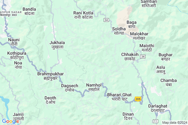
Panjel Kalan
Panjel Kalan Map
EDIT Map
Add Your House
 ..
..
Current Corona Virus Infected Patients Count in Bilaspur District District
| City Name | District Name | Total Covid cases |
|---|
Locality Name :
Panjel Kalan
( पन्जेल कलां )
Tehsil Name : Bilaspur
District : Bilaspur District
State : Himachal Pradesh
Language : Hindi
Current Time 07:40 AM
Date: Saturday , Apr 26,2025 (IST)
Time zone: IST (UTC+5:30)
Elevation / Altitude: 375 meters. Above Seal level
Telephone Code / Std Code: 01978
Assembly constituency : Sri Naina Deviji assembly constituency
Assembly MLA : Randhir Sharma
Lok Sabha constituency : Hamirpur parliamentary constituency
Parliament MP : ANURAG SINGH THAKUR
Serpanch Name :
Main Village Name : Panjel Kalan
Commodities Prices : Bilaspur Market / Mandi
Panjel Kalan Live Weather
Temperature: 21.1 °C
clear sky
Humidity: 23%
Wind : 3.52 mt/sec towards E
StationName : "Bilaspur"
observed on Now
Temperature: 21.1 °C
clear sky
Humidity: 23%
Wind : 3.52 mt/sec towards E
StationName : "Bilaspur"
observed on Now
Panjel Kalan Weather Forecast for Next 5 days
27-04-2025
21.3°C to 36.2°C
clear sky, scattered clouds, few clouds
21.3°C to 36.2°C
clear sky, scattered clouds, few clouds
28-04-2025
20.0°C to 37.4°C
clear sky, few clouds, broken clouds, scattered clouds
20.0°C to 37.4°C
clear sky, few clouds, broken clouds, scattered clouds
29-04-2025
20.2°C to 38.4°C
clear sky, few clouds
20.2°C to 38.4°C
clear sky, few clouds
30-04-2025
21.4°C to 38.9°C
clear sky, scattered clouds, few clouds, broken clouds
21.4°C to 38.9°C
clear sky, scattered clouds, few clouds, broken clouds
01-05-2025
22.3°C to 38.1°C
clear sky
22.3°C to 38.1°C
clear sky
National Highways Reachable To Panjel Kalan
Nationa High Way :NH205
Nationa High Way :NH5
Nationa High Way :NH205
Nationa High Way :NH5
Rivers Near Panjel Kalan
Chikhar Nala
Sutlej :Sutlej River :सतलुज नदी :ਸਤਲੁਜ :ستلج
Chikhar Nala
Sutlej :Sutlej River :सतलुज नदी :ਸਤਲੁਜ :ستلج
About Panjel Kalan
Correct below Info and add more info about Panjel KalanPanjel Kalan is a small Village/hamlet in Bilaspur Tehsil in Bilaspur District District of Himachal Pradesh State, India. It comes under Panjel Kalan Panchayath. It is located 14 KM towards East from District head quarters Bilaspur,. 10 KM from Bilaspur. 40 KM from State capital Shimla
Ghayal ( 3 KM ) , Chhakoh ( 4 KM ) , Soldha ( 5 KM ) , Jukhala ( 5 KM ) , Seohla ( 6 KM ) are the nearby Villages to Panjel Kalan. Panjel Kalan is surrounded by Kunihar Tehsil towards South , Sundarnagar Tehsil towards North , Nalagarh Tehsil towards South , Jhandutta Tehsil towards west .
Sundarnagar , Shimla , Baddi , Rupnagar are the near by Cities to Panjel Kalan.
This Place is in the border of the Bilaspur District District and Mandi District. Mandi District Sundarnagar is North towards this place . Also it is in the Border of other district Hamirpur .
Panjel Kalan 2011 Census Details
Panjel Kalan Local Language is Hindi. Panjel Kalan Village Total population is 203 and number of houses are 37. Female Population is 50.7%. Village literacy rate is 70.0% and the Female Literacy rate is 31.5%.
Population
| Census Parameter | Census Data |
| Total Population | 203 |
| Total No of Houses | 37 |
| Female Population % | 50.7 % ( 103) |
| Total Literacy rate % | 70.0 % ( 142) |
| Female Literacy rate | 31.5 % ( 64) |
| Scheduled Tribes Population % | 0.0 % ( 0) |
| Scheduled Caste Population % | 13.8 % ( 28) |
| Working Population % | 65.5 % |
| Child(0 -6) Population by 2011 | 20 |
| Girl Child(0 -6) Population % by 2011 | 50.0 % ( 10) |
Panjel Kalan Census More Deatils.
Politics in Panjel Kalan
Bharatiya Janata Party , BJP , INC are the major political parties in this area.Polling Stations /Booths near Panjel Kalan
1)G.s.s.s.-rani Kotla2)G.p.s.-sai Brahamana
3)G.p.s.-sayar
4)G.m.s.- Dadwal
5)G.p.s.-ashamajari
HOW TO REACH Panjel Kalan
By Rail
There is no railway station near to Panjel Kalan in less than 10 km.Pincodes near Panjel Kalan
171102 ( Darla ) , 173230 ( Nauni ) , 175038 ( Nihri )Colleges near Panjel Kalan
G.d.c. Jukhala
Address :
Schools near Panjel Kalan
Gsss Raghunathpura
Address : raghunathpura , sadar , bilaspur (h.p.) , Himachal Pradesh . PIN- 174005 , Post - Raghunath Pura
Gsss Baddu (dadhog)
Address : dadhog , swarghat , bilaspur (h.p.) , Himachal Pradesh . PIN- 174001 , Post - Bilaspur (Bilaspur- HP)
Gsss Sohri
Address : sohri , sadar , bilaspur (h.p.) , Himachal Pradesh . PIN- 174032 , Post - Namhol
Gsss Nakrana
Address : nakrana , swarghat , bilaspur (h.p.) , Himachal Pradesh . PIN- 174310 , Post - Naina Devi
Govt Health Centers near Panjel Kalan
1) Battal PHC , NA , NA , Near GDC2) Sharda PHC , Sharda , Sharda , Sharda
3) Badehri SC , Totu , ,
Sub Villages in Panjel Kalan
Petrol Bunks in Panjel Kalan,Bilaspur
HP PETROL PUMP - JAGDAMBHA HP CENTER
Bhararighat Namhol; Shimla; Himachal Pradesh 171102; India
4.3 KM distance Detail
SATYAM SERVICE STATION
CHAMKRIPUL; SHIMLA BILASPU; SOLON; Himachal Pradesh 171102; India
4.3 KM distance Detail
more ..
Colleges in Panjel Kalan,Bilaspur
Govt College Jukhala
Jukhala College Road; Dhamthal; Himachal Pradesh 174033; India
6.5 KM distance Detail
Government Hydro Engineering College Bandla; Bilaspur
Bandla; Himachal Pradesh 174005; India
10.1 KM distance Detail
more ..
Electronic Shops in Panjel Kalan,Bilaspur
Ambika Electrical
Shimla-Kangra Rd; BRAMPUKHAR; Brahmpukhar; Himachal Pradesh 174032; India
5.4 KM distance Detail
Local Parks in Panjel Kalan,Bilaspur
Police Lines Distt. Bilaspur
Bilaspur Sadar; Bilaspur; Himachal Pradesh 174001; India
12.3 KM distance Detail
Police Line Park
NH21; Bilaspur Sadar; Bilaspur; Himachal Pradesh 174001; India
12.3 KM distance Detail
Police Stations near Panjel Kalan,Bilaspur
Bilaspur Police Line
Shimla-Kangra Rd; Bilaspur Sadar; Bilaspur; Himachal Pradesh 174001; India
12.7 KM distance Detail
Governement Offices near Panjel Kalan,Bilaspur
Block Development Office
Bilaspur Sadar; Bilaspur; NH-88; Shimla Kangar Road; Bilaspur; Bilaspur; Himachal Pradesh 174005; India
12.1 KM distance Detail
NCC Unit 1 HP NAVAL
Cinema Colony; Kosrian Sector; Bilaspur; Himachal Pradesh 174001; India
12.8 KM distance Detail
About Panjel Kalan &
History
How to reach Panjel Kalan
Tourist Places Near By Panjel Kalan
Schools in Panjel Kalan
Colleges in Panjel Kalan
Temperature & weather of Panjel Kalan
places in Panjel Kalan
Panjel Kalan photos
More Information
How to reach Panjel Kalan
Tourist Places Near By Panjel Kalan
Schools in Panjel Kalan
Colleges in Panjel Kalan
Temperature & weather of Panjel Kalan
places in Panjel Kalan
Panjel Kalan photos
More Information
Village Talk
Post News or Events about this Village
Near Cities
Sundarnagar 30 KM near
Shimla 39 KM near
Baddi 43 KM near
Rupnagar 49 KM near
Sundarnagar 30 KM near
Shimla 39 KM near
Baddi 43 KM near
Rupnagar 49 KM near
Near By Taluks
Bilaspur 9 KM near
Kunihar 16 KM near
Sundarnagar 23 KM near
Nalagarh 25 KM near
Bilaspur 9 KM near
Kunihar 16 KM near
Sundarnagar 23 KM near
Nalagarh 25 KM near
Near By Air Ports
Simla Airport 36 KM near
Chandigarh Airport 75 KM near
Bhuntar Airport 91 KM near
Ludhiana Airport 117 KM near
Simla Airport 36 KM near
Chandigarh Airport 75 KM near
Bhuntar Airport 91 KM near
Ludhiana Airport 117 KM near
Near By Tourist Places
Chindi 35 KM near
Naldehra 36 KM near
Shimla 41 KM near
Kiarighat 42 KM near
Rewalsar 44 KM near
Chindi 35 KM near
Naldehra 36 KM near
Shimla 41 KM near
Kiarighat 42 KM near
Rewalsar 44 KM near
Near By Districts
Bilaspur District 13 KM near
Shimla 39 KM near
Rupnagar 52 KM near
Mandi 53 KM near
Bilaspur District 13 KM near
Shimla 39 KM near
Rupnagar 52 KM near
Mandi 53 KM near
Near By RailWay Station
Anandpur Sahib Rail Way Station 38 KM near
Rupnagar Rail Way Station 51 KM near
Anandpur Sahib Rail Way Station 38 KM near
Rupnagar Rail Way Station 51 KM near