| Home | City Bus | Maps | Villages | Cities | Rail | Tourist Places | School | College | Pin Codes | Corona Cases Count |
| Distance Calculator Bus Services IFSC Codes Trace Mobile Number Weather Search Place Trace IP Available Cash ATM/Banks Locate Polling Booth Report an Error contact People |
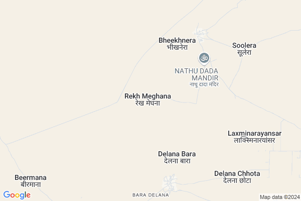
Rekh Meghana
Rekh Meghana Map
EDIT Map
Add Your House
 ..
..
Current Corona Virus Infected Patients Count in Bikaner District
| City Name | District Name | Total Covid cases |
|---|---|---|
| Bikaner District | Bikaner | 37 |
Locality Name :
Rekh Meghana
( रेख मेघना )
Tehsil Name : Lunkaransar
District : Bikaner
State : Rajasthan
Division : Bikaner
Language : Rajasthani and Hindi
Current Time 12:35 PM
Date: Wednesday , Apr 30,2025 (IST)
Time zone: IST (UTC+5:30)
Elevation / Altitude: 194 meters. Above Seal level
Telephone Code / Std Code: 01529
Assembly constituency : Lunkaransar assembly constituency
Assembly MLA : Sumit Godara
Lok Sabha constituency : Bikaner parliamentary constituency
Parliament MP : ARJUN RAM MEGHWAL
Serpanch Name :
Pin Code : 334021
Post Office Name : Chhatararh
Main Village Name : Rekh Meghana
Commodities Prices : Lunkaransar Market / Mandi
National Highways Reachable To Rekh Meghana
Nationa High Way :NH754K
Nationa High Way :NH62
Nationa High Way :NH754K
Nationa High Way :NH62
About Rekh Meghana
Correct below Info and add more info about Rekh MeghanaRekh Meghana is a small Village/hamlet in Lunkaransar Tehsil in Bikaner District of Rajasthan State, India. It comes under Rekh Meghana Panchayath. It belongs to Bikaner Division . It is located 87 KM towards North from District head quarters Bikaner. 20 KM from Loonkaransar. 339 KM from State capital Jaipur
Rekh Meghana Pin code is 334021 and postal head office is Chhatararh .
Baderan ( 16 KM ) are the nearby Villages to Rekh Meghana. Rekh Meghana is surrounded by Anupgarh Tehsil towards North , Sri Dungargarh Tehsil towards South , Bikaner Tehsil towards South , Suratgarh Tehsil towards North .
Vijainagar , Bikaner , Suratgarh , Sardarshahar are the near by Cities to Rekh Meghana.
Rekh Meghana 2011 Census Details
Rekh Meghana Local Language is Rajasthani. Rekh Meghana Village Total population is 606 and number of houses are 62. Female Population is 46.7%. Village literacy rate is 57.3% and the Female Literacy rate is 20.5%.
Population
| Census Parameter | Census Data |
| Total Population | 606 |
| Total No of Houses | 62 |
| Female Population % | 46.7 % ( 283) |
| Total Literacy rate % | 57.3 % ( 347) |
| Female Literacy rate | 20.5 % ( 124) |
| Scheduled Tribes Population % | 0.0 % ( 0) |
| Scheduled Caste Population % | 10.2 % ( 62) |
| Working Population % | 63.4 % |
| Child(0 -6) Population by 2011 | 120 |
| Girl Child(0 -6) Population % by 2011 | 45.8 % ( 55) |
Rekh Meghana Census More Deatils.
Politics in Rekh Meghana
INC , BJP , BJP , INC , INLD are the major political parties in this area.Polling Stations /Booths near Rekh Meghana
1)Gss Baladesar2)Gss Kankrwala Left Side
3)Gps Railway St. Mahajan
4)Gups Bandha
5)Gss Khokhrana Left Side
HOW TO REACH Rekh Meghana
By Rail
There is no railway station near to Rekh Meghana in less than 10 km.Colleges near Rekh Meghana
Govt. College
Address :
Schools in Rekh Meghana
G.p.s., Meghana
Address : rekh meghana , lunkaransar , bikaner , Rajasthan . PIN- 334603 , Post - Lunkaransar
Govt Health Centers near Rekh Meghana
1) Bhiknera , PHC BHIKNERA , BLOCK LOONKARANSAR ,2) Delana Bada , SUBCENTER DELANA BADA , PHC BHIKNERA ,
3) Delana Chota , SUBCENTER DELNA CHOTA , PHC BHIKNERA ,
Sub Villages in Rekh Meghana
Schools in Rekh Meghana,Lunkaransar
Government Higher Secondary School Biknera
Bheekhnera; Rajasthan 334603; India
6.2 KM distance Detail
Super Markets in Rekh Meghana,Lunkaransar
Local Parks in Rekh Meghana,Lunkaransar
Police Stations near Rekh Meghana,Lunkaransar
About Rekh Meghana &
History
How to reach Rekh Meghana
Tourist Places Near By Rekh Meghana
Schools in Rekh Meghana
Colleges in Rekh Meghana
Temperature & weather of Rekh Meghana
places in Rekh Meghana
Rekh Meghana photos
More Information
How to reach Rekh Meghana
Tourist Places Near By Rekh Meghana
Schools in Rekh Meghana
Colleges in Rekh Meghana
Temperature & weather of Rekh Meghana
places in Rekh Meghana
Rekh Meghana photos
More Information
Village Talk
Post News or Events about this Village
Near Cities
Vijainagar 75 KM near
Bikaner 81 KM near
Suratgarh 91 KM near
Sardarshahar 102 KM near
Vijainagar 75 KM near
Bikaner 81 KM near
Suratgarh 91 KM near
Sardarshahar 102 KM near
Near By Taluks
Lunkaransar 19 KM near
Anupgarh 75 KM near
Sri Dungargarh 80 KM near
Bikaner 83 KM near
Lunkaransar 19 KM near
Anupgarh 75 KM near
Sri Dungargarh 80 KM near
Bikaner 83 KM near
Near By Air Ports
Surat Gujarat Airport 89 KM near
Jodhpur Airport 302 KM near
Sanganeer Airport 331 KM near
Jaisalmer Airport 366 KM near
Surat Gujarat Airport 89 KM near
Jodhpur Airport 302 KM near
Sanganeer Airport 331 KM near
Jaisalmer Airport 366 KM near
Near By Tourist Places
Bikaner 82 KM near
Gajner 104 KM near
Tal Chhapar Sanctuary 139 KM near
Churu 155 KM near
Shri Ganganagar 162 KM near
Bikaner 82 KM near
Gajner 104 KM near
Tal Chhapar Sanctuary 139 KM near
Churu 155 KM near
Shri Ganganagar 162 KM near
Near By Districts
Bikaner 83 KM near
Hanumangarh 142 KM near
Churu 155 KM near
Ganganagar 161 KM near
Bikaner 83 KM near
Hanumangarh 142 KM near
Churu 155 KM near
Ganganagar 161 KM near
Near By RailWay Station
Lunkaransar Rail Way Station 24 KM near
Mahajan Rail Way Station 33 KM near
Lunkaransar Rail Way Station 24 KM near
Mahajan Rail Way Station 33 KM near