| Home | City Bus | Maps | Villages | Cities | Rail | Tourist Places | School | College | Pin Codes | Corona Cases Count |
| Distance Calculator Bus Services IFSC Codes Trace Mobile Number Weather Search Place Trace IP Available Cash ATM/Banks Locate Polling Booth Report an Error contact People |
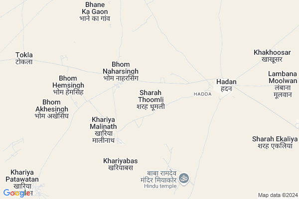
Sharah Thoomli Map
EDIT Map
Add Your House
 ..
..
Current Corona Virus Infected Patients Count in Bikaner District
| City Name | District Name | Total Covid cases |
|---|---|---|
| Bikaner District | Bikaner | 37 |
Locality Name :
Sharah Thoomli
( शरह थूमली )
Tehsil Name : Kolayat
District : Bikaner
State : Rajasthan
Division : Bikaner
Language : Rajasthani and Hindi
Current Time 07:39 PM
Date: Friday , Apr 25,2025 (IST)
Time zone: IST (UTC+5:30)
Elevation / Altitude: 217 meters. Above Seal level
Telephone Code / Std Code: 01533
Assembly constituency : Kolayat assembly constituency
Assembly MLA : Anshuman Singh Bhati
Lok Sabha constituency : Bikaner parliamentary constituency
Parliament MP : ARJUN RAM MEGHWAL
Serpanch Name :
Pin Code : 334302
Post Office Name : Sri Kolayat Ji
Main Village Name : Sharah Thoomli
Commodities Prices : Bajju Market / Mandi
Sharah Thoomli Live Weather
Temperature: 36.2 °C
overcast clouds
Humidity: 8%
Wind : 4.5 mt/sec towards W
StationName : "Deshnoke"
observed on Now
Temperature: 36.2 °C
overcast clouds
Humidity: 8%
Wind : 4.5 mt/sec towards W
StationName : "Deshnoke"
observed on Now
Sharah Thoomli Weather Forecast for Next 5 days
26-04-2025
30.9°C to 34.3°C
overcast clouds, scattered clouds
30.9°C to 34.3°C
overcast clouds, scattered clouds
27-04-2025
28.0°C to 41.3°C
scattered clouds, broken clouds, few clouds, clear sky
28.0°C to 41.3°C
scattered clouds, broken clouds, few clouds, clear sky
28-04-2025
27.7°C to 43.3°C
clear sky
27.7°C to 43.3°C
clear sky
29-04-2025
27.1°C to 43.9°C
clear sky
27.1°C to 43.9°C
clear sky
30-04-2025
29.3°C to 44.1°C
clear sky
29.3°C to 44.1°C
clear sky
National Highways Reachable To Sharah Thoomli
Nationa High Way :NH754K
Nationa High Way :NH754K
About Sharah Thoomli
Correct below Info and add more info about Sharah ThoomliSharah Thoomli is a small Village/hamlet in Kolayat Tehsil in Bikaner District of Rajasthan State, India. It comes under Sharah Thoomli Panchayath. It belongs to Bikaner Division . It is located 75 KM towards west from District head quarters Bikaner. 25 KM from Kolayat. 357 KM from State capital Jaipur
Sharah Thoomli Pin code is 334302 and postal head office is Sri Kolayat Ji .
Bhane Ka Gaon ( 14 KM ) are the nearby Villages to Sharah Thoomli. Sharah Thoomli is surrounded by Bap Tehsil towards west , Nokha Tehsil towards East , Bikaner Tehsil towards East , Phalodi Tehsil towards South .
Siana , Nokha , Bikaner , Nagaur are the near by Cities to Sharah Thoomli.
Sharah Thoomli 2011 Census Details
Sharah Thoomli Local Language is Rajasthani. Sharah Thoomli Village Total population is 206 and number of houses are 28. Female Population is 52.4%. Village literacy rate is 66.5% and the Female Literacy rate is 29.1%.
Population
| Census Parameter | Census Data |
| Total Population | 206 |
| Total No of Houses | 28 |
| Female Population % | 52.4 % ( 108) |
| Total Literacy rate % | 66.5 % ( 137) |
| Female Literacy rate | 29.1 % ( 60) |
| Scheduled Tribes Population % | 0.0 % ( 0) |
| Scheduled Caste Population % | 0.0 % ( 0) |
| Working Population % | 49.0 % |
| Child(0 -6) Population by 2011 | 42 |
| Girl Child(0 -6) Population % by 2011 | 54.8 % ( 23) |
Sharah Thoomli Census More Deatils.
Politics in Sharah Thoomli
RSNM , BJP , INC are the major political parties in this area.Polling Stations /Booths near Sharah Thoomli
1)Gups Khara Lohan2)Gups Sans Khetolai Bhurj
3)Gss Khakhusar
4)Gsss Left Part Girajsar
5)Gsss Right Part Gajner
HOW TO REACH Sharah Thoomli
By Rail
There is no railway station near to Sharah Thoomli in less than 10 km.Colleges near Sharah Thoomli
Pr College
Address :
M.d.digree College Bajju
Address :
Sanskar College Bajju
Address : Mistri Market Bajju
Schools near Sharah Thoomli
Shree Narayan Pathshala
Address : girajsar , kolayat , bikaner , Rajasthan . PIN- 334303 , Post - Diyatra
Sharda V.m., School, Bajju
Address : bajju khalsa , kolayat , bikaner , Rajasthan . PIN- 334305 , Post - Bajju
Nav Jyoti Pub.sch., Rd 25 Fulasar
Address : fulasar chhota , kolayat , bikaner , Rajasthan . PIN- 334305 , Post - Bajju
Shiv Shakti S.s., Dasouri
Address : dasouri , kolayat , bikaner , Rajasthan . PIN- 334302 , Post - Sri Kolayat Ji
Govt Health Centers near Sharah Thoomli
1) Khari Mallinath , SHC Khari mallinath , ,2) Kharia Patawtan , SHC Khariya patawtan , ,
3) Khariawas , SHC Khariawas , ,
Sub Villages in Sharah Thoomli
Electronic Shops in Sharah Thoomli,Kolayat
AD Computers & E-mitra Centre
Nemji Ostwal ki dukan main bazar; Diyatra; Rajasthan; India
20.5 KM distance Detail
Local Parks in Sharah Thoomli,Kolayat
Police Stations near Sharah Thoomli,Kolayat
Governement Offices near Sharah Thoomli,Kolayat
About Sharah Thoomli &
History
How to reach Sharah Thoomli
Tourist Places Near By Sharah Thoomli
Schools in Sharah Thoomli
Colleges in Sharah Thoomli
Temperature & weather of Sharah Thoomli
places in Sharah Thoomli
Sharah Thoomli photos
More Information
How to reach Sharah Thoomli
Tourist Places Near By Sharah Thoomli
Schools in Sharah Thoomli
Colleges in Sharah Thoomli
Temperature & weather of Sharah Thoomli
places in Sharah Thoomli
Sharah Thoomli photos
More Information
Village Talk
Post News or Events about this Village
Near Cities
Siana 24 KM near
Nokha 71 KM near
Bikaner 73 KM near
Nagaur 113 KM near
Siana 24 KM near
Nokha 71 KM near
Bikaner 73 KM near
Nagaur 113 KM near
Near By Taluks
Kolayat 24 KM near
Bap 60 KM near
Nokha 71 KM near
Bikaner 72 KM near
Kolayat 24 KM near
Bap 60 KM near
Nokha 71 KM near
Bikaner 72 KM near
Near By Air Ports
Jodhpur Airport 171 KM near
Jaisalmer Airport 231 KM near
Surat Gujarat Airport 239 KM near
Sanganeer Airport 344 KM near
Jodhpur Airport 171 KM near
Jaisalmer Airport 231 KM near
Surat Gujarat Airport 239 KM near
Sanganeer Airport 344 KM near
Near By Tourist Places
Gajner 46 KM near
Bikaner 73 KM near
Khimsar 102 KM near
Osian 112 KM near
Pokran 133 KM near
Gajner 46 KM near
Bikaner 73 KM near
Khimsar 102 KM near
Osian 112 KM near
Pokran 133 KM near
Near By Districts
Bikaner 72 KM near
Nagaur 113 KM near
Jodhpur 170 KM near
Jaisalmer 229 KM near
Bikaner 72 KM near
Nagaur 113 KM near
Jodhpur 170 KM near
Jaisalmer 229 KM near
Near By RailWay Station
Deshnoke Rail Way Station 59 KM near
Nokha Rail Way Station 71 KM near
Deshnoke Rail Way Station 59 KM near
Nokha Rail Way Station 71 KM near