| Home | City Bus | Maps | Villages | Cities | Rail | Tourist Places | School | College | Pin Codes | Corona Cases Count |
| Distance Calculator Bus Services IFSC Codes Trace Mobile Number Weather Search Place Trace IP Available Cash ATM/Banks Locate Polling Booth Report an Error contact People |
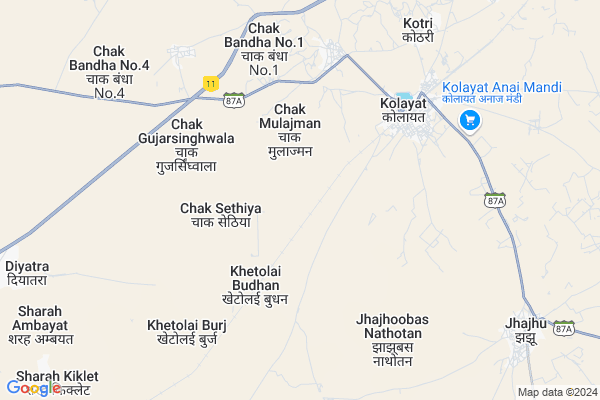
Keharli Map
EDIT Map
Add Your House
 ..
..
Current Corona Virus Infected Patients Count in Bikaner District
| City Name | District Name | Total Covid cases |
|---|---|---|
| Bikaner District | Bikaner | 37 |
Locality Name :
Keharli
( केहरली )
Tehsil Name : Kolayat
District : Bikaner
State : Rajasthan
Division : Bikaner
Language : Rajasthani and Hindi
Current Time 07:44 PM
Date: Friday , Apr 25,2025 (IST)
Time zone: IST (UTC+5:30)
Elevation / Altitude: 217 meters. Above Seal level
Telephone Code / Std Code: 01533
Assembly constituency : Kolayat assembly constituency
Assembly MLA : Anshuman Singh Bhati
Lok Sabha constituency : Bikaner parliamentary constituency
Parliament MP : ARJUN RAM MEGHWAL
Serpanch Name :
Main Village Name : Keharli
Commodities Prices : Bajju Market / Mandi
Keharli Live Weather
Temperature: 36.2 °C
overcast clouds
Humidity: 8%
Wind : 4.63 mt/sec towards W
StationName : "Deshnoke"
observed on 39 Mins Back
Temperature: 36.2 °C
overcast clouds
Humidity: 8%
Wind : 4.63 mt/sec towards W
StationName : "Deshnoke"
observed on 39 Mins Back
Keharli Weather Forecast for Next 5 days
26-04-2025
30.7°C to 34.4°C
overcast clouds, broken clouds, scattered clouds
30.7°C to 34.4°C
overcast clouds, broken clouds, scattered clouds
27-04-2025
28.2°C to 41.4°C
scattered clouds, broken clouds, overcast clouds, few clouds, clear sky
28.2°C to 41.4°C
scattered clouds, broken clouds, overcast clouds, few clouds, clear sky
28-04-2025
28.0°C to 43.3°C
clear sky
28.0°C to 43.3°C
clear sky
29-04-2025
28.8°C to 44.1°C
clear sky
28.8°C to 44.1°C
clear sky
30-04-2025
29.5°C to 44.4°C
clear sky
29.5°C to 44.4°C
clear sky
National Highways Reachable To Keharli
Nationa High Way :NH754K
Nationa High Way :NH754K
About Keharli
Correct below Info and add more info about KeharliKeharli is a small Village/hamlet in Kolayat Tehsil in Bikaner District of Rajasthan State, India. It comes under Keharli Panchayath. It belongs to Bikaner Division . It is located 53 KM towards west from District head quarters Bikaner. 354 KM from State capital Jaipur
Keharli is surrounded by Bikaner Tehsil towards East , Nokha Tehsil towards East , Bap Tehsil towards South , Phalodi Tehsil towards South .
Siana , Bikaner , Nokha , Nagaur are the near by Cities to Keharli.
Keharli 2011 Census Details
Keharli Local Language is Rajasthani. Keharli Village Total population is 419 and number of houses are 62. Female Population is 46.1%. Village literacy rate is 46.1% and the Female Literacy rate is 15.0%.
Population
| Census Parameter | Census Data |
| Total Population | 419 |
| Total No of Houses | 62 |
| Female Population % | 46.1 % ( 193) |
| Total Literacy rate % | 46.1 % ( 193) |
| Female Literacy rate | 15.0 % ( 63) |
| Scheduled Tribes Population % | 0.0 % ( 0) |
| Scheduled Caste Population % | 49.6 % ( 208) |
| Working Population % | 45.6 % |
| Child(0 -6) Population by 2011 | 80 |
| Girl Child(0 -6) Population % by 2011 | 45.0 % ( 36) |
Keharli Census More Deatils.
Politics in Keharli
RSNM , BJP , INC are the major political parties in this area.Polling Stations /Booths near Keharli
1)Gups Left Part Jaganwala2)Gups Right Part Mudh
3)Ggss Right Part Kharicharnan
4)Gups Right Part Kharicharnan
5)Gups Right Part Railwayline Kolayat
HOW TO REACH Keharli
By Rail
Kolayat Rail Way Station is the very nearby railway stations to Keharli.Pincodes near Keharli
334302 ( Sri Kolayat Ji ) , 334402 ( Udairamsar ) , 334804 ( Panchoo )Colleges near Keharli
Pr College
Address :
M.d.digree College Bajju
Address :
Sanskar College Bajju
Address : Mistri Market Bajju
Schools near Keharli
Shree Narayan Pathshala
Address : girajsar , kolayat , bikaner , Rajasthan . PIN- 334303 , Post - Diyatra
Sharda V.m., School, Bajju
Address : bajju khalsa , kolayat , bikaner , Rajasthan . PIN- 334305 , Post - Bajju
Nav Jyoti Pub.sch., Rd 25 Fulasar
Address : fulasar chhota , kolayat , bikaner , Rajasthan . PIN- 334305 , Post - Bajju
Shiv Shakti S.s., Dasouri
Address : dasouri , kolayat , bikaner , Rajasthan . PIN- 334302 , Post - Sri Kolayat Ji
Govt Health Centers near Keharli
1) NOTIONAL ISHRU , PHC ISHRU , OPPOSITE GOVT.SENIOR.SEC.SCHOOL, PHC ISHRU , OPPOSITE GOVT.SENIOR.SEC.SCHOOL, PHC ISHRU2) ISHRU , PHC ISHRU , OPPOSITE GOVT.SENIOR.SEC.SCHOOL, PHC ISHRU , OPPOSITE GOVT.SENIOR.SEC.SCHOOL
3) Hadda , PHC Hadda , Main Market Hadda ,
Sub Villages in Keharli
Hospitals in Keharli,Kolayat
Dr. Ramesh Poonia
Rajshree Nursing Home; Near SBI Bank; Front of Government Hospital;; Kolayat; India
6.2 KM distance Detail
more ..
Petrol Bunks in Keharli,Kolayat
Indian Oil Corporation Petrol Pump
NH 11; Techari Phanta; Rajasthan 334302; India
11.6 KM distance Detail
Indian Oil Corporation Petrol Pump
Techari Phanta; NH 11; Rajasthan 334302; India
11.9 KM distance Detail
more ..
About Keharli &
History
How to reach Keharli
Tourist Places Near By Keharli
Schools in Keharli
Colleges in Keharli
Temperature & weather of Keharli
places in Keharli
Keharli photos
More Information
How to reach Keharli
Tourist Places Near By Keharli
Schools in Keharli
Colleges in Keharli
Temperature & weather of Keharli
places in Keharli
Keharli photos
More Information
Village Talk
Post News or Events about this Village
Near Cities
Siana 24 KM near
Bikaner 51 KM near
Nokha 67 KM near
Nagaur 117 KM near
Siana 24 KM near
Bikaner 51 KM near
Nokha 67 KM near
Nagaur 117 KM near
Near By Taluks
Kolayat 0 KM near
Bikaner 51 KM near
Nokha 66 KM near
Bap 82 KM near
Kolayat 0 KM near
Bikaner 51 KM near
Nokha 66 KM near
Bap 82 KM near
Near By Air Ports
Jodhpur Airport 193 KM near
Surat Gujarat Airport 215 KM near
Jaisalmer Airport 249 KM near
Sanganeer Airport 341 KM near
Jodhpur Airport 193 KM near
Surat Gujarat Airport 215 KM near
Jaisalmer Airport 249 KM near
Sanganeer Airport 341 KM near
Near By Tourist Places
Gajner 22 KM near
Bikaner 52 KM near
Khimsar 116 KM near
Osian 134 KM near
Pokran 156 KM near
Gajner 22 KM near
Bikaner 52 KM near
Khimsar 116 KM near
Osian 134 KM near
Pokran 156 KM near
Near By Districts
Bikaner 51 KM near
Nagaur 117 KM near
Jodhpur 191 KM near
Churu 233 KM near
Bikaner 51 KM near
Nagaur 117 KM near
Jodhpur 191 KM near
Churu 233 KM near
Near By RailWay Station
Kolayat Rail Way Station 5.2 KM near
Deshnoke Rail Way Station 45 KM near
Bikaner Junction Rail Way Station 50 KM near
Kolayat Rail Way Station 5.2 KM near
Deshnoke Rail Way Station 45 KM near
Bikaner Junction Rail Way Station 50 KM near